

Canberra is the capital of Australia, a planned city of about 484,630 people (2025 estimate) set on the Molonglo River roughly 150 km inland from the east coast, in the Australian Capital Territory. It sits at around 580 metres above sea level in a bowl of low hills, with the Brindabella Ranges to the south and west, and its defining feature is an artificial one: Lake Burley Griffin, made by damming the Molonglo in 1963 so that the city could be arranged around water and along lines drawn between its hilltops. It is Australia's largest inland city and its eighth-largest city overall.
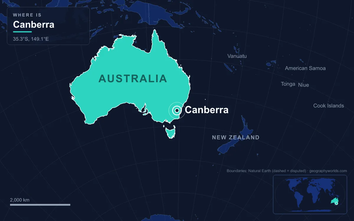
Most capitals grew up where a harbour, a ford or a trade route already gave people a reason to gather. Canberra did the reverse. Politicians chose a stretch of sheep country first, and designers then read its hills, plains and river as a set of drawing instruments. To understand the city, start with the ground.
The Limestone Plains and the 1908 Choice of Site
Before it was a capital, the area was known to British settlers as the Limestone Plains. Charles Throsby Smith led the first British expedition there in October 1820, and by the time explorer Mark John Currie drew the first accurate map in June 1823 the name had stuck. The land was already occupied: the Ngunnawal and Ngambri peoples had lived here for up to 21,000 years, and archaeologists have recorded rock shelters, engravings, quarry sites and stone tools across the district. One clan, remembered in colonial records as the Canberry or Nganbra, lived around Sullivan's Creek and held ceremonies at the foot of Black Mountain, which they called Galambary.
That clan gave the city its name. Joshua John Moore, the first European landowner, called his 1823 grant "Canberry", and the spelling "Canberra" appears on maps from around 1857. Pastoral stations spread along the river flats, and the Anglican church of St John the Baptist in present-day Reid, consecrated in 1845, survives as the oldest public building in the city.
The plains became a capital because of a rivalry. At federation on 1 January 1901, neither Sydney nor Melbourne would accept the other as the seat of government, so section 125 of the Constitution required the capital to be in New South Wales but at least 100 miles (160 km) from Sydney, with Parliament sitting in Melbourne until it was built. Surveyors looked at Bombala, Orange, Albury, Tumut, Armidale and others, and the Seat of Government Act 1904 actually named Dalgety, on the Snowy River. New South Wales refused to hand over land there. In 1906 it agreed to cede territory only if it lay in the Yass–Canberra district, closer to Sydney, and in 1908 that district was chosen, helped along by the government surveyor Charles Scrivener's fieldwork. New South Wales ceded the land in 1911, creating the Federal Capital Territory.
Black Mountain, Mount Ainslie and Griffin's Axes
What made the site attractive to designers was its relief. Canberra's suburbs spread across four plains, Ginninderra, Molonglo, Limestone and Tuggeranong, separated by ridges and isolated hills that stand roughly 230 to 310 metres above the city. Mount Majura, at 888 metres, is the highest point near the built-up area; Mount Taylor reaches 855 metres, Mount Ainslie 843 metres, and both Black Mountain and Mount Mugga Mugga 812 metres.
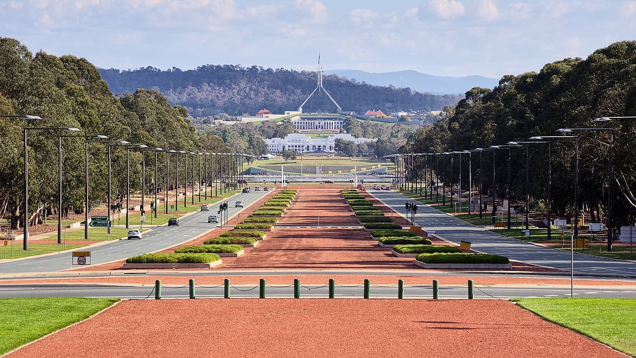
An international design competition opened on 30 April 1911 and closed on 31 January 1912, and drew 137 valid entries. The winners were the Chicago architects Walter Burley Griffin and Marion Mahony Griffin, ahead of the Finnish architect Eliel Saarinen in second place. Their plan treated the hills as survey points. A land axis runs from Capital Hill north-north-east across the water, along what is now Anzac Parade, to the Australian War Memorial, which sits directly at the foot of Mount Ainslie when viewed from Capital Hill. Extended the other way, the same line points to Bimberi Peak, the highest mountain in the ACT, about 52 km to the south-west. A water axis, set at right angles, runs north-west towards Black Mountain, and a municipal axis parallel to it became Constitution Avenue.
The Griffins also gave the hills symbolic roles, planning to plant Mount Ainslie, Black Mountain and Red Hill each with flowers of a single colour. That part never happened. On 12 March 1913 Lady Denman announced the city's name at a ceremony on Kurrajong Hill, but bureaucratic fights followed, a Royal Commission in 1916 found that officials had undermined Griffin's authority, and by the time he was dismissed in 1920 little had been built beyond the earthworks of the main avenues. Black Mountain did eventually get its landmark: the Telstra Tower, which rises 195.2 metres above the summit and is the tallest structure in Canberra. It closed to visitors in 2021 and is expected to reopen in the summer of 2027–28.
Damming the Molonglo into Lake Burley Griffin
The river that made the lake possible is modest. The Molonglo rises at about 1,130 metres in Tallaganda State Forest, on the western side of the Great Dividing Range, and runs 115 km, picking up its main tributary, the Queanbeyan River, on the outskirts of Queanbeyan before crossing Canberra and joining the Murrumbidgee near Uriarra Crossing. Across the Molonglo Plain it used to spread into a flood plain, and it had a record of damaging floods.
Scrivener's survey had already noted that this terrain could hold water "for ornamental purposes at reasonable cost", and his maps shaded in a possible lake along with four candidate dam sites. The Griffins built their whole composition around one: a Central Basin shaped as a circular segment, with East and West Basins and larger lakes at each end. Yet the lake waited half a century. The Depression and the Second World War stalled construction, and planning bodies argued over its shape for four decades until the National Capital Development Commission, formed in 1957 with real executive powers, settled the design. With strong backing from Prime Minister Robert Menzies, excavation began in 1960.

The gates of the 33-metre Scrivener Dam, designed to cope with a flood expected once in 5,000 years, were closed in September 1963. Drought meant the target level was not reached until April 1964, and the lake was inaugurated on 17 October 1964. It is about 11 km long and 1.2 km across at its widest, with an average depth of only 4 metres and a maximum of about 18 metres near the dam. When rainfall is short, water can be released from Googong Dam upstream. Two smaller creeks were later treated the same way, producing Lake Ginninderra and Lake Tuggeranong.
Capital Hill and the Parliamentary Triangle
Once the lake existed, the institutional core could take the shape Griffin intended. Commonwealth Avenue and Kings Avenue run from Capital Hill across the water to City Hill and the Market Centre, and with Constitution Avenue they enclose the Parliamentary Triangle. Along its lakeshore edge now stand the National Library, the High Court and the National Gallery, with the National Museum and the Australian National University elsewhere on the shoreline.
Parliament had arrived long before the lake. It moved from Melbourne on 9 May 1927 into a Provisional Parliament House built to last about 50 years; it stayed 61. On 9 May 1988 a permanent Parliament House opened on Capital Hill, the old Kurrajong Hill where the city had been named 75 years earlier. The building, designed by Mitchell/Giurgola & Thorp and costing more than $1.1 billion, replaced the provisional building, which is now known as Old Parliament House. The same year the Commonwealth granted the Australian Capital Territory self-government, and its first Legislative Assembly sat in 1989.
Valleys, Rain Shadow and the Brindabella Fire Country
The hills that organise the centre also dictate how the rest of the city grew. Rather than sprawling outward in a continuous ring, Canberra was built as a chain of separate districts in the valleys between the hills, most with their own town centre. Woden Valley was first settled in 1964, Belconnen in 1966, Tuggeranong from the mid-1970s and Gungahlin in the 1990s. The population grew by more than half in every five-year period between 1955 and 1975 as departments moved from Melbourne.
Topography also shapes the weather. The Brindabellas to the west throw a rain shadow over the valleys, so Canberra receives the third-lowest rainfall of the Australian capitals, after Adelaide and Hobart. Being inland at 580 metres gives it wide swings: January highs average around 29°C and July highs around 12°C, with frequent winter frosts. The record high is 44.0°C, set on 4 January 2020, and the record low −10.0°C on 11 July 1971. Snow is often visible on the Brindabellas but rarely settles in the centre; the last significant fall there was in 1968.
The same bushland that makes the setting attractive makes it dangerous. On 18 January 2003 fires burning out of the western ranges reached the suburbs, killing four people, destroying more than 500 homes and wrecking the research telescopes of the Australian National University's Mount Stromlo Observatory, whose slopes had been planted with pine trials since 1915. During the 2019–20 fire season smoke haze gave Canberra the worst air quality of any major city in the world on 1 January 2020.
Canberra is therefore a capital defined by its terrain twice over: chosen as a political compromise between two coastal rivals, then drawn by designers who used its hills as fixed points and its river as raw material. For how it compares with the coastal state capitals it was built to keep apart, see our guide to Australia's state capitals; the government of Australia explains the institutions that fill the Parliamentary Triangle, and our ranking of the largest cities in Australia shows where its population sits among them.
Quick Facts About Canberra
- Country: Australia
- Continent: Oceania
- Country population: approximately 27.2 million
- Capital city status: Canberra is the capital of Australia, the seat of national government, and the location of foreign embassies, parliament, and the head of state's official residence.
Frequently Asked Questions
What is the capital of Australia?
The capital of Australia is Canberra. Canberra is the seat of national government, hosts most foreign embassies and consulates, and is typically where the head of state and parliament are located.
What continent is Canberra in?
Canberra, the capital of Australia, is located in Oceania. As Australia's capital, Canberra serves as the country's primary connection to the broader Oceanian political, economic, and cultural sphere.
Why is Canberra the capital of Australia?
Canberra was chosen as the capital of Australia for reasons that typically combine geography, history, and politics. Capital city selections often reflect a desire for centrality (being accessible from across the country), historical importance (being a longstanding seat of government or culture), or neutrality (being acceptable to multiple regions or ethnic groups within the country). The specific reasons for Canberra's designation are detailed in the city's history above.
What is Canberra known for?
As the capital of Australia, Canberra is best known for housing the country's central government institutions — parliament, presidential or royal residences, supreme court, and key ministries. It is also typically a major cultural and economic center within Australia, hosting national museums, embassies, and signature monuments. The introduction and history sections above provide detailed coverage of the city's specific notable institutions and landmarks.
Related Pages
- Australia Country Guide — full geography, climate, economy, and culture overview
- Flag of Australia — meaning, history, and design of Australia's national flag