
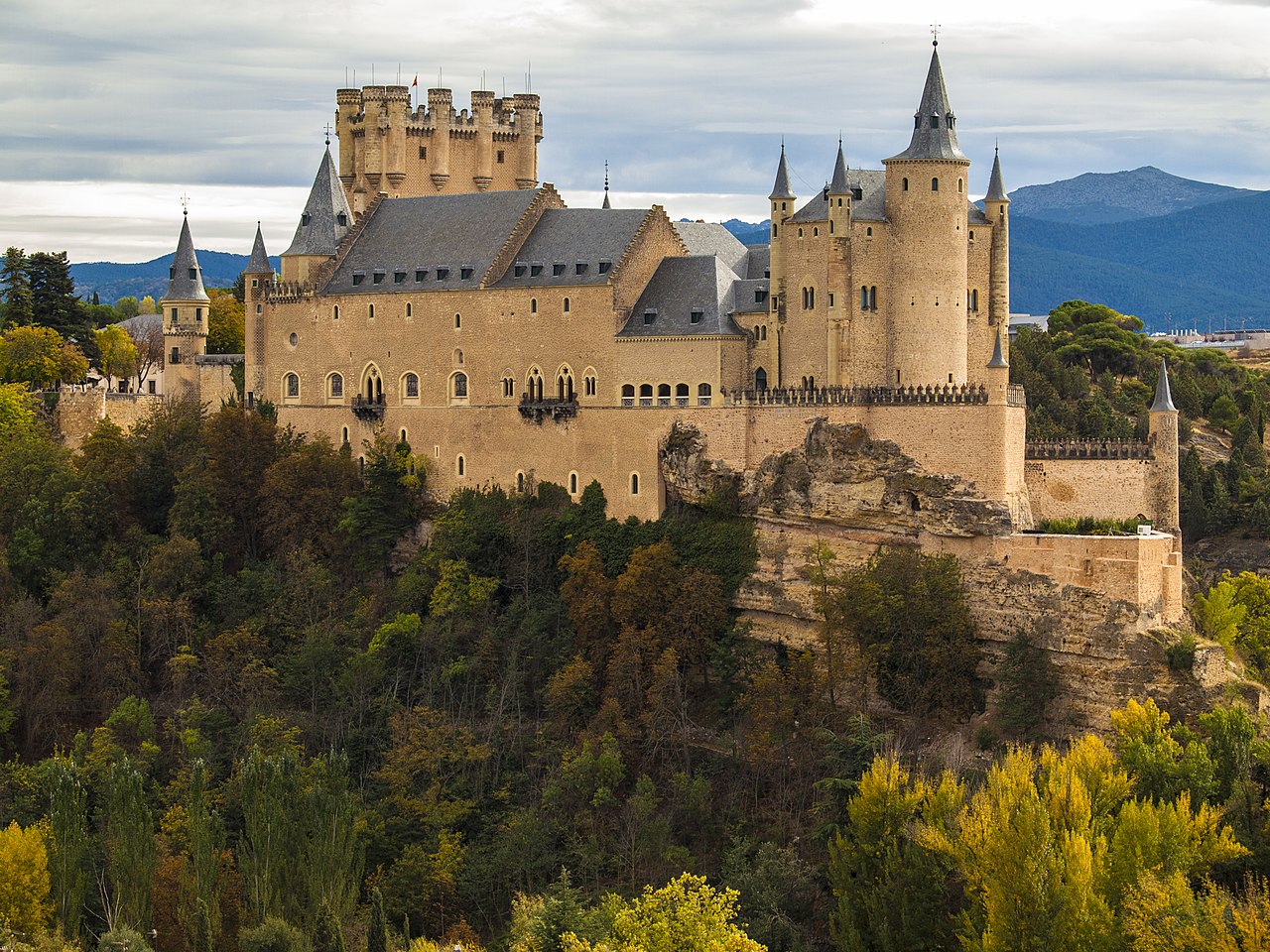
The thousands of castles scattered across Europe are not randomly placed. Every castle was built at a specific location for specific geographic reasons — to control a river crossing, dominate a mountain pass, guard a coastline, or exploit a natural defensive feature. Understanding castle geography means understanding how medieval lords and kings read the landscape and turned terrain into military advantage.
Introduction
Castle building in Europe spanned roughly from the 9th to the 17th centuries, a period during which fortress design evolved dramatically in response to changing military technology. From simple earthwork mottes to massive concentric stone fortresses, the relationship between castle and landscape remained the constant thread: the best castles worked with the terrain rather than against it.
Hilltop & Clifftop Castles
- Principle: Height equals advantage in pre-gunpowder warfare
- Notable Examples: Edinburgh Castle, Predjama Castle, Château de Montségur
- Advantages: 360° visibility, difficult assault, psychological dominance
- Disadvantage: Water supply difficult at elevation
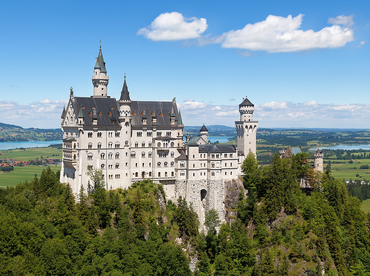
Hilltop castles exploited the most fundamental principle of medieval warfare: height equals advantage. Attackers had to fight uphill, exhaust themselves before reaching the walls, and expose themselves to missile fire from above. Edinburgh Castle, perched on a volcanic plug rising 130 meters above the city, was virtually impregnable from three sides due to sheer cliff faces, with only a narrow ridge approach from the east.
Predjama Castle in Slovenia takes the clifftop concept to its extreme, built into the mouth of a cave halfway up a 123-meter cliff face. The cave behind the castle provided a secret escape route and fresh water supply, solving the greatest weakness of elevated fortresses. Château de Montségur in the French Pyrenees sits on a limestone pog at 1,207 meters altitude, its walls following the contours of the rocky summit so precisely that castle and mountain appear as one.
River & Valley Castles
- Principle: Control water trade routes and crossing points
- Notable Examples: Château Gaillard, Krak des Chevaliers, Rhine castles
- Rhine Valley: 40+ castles in 65 km stretch
- Economic Function: Toll collection on river traffic
Rivers were the highways of medieval Europe, and controlling a river meant controlling trade, communication, and military movement. The Rhine Gorge between Koblenz and Bingen contains over 40 castles in a 65-kilometer stretch — the densest concentration of medieval fortifications in Europe. Most were built by local lords to collect tolls from the river traffic that carried wine, grain, timber, and other goods between the Alps and the North Sea.
Château Gaillard, built by Richard the Lionheart in 1196-1198 on a limestone cliff above a bend in the Seine, demonstrates how river geography could be exploited for maximum defensive advantage. The castle controlled the approach to Rouen and the entire lower Seine valley. Its concentric design, with three successive lines of defense, was revolutionary for its time and influenced castle design across Europe for the following century.
Coastal & Island Castles
- Principle: Control harbors, resist naval invasion, exploit tidal access
- Notable Examples: Mont-Saint-Michel, Bodiam Castle, Kronborg Castle
- Tidal Castles: Cut off from land at high tide
- Coastal Defense: Ring of castles around England, Wales
Coastal castles served multiple geographic functions: defending harbors and anchorages, protecting against seaborne invasion, controlling fishing grounds, and serving as landmarks for navigation. Edward I's ring of massive castles around North Wales — including Caernarfon, Conwy, Harlech, and Beaumaris — were deliberately sited to be supplied by sea, making them independent of the hostile Welsh interior.
Mont-Saint-Michel, perched on a tidal island off the Normandy coast, is perhaps the most dramatic example of coastal castle geography. At high tide, the rock was completely surrounded by water, making assault virtually impossible. At low tide, the surrounding mudflats were treacherous for attackers unfamiliar with the tidal patterns. This combination of natural defenses meant Mont-Saint-Michel was never captured during the Hundred Years' War.
Pass & Bridge Castles
- Principle: Control movement through geographic bottlenecks
- Notable Examples: Marksburg Castle, Hohenwerfen, Château de Quéribus
- Alpine Passes: Castles at every major mountain crossing
- Bridge Castles: Combined fortress and toll bridge functions
Mountain passes were natural chokepoints where a small garrison could control the movement of entire armies and trade caravans. Hohenwerfen Castle in the Austrian Alps sits at 623 meters above the Salzach Valley, commanding the only route between Salzburg and southern Austria. Built in 1077, it could seal the valley with a garrison of just a few hundred men, making it one of the most strategically valuable positions in the eastern Alps.
Bridge castles combined military control with economic exploitation of river crossings. Marksburg Castle above the Rhine at Braubach controlled a critical narrows in the river where boats were forced to slow down, making toll collection unavoidable. In southern France, the Cathar castles of Quéribus and Peyrepertuse were built on razor-thin ridgelines in the Pyrenean foothills, controlling the passes between France and Aragon with minimal fortification thanks to their extraordinary natural positions.
Lowland & Moated Castles
- Principle: Artificial water defenses where natural elevation is absent
- Notable Examples: Bodiam Castle, Muiden Castle, Leeds Castle
- Moat Widths: Up to 20+ meters
- Water Source: Rivers, streams, or spring-fed systems
In the flat lowlands of England, the Netherlands, and northern Europe, where no hills or cliffs were available, castle builders turned to water for defense. The moated castle became the defining fortress type of these regions, with wide water-filled ditches replacing the natural advantages of elevation. Bodiam Castle in Sussex, built in 1385, sits in the center of a broad rectangular moat that reflected its perfectly symmetrical walls — creating one of the most photogenic castles in England.
Leeds Castle in Kent, sometimes called the loveliest castle in the world, is built on two islands in a lake formed by the River Len. The water surrounding the castle was both a defensive feature and a statement of wealth and power. Dutch and Flemish moated castles took the concept further, incorporating complex hydraulic systems that could flood surrounding fields on command, turning entire landscapes into defensive obstacles — a technique that remained effective into the 18th century.
Key Facts
- The Rhine Gorge contains over 40 castles in a 65-kilometer stretch — Europe's densest concentration.
- Edinburgh Castle sits on a volcanic plug rising 130 meters above the surrounding city.
- Mont-Saint-Michel was never captured during the Hundred Years' War thanks to its tidal island geography.
- Edward I built a ring of castles around North Wales designed to be supplied by sea.
- Castle building in Europe spanned from roughly the 9th to the 17th centuries.
Fun Facts
- Predjama Castle in Slovenia is built into a cave mouth halfway up a 123-meter cliff, with a secret tunnel through the mountain behind it.
- The builders of Château Gaillard quarried approximately 17,000 tonnes of stone in just two years.
- Some lowland Dutch castles could deliberately flood surrounding fields to create impassable lakes.
- The word "castle" comes from the Latin "castellum," meaning a small fortified place.
Final Thoughts
European castles are geography made visible — each one a three-dimensional map of how medieval minds read terrain, water, and elevation for strategic advantage. From the volcanic plug of Edinburgh to the tidal island of Mont-Saint-Michel, these structures demonstrate that the most powerful fortresses were not just built on the landscape but were inseparable from it. To understand a castle, look first at the ground it stands on.
Test Your Knowledge!
Think you know your architecture and cities? Try our interactive quiz!
Play Geography Games →