
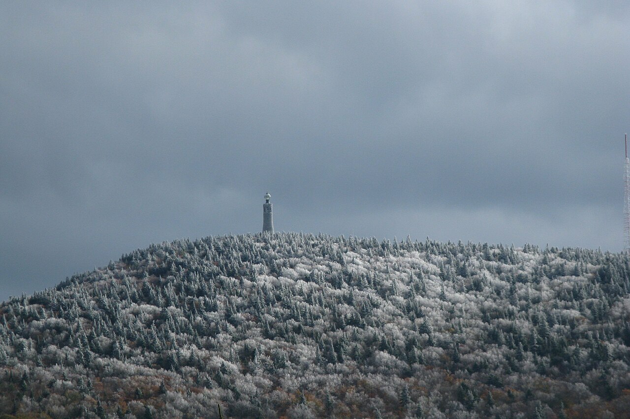
Massachusetts covers 27,340 km² (10,555 square miles), and in that small area it crosses six distinct landform regions from west to east: the Taconic Mountains on the New York border, the Hoosac Range and Berkshire Plateau, the Connecticut River's Pioneer Valley, the rolling uplands of Worcester County, the low coastal country around Boston, and the glacial sands of Cape Cod and the islands. The highest point is Mount Greylock at about 1,063 m (3,489 ft), in the Taconics near the state's northwest corner; the lowest is sea level along the Atlantic. The Connecticut River, New England's longest at 653 km (406 miles), cuts the state in two, and the Quabbin Reservoir, at 100 km² (38.6 square miles), is its largest inland body of water. Every region was buried by ice during the Wisconsin glaciation, which is why till, kettle ponds, drumlins and moraines turn up from the Berkshires to Nantucket.
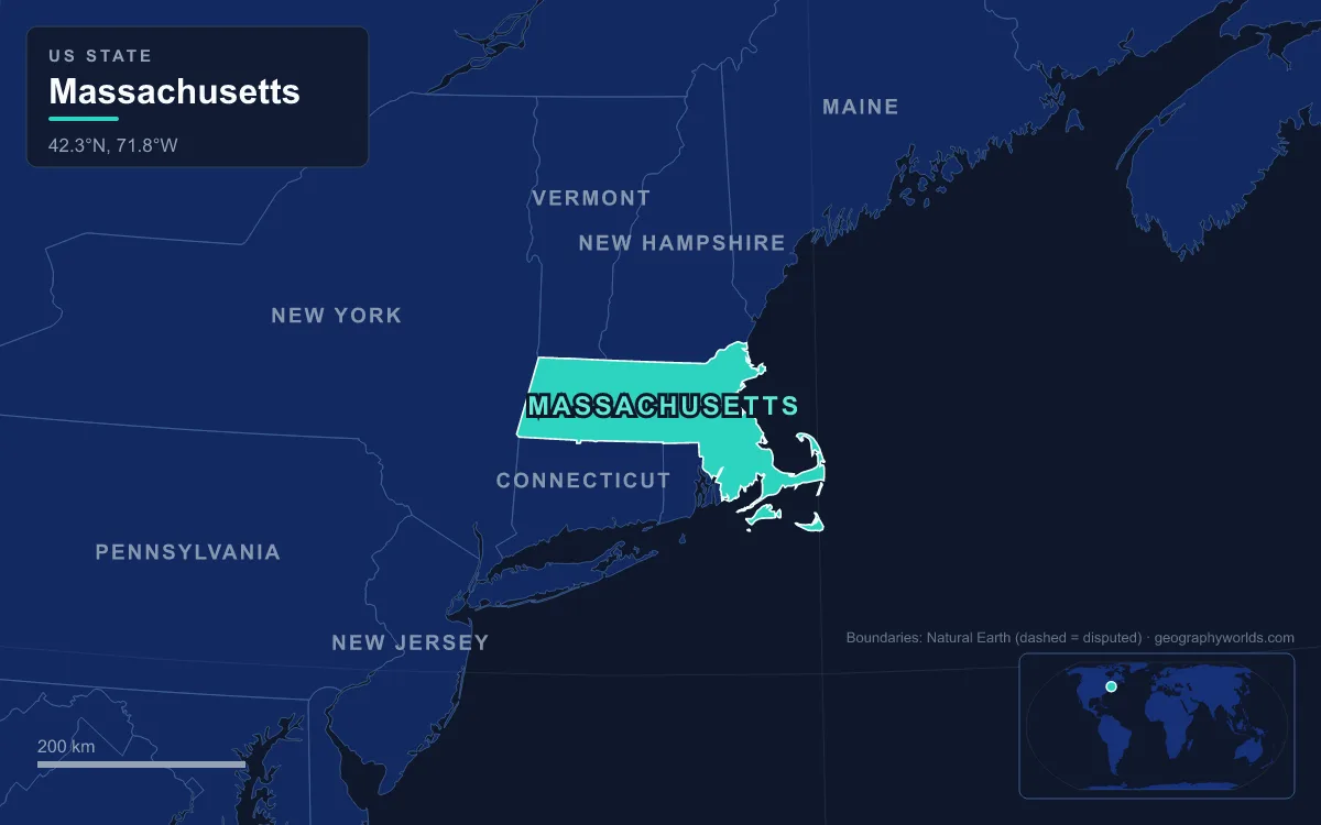
The Taconic Range and Mount Greylock on the New York line
Start at the western edge. The Taconic Mountains are a 240 km (150 mile) sub-range of the Appalachians running along the New York border through Vermont, Massachusetts and Connecticut. In Massachusetts they carry two anchors: Mount Everett, about 793 m (2,602 ft), in the southwest corner of the state, and Mount Greylock in the northwest. The Taconics are geologically distinct from the Berkshires just to the east, and a string of valleys separates the two, chiefly the Housatonic in the south and the Hoosic in the north.
Greylock itself is the high point of an 18 km (11 mile) massif that also includes Saddle Ball Mountain and Mount Fitch. The summit sits in the town of Adams and stands roughly 610 m (2,000 ft) above the Hoosic Valley at its foot; on a clear day sight lines reach about 116 km (72 miles). Its upper slopes carry balsam fir and red spruce, a small patch of sub-alpine forest, and the Appalachian Trail crosses the summit. Apart from a small corner near Lanesborough that drains to the Housatonic, the massif lies in the Hudson River watershed by way of the Hoosic River, so most of the state's highest ground sheds its water to New York rather than to the Massachusetts coast.
The Hoosac Range and the Berkshire Plateau
East of the Hoosic and Housatonic valleys rises the Berkshire upland, a broad belt of steep, rolling hills that is a southern extension of Vermont's Green Mountains and runs all the way to the Connecticut line. Its western rampart in the north is the Hoosac Range, which climbs abruptly from the Hoosic and North Hoosic rivers and drops on its eastern side into the deep gorge of the upper Deerfield River. The highest point of the Berkshires proper, Crum Hill, 866 m (2,841 ft), on the line between Monroe and Florida, lies in this range; Greylock is higher, but belongs geologically to the Taconics.

That ridge was the great obstacle to linking Boston with the Hudson. The answer was the Hoosac Tunnel, a 7.64 km (4.75 mile) railway bore running in a straight line from the Deerfield River in the town of Florida to North Adams. Work began in 1851 on an estimated budget of $2 million and ended in 1875 at a cost of $21 million. When it opened it was the second-longest tunnel in the world after the Mont Cenis tunnel in the Alps, and it is still the longest active transport tunnel east of the Rocky Mountains.
The Berkshire soils disappointed the Scotch-Irish settlers who arrived in the 18th century after the Connecticut River lowlands had been taken; the farmland was poor. What the plateau had instead were fast-moving rivers to power industry, and Pittsfield and North Adams grew into small but prosperous mill cities. Winters here are among the coldest in the state: Stockbridge averages −5.8 °C (21.6 °F) in January, against −1.7 °C (29.0 °F) in Boston.
The Pioneer Valley, Mount Tom and the bed of Lake Hitchcock
Coming down off the Berkshires, the ground falls away along a sharp western escarpment roughly 300 m (1,000 ft) high into the Connecticut River Valley, known within Massachusetts as the Pioneer Valley. It is an ancient rift valley that opened in the Mesozoic, when the supercontinent Pangaea split and North America pulled away from Africa and Europe.
The rifting also left dark volcanic rock. The Metacomet Ridge, a 160 km (100 mile) chain of basalt and sedimentary ridges, runs up the valley from Long Island Sound, and in Massachusetts it forms Mount Tom, Mount Holyoke and Mount Toby. Mount Tom, at 366 m (1,202 ft), is the highest traprock peak on the whole ridge, rising about 340 m (1,100 ft) above the river with a continuous line of cliffs and talus slopes on its western and southern sides.
The valley floor owes its fertility to the ice age. About 15,000 years ago, as the Laurentide ice sheet melted back, a moraine at Rocky Hill in Connecticut dammed the river and created Lake Hitchcock, which at its largest stretched about 320 km (200 miles) north to St. Johnsbury, Vermont. It lasted around 3,000 years, laying down fine layered silts and clays, before the dam was breached. Those lake beds are why the Pioneer Valley has some of the best soil in the northeastern United States, long used for shade tobacco and Hadley asparagus. At Springfield, about 8 km (5 miles) north of the Connecticut line, the Westfield River joins from the west and the Chicopee from the east.
Worcester County's uplands, Mount Wachusett and the Quabbin
East of the valley the land rises steeply again onto a plateau of rolling, rocky hills that fills most of Worcester County. The geographic center of Massachusetts is here, in the town of Rutland. A drainage divide runs north to south through this upland, separating streams bound for the Connecticut from those that drain to the Merrimack, Quinebaug, Blackstone and Charles.
The highest point east of the Connecticut River is Mount Wachusett, 611 m (2,006 ft), which straddles Princeton and Westminster. It is a monadnock, a lone summit standing above a fairly level landscape, and its glaciated flanks show the ice sheet's work: at Balance Rock on its northeast side, two large boulders were left stacked one atop the other. Water from the mountain goes in several directions at once, west to the Ware and Chicopee rivers and so to the Connecticut, and east to the Nashua and Merrimack.
On the western edge of the county lies the Quabbin Reservoir, the largest inland body of water in the state. Winsor Dam and Goodnough Dike, built between 1930 and 1939, flooded the Swift River Valley; the reservoir took until 1946 to fill. Some 2,500 people were displaced and four towns, Dana, Enfield, Greenwich and Prescott, disappeared under the water. The Quabbin holds about 1,560 billion litres (412 billion US gallons), and a 40 km (25 mile) aqueduct sends it east to the Wachusett Reservoir and on to Boston, 105 km (65 miles) away.
The Boston Basin, the Blue Hills and the Bay State's harbors
East of the Worcester divide the hilltops fall steadily. Within 48 km (30 miles) of the coast few hills pass 91 m (300 ft), and swamps, marshes and ponds alternate with low rises of glacial debris. The main exception is the Blue Hills, a chain of 22 granite hills about 16 km (10 miles) south of downtown Boston. Great Blue Hill, 194 m (635 ft), is the highest point in the Greater Boston area, and the state probably takes its name from the Massachusett people's name for it.
Boston itself sits at the innermost point of Massachusetts Bay, at the mouth of the Charles River. The Charles is the longest river entirely within the state, 129 km (80 miles) from Hopkinton, doubling back on itself as it passes through 23 cities and towns. Offshore, the Boston Harbor Islands national and state park takes in 34 islands and peninsulas, many of them drumlins, the smooth, streamlined hills of till that the ice sheet shaped as it moved. North of Boston, the Merrimack enters the Gulf of Maine at Newburyport after 188 km (117 miles), and just off its mouth lies Plum Island, an 18 km (11 mile) barrier island whose sand is tinted purple by tiny grains of garnet.
The coast is deeply cut into bays, coves and estuaries, and those natural harbors made ports of Newburyport, Gloucester, Salem, Boston and New Bedford. It is this shoreline, with Massachusetts Bay and Cape Cod Bay to the east and Buzzards Bay to the south, that gave the state its nickname, the Bay State. You can follow the city's own landforms further in our guide to Boston's geography.
Cape Cod, Martha's Vineyard and Nantucket: moraines in the Atlantic
The last region is the youngest. Cape Cod is made almost entirely of glacial deposits, terminal moraines and sandy outwash plains, laid down roughly 16,000 to 20,000 years ago at the southern limit of the ice. The Laurentide ice sheet reached its farthest south about 23,000 years ago and had retreated past the Cape by around 18,000 years ago, leaving blocks of buried ice that melted into the Cape's many kettle ponds. The same line of moraines surfaces to the south as Martha's Vineyard, about 250 km² (96 square miles) of land, Nantucket, about 48 km (30 miles) off the Cape, and the Elizabeth Islands. With Long Island and Block Island they form a chain geologists call the Outer Lands.

Once the ice melted, the rising sea began reshaping those deposits. By about 6,000 years ago the ocean was high enough to erode the outer Cape, and longshore drift carried the sand north and south. The northbound sand built the hook at the Cape's tip, so the whole town of Provincetown stands on a spit of marine sediment; the southbound sand built the shoals and islands of Monomoy. The process continues: during Hurricane Bob in 1991 the sea broke through the barrier beach at Chatham.
Much of the outer Cape is protected as Cape Cod National Seashore, created on 7 August 1961 and covering 176.5 km² (43,607 acres) with nearly 64 km (40 miles) of Atlantic beach from Chatham to Provincetown. Its forests are Atlantic coastal pine barrens, a fire-shaped ecoregion that in Massachusetts runs from Plymouth across Cape Cod to Martha's Vineyard and Nantucket. At the Cape's neck, the Cape Cod Canal, about 11.9 km (7.4 miles) long, links Cape Cod Bay with Buzzards Bay and saves ships up to 217 km (135 miles) around the peninsula. For the dunes, ponds and outer beaches in more detail, see our Cape Cod geography guide, and for the mountain chain that the Taconics and Berkshires belong to, read about the Appalachian Mountains.