
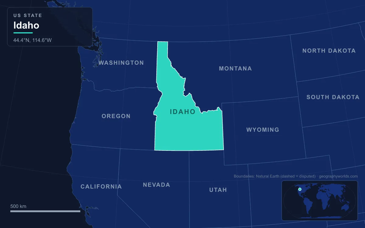
Idaho’s landforms divide into three broad zones: a mass of mountains across the centre and north, including the Sawtooth, Salmon River, Clearwater, Lost River and Bitterroot ranges; the Snake River Plain, a bow-shaped volcanic lowland about 640 km (400 mi) long that sweeps across the south and covers roughly a quarter of the state; and deep river canyons, above all Hells Canyon on the Oregon border, the deepest river gorge in North America at 2,436 m (7,993 ft). The highest point is Borah Peak in the Lost River Range at 3,859 m (12,662 ft), and the lowest is 216 m (710 ft) at Lewiston, where the Clearwater River joins the Snake. The state covers 216,440 km² (83,569 sq mi). Those three zones decide almost everything about how Idaho is lived in: where its roughly two million people settled, what they farm, where they mined, why the capital moved and even why the state has its narrow northern Panhandle.
The Snake River Plain: A Hotspot Track Turned Emigrant Road
The Snake River Plain is the reason southern Idaho is flat enough to cross and farm. Its eastern half traces the path of the North American Plate over the Yellowstone hotspot. As the continent drifted south-west over the hotspot during the past 16 million years or so, a string of giant caldera eruptions blew out the crust, and later shield volcanoes flooded the resulting trough with basalt. The western plain around Boise is different: a rift valley, or graben, filled with several kilometres of sediment from ancient Lake Idaho.
For people, the plain was a gift. It gave westbound emigrants on the Oregon Trail an easy pass through the Rocky Mountains, and many settlers stopped in Idaho rather than face the Blue Mountains and the Cascades beyond. Today most of the state’s large cities stand on it, strung from west to east: Caldwell, Nampa, Meridian and Boise in the Treasure Valley, which is framed by the Owyhee Mountains to the south-west and the Boise Mountains to the north-east; Twin Falls in the central Magic Valley; and Pocatello and Idaho Falls in the east.
Canals from Milner Dam: How Irrigation Made the Magic Valley
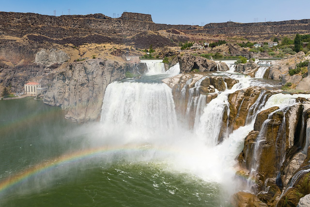
Flat is not the same as fertile. The plain is semi-desert, and in its central stretch the Snake runs at the bottom of a steep canyon cut into the basalt, far below the fields it could water. The landform to see here is Shoshone Falls, about 5 km (3 mi) north-east of Twin Falls, where the river drops 65 m (212 ft) over a rim nearly 300 m (1,000 ft) wide. It is 14 m (45 ft) higher than Niagara Falls. The falls and the canyon below them were shaped about 14,000 years ago by the outburst flood from Lake Bonneville in Utah, and the falls marked the upper limit of salmon migration on the Snake, which made them a major fishing and trading place for the Shoshone and neighbouring peoples.
By 1890 a few farms operated on the canyon floor, but the land above was out of reach. In 1900 I. B. Perrine founded the Twin Falls Land and Water Company, and with financing from the Salt Lake City businessman Stanley Milner and others under the Carey Act of 1894 he built a dam on the Snake near Caldron Linn. Milner Dam and its canals, completed in 1905, made commercial irrigation above the canyon practical for the first time. Twin Falls was founded as a planned town in 1904, and Kimberly, Buhl, Filer, Hansen and Murtaugh grew from lots set aside in the same survey. The price is visible at the falls themselves: water diverted for irrigation and power means flow can fall from more than 570 m³/s in a wet spring to a minimum “scenic flow” of 8.5 m³/s in dry years.
The state is the country’s top potato producer, and almost one-third of the nation’s potatoes are grown on the Snake River Plain. Underneath lies the Snake River Aquifer, which also runs about 640 km (400 mi) east to west. In the east it sits in a pile of basalt flows that may be about 1.6 km (1 mi) thick, each flow 6 to 9 m (20 to 30 ft) thick with a porous rubble top. Much of the aquifer’s water comes from irrigation seeping back down, and it emerges again as springs in the walls of the Snake River Canyon around the Hagerman Valley, where five units make up Thousand Springs State Park.
Craters of the Moon and the Lava Desert Around Arco
Not all of the plain could be farmed. Between the small towns of Arco and Carey, at an average elevation of about 1,800 m (5,900 ft), lies the Craters of the Moon Lava Field, 1,601 km² (618 sq mi) of black basalt and the largest mostly Holocene basaltic lava field in the contiguous United States. Its 60 distinct lava flows range from 15,000 to just 2,000 years old, and more than 25 volcanic cones rise above them. All of them erupted along the Great Rift of Idaho, a line of open cracks that includes the deepest known rift crack on Earth, about 240 m (800 ft) deep. The last eruptions ended around 2,100 years ago and were likely witnessed by the region’s indigenous peoples.

The lava field receives 380 to 510 mm (15 to 20 in) of precipitation a year, but most of it vanishes into cracks in the basalt and re-emerges in springs in the Snake River Canyon, leaving only sparse, seasonal plant cover. The monument was established on 2 May 1924. Apollo astronauts including Alan Shepard, Edgar Mitchell and Eugene Cernan trained on the lava here, learning to pick good rock samples in harsh terrain. North-east of Arco, the same empty lava plain was chosen for the National Reactor Testing Station, now the Idaho National Laboratory. On 17 July 1955, power from its BORAX-III reactor lit Arco for about an hour, making it the first community in the world lit solely by nuclear-generated electricity.
Hells Canyon, the Salmon River and the Roadless Middle
North of the plain, the land rises into a block of mountains that has kept central Idaho almost empty of roads. Much of it is the Idaho Batholith, a body of granite and granodiorite covering about 25,000 km² (9,700 sq mi) of central Idaho and neighbouring Montana, intruded between about 98 and 43 million years ago. Rivers such as the Middle Fork and Main Salmon have cut steep canyons through it. The Salmon earned the name “River of No Return” because its current and rapids made upstream travel so difficult, and the wilderness named after it, the Frank Church–River of No Return Wilderness created in 1980, covers 9,580 km² (2.367 million acres). It is the largest contiguous federally managed wilderness in the United States outside Alaska, and a single dirt road, the Magruder Corridor, separates it from the Selway-Bitterroot Wilderness to the north.
The mountains are still moving. On 28 October 1983 a magnitude 6.9 earthquake struck the Lost River Range: Borah Peak rose about 30 cm (1 ft) and the valley beside it dropped about 2.4 m (8 ft), killing two children in Challis. The peak, named in 1934 after Senator William Borah, holds Idaho’s only active glacier, recognised by the USGS in 2021.
West of the batholith, the Snake runs through Hells Canyon along the Oregon border, more than 1.6 km (1 mi) below the Oregon rim and about 2,260 m (7,400 ft) below Idaho’s Seven Devils Mountains. The canyon is about 16 km (10 mi) wide and significant canyon-shaping events occurred as recently as 15,000 years ago, during the Lake Bonneville flood. Idaho Power built three dams under a 1955 licence, Brownlee (its reservoir began filling in 1958), Oxbow (1961) and Hells Canyon (1967), with a combined 1,167 MW that supplies about 70 percent of Idaho’s hydroelectricity, though they block salmon migration upstream of Hells Canyon Dam.
Below the canyon the river reaches Idaho’s lowest ground at Lewiston, whose port at the Clearwater confluence is the farthest-inland seaport on the West Coast, 465 river miles (748 km) from the Pacific at Astoria. Lewiston was the first territorial capital from 1863, but as gold strikes pulled settlers south, the territorial legislature voted on 7 December 1864 to move the capital to Boise on the plain, and in 1866 a one-vote majority of the territorial supreme court confirmed the move. That split still shows on the clock: areas north of the Salmon River keep Pacific Time, while Boise and the south use Mountain Time.
The Panhandle: A Bitterroot Border, the Silver Valley and Lake Pend Oreille
Idaho’s odd outline is itself a product of the land. The original Idaho Territory of 1863 covered present-day Idaho, Montana and most of Wyoming. In 1864 Congress carved the Montana Territory from the section east of the Bitterroot Range, so the crest of the Bitterroots became Idaho’s eastern border, and the state was left with a narrow northern strip that reaches the Canadian border with British Columbia.
That strip holds the Coeur d’Alene Mountains and the Silver Valley, a narrow valley about 64 km (40 mi) long on the South Fork of the Coeur d’Alene River, running east from the city of Coeur d’Alene toward Lookout Pass on the Montana line. Its Proterozoic quartzite and argillite of the Belt series held some of the richest silver, lead and zinc veins ever mined. Since the 1880s the district has produced more than a billion ounces of silver, 3 million tons of zinc and 8 million tons of lead, ranking it among the top ten mining districts in history; in the 1970s nearly half of the nation’s silver came from here. Towns such as Kellogg, Wallace and Mullan followed the valley floor.
Farther north, ice sculpted the land. Lake Pend Oreille, Idaho’s largest lake, covers 380 km² (148 sq mi), is 69 km (43 mi) long and reaches 351 m (1,152 ft) deep, making it the fifth-deepest lake in the United States. It lies at the south end of the Purcell Trench, gouged by glaciers moving south from Canada, and a lobe of that ice is thought to have dammed the Clark Fork River where it enters the lake, creating the glacial lake whose repeated failures sent the Missoula Floods across the Northwest.

Sandpoint is the largest town on the lake. From the lava of Arco to the silver veins of Wallace, Idaho’s towns sit exactly where the land allowed them. To follow the river that links most of these places, read our guide to the Snake River, see how the hotspot behind the plain behaves today in the Yellowstone supervolcano guide, or take a wider view of the state in our complete guide to Idaho geography.