
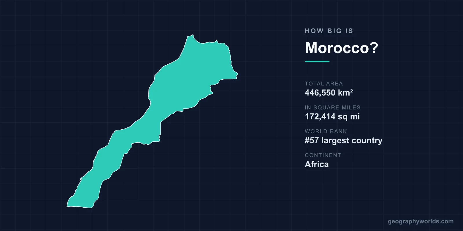
Morocco covers 446,550 km², or 172,414 square miles, making it the 57th largest country in the world. That is a little larger than Sweden or Uzbekistan and about four-fifths the size of France. But it is one of the few national area figures that routinely appears in two versions differing by more than 50 per cent, because it depends on how you treat Western Sahara.
The Two Numbers
Western Sahara covers roughly 266,000 km². Morocco administers the large majority of it, claims all of it, and Moroccan official figures give the country's area as around 710,850 km² — which would place it about 40th in the world rather than 57th.
The United Nations lists Western Sahara as a non-self-governing territory. The Polisario Front claims it as the Sahrawi Arab Democratic Republic, recognised by a number of states and a member of the African Union. A UN mission, MINURSO, has been deployed since 1991 to organise a referendum that has never been held.
Most international reference sources therefore give Morocco's area excluding Western Sahara, which is the 446,550 km² figure used here. Both numbers are in circulation and neither is neutral.
The Sand Wall Through Western Sahara
The territorial reality is marked physically. Morocco built a sand wall — the berm — running roughly 2,700 kilometres through Western Sahara, constructed in stages during the 1980s.
It consists of sand and stone ramparts several metres high, with bunkers, artillery positions, radar and one of the densest minefields in the world alongside it. It separates the Moroccan-controlled western portion, containing the phosphate deposits at Bou Craa, the fishing ports and essentially all the population, from the eastern strip held by Polisario.
It is among the longest continuous barriers ever constructed, and it is the reason the area dispute has been static rather than fluid for four decades.
The Size of Sweden, or of Chile
- Sweden (450,295 km²) is almost exactly the same size as Morocco proper.
- California (423,967 km²) is slightly smaller.
- France (551,695 km²) is about a fifth larger.
- Spain (505,992 km²), across the strait, is somewhat larger.
- Including Western Sahara, Morocco would be comparable to Chile or Zambia.
The Mountains Down the Middle
Morocco is the most mountainous country in North Africa. The Atlas system runs north-east to south-west in three parallel chains: the Rif along the Mediterranean, the Middle Atlas, and the High Atlas, which reaches 4,167 metres at Toubkal — the highest point in North Africa and in the Arab world.
The Anti-Atlas runs south of that before the land falls away into the Sahara. The ranges are what separate Morocco's climate from Algeria's interior: they catch Atlantic moisture, which is why the northern and western slopes are green and support agriculture while the land beyond is desert.
They also explain the country's history of regional autonomy. The distinction between bled el-makhzen, the land of government, and bled es-siba, the land of dissidence, was substantially a distinction between plains the sultan could tax and mountains he could not.
Two Coasts
Morocco has around 1,835 kilometres of coastline on the Atlantic and roughly 500 on the Mediterranean, which makes it one of relatively few countries facing both.
The Strait of Gibraltar is about 14 kilometres wide at its narrowest, and the Moroccan shore faces Spain across it. The Atlantic coast supports one of the most productive fisheries in the world, driven by the Canary Current upwelling, and fishing rights in the waters off Western Sahara have been the subject of repeated European court rulings.
Spanish Territory Inside Morocco
Two pieces of land on Morocco's Mediterranean coast are not Moroccan. Ceuta, about 18.5 km², and Melilla, about 12.3 km², are Spanish cities with their own autonomous status, held since the fifteenth and sixteenth centuries respectively.
Morocco claims both. Spain treats them as integral national territory, and they are the European Union's only land borders with Africa — which is why their perimeter fences are among the most heavily fortified in the world.
Spain also holds several plazas de soberanía off the coast, including the Peñón de Vélez de la Gomera, connected to the Moroccan mainland by a sand isthmus about 85 metres long, which is sometimes described as the shortest land border in the world.
The Desert Share
A large part of Morocco's south and east is Sahara or pre-Sahara. The Erg Chebbi and Erg Chigaga dune fields, the stony hammada plateaus and the oasis valleys of the Draa and Ziz cover a substantial area with very little population.
The Draa is nominally Morocco's longest river at around 1,100 kilometres, though it reaches the Atlantic only in exceptional flood years and is dry for most of its lower course. Arable land is around 18 per cent of the total, concentrated in the Atlantic plains — the Gharb, the Chaouia, the Doukkala and the Souss.
Phosphate, Which Is Mostly About Area
Morocco holds the large majority of the world's known phosphate rock reserves — by most estimates around 70 per cent — concentrated at Khouribga, Youssoufia and Benguerir, with further deposits at Bou Craa in Western Sahara.
That is the single most consequential fact about what Morocco's territory contains. Phosphate is essential to fertiliser and has no substitute, which gives a mid-sized country a structural position in global food production, and it is part of why the Western Sahara question is not purely about sovereignty.
A Long, Old Border With Algeria
Morocco's eastern boundary with Algeria runs roughly 1,900 kilometres and has been closed since 1994. The two countries fought the Sand War in 1963 over the Tindouf and Béchar regions, which France had transferred from Moroccan to Algerian administration during the colonial period.
The dispute was never resolved so much as frozen. Algeria hosts and supports Polisario, and the Sahrawi refugee camps near Tindouf have existed since 1975. The closed border is the longest-standing in Africa and imposes considerable economic cost on both sides.
Rivers That Run Dry
Morocco's water comes from the Atlas, and it arrives seasonally. The Oum Er-Rbia, at around 555 kilometres, is the longest river flowing entirely within Morocco proper and reaches the Atlantic year-round; the Sebou drains the Gharb plain and is the most voluminous.
The Draa, nominally the longest at some 1,100 kilometres, is the more revealing case: it rises in the High Atlas, runs south-east through a string of oases, turns west and reaches the Atlantic only in exceptional flood years. For most of its length and most of the time it is a dry bed with palm groves along it.
Morocco has built well over a hundred large dams since independence, a programme begun under Hassan II explicitly to secure irrigation, and the country has among the highest reservoir capacity in Africa. A multi-year drought through the 2020s nonetheless dropped storage to critical levels, forcing restrictions on urban supply and on irrigated agriculture — a reminder that in a country where most of the area is arid, the usable extent is set by rainfall rather than by the boundary.
Where the People Are
With around 39 million people in 446,550 km², Morocco's density is roughly 87 per square kilometre — but that average describes almost nowhere.
The population is concentrated on the Atlantic plains between Kenitra and El Jadida, in the Casablanca-Rabat corridor, and in the northern cities of Fez, Meknes and Tangier. Casablanca's metropolitan area alone holds several million. South and east of the Atlas, densities fall to a handful of people per square kilometre, and Western Sahara, whether or not one counts it, has among the lowest population densities on earth at roughly two people per square kilometre.
Around two-thirds of Moroccans now live in cities, up from under a third at independence in 1956, which means the country's effective inhabited area has been shrinking even as its population has more than quadrupled.
Ceuta, Melilla and the Fences
The land Morocco does not control on its own coast is tiny in area and enormous in significance. Ceuta covers about 18.5 km² and Melilla about 12.3 km², together less than a thousandth of one per cent of Morocco's territory.
Both are Spanish, held since the fifteenth and sixteenth centuries, and both are surrounded by multi-layered fences six metres high with sensors, watchtowers and rapid-response units, because they constitute the European Union's only land frontier with Africa. Attempts to cross in large groups have repeatedly ended in deaths, most severely at Melilla in June 2022.
Spain also holds several plazas de soberanía — rocks and islets off the Moroccan coast including the Chafarinas, Alhucemas and the Peñón de Vélez de la Gomera, which is joined to the mainland by a sand isthmus about 85 metres across, sometimes described as the shortest land border in the world. Morocco claims all of them, and the dispute over Perejil island in 2002 briefly produced a military standoff between two NATO members over an uninhabited rock of roughly 0.15 km².
Two Answers, and Both Are Political
446,550 km² by the figure most international sources use, 57th in the world, about the size of Sweden — or 710,850 km² and around 40th if you accept the Moroccan claim.
It is one of the clearest illustrations that a country's area is a political statement as much as a measurement, and that the right answer depends on which map you are holding. Morocco in wider terms is our Morocco country guide, and the desert filling its south — and most of the territory in dispute — is described in the geography of the Sahara.
