
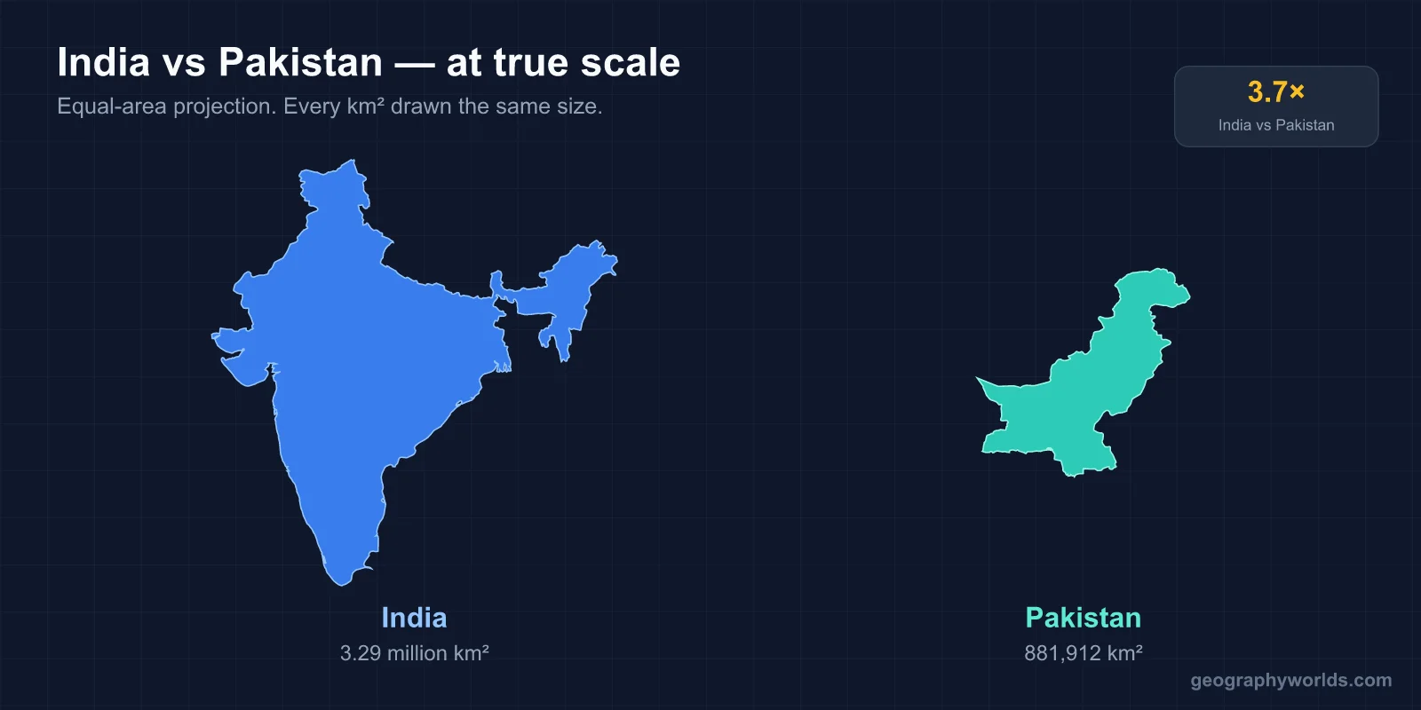
India is the bigger, more populous and richer of the two. It covers 3,287,263 km² against Pakistan’s 881,913 km², so India is about 3.7 times larger. India’s official figure counts the whole of the former princely state of Jammu and Kashmir, including areas Pakistan and China administer; Pakistan’s covers only the parts it administers, Azad Kashmir and Gilgit-Baltistan. India had roughly 1.46 billion people in 2025, while Pakistan’s 2023 census counted 241.5 million, excluding Azad Kashmir and Gilgit-Baltistan. On IMF estimates for 2025–26, India’s nominal GDP per head is about $2,813 and Pakistan’s about $1,700. The capitals are New Delhi and Islamabad. India’s official languages at national level are Hindi and English; Pakistan’s are Urdu and English. Both countries were carved out of British India on 14–15 August 1947, and almost every contrast below traces back to that partition.
The Ganges Plain Against the Indus Plain
Each country is organised around one great river system, and the two rivers explain much of how people live. India’s heartland is the plain of the Ganges, a 2,525-kilometre river that rises in Uttarakhand, collects the Yamuna and a series of tributaries draining from Nepal, and runs east through Uttar Pradesh, Bihar and West Bengal before entering Bangladesh as the Padma. This plain, fed by monsoon rain, carries the densest belt of farming population in the country and cities such as Kanpur, Varanasi and Patna.
Pakistan is, in effect, the valley of the Indus. The river is about 3,180 km long, rises in Tibet, crosses Indian-administered Ladakh and Pakistani-administered Gilgit-Baltistan, then turns south past the Nanga Parbat massif and flows the length of Pakistan to the Arabian Sea near Karachi. On the plains it is joined by the Panjnad, which gathers the five rivers of Punjab: the Jhelum, Chenab, Ravi, Beas and Sutlej. Much of lower Pakistan is dry, so the country’s wheat, cotton and rice depend on irrigation canals drawn from this one system rather than on rain.

The two countries share the Thar Desert, which covers about 264,091 km²; roughly two-thirds of it lies in Rajasthan and neighbouring Indian states, the rest in Sindh and Punjab in Pakistan. They also share the ownership of mountains in a way that follows the Kashmir dispute. Pakistan’s highest summit is K2, at 8,611 m the second-highest mountain on Earth, which stands in the Karakoram on the line between Pakistani-administered Gilgit-Baltistan and the China-administered Trans-Karakoram Tract. India’s highest summit on territory it controls is Kangchenjunga, 8,586 m, on the border between Sikkim and Nepal. The difference is only 25 metres, but the landscapes differ: India also has a peninsula, with the Deccan Plateau and the Western Ghats, which have no Pakistani equivalent.
Eighty Percent to Pakistan, Twenty to India: The 1960 Water Split
Because the Indus rises in or passes through territory that India controls, water is the part of the geography that most directly binds the neighbours. The Indus Waters Treaty, brokered by the World Bank and signed in Karachi on 19 September 1960 by Jawaharlal Nehru and Ayub Khan, split the six rivers of the basin. India received the three eastern rivers, the Beas, Ravi and Sutlej. Pakistan received the three western rivers, the Indus, Jhelum and Chenab, though India kept rights to limited irrigation and to run-of-river hydropower on them.
By volume, India received roughly 20% of the system’s water and Pakistan roughly 80%, a split that reflects how much more of Pakistan’s farmland depends on the basin. The treaty survived the wars of 1965 and 1971 and was often cited as one of the most durable water-sharing agreements anywhere. On 23 April 2025, after the attack on tourists at Pahalgam in Indian-administered Kashmir, the Indian government announced that it was suspending the treaty, citing national security and alleging Pakistani support for militancy; Pakistan rejects those allegations. The suspension turned a technical river-flow arrangement into a front-page issue in both countries.
1.46 Billion People Against 241 Million
India is the world’s most populous country. Its population rose from 361 million in 1951 to about 1.46 billion in 2025, and it is organised into 28 states and 8 union territories, many drawn along language lines after the States Reorganisation Act of 1956. The largest city proper, according to the 2011 census, is Mumbai, with almost 12.5 million people; Delhi, Kolkata, Bengaluru, Chennai and Hyderabad each anchor metropolitan regions of many millions.
Pakistan ranked fifth in the world by population in the 2023 census, with 241,499,431 people in its four provinces, Punjab, Sindh, Khyber Pakhtunkhwa and Balochistan, plus the Islamabad Capital Territory. Karachi, with more than 20 million people, is the largest city and was the federal capital from 1947 to 1959, before the government moved north, first provisionally to Rawalpindi and then, in 1967, to the purpose-built Islamabad. Lahore, the capital of Punjab, is the second city. The gap in absolute numbers is roughly six Indians for every Pakistani, but Pakistan is growing faster: its population rose more than sevenfold between 1951 and 2023, its fertility rate was estimated at 3.5 children per woman in 2022, and its median age is only 19.
Hindi and Urdu: One Spoken Language, Two Scripts
The most striking cultural contrast is also the smallest in everyday speech. Hindi and Urdu are two standard registers of Hindustani, the lingua franca of north India and of Pakistan. Colloquially they are largely mutually intelligible; the difference lies in script and vocabulary. Standard Hindi is written in Devanagari and draws learned words from Sanskrit, while Urdu is written in a Perso-Arabic script, usually in the Nastaliq style, and borrows from Persian and Arabic. A Bollywood film from Mumbai and a television drama from Lahore can be followed on either side of the border.
Beyond Hindustani, the two countries diverge. India’s linguistic map is enormous, with Bengali, Marathi, Telugu, Tamil, Gujarati, Kannada and Malayalam each the first language of tens of millions, and states such as Tamil Nadu and Kerala using Dravidian languages unrelated to Hindi. In Pakistan, Punjabi is the first language of about 37% of the population, and Pashto, Sindhi, Saraiki and Balochi each have millions of native speakers, while Urdu serves as the common national language.
Religion follows the logic of 1947. At the 2011 census, 79.8% of Indians were Hindu, 14.2% Muslim, 2.3% Christian and 1.7% Sikh, which gives India the third-largest Muslim population in the world after Indonesia and Pakistan. In Pakistan, Islam is the state religion under Article 2 of the constitution and is followed by 96.35% of the population, most of them Sunni, with Shia, Hindu, Christian and Ahmadi minorities.

The shared Mughal past is visible on both sides. The Badshahi Mosque, completed in 1673 opposite Lahore Fort, was the largest mosque built during the Mughal era; the Taj Mahal in Agra and the Red Fort in Delhi belong to the same imperial tradition. Cricket is the other common language: India won the men’s Cricket World Cup in 1983 and 2011, Pakistan in 1992, and India joined Test cricket in 1932, Pakistan in 1952.
A Services Boom in Bengaluru, Textiles in Faisalabad
India’s economy was the world’s sixth-largest by nominal GDP and third-largest by purchasing power parity as of April 2026. After the balance-of-payments crisis of 1991, the government cut tariffs and opened industries to private investment. Services now make up around 55% of output, led by software and outsourcing firms concentrated in Bengaluru, Hyderabad and Pune, and India supplies about a fifth of global demand for pharmaceuticals. Nominal GDP per head, at about $2,813, still ranks only around 148th in the world, a reminder of how large the population is and how many Indians still live in rural areas.
Pakistan’s economy is about $408 billion in nominal terms (2025), roughly a tenth of India’s. It relies more on agriculture and on textiles, which provide the bulk of its exports; growth centres cluster along the Indus in Karachi and in Punjabi cities such as Lahore, Faisalabad, Gujranwala and Sialkot. Sialkot alone exported around $2.5 billion of goods in 2017, from surgical instruments to footballs. Pakistan has faced repeated balance-of-payments crises and a weak rupee, and nominal GDP per head of about $1,700 ranks around 160th.
Parliament in New Delhi, the Army in Rawalpindi
Both countries are federal parliamentary republics on paper, but their political histories split early. India adopted its constitution on 26 January 1950 and has changed government through elections ever since, with the exception of the 21-month Emergency declared by Indira Gandhi in 1975–77. Pakistan became a republic under its first constitution in 1956, which was suspended when martial law was imposed in 1958 and General Ayub Khan took power. General Zia-ul-Haq ruled after the 1977 coup, and General Pervez Musharraf after the bloodless coup of 1999; the army, headquartered in Rawalpindi next to Islamabad, has remained a central actor even under civilian governments. The current constitution dates from 1973.
The neighbours have fought wars in 1947–48, 1965 and 1971, the last of which ended with East Pakistan becoming Bangladesh, and a limited conflict at Kargil in 1999. India tested a nuclear device, Smiling Buddha, at Pokhran in Rajasthan on 18 May 1974 and carried out five further tests in May 1998. Pakistan answered with five simultaneous tests in the Chagai District of Balochistan on 28 May 1998.
At the centre of the rivalry is Kashmir. Both countries claim the whole of the former princely state of Jammu and Kashmir. India controls about 55% of its land area and 70% of its population, including the Kashmir Valley and Ladakh; Pakistan controls about 30%, made up of Azad Kashmir and Gilgit-Baltistan; China controls the remaining 15%, including Aksai Chin. The ceasefire line was renamed the Line of Control under the Simla Agreement of 2 July 1972, and it remains a de facto rather than a legally recognised international border. South of it, the India–Pakistan border follows the Radcliffe Line through Punjab and runs down to Sir Creek in the Rann of Kutch.
For the full background to the dispute, see our guide to the Kashmir border dispute, and for how the boundary was drawn in the first place, read about the historical geography of the partition of India.