

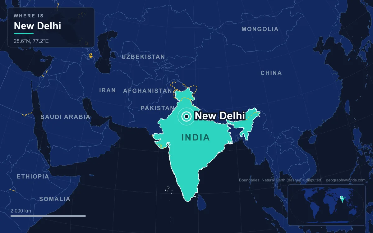
New Delhi is the capital of India. It is a planned city inside the National Capital Territory of Delhi, on the plains west of the Yamuna River in the north of the country, and it houses all three branches of the national government: the President at Rashtrapati Bhavan, Parliament, and the Supreme Court. The capital itself is small. The New Delhi Municipal Council area covers 42.7 square kilometres and counted 249,998 residents in the 2011 census, while the wider National Capital Territory around it held about 16.8 million people that year. It was laid out as an imperial set piece by the British architects Edwin Lutyens and Herbert Baker after 1911 and inaugurated in February 1931.
Raisina Hill and the Viceroy’s House That Became Rashtrapati Bhavan
The capital began with a political decision. Calcutta had been the seat of British India, but it had also become the centre of nationalist agitation after Lord Curzon partitioned Bengal in 1905. At the Delhi Durbar on 12 December 1911, George V announced that the capital would move to Delhi, the old seat of the Delhi Sultanate and the Mughal Empire. Three days later he and Queen Mary laid a foundation stone for the new city at Kingsway Camp in the north of Delhi. That site was soon rejected as too expensive and too crowded with heritage, and the planning committee, which included Lutyens, moved the scheme south to a rocky outcrop called Raisina Hill.
About 4,000 acres were acquired between 1911 and 1916, which meant relocating the villages of Raisina and Malcha and about 300 families under the Land Acquisition Act of 1894. On top of the hill Lutyens built the Viceroy’s House. Work started in 1912 and the building was largely finished by 1929. It is H-shaped, with 340 rooms, about 2.5 kilometres of corridors and roughly 200,000 square metres of floor area on a 320-acre estate. By floor area it is the largest official residence of any head of state in the world. Its copper-faced dome borrows from both the Pantheon in Rome and the Buddhist stupa at Sanchi. The columns carry Lutyens’ invented “Delhi Order”, which adds carved Indian bells to acanthus leaves. Because an old Indian belief held that ringing bells marked the end of a dynasty, it was said that British rule would last as long as these stone bells stayed silent.
The building was the Viceroy’s House from 1931 to 1947 and Government House under the Governor-General from 1947 to 1950. When India became a republic in 1950, it was renamed Rashtrapati Bhavan, the President’s House. Below the palace, Herbert Baker’s two Secretariat blocks, known as North Block and South Block, flank the approach. Both are built of cream and red Dholpur sandstone. The famous flaw in the design is the slope between them. Lutyens and Baker quarrelled over it, the gradient was set at 1 in 22, and the result is that the palace front sinks out of sight as you walk up the avenue.
India Gate and the Ceremonial Axis of Kartavya Path
From Raisina Hill the city’s spine runs due east. The British called it Kingsway, after George V. After independence it became Rajpath, a Hindi rendering of the same idea. In September 2022, after a redevelopment under the Central Vista project, it was renamed Kartavya Path, the “Path of Duty”. At Vijay Chowk it meets Sansad Marg, the road to Parliament. Every 26 January the Republic Day parade marches down it.
At the eastern end stands India Gate, which Lutyens designed as the All India War Memorial. The Duke of Connaught laid its foundation stone on 10 February 1921. Lord Irwin inaugurated it on 12 February 1931, as part of the ceremonies that opened the new capital. The arch is 42 metres tall and made of sandstone on a base of red Bharatpur stone. It commemorates about 74,187 soldiers of the Indian Army who died between 1914 and 1921 in the First World War and the Third Anglo-Afghan War. About 13,300 names are carved into it.

The memorial has changed with the country. After the 1971 war with Pakistan, the Amar Jawan Jyoti, a black marble plinth with an inverted rifle and a helmet, was placed under the arch. It was inaugurated on 26 January 1972 and served as India’s tomb of the unknown soldier. A separate National War Memorial opened nearby in February 2019. On 21 January 2022 the old flame was merged with the new one. About 150 metres east of the arch is a 22-metre stone canopy that once held a marble statue of George V. Protesters from the Samyukta Socialist Party defaced it in 1965, and it was taken away in 1968 and moved to Coronation Park, back where the capital was first proclaimed. A statue of Subhas Chandra Bose was unveiled beneath it on 8 September 2022.
Samvidhan Sadan, the Round Council House, and the 2023 Parliament Beside It
North of Kartavya Path, on Sansad Marg, sits a building that looks like a stone drum. The Duke of Connaught laid its foundation on 12 February 1921. It was designed by Lutyens and Baker as the Council House for the Imperial Legislative Council, which the Montagu–Chelmsford reforms of 1919 had made bicameral. It opened in January 1927 with a ring of 144 sandstone columns around a circular central chamber and three semicircular halls, one each for the Chamber of Princes, the Council of State and the Central Legislative Assembly.
Few buildings in the capital have seen more history. The Constituent Assembly sat there from 15 August 1947 until the Constitution took effect. From 26 January 1950 it was the Parliament of the Republic, housing the Lok Sabha and the Rajya Sabha for nearly 73 years. By the 2010s it was ageing and too small. Under the Central Vista Redevelopment Project, work began in January 2021 on a triangular new Parliament House designed by Bimal Patel, on the plot right next to the old one. The Supreme Court cleared the project that same month after litigation over land-use and environmental rules.
Prime Minister Narendra Modi inaugurated the new building on 28 May 2023. It held its first sitting on 19 September 2023. Its Lok Sabha chamber seats 888 members and can hold 1,272 for a joint session. The Rajya Sabha chamber seats 384. The old round building was not demolished. It was renamed Samvidhan Sadan, “Constitution House”, so the two parliaments now stand side by side.
Connaught Place, the White Georgian Ring Built for Commerce
A capital of offices needed shops, and in 1929 work began on a commercial centre north of the government quarter. Robert Tor Russell, chief architect of the Public Works Department, designed it, and Sobha Singh built much of it. The name honours Prince Arthur, Duke of Connaught. The model was the Royal Crescent in Bath. Connaught Place has two storeys instead of three and closes almost into a full circle, with an Inner Circle, a Middle Circle and an Outer Circle known as Connaught Circus. The ground floors were built for shops and the upper floors for flats, behind a white colonnade. It was completed in 1933. The villages of Madhoganj, Jaisingh Pura and Raja ka Bazaar were cleared for it, and their residents were moved to Karol Bagh.
Connaught Place has kept changing. Palika Bazaar, one of Delhi’s first underground markets, opened beneath the Inner Circle in the late 1970s. In 1986 Charles Correa’s red sandstone and glass Jeevan Bharti tower rose above the white arcades. The central park was rebuilt in 2005–06 above Rajiv Chowk metro station, an interchange between the Yellow and Blue lines of the Delhi Metro. In July 2018 it ranked as the ninth most expensive office location in the world, at about 1,650 US dollars per square metre a year.
Jantar Mantar, the 1724 Observatory the Planners Left Standing
When the villages near Connaught Place were cleared, three older structures were kept: a Hanuman temple, a Jain temple and Jantar Mantar. The observatory is nearly two centuries older than anything Lutyens built. Maharaja Jai Singh II of Jaipur completed it around 1724. It was the first of five observatories he built, and the others are in Jaipur, Ujjain, Mathura and Varanasi. Its thirteen masonry instruments were used to compile astronomical tables and to predict the movements of the Sun, Moon and planets without telescopes.

The largest instrument is the Samrat Yantra, a giant equal-hour sundial. Its triangle is about 70 feet high and 114 feet long at the base, and its 128-foot hypotenuse runs parallel to the Earth’s axis, pointing at the celestial pole. The office towers behind it are a reminder that New Delhi was built around older Delhi, not on empty ground.
Lodi Gardens, Where Fifteenth-Century Tombs Became a Colonial Park
The southern edge of Lutyens’ plan shows the same thing. Land was acquired as far as Safdarjung’s Tomb to create what is now the Lutyens’ Bungalow Zone, the tree-lined district of large official bungalows south of the government quarter. Between Khan Market and Safdarjung’s Tomb, on Lodi Road, is Lodi Gardens, a park of about 90 acres laid out around some of the few surviving buildings of the Sayyid dynasty (1414–1451) and the Lodi dynasty (1451–1526). The octagonal tomb of Muhammad Shah, the last Sayyid ruler, dates from 1444. The Bara Gumbad, a large domed gateway, and its three-domed mosque were built in 1494 under Sikandar Lodi. Sikandar Lodi’s own walled tomb stands on the north side. The colonial park around them was opened on 9 April 1936 by Lady Willingdon, the Viceroy’s wife, as Lady Willingdon Park, and renamed Lodi Gardens after independence.
The residential quarter next to it, Lodi Colony, went up in the 1940s to house government staff. It was one of the last residential districts the British Raj built before independence. In the 1950s the Central Public Works Department laid out Chanakyapuri to the south-west as the diplomatic enclave, with embassies and high commissions along the wide Shanti Path. The Sixty-ninth Amendment of 1991 made Delhi the National Capital Territory, with an elected government from 1993, although law and order stayed with the central government.
That leaves New Delhi as a small, low, green capital inside a very large city. It sits on the Indo-Gangetic Plain, with the Delhi Ridge, the last remnant of the Aravalli Range, as its only real high ground. For the megacity that surrounds the Lutyens quarter, from the Mughal walled city to the satellite towns of Gurgaon and Noida, see our guide to Delhi’s city geography. The India country guide covers the nation the capital governs. If you have wondered how the capital region measures up against India’s commercial capital, our comparison asking whether Delhi is bigger than Mumbai has the numbers.
Quick Facts About New Delhi
- Country: India
- Continent: Asia (South Asia)
- Country population: approximately 1476.6 million
- Capital city status: New Delhi is the capital of India, the seat of national government, and the location of foreign embassies, parliament, and the head of state's official residence.
Frequently Asked Questions
What is the capital of India?
The capital of India is New Delhi. New Delhi is the seat of national government, hosts most foreign embassies and consulates, and is typically where the head of state and parliament are located.
What continent is New Delhi in?
New Delhi, the capital of India, is located in Asia, in the South Asia region. As India's capital, New Delhi serves as the country's primary connection to the broader Asian political, economic, and cultural sphere.
Why is New Delhi the capital of India?
New Delhi was chosen as the capital of India for reasons that typically combine geography, history, and politics. Capital city selections often reflect a desire for centrality (being accessible from across the country), historical importance (being a longstanding seat of government or culture), or neutrality (being acceptable to multiple regions or ethnic groups within the country). The specific reasons for New Delhi's designation are detailed in the city's history above.
What is New Delhi known for?
As the capital of India, New Delhi is best known for housing the country's central government institutions — parliament, presidential or royal residences, supreme court, and key ministries. It is also typically a major cultural and economic center within India, hosting national museums, embassies, and signature monuments. The introduction and history sections above provide detailed coverage of the city's specific notable institutions and landmarks.
Related Pages
- India Country Guide — full geography, climate, economy, and culture overview
- Flag of India — meaning, history, and design of India's national flag