

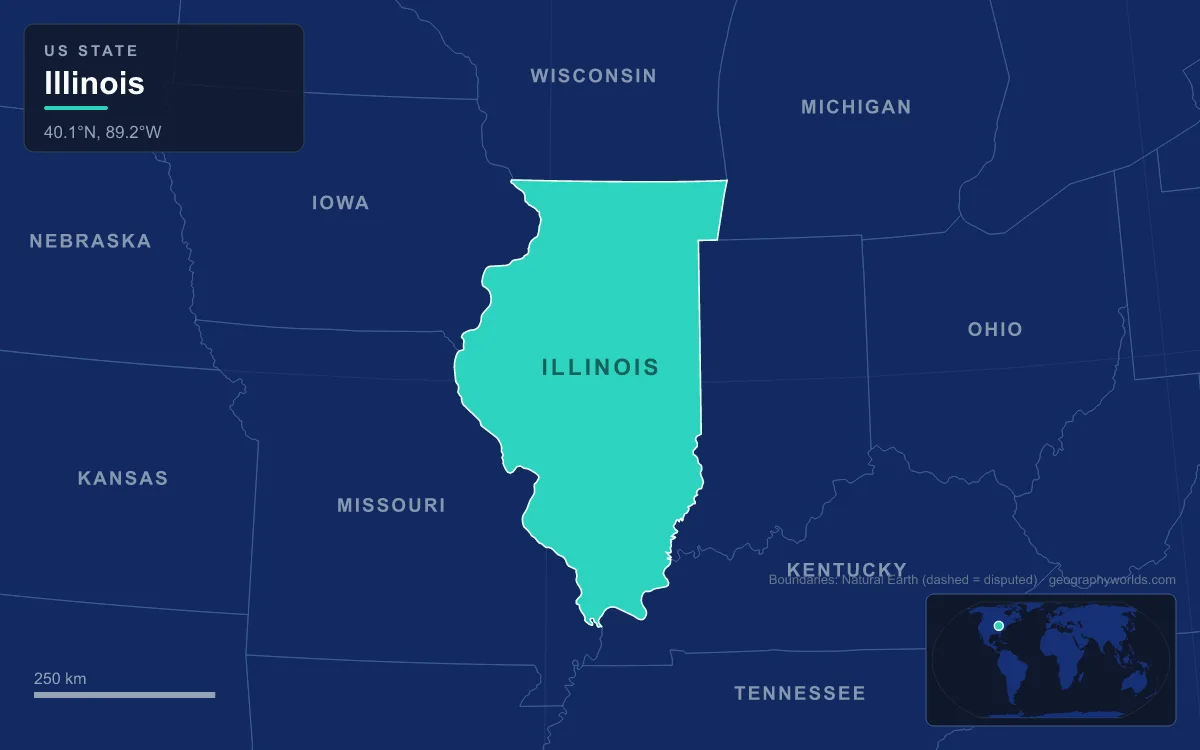
Illinois is mostly a flat glacial till plain, the old tallgrass prairie of the centre, but its landforms change sharply at the edges: the unglaciated Driftless hills of the far north-west, the lake plain and moraines around Chicago, the sandstone canyons of the Illinois River valley, the Mississippi River bluffs and floodplain in the west, the Shawnee Hills in the south and a cypress-swamp lowland at the southern tip. The highest natural point is Charles Mound in Jo Daviess County at 376 m (1,235 ft), and the lowest is the Mississippi River at Cairo at 85 m (279 ft), so the whole state spans less than 300 m of relief. Illinois covers 150,010 km² (57,918 sq mi) and stretches about 630 km (390 mi) from north to south, with an average elevation of about 180 m (600 ft). What made the difference between flat and rugged was ice: wherever the glaciers reached, they planed the land and buried it in till, and the few corners they missed kept their hills. Taking the regions one at a time, from the Wisconsin line to the Ohio River, shows how.
The Driftless Corner of Jo Daviess County
In the extreme north-west, a small part of Illinois belongs to the Driftless Area, a region shared with south-western Wisconsin, south-eastern Minnesota and north-eastern Iowa that was never covered by ice during the last glacial period. “Driftless” means it lacks drift, the till, sand and gravel that glaciers leave behind. Instead of smoothed plain, the landscape is one of steep hills, forested ridges and deeply carved valleys.
Charles Mound, the state high point, sits here in Scales Mound Township, about 3.2 km (2 mi) north-east of the village of Scales Mound and 18 km (11 mi) north-east of Galena. Despite the name, it is a natural erosional hill, not a Native American earthwork, and its summit is only about 400 m (0.25 mi) from the Wisconsin border. It is the lowest state high point in the Midwest, a gentle rise on private farmland rather than a peak.

The same rocks held lead ore. The mineral galena gave its name to the town of Galena, where Meskwaki, Ho-Chunk, Sauk and Menominee miners had worked the deposits for more than a thousand years before the first major mineral rush in the United States. By 1828 Galena had an estimated 10,000 people, rivalling Chicago at the time.
The Chicago Lake Plain and the Valparaiso Moraine
The north-east corner is the flattest part of a flat state, because it was the floor of a lake. About 13,000 years ago, meltwater from the retreating ice filled Lake Chicago, the ancestor of Lake Michigan, and it drained south-west through the Chicago Outlet River along the Des Plaines and Sag valleys. When the water fell back, it left a level lake plain on which Chicago was built.
That plain is ringed by the Valparaiso Moraine, a recessional moraine that forms an immense U around the southern end of the Lake Michigan basin. It is a band of hilly till and sand dropped where the thinning glacier stalled, and in Illinois it runs south from the Wisconsin line through Lake, McHenry, Cook, DuPage and Will counties before turning into Indiana. The Tinley Moraine formed later, closer to the lake. The Valparaiso ridge is part of the continental divide between the Great Lakes–St. Lawrence and Mississippi basins, and a canal first breached that low divide at the Chicago Portage gap in the mid-19th century. The Chicago Sanitary and Ship Canal, completed by 1900, reversed the flow of the Chicago River’s main stem and South Branch, so that water now leaves Lake Michigan and flows toward the Mississippi.
At the lake edge, the land is still shifting. Illinois Beach State Park in northern Lake County sits on the Zion Beach Ridge Plain, about 19 km (12 mi) long, with dunes, wetlands and black oak savanna along more than 10 km (6 mi) of Lake Michigan shore.
The Grand Prairie of Central Illinois
South and west of Chicago lies the heart of the state: a till plain left by repeated glaciations, including the Illinoian glaciation of about 191,000 to 130,000 years ago, which covered about 85 percent of Illinois and reached its southernmost point in North America near Carbondale, and the later Wisconsin glaciation, which left a series of low curved moraines across the north and east. The land between those ridges was once almost unbroken tallgrass prairie. The till and the wind-blown silt called loess on top of it weathered into deep, dark soils.
This is the Illinois of Peoria, Springfield, Bloomington-Normal, Decatur and Champaign-Urbana, a landscape of corn and soybeans. Sticky prairie clay clogged cast-iron ploughs until John Deere, a blacksmith in Grand Detour, made the first commercially successful steel plough in 1837, a polished, self-scouring blade that could cut the prairie’s sticky clay. Very little native prairie survives. The largest conservation site in the Chicago region is the Midewin National Tallgrass Prairie on the site of the former Joliet Army Ammunition Plant, near Elwood, founded in 1996; it is the only federal tallgrass prairie preserve east of the Mississippi and has kept a conservation herd of bison since 2015.
Starved Rock and the Illinois River Valley
The Illinois River, 439 km (273 mi) long, begins where the Des Plaines and Kankakee rivers meet south-west of Chicago and crosses the state diagonally to the Mississippi at Grafton. Much of its course was shaped by the Kankakee Torrent, a series of catastrophic floods released when moraines holding back Lake Chicago and other glacial lakes gave way. The torrent is dated to about 19,000 calibrated years ago, and the Kankakee and Illinois rivers largely follow the paths the floodwater cut, probably in a matter of days. Below the Great Bend in Bureau County, the Illinois occupies the abandoned valley of the ancestral Mississippi.
Near Utica in LaSalle County, the flood cut into St. Peter Sandstone, a pure, poorly cemented rock that is normally buried. It reaches the surface here because of an anticline, an upward fold in the strata, and where streams cross the fold they cut canyons. Starved Rock State Park, 1,064 hectares (2,630 acres) on the south bank, is defined by these canyons and draws more than two million visitors a year, the most of any Illinois state park. The park takes its name from a sandstone butte above the river, where the French built Fort St. Louis by 1683 and where, according to a legend with no historical evidence behind it, a band of Illinois people starved under siege around 1769.
The Mississippi Bluffs and the American Bottom
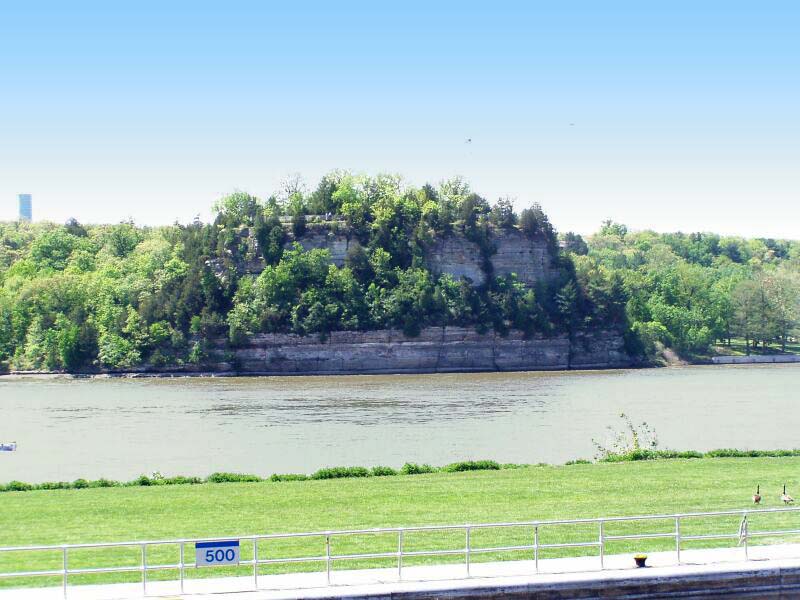
Almost the whole western border of Illinois follows the Mississippi River, and along much of it limestone bluffs stand above a wide floodplain. The best known stretch of floodplain is the American Bottom, about 450 km² (175 sq mi) of rich alluvial land running from Alton south to the Kaskaskia River, opposite St. Louis. Its soils supported the city of Cahokia, whose Monks Mound, begun between 900 and 955 CE, is about 30 m (100 ft) high and the largest pre-Columbian earthwork in the Americas, with a base roughly the size of the Great Pyramid of Giza.
The river is not a fixed line. In the 19th century, crews stripped the banks of timber to fuel steamboats and railways, the banks collapsed, and the channel widened and wandered. In April 1881 the Mississippi shifted east into the lower 16 km (10 mi) of the Kaskaskia River and destroyed most of Kaskaskia, the first state capital from 1818 to 1819. The state line stayed where it was, so Kaskaskia is now an Illinois exclave on the west side of the river, reachable only from Missouri, with 21 residents in 2020.
The Shawnee Hills and the Garden of the Gods
Across the south of the state, the Illinoian ice sheet stopped just short. Beyond its limit rise the Shawnee Hills, part of the Interior Low Plateaus, which curve east–west from the Mississippi to the Ohio along the southern rim of the Illinois Basin. Here the Mississippian and Pennsylvanian limestones and sandstones that lie deep under central Illinois tilt up to the surface, and their harder layers form ridges and cliffs that the ice never ground down. Tourist brochures call them the “Illinois Ozarks”, though the true Ozarks begin across the Mississippi in Missouri.
The showpiece is the Garden of the Gods Wilderness, 13.4 km² (3,318 acres) in Hardin, Pope, Saline and Gallatin counties near the village of Equality. It sits on an uplifted plateau of grey sandstone laid down about 300 million years ago, and erosion has cut it into hoodoos with names like Anvil Rock, Camel Rock and Table Rock, with a view from Buzzards Point over the forest. The surrounding Shawnee National Forest, about 201,782 hectares (498,615 acres), is the largest publicly owned landholding in Illinois; much of it was worn-out farmland bought from the 1930s onward. Faulting in the hills also concentrated fluorite, and at one time about 80 percent of the world’s fluorspar ore came from mines near Rosiclare and Cave-in-Rock on the Ohio.
The Cache River Wetlands and the Cairo Lowland
South of the hills, Illinois ends in a wedge of low, wet ground between the two great rivers. The Cache River, 148 km (92 mi) long, drains 1,910 km² (737 sq mi) of Alexander, Johnson, Massac, Pope, Pulaski and Union counties at the meeting point of four physiographic regions. Its wetlands form America’s northernmost cypress–tupelo swamp and hold 91 percent of the state’s high-quality swamp communities, with bald cypress rising from open water, a scene that belongs more to Arkansas or Louisiana than to the Midwest. The Cache was named a Wetland of International Importance under the Ramsar Convention in 1996, and Cypress Creek National Wildlife Refuge, established in 1990, protects more than 65 km² (16,000 acres) of it.
At the very tip, Cairo sits at the confluence of the Ohio and Mississippi, the lowest place in the state and the only Illinois city entirely ringed by levees. From the Driftless farmland at Charles Mound to the levees of Cairo is under 300 m of descent, yet the regions in between could hardly be more different. For the river that shapes the whole western edge, see our Mississippi River geography guide; for the lake on the other side of the state, read about Lake Michigan’s geography; or take a broader tour in our complete guide to Illinois geography.