

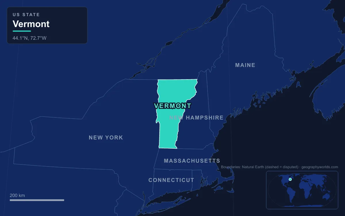
Vermont is a landlocked New England state of about 24,900 km² (9,614 sq mi), 256 km from north to south and 143 km across at its widest, along the Canadian border. Its geography runs in north–south bands: the Champlain Valley and Lake Champlain in the west, the Green Mountains down the middle, the Taconic Mountains in the southwest, rolling uplands and the Northeastern Highlands in the east, and the Connecticut River valley along the New Hampshire line. The highest point is Mount Mansfield at 1,340 m (4,395 ft); the lowest is the surface of Lake Champlain at about 29 m (95 ft). The clearest way to see those bands is to cross them, and U.S. Route 2 does exactly that, running 242 km from the New York line at Alburgh to the Connecticut River at Guildhall.
Alburgh and the Lake Champlain Islands
Route 2 enters Vermont on a bridge from Rouses Point, New York, across the Richelieu River outlet of Lake Champlain; a toll swing bridge opened here in 1937, replaced by a free fixed span on 22 September 1987. Alburgh sits on the Alburgh Tongue, a peninsula reaching down from Canada into the lake, and from it the highway hops south over a string of islands and causeways that make up Grand Isle County. Because the Treaty of Paris of 1783 fixed Vermont’s northern border along the 45th parallel, the county has no dry-land connection to the rest of the United States. Its 7,293 residents (2020 census) live on the Alburgh peninsula and the islands of North Hero, Grand Isle and Isle La Motte, all tied together by bridges and causeways.
A short detour west leads to Isle La Motte and some of the oldest rock on the route. Its bedrock is a reef about 480 million years old, built in a shallow Ordovician sea by bryozoans, stromatolites, sponges and algae, and preserved as part of the Chazy Fossil Reef, a National Natural Landmark since 2009. The dark Chazy limestone was quarried here from 1832 and sold as “black marble”; it went into the U.S. Capitol and the National Gallery of Art.
Burlington and the Floor of the Champlain Valley
From the islands the road reaches the mainland at Milton and turns south to Burlington, the state’s largest city, on the shore of Lake Champlain. The lake is 172 km long and covers about 1,331 km², shared between Vermont, New York and a sliver of Quebec. It lies at 29 to 30 m above sea level, reaches 122 m at its deepest, and drains north through the 171 km Richelieu River to the St. Lawrence. Rivers carry water from nearly half of Vermont into it, and about 250,000 people drink from it. Geologically, the Champlain Valley is the northernmost section of the Great Appalachian Valley, which runs south to Alabama.

The valley floor was briefly seabed. When the last ice sheet melted, the land beneath it was still pressed down by the weight of ice, and from about 13,000 to 10,000 years ago the Atlantic flooded in as the Champlain Sea, reaching as far south as the lake. In 1849 workers building the railway between Rutland and Burlington dug up bones about 3 m below a farmer’s field in Charlotte; they belonged to a beluga whale. The Charlotte whale was Vermont’s state fossil from 1993 to 2014 and has since been its state marine fossil. How ice sheets shaped valleys like this one is explained in this guide to glacial landforms.
The Winooski Gap Through the Green Mountains
At Burlington, Route 2 turns east and joins the Winooski River, which it follows for the next 58 km. This is the old line of the Winooski Turnpike, chartered in 1805 because the river’s flat banks offered the easiest path between Burlington and Montpelier; Interstate 89 now runs alongside. The Winooski is an antecedent river: it is older than the present shape of the Green Mountains and kept cutting down through them as they rose and eroded, which is why a road can cross the state’s main range here without climbing it.
Past Richmond and Bolton the valley narrows between two of the range’s high points. To the north lies Mount Mansfield; to the south, its north slope running down to the river, is Camel’s Hump, 1,244 m (4,083 ft). Its lopsided profile, with a steep drop on the south side, was carved by moving ice that plucked rock from its lee, making it a roche moutonnée. Samuel de Champlain called it “Le Lion Couchant” in 1609; it has carried its present name since about 1830 and appears on the Vermont state quarter. About 4 hectares (10 acres) of alpine tundra survive on its summit of phyllite, quartzite and schist.
Montpelier, Barre Granite and the Road to Danville
East of the range, the road reaches Montpelier, the state capital, where the Winooski passes the south side of downtown and the State House. The valley’s position below the mountains makes it prone to flooding: the Great Vermont Flood of 1927 killed 85 people, an ice jam flooded downtown Montpelier in 1992, and heavy rain in July 2023 pushed water in the Winooski valley above the levels of Tropical Storm Irene in 2011.
In neighbouring Barre, the rock changes. The Barre granite is a Devonian pluton, a body of magma that cooled underground and intruded the older Waits River Formation. Fine-grained and even-textured, it has been quarried for well over a century; the E. L. Smith Quarry, run by the Rock of Ages company founded in 1885, is described as the world’s largest “deep hole” granite quarry. Every headstone in Barre’s Hope Cemetery is cut from it.

Beyond Montpelier, Route 2 bends northeast toward the upper Winooski, which rises in the town of Cabot and flows southwest to the capital before turning through the mountains; its whole course to Lake Champlain is about 145 km. East of the Green Mountains there is no single range to cross, only a succession of hills and stream valleys. The road then passes into Caledonia County and runs through Danville on its way east. This stretch, between Montpelier and St. Johnsbury, was not the first choice for the highway: when U.S. 2 was designated in 1926 it followed today’s U.S. 302 to Wells River, and it moved onto this line, the old route of the 1919 Theodore Roosevelt International Highway, only in the mid-1930s.
St. Johnsbury and the Passumpsic Valley
St. Johnsbury is the gateway to the Northeast Kingdom, the name for Vermont’s three northeastern counties of Caledonia, Essex and Orleans. The town sits on the Passumpsic River, 36.5 km long, the only river that flows through all three counties. Its east and west branches rise in the hills to the north and meet at Lyndonville; the river then runs south through St. Johnsbury and Barnet to join the Connecticut. Where Route 2 leaves town it heads into Essex County and the Northeastern Highlands, a set of mountains that locals often lump in with the Green Mountains but that are geologically a separate range. The Green Mountains themselves are folded rock; Camel’s Hump, for instance, was designated a National Natural Landmark in 1968 as an exceptional example of the anticlinal folding that built the range.
Guildhall and the Connecticut River Line
The route ends at Guildhall, where a bridge crosses the Connecticut River into Lancaster, New Hampshire. The Connecticut is New England’s longest river, running 653 km from its source 270 m south of the Quebec border to Long Island Sound. A royal decision of 20 July 1764 by George III fixed the boundary between New Hampshire and New York on the river’s west bank, and Vermont inherited that line, so most of the channel lies in New Hampshire. About 41 per cent of Vermont’s land drains into the Connecticut, compared with nearly half into Lake Champlain, so the high ground of the centre of the state separates its two great drainage basins.
North of the Road: Mount Mansfield and Lake Willoughby
Two of Vermont’s signature landforms lie off Route 2. Mount Mansfield, whose summit is in Underhill and whose ridge extends into Stowe, is the highest point in the state. Seen from the east or west its long ridge resembles a human face in profile, with a Forehead, Nose and Chin, the Chin being the highest point. About 81 hectares (200 acres) of alpine tundra survive there from the Ice Age, the largest of Vermont’s three patches.
In the Northeast Kingdom, Lake Willoughby is a glacial lake in Westmore, flanked by Mount Pisgah and Mount Hor at Willoughby Gap. It is about 91 m (300 ft) deep, and its outlet flows north through Lake Memphremagog to the St. Lawrence, not south to the Connecticut.
South of the Road: Killington and the Taconic Mountains
South of the Winooski, the Green Mountains continue to Massachusetts with Killington Peak, the second-highest in the state at 1,293 m (4,241 ft), and in the north the range includes Jay Peak, 1,177 m, noted for the heaviest average snowfall in the eastern United States. In the southwest corner stands a separate range, the Taconic Mountains, which are geologically distinct from the Green Mountains. Their highest peak, Equinox Mountain, rises nearly 914 m above its eastern foot in Manchester to more than 1,170 m.
Every one of these bands changes character with the seasons, from snow on Jay Peak to ice on Lake Champlain, and this guide on the best time to visit Vermont explains when each is at its best; for how the state fits among its neighbours, see this New England geography guide.