

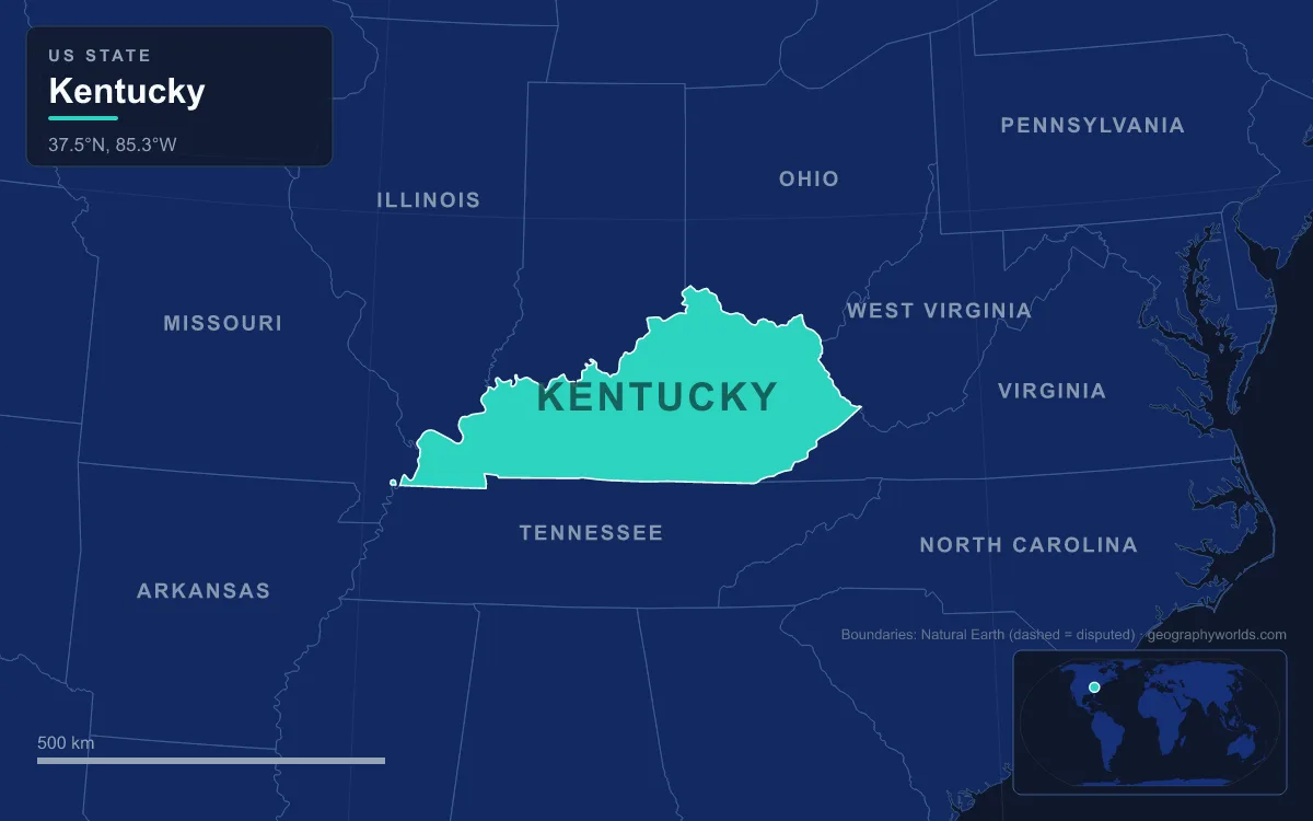
Kentucky’s landforms divide into five main regions: the rugged Cumberland Plateau and its mountains in the east, the rolling Bluegrass around Lexington in the north-centre, ringed by the conical hills of the Knobs, the cave-riddled Pennyroyal Plateau across the south, the Western Coal Field in the north-west, and the low Jackson Purchase between the Tennessee and Mississippi rivers. Across its 104,656 km² (40,408 sq mi) the state drops from 1,263 m (4,145 ft) on Black Mountain in Harlan County to 78 m (257 ft) on the Mississippi at Kentucky Bend, and six individual features show how each region was made: a coal-country summit, a mountain pass, a sandstone gorge, a limestone river canyon, the longest cave known on Earth, and a river loop that left part of the state cut off.
Black Mountain and Pine Mountain: the Cumberland Plateau’s high ground
Kentucky’s highest ground sits in its far south-eastern corner, on the Virginia line above the coal towns of Lynch, Kentucky, and Appalachia, Virginia. Black Mountain rises to 1,263 m (4,145 ft), with more than 760 m (2,500 ft) between its base and its summit, and Route 160 crosses its shoulder at the state line, the highest point on that road. The summit carries an abandoned fire lookout tower, with a Federal Aviation Administration radar dome just below it, and on clear days the Great Smoky Mountains are visible to the south.
The mountain’s story is bound up with coal. The Cumberland Plateau holds one of Kentucky’s two large coal fields, formed in Pennsylvanian-era swamps, and Lynch was once one of the largest coal-mining towns in the United States. In 1998 Jericol Mining petitioned to use mountaintop removal near Black Mountain; after public protest over the state’s high point, Kentucky bought the mineral and timber rights to the summit in 1999, halting large-scale mining there.
Just north-west runs Pine Mountain, a single ridge about 201 km (125 mi) long from near Pioneer, Tennessee, to near Elkhorn City, Kentucky. Its highest point, Birch Knob, reaches 998 m (3,273 ft) on the Virginia border. The ridge has always been a barrier: the Cumberland River at Pineville is one of only two waterways that cut all the way through it. Together with Cumberland Mountain to the south-east, it belongs to the Pine Mountain Thrust Sheet, rock pushed upward when the region was compressed.
Cumberland Gap: a notch cut by the Rocky Face Fault
On the far side of that thrust sheet, where Kentucky, Virginia and Tennessee meet, the long ridge of Cumberland Mountain is broken by a V-shaped pass at 497 m (1,631 ft). The ridge rises about 180 m (600 ft) above the gap to the south, and to the north the Pinnacle Overlook stands 270 m (900 ft) higher, at 765 m (2,505 ft).
Three structures made the gap. Compression between roughly 320 and 200 million years ago pushed the Pine Mountain Thrust Sheet upward and tilted its once-flat rocks about 40 degrees to the north-west. Between Pine Mountain and Cumberland Mountain the rocks sagged into a U-shaped fold, the Middlesboro Syncline. Then a north–south break, the Rocky Face Fault, cut across Cumberland Mountain, shattering the rock so that weathering and streams could open a notch. There is a fourth ingredient as well. Less than 300 million years ago a meteorite struck between Pine Mountain and Cumberland Mountain, leaving a crater about 5 to 6 km (3 to 3.7 mi) across; the city of Middlesboro now occupies much of it, and in 1966 Robert Dietz confirmed the impact by finding shatter cones in the local sandstone.
The gap mattered enormously to people. Long used by Native Americans, it was brought to settlers’ attention in 1750 by the Virginia physician Thomas Walker, and a party led by Daniel Boone opened the route that became the Wilderness Road, carrying pioneers into Kentucky and Tennessee. It is now part of Cumberland Gap National Historical Park.
Red River Gorge: more than 100 arches on the Pottsville Escarpment
Where the Cumberland Plateau ends on its western side, it breaks off in the Pottsville Escarpment, also called the Cumberland Escarpment, a belt of resistant sandstone cliffs and steep, narrow valleys. In east-central Kentucky the Red River has cut a canyon system into that edge. The Red River Gorge Geological Area covers about 12,000 ha (29,000 acres) of the Daniel Boone National Forest and holds more than 100 natural sandstone arches, along with high cliffs, waterfalls and rock shelters.
All of them were shaped out of the escarpment’s sandstone by weathering over millions of years. The best known, in Natural Bridge State Resort Park on the Middle Fork of the Red River, spans 24 m (78 ft) and stands 20 m (65 ft) high; the park was opened as a private attraction by the Lexington and Eastern Railroad in 1895 and became one of Kentucky’s original four state parks in 1926. The same cliff lines have made the gorge one of the world’s leading rock-climbing destinations, and its rock shelters hold 442 known archaeological and historic sites, including hearths, storage pits and animal petroglyphs. The area was designated a National Natural Landmark in 1976, and the upper gorge is a legally protected Kentucky Wild River.
The Kentucky River Palisades: an entrenched meander in the Bluegrass
West of the escarpment and the Knobs lies the Bluegrass, where Kentucky’s oldest surface rocks are exposed. The Inner Bluegrass, roughly 140 km (90 mi) around Lexington, is gently rolling country on Ordovician limestone; the Outer Bluegrass spreads across most of the north, much of it in the short, steep Eden Shale Hills. Wrapping around the south and east of the Bluegrass are the Knobs, an arc 370 km (230 mi) long of hundreds of isolated conical hills, some several hundred feet high, capped by Mississippian limestone over Devonian and Mississippian shale. They are remnants left as the edges of the Pennyroyal and Cumberland plateaus wore back.
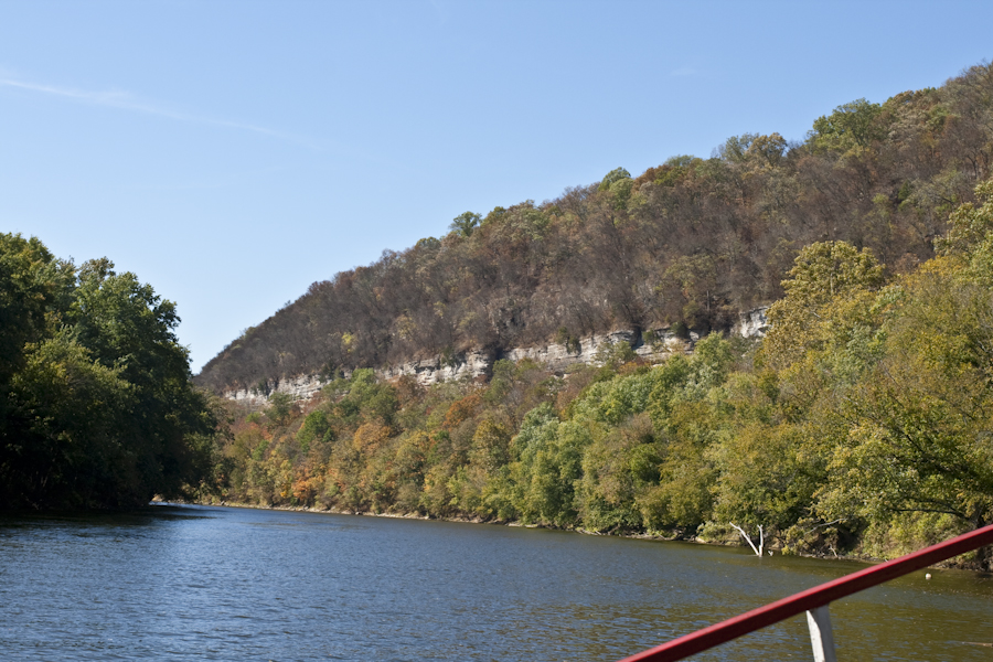
The Bluegrass also has a canyon. For about 160 km (100 mi) of its course through central Kentucky, the Kentucky River runs between the Palisades, cliffs of limestone and dolomite that tower over tight bends. The meanders first formed when the river wandered across a flat surface, the Lexington Peneplain. When sea level fell during the Quaternary, the river cut straight down while keeping its looping course, creating what geologists call an entrenched meander. Where it hit the thick, resistant limestones and dolomites of the High Bridge Group, the valley walls became sheer cliffs; the Middle Ordovician Camp Nelson Limestone in the gorge between Frankfort and Boonesborough is the oldest rock exposed anywhere in Kentucky. The Kentucky River Fault System runs along part of the Palisades, and movement on it raised the rocks on the north side several hundred feet relative to the south. Daniel Boone’s Fort Boonesborough was built close to that fault, near the eastern end of the cliffs.
Mammoth Cave: 686 km of passages under the Pennyroyal
South of the Bluegrass, across Muldraugh Hill, the Pennyroyal Plateau, whose western part is known as the Pennyrile, is Kentucky’s karst country, a land of rolling hills, sinkholes and caves formed in Mississippian limestone. Its crown is Mammoth Cave, in Edmonson County along the Green River, the longest cave system known anywhere. Since 1972, when explorers linked it to the caves under Flint Ridge, it has formally been the Mammoth–Flint Ridge Cave System, and by 2025 more than 686 km (426 mi) of passage had been surveyed, over 1.5 times the length of the second-longest system, Mexico’s underwater Ox Bel Ha.
The cave owes its size to its rock layers. The limestones began forming about 330 million years ago in a shallow sea and are capped by the Big Clifty Sandstone, which keeps water out and makes the whole system unusually stable. Water sinking through cracks in that caprock dissolved passages in the Girkin, Ste. Genevieve and St. Louis limestones below; it began reaching the Girkin about 10 million years ago, and the upper parts of the cave formed around 3.2 million years ago. Because the sandstone keeps dripping water out, many of those older upper galleries are dry and free of stalactites. Where the sandstone has worn away, dripping water decorates rooms such as Frozen Niagara, and at Cedar Sink in the south of the park a stream appears on one side of a huge sinkhole and vanishes underground on the other. Mammoth Cave National Park, covering 21,046 ha (52,007 acres), was established on 1 July 1941 and named a World Heritage Site in 1981.

Kentucky Bend: a Mississippi River oxbow at the state’s lowest point
The far west is a different world. Beyond the Western Coal Field and the Tennessee River lies the Jackson Purchase, bounded by the Mississippi, Ohio and Tennessee rivers. Kentucky claimed it at statehood in 1792, but it came under definitive U.S. control only in 1818, when Andrew Jackson and former governor Isaac Shelby bought it from the Chickasaw through several treaties, including the Treaty of Tuscaloosa. It is low, young country of river plains, and its south-western tip holds the state’s lowest point.
That tip is Kentucky Bend, an exclave of Fulton County on a peninsula made by a tight loop of the Mississippi. It is surrounded by Missouri across the water and Tennessee by land, so the only road in is Tennessee State Route 22, and residents, nine people in 2020, use a Tiptonville, Tennessee, mailing address. The bend covers 69.6 km² (26.9 sq mi), 35% of it water. It exists because surveyors marking the Kentucky–Tennessee line only estimated where it would meet the Mississippi; later surveys showed the line crossing the river twice as it doubled back on itself. The great New Madrid earthquakes of 1811–12 struck nearby, and in places made the river run backwards, but they did not create the bend.
Taken together, these six places cover almost the whole range of the state, from a summit above 1,200 m to a floodplain below 80 m. For the rivers, climate and borders that tie them together, see our guide to Kentucky’s geography; to see how Mammoth Cave compares with its rivals, read our list of the longest caves in the world, and for the chemistry behind the Pennyroyal’s sinkholes, try what karst topography is.