

Utah sits where three great landform regions meet: the Rocky Mountains, represented by the north–south Wasatch Range and the east–west Uinta Mountains; the Basin and Range country of the west, with Great Salt Lake and the Bonneville Salt Flats; and the sandstone canyons, arches and mesas of the Colorado Plateau in the south and east. The highest point is Kings Peak in the Uintas at 4,123 m (13,528 ft) and the lowest is Beaver Dam Wash in the far southwest at about 610 m (2,000 ft). The state covers 219,890 km² (84,899 sq mi), yet where its 3,271,616 people (2020 census) live, farm, mine and travel is shaped largely by those three regions, and above all by one narrow strip of land at the foot of the Wasatch.
Why 1847’s Settlers Stopped at the Foot of the Wasatch Range
In July 1847 the first Latter-day Saint pioneers, led by Brigham Young, came out of the mountains into the Salt Lake Valley. They were leaving the United States for what was then Mexican territory, and they found a semi-arid valley with no settlement on its floor; the Shoshone and the Utes, who were at war, used it as a buffer zone. What made it habitable was the landform behind them. The Wasatch Range rises abruptly several thousand feet above the valley floors, and numerous rivers leave the mountains along its western front; for the settlers the range was a vital source of water, timber and granite. They broke ground, dug irrigation ditches and planted potatoes and turnips within days of arriving, and Salt Lake City was founded that year.
The pattern repeated along the mountain front, and it still shapes the state. The Wasatch Front, the urban corridor at the western base of the range, runs about 177 km (110 mi) north to south and is squeezed between the mountains on one side and Great Salt Lake, the Oquirrh Mountains and Utah Lake on the other. The built-up strip is about 190 km (120 mi) long but on average only 8 km (5 mi) wide, and it never exceeds about 29 km (18 mi) because of those natural barriers. Ogden, Salt Lake City and Provo lie along it, and more than 2.6 million people, about four in five Utahns, live in this corridor, which accounts for about 80 percent of the state economy.
The highest point on the Wasatch is Mount Nebo at 3,636 m (11,928 ft), at the southern end near Nephi. Mount Timpanogos, at 3,582 m (11,752 ft), is the range’s second-highest peak and towers about 2,100 m (7,000 ft) over Utah Valley and the cities of Provo, Orem and Lehi. Lehi now holds the state’s centre of population. The mountains also bring one modern industry: lake-effect storms off Great Salt Lake dump deep powder in the canyons east of Salt Lake City, with some places receiving more than 12,700 mm (500 in) of snow a year, the basis of the ski industry’s “Greatest Snow on Earth” slogan adopted in the 1980s. The same valley shape traps cold air in winter, producing temperature inversions that give Salt Lake City some of the worst winter air pollution in the country.
Great Salt Lake and the Shorelines of Lake Bonneville
West of the cities lies the floor of a vanished sea. During the last ice age, Lake Bonneville covered much of western Utah and reached into Idaho and Nevada. At its peak it was more than 300 m (980 ft) deep and covered roughly 51,000 km² (20,000 sq mi), almost as much as Lake Michigan today. About 17,500 years ago it overtopped its rim at Red Rock Pass in Idaho, and the Bonneville flood, lasting less than a year, poured about 5,000 km³ of water into the Snake River and dropped the lake by about 125 m. A drier climate later shrank the remainder, and by 13,000 years ago it stood near the level of today’s Great Salt Lake. Great Salt Lake, Utah Lake and Sevier Lake are the largest lakes left in the basin.
The old lake is still visible from downtown Salt Lake City. Its shorelines appear as shelves or benches protruding from the mountainsides above the valley floor; the three that can be traced around the whole basin are named Stansbury, Bonneville and Provo. They are not quite level. With the weight of the water gone, the crust rebounded most where the lake was deepest, so the Bonneville shoreline sits at 1,586 m (5,203 ft) near Salt Lake City but 1,599 m (5,246 ft) on Antelope Island, out in the lake.
Great Salt Lake is the largest saltwater lake in the Western Hemisphere. It has no outlet except evaporation, so the Jordan, Weber and Bear rivers, which together carry about 1.1 million tons of minerals into it each year, have made it far saltier than seawater. Because its average depth is only about 4.9 m (16 ft), its area swings widely with rainfall and with how much water people take upstream. The US Geological Survey puts the historical average (1847–1986) at about 4,400 km² (1,700 sq mi). In the 1980s it rose to about 8,500 km² (3,300 sq mi) and flooded enough land that the state built the West Desert Pumping Project to push water out into the Great Salt Lake Desert. In 2021, after years of drought and diversion, it fell to its smallest recorded area, about 2,500 km² (950 sq mi). Our Great Salt Lake geography guide explains the lake’s salt, birds and brine shrimp in more detail.
Copper in the Oquirrh Mountains, Salt at Wendover, Rails at Promontory
The Basin and Range landscape west of the Wasatch Front is dry, but it gave Utah its heavy industries. In the Oquirrh Mountains, southwest of Salt Lake City, a large porphyry copper deposit has been mined from Bingham Canyon since 1906. The open pit is now more than 1,210 m (0.75 mi) deep and 4 km (2.5 mi) wide, covering about 7.7 km², and it is considered the largest human-made excavation and the deepest open-pit mine in the world. It is thought to have produced more copper than any other mine in history, more than 17 million tonnes. A huge landslide inside the pit in April 2013 showed how steep its terraced walls have become.

Further west, towards Wendover on the Nevada line, the Bonneville Salt Flats are the largest of the many salt flats west of Great Salt Lake: about 19 km (12 mi) long and 8 km (5 mi) wide, with a crust almost 1.5 m (5 ft) thick at the centre, holding an estimated 147 million tons of salt. A railway line crossed them in 1910, and Teddy Tetzlaff set the first land speed record there in 1914. Flat basin floors also suited railway builders. On May 10, 1869, the first transcontinental railroad was completed at Promontory Summit, a rise of high ground north of the lake at 1,494 m (4,902 ft), where the lines from Sacramento and Omaha met.

How the Uinta Mountains and the 109th Meridian Drew Utah’s Borders
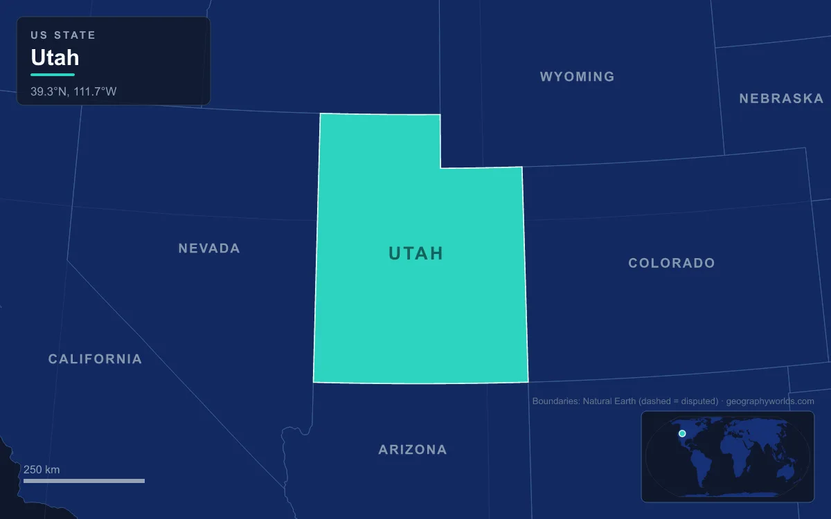
Utah’s rectangular outline with a notch in the northeast corner looks arbitrary, but landforms helped to cut it. The northern border with Idaho follows the 42nd parallel inherited from the Adams–Onís Treaty of 1819. The Compromise of 1850 created a Utah Territory far larger than today’s state. When Colorado Territory was formed in 1861, Utah’s eastern edge was moved from the crest of the Rockies to the 109th meridian. Its western line then moved step by step from the 116th to the 114th meridian as Nevada, created during the Civil War to secure the Comstock Lode silver district, took more land.
The notch is where the mountains mattered most. The notch first appeared when Nebraska Territory was formed in 1854, and it was enlarged in 1868 to give the new Wyoming Territory seven degrees of longitude. The Uinta Mountains and the Wasatch Range separate the area from Salt Lake City, which made it easier to govern from the Wyoming side. The Uintas are unusual as the highest range in the contiguous United States that runs east to west, with peaks from about 3,350 m to Kings Peak’s 4,123 m, roughly 160 km (100 mi) east of Salt Lake City. South of them lies the Uinta Basin, a structural basin that produces commercial oil and gas; oil was found there in 1948, and Vernal is its largest town.
In the far southwest, around St. George, the land drops towards the Mojave Desert. Early settlers grew some cotton there, so the area is still called Utah’s Dixie. It holds both Beaver Dam Wash, the state’s lowest point, and its record high temperature of 48°C (118°F), set south of St. George on July 4, 2007.
Red Rock Country: Uranium at Moab, Water at Lake Powell, Visitors in Zion
The southern and eastern half of Utah belongs to the Colorado Plateau, where the Colorado and Green rivers have cut through thick layers of Navajo and Kayenta sandstone. The area around their confluence was the last in the lower 48 states to be mapped. Erosion carved the rock into canyons, arches, pinnacles, buttes and mesas, and isolated ranges such as the La Sal, Abajo and Henry mountains rise above the tablelands.
That rock brought three waves of people. The first was miners. Uranium and vanadium were found near Moab in the 1910s and 1920s, and after the geologist Charles Steen found a rich uranium deposit south of the town, Moab became known in the 1950s as the “Uranium Capital of the World”. The boom ended with the Cold War, and by the early 1980s nearly all the mines had closed. The second was engineers. Glen Canyon Dam, built from 1956 to 1966 just over the line in Arizona, flooded the sandstone gorges of Glen Canyon to form Lake Powell, which lies mostly in southern Utah and holds about 30 km³ of water when full, second in the United States only to Lake Mead.
The third wave is still arriving: visitors to Arches, Bryce Canyon, Canyonlands, Capitol Reef and Zion national parks, and to Grand Staircase–Escalante, Natural Bridges and Monument Valley. Zion sits at the junction of the Colorado Plateau, the Great Basin and the Mojave Desert, and its deep canyons are cut in Navajo sandstone. The Colorado Plateau geography guide follows the plateau into Arizona, Colorado and New Mexico, and our broader Utah geography overview puts the canyons, the lake and the Wasatch Front on one map.