

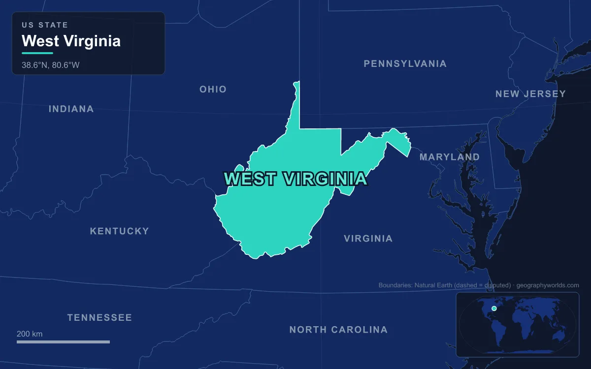
West Virginia’s mountains cover practically the whole state, which lies entirely within the Appalachians and is nicknamed the Mountain State. The highest range is the Allegheny Mountains along the eastern border, where Spruce Knob on Spruce Mountain reaches 1,482 m (4,863 ft), the top of both the state and the entire Allegheny range. East of the Allegheny Front, the Ridge-and-Valley folds of the Potomac Section run into the Eastern Panhandle; west of it, the Allegheny Plateau has been cut by rivers such as the New, Gauley, Kanawha and Elk into steep, tangled hill country down to the Ohio River. The lowest point, 73 m (240 ft), is where the Potomac leaves the state at Harpers Ferry, and the mean elevation is about 460 m (1,500 ft). Across 62,755 km² (24,230 sq mi), that relief decided where people farmed, mined, built railroads and drew borders.
The Allegheny Front and the Split From Virginia in 1863
The Allegheny Front is the east-facing escarpment that separates the Ridge-and-Valley Appalachians from the Appalachian Plateau. In West Virginia it runs close to the Eastern Continental Divide: water on one side flows to the Potomac and Chesapeake Bay, on the other to the Ohio, the Mississippi and the Gulf of Mexico. For the people of colonial and early republican Virginia, this wall of ridges was the line between the Tidewater and Piedmont, with their planter economy and seat of government at Richmond, and “Trans-Allegheny Virginia”, a land of smaller farms whose rivers and trade looked west toward Pittsburgh and the Ohio Valley.
The mountains made that division political. Western residents complained for decades that the legislature, weighted by the counting of enslaved people, under-represented them. When the Virginia convention voted to secede in April 1861, delegates from the northwestern counties met at Wheeling, on the Ohio River, and formed the Restored Government of Virginia. A vote on statehood followed on 24 October 1861, and after Congress and President Lincoln set a condition for the gradual abolition of slavery, West Virginia joined the Union on 20 June 1863, the only state created by breaking away from a Confederate state. Berkeley and Jefferson counties, east of the mountains on the Potomac, were added the same year. Wheeling served as the state capital from 1863 to 1870 and again from 1875 to 1885.
The border chart shows the terrain at work. The longest boundary, 613 km with Virginia, runs through mountain country, following ridges such as Peters Mountain, an 84 km crest shared between Monroe County and the Virginia counties of Giles, Craig and Alleghany. The Ohio River forms the line with Ohio, while the Tug Fork and the Big Sandy River, which the Tug Fork forms by joining the Levisa Fork at Louisa, Kentucky, form the line with Kentucky past the coal town of Williamson.
Harpers Ferry, the State’s Lowest Ground
At the eastern tip of the state, the Shenandoah River joins the Potomac, and the combined river cuts a water gap through the Blue Ridge where Maryland, Virginia and West Virginia meet. Harpers Ferry sits on the point between the two rivers, the easternmost town in West Virginia and its lowest ground. Robert Harper, a millwright, saw the water power of the confluence in 1747 and bought the ferry rights. Thomas Jefferson, viewing “the passage of the Potomac through the Blue Ridge” in 1783, called it one of the most stupendous scenes in nature, and George Washington proposed the site for a federal armory in 1794, its machinery driven by river water.
That geography made Harpers Ferry a target. John Brown raided the armory in 1859, and in the Civil War the town, the northernmost point of Confederate-held territory, changed hands several times. Floods pouring through the same gap later wrecked much of the lower town. Today the population is 269 (2020 census), the National Park Service maintains the historic district, and the Appalachian Trail, whose headquarters is in the town, passes close to its own midpoint nearby.
Spruce Knob, Seneca Rocks and the Cut-Over Highlands
Spruce Mountain in Pendleton County is a whale-backed ridge only 26 km long, but several of its peaks top 1,370 m (4,500 ft), and Spruce Knob is the highest point in the eastern United States between the Adirondacks and Mount Rogers in Virginia. The high ground is an island of colder climate, with ecosystems similar to those of northern New England and eastern Canada: Spruce Knob’s summit averages around 4.6 m of snow a year, and Canaan Valley in Tucker County, with a valley floor averaging 980 m (3,200 ft), is a National Natural Landmark valued as a relict of boreal, ice-age habitats. The Blackwater River leaves the valley over the 19 m Blackwater Falls, its water stained dark by tannins.

North-east of Spruce Knob, Seneca Rocks rises nearly 270 m (900 ft) above the North Fork of the South Branch of the Potomac, a fin of rock whose south peak can be reached only by technical climbing, the only such summit on the East Coast. These highlands, where boreal red spruce still crowns the summits above 1,200 m, were cut over almost completely around the start of the 20th century, and nearly every tree in the Monongahela National Forest today is second growth. The forest now protects more than 3,700 km² within a proclamation boundary of about 6,880 km² in ten counties, from about 270 m at Petersburg to Spruce Knob itself.
The same isolation gives the highlands a modern use. Pocahontas County’s Green Bank hosts the Robert C. Byrd Green Bank Telescope, the world’s largest fully steerable radio telescope, 100 m across. It sits within the National Radio Quiet Zone, a rectangle of about 34,000 km² straddling West Virginia and Virginia where radio transmissions are restricted by law. Mountains that once kept railroads out now keep interference out.
Coal Seams, Railroad Towns and the Kanawha Valley
The Allegheny Plateau is made of flat-lying sedimentary rock, and among its layers are some of the best coal seams in the world. When railroads finally pushed into the southern mountains in the 1870s and 1880s, they opened those seams to large-scale mining, and by the early 20th century West Virginia was one of the nation’s leading coal producers. In the Pocahontas Coalfield of Mercer and McDowell counties, seams such as Pocahontas No. 3 rated at 15,000 Btu per pound; the Norfolk and Western Railway laid track along Elkhorn Creek toward Welch, and coal camps such as Keystone, Elkhorn and Maybeury grew along it.
Farther north, the Chesapeake and Ohio Railway threaded the New River Gorge. The New River, which rises in North Carolina and flows north through Virginia, is considered one of the oldest rivers in the world geologically, and unusually it cuts across the grain of the Appalachian ridges rather than running along them. Mining towns clung to the narrow gorge floor. Thurmond, incorporated in 1903, was a busy C&O town in the coal boom; at the 2020 census it had five residents, and most of it now belongs to New River Gorge National Park and Preserve, which protects 85 km of the river from below Hinton to Hawks Nest State Park.
At the western end of the line the railroad created a city. Collis P. Huntington chose flat land on the Ohio River, west of the mouth of the Guyandotte, as the C&O’s western terminus, and Huntington grew rapidly after the railroad was completed in 1871. Its population began to fall after 1950 with suburban sprawl and the decline of steel and manufacturing, and it counted 46,842 people in 2020.
The New and Gauley rivers meet at Gauley Bridge to form the Kanawha, which drops over the 7 m Kanawha Falls and then flows about 156 km northwest to the Ohio at Point Pleasant. It is the largest inland waterway in the state, and its valley has been an industrial corridor through the dissected plateau since early in the 19th century. Charleston grew where the Elk River enters the Kanawha, first on the salt industry of the early 19th century, then on coal and one of the first natural gas wells, and later on chemical plants. It became the permanent state capital in 1885, and it had 48,864 residents at the 2020 census.
The narrowness of these valleys shapes daily life. Towns string along valley floors, highways follow creeks, and dense fog often fills valleys in the Kanawha section. Elkins and Beckley rank among the cloudiest cities in the country, with more than 210 cloudy days a year, because the Allegheny ridges dam the moisture carried in by passing weather systems.
The New River Gorge Bridge and the Road Out of the Hollows
For most of the state’s history, crossing the plateau meant winding down one side of a gorge and up the other. The Appalachian Development Highway System was designed to end that, and its Corridor L, now U.S. Route 19, was completed in 1977 with the New River Gorge Bridge near Fayetteville. The steel arch spans 518 m, the whole bridge is 924 m long, and the roadway stands 267 m above the river. For 26 years it was the world’s longest single-span arch bridge, and when it opened it was the highest bridge in the world carrying a regular roadway, a title it kept until 2001.

The bridge is pictured on West Virginia’s state quarter, and on Bridge Day, the third Saturday of every October, it closes to traffic for rappelling, ascending and BASE-jumping demonstrations. The gorge that once confined coal towns now draws rafters from the Cunard put-in to Fayette Station and climbers to its cliffs, and in 2020 it was redesignated as a national park.
West Virginia’s mountains, in short, explain its map, its industries and its separate statehood. For the wider range they belong to, see our guide to the Appalachian Mountains and the geography of the Appalachia region, and for the state’s rivers, climate and regions in more detail, continue to the West Virginia geography guide.