
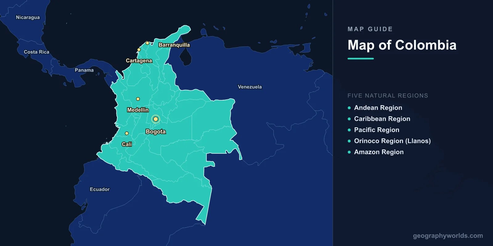
Colombia is located in northwestern South America, covering approximately 1,141,748 square kilometers between 12°N and 4°S latitude. It is the only South American country with coastlines on both the Caribbean Sea (north) and the Pacific Ocean (west). The country is divided into 32 departments and one capital district, with landscapes ranging from the Andes Mountains to the Amazon Rainforest, Caribbean beaches to Pacific mangroves.
Introduction
Colombia's geographic diversity is extraordinary. Three branches of the Andes run through the western half of the country, while the eastern half consists of vast llanos (plains) and dense Amazon jungle. This guide explores Colombia's regions, departments, major cities, and the physical geography that makes it one of the most biodiverse countries on Earth — second only to Brazil in total species count.

The Five Natural Regions
Colombia is traditionally divided into five natural regions based on geography:
- Andean Region: Three Andean cordilleras (Western, Central, Eastern) run north-south, separated by the Cauca and Magdalena river valleys. This region is the most populated, containing Bogota, Medellin, and Cali. Coffee grows on the slopes of the Central Cordillera in the famous Coffee Triangle (Eje Cafetero).
- Caribbean Region: The flat northern coastal plain along the Caribbean Sea. Includes Cartagena, Barranquilla, Santa Marta, and the Sierra Nevada de Santa Marta — the world's highest coastal mountain range, reaching 5,775 m at Pico Cristobal Colon.
- Pacific Region: A narrow, heavily forested strip along the Pacific coast. One of the wettest regions on Earth, with annual rainfall exceeding 10,000 mm in some areas. The port of Buenaventura handles much of Colombia's trade.
- Orinoco Region (Llanos): Vast tropical grasslands in the east, drained by tributaries of the Orinoco River. Cattle ranching dominates this flat, seasonally flooded landscape.
- Amazon Region: Dense tropical rainforest covering the southeastern third of the country. Sparsely populated, home to indigenous communities and extraordinary biodiversity. Leticia, on the Amazon River, is the southernmost city.
Major Cities
- Bogota: Capital, 4.7°N, 74.1°W, at 2,640 m elevation. Population ~8 million (metro ~11 million). Located on a high plateau of the Eastern Cordillera.
- Medellin: 6.2°N, 75.6°W, at 1,495 m. Population ~2.5 million (metro ~4 million). Known as the "City of Eternal Spring" for its mild climate.
- Cali: 3.4°N, 76.5°W. Population ~2.2 million. Capital of salsa music, located in the Cauca Valley.
- Barranquilla: 10.9°N, 75.0°W. Population ~1.2 million. Major Caribbean port at the mouth of the Magdalena River.
- Cartagena: 10.4°N, 75.5°W. Population ~1 million. UNESCO World Heritage walled city and top tourist destination.
Departments of Colombia
Colombia's 32 departments function similarly to states or provinces. Some notable ones include:
- Antioquia: Centred on Medellin, Colombia's industrial and innovation hub in the Central Cordillera.
- Cundinamarca: Surrounds the capital district of Bogota on the high Andean plateau.
- Amazonas: The largest department by area, covering 109,665 km² of Amazon rainforest in the southeast.
- Valle del Cauca: Home to Cali, in the fertile Cauca River valley between the Western and Central Cordilleras.
- San Andres y Providencia: An archipelago in the Caribbean Sea, closer to Nicaragua than to mainland Colombia, with a distinct English Creole-speaking culture.
Physical Geography
- Highest Point: Pico Cristobal Colon, 5,775 m, in the Sierra Nevada de Santa Marta
- Major Rivers: Magdalena (1,528 km), Cauca, Atrato, Putumayo, Caqueta
- Coastline: 3,208 km (1,600 km Caribbean, 1,300 km Pacific)
- Area: 1,141,748 km² (26th largest in the world)
The Magdalena River is Colombia's most important waterway, flowing 1,528 km northward between the Central and Eastern Cordilleras before emptying into the Caribbean at Barranquilla. It has been the country's primary transportation artery since pre-Columbian times.
The Sierra Nevada de Santa Marta is a remarkable isolated mountain massif on the Caribbean coast. It rises from sea level to 5,775 m in just 42 km — one of the steepest elevation gradients on Earth. This unique geography creates virtually every climate zone within a compact area.
Borders & Position
Colombia borders five countries: Venezuela and Brazil to the east, Peru and Ecuador to the south, and Panama to the northwest. The Panama border is notable because it crosses the Darien Gap, one of the most impenetrable jungles on Earth and the only break in the Pan-American Highway.
Key Facts
- Colombia has both Caribbean and Pacific coastlines — the only South American country to do so.
- Three Andean cordilleras run through the western half of the country.
- Bogota sits at 2,640 m elevation on a high Andean plateau.
- The Sierra Nevada de Santa Marta is the world's highest coastal mountain range.
- Colombia is the second most biodiverse country on Earth after Brazil.
Fun Facts
- Colombia's Cano Cristales river is called the "River of Five Colors" due to aquatic plants that turn it red, yellow, green, blue, and black.
- The Darien Gap between Colombia and Panama is the only break in the 30,000 km Pan-American Highway.
- Colombia produces more emeralds than any other country, accounting for 70-90% of the world's supply.
- The country is named after Christopher Columbus, though he never actually set foot on Colombian soil.
Final Thoughts
Colombia's map reveals one of the most geographically complex countries in the Americas. From the snow-capped Andean peaks to the Caribbean coast, from the Pacific rainforest to the Amazon basin, its five natural regions encompass extraordinary diversity. Understanding Colombia's geography — its three cordilleras, two coastlines, and vast eastern plains — is essential to appreciating why it ranks among the most biodiverse and culturally rich nations on Earth.
Test Your Knowledge!
Think you know where things are on the map? Test your skills!
Play Geography Games →