
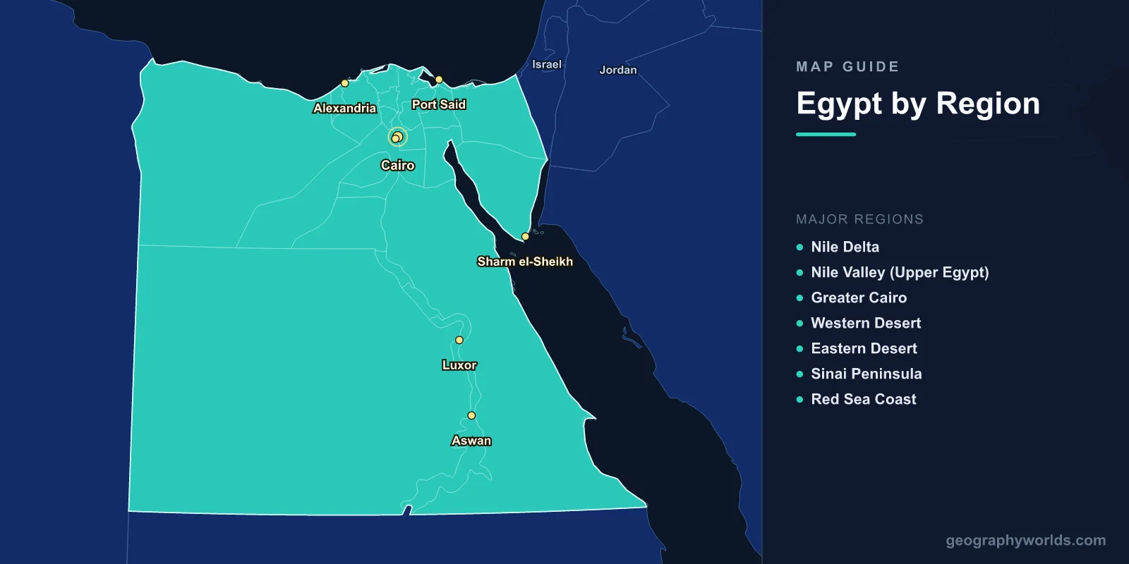
A map of Egypt shows a country of 1,010,408 km2 (390,121 sq mi) at the crossroads of Africa and Asia, with a population of 104 million. Yet Egypt's habitable land tells a dramatically different story: approximately 96% of the country is desert, and nearly all Egyptians live along the Nile River and its delta—a narrow green ribbon cutting through vast arid landscapes. The map reveals the Nile Valley, the Sinai Peninsula, the Western Desert, the Eastern Desert, the Mediterranean and Red Sea coasts, and the Suez Canal connecting two continents and two seas.
Geography of Egypt
Egypt occupies the northeastern corner of Africa, with the Sinai Peninsula extending into Asia. It is bordered by Libya to the west, Sudan to the south, Israel and the Gaza Strip to the northeast, the Mediterranean Sea to the north, and the Red Sea to the east.
The Nile River, the world's longest river at approximately 6,650 km, enters Egypt from Sudan and flows 1,545 km northward to the Mediterranean. The Nile Valley averages just 10–15 km wide through Upper Egypt (the south), widening into the vast Delta north of Cairo. The Delta extends 240 km from north to south and 260 km along the Mediterranean coast, covering about 24,000 km2 of Egypt's most fertile land.
West of the Nile, the Western Desert (Sahara) covers approximately 680,000 km2—about two-thirds of Egypt's total area. This vast desert contains several depressions, including the Qattara Depression (-133 m, the lowest point in Africa outside the lakes), the Siwa Oasis, and the Fayoum Oasis. The Great Sand Sea near the Libyan border is one of the world's largest sand dune fields.
East of the Nile, the Eastern Desert (Arabian Desert) extends to the Red Sea coast, characterized by a rugged mountain range (the Red Sea Mountains) reaching 2,187 m at Mount Shayib al-Banat. The Sinai Peninsula, a triangular landmass between the Gulf of Suez and the Gulf of Aqaba, contains Mount Sinai (2,285 m) and Mount Catherine (2,629 m—Egypt's highest peak).
Major Regions
- Nile Delta: Northern Egypt; fan-shaped alluvial plain. Egypt's most densely populated and agriculturally productive region. Major cities include Alexandria, Tanta, and Mansoura. Two main Nile branches: Rosetta (west) and Damietta (east).
- Nile Valley (Upper Egypt): Narrow fertile strip from Cairo to Aswan. Ancient temple sites at Luxor, Karnak, Abu Simbel, and Edfu line the riverbanks. Aswan High Dam creates Lake Nasser (5,250 km2).
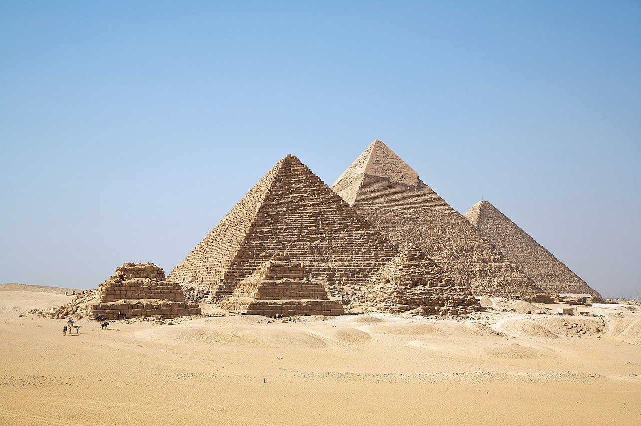
- Greater Cairo: Metropolitan area of 22 million—Africa's largest city and one of the world's most densely populated urban areas. Located where the Nile Valley meets the Delta. The Giza Plateau with the Great Pyramids sits on the western edge.
- Western Desert: Vast Saharan expanse with scattered oases (Siwa, Bahariya, Farafra, Dakhla, Kharga). The White Desert near Farafra features surreal chalk formations. Mostly uninhabited.
- Eastern Desert: Rocky, mountainous terrain between the Nile and the Red Sea. Ancient Roman quarries and mining sites. Minimal population.
- Sinai Peninsula: Triangular landmass connecting Africa and Asia. Southern mountains, central plateau, northern coastal plain. Sharm el-Sheikh is the main tourist center. Mount Catherine (2,629 m) is Egypt's highest peak.
- Red Sea Coast: 1,200 km of coastline. Resort cities of Hurghada and Marsa Alam. World-class coral reefs and marine biodiversity.
Major Cities
- Cairo: 10 million (city), 22 million (metro); capital; at the apex of the Nile Delta. Africa's largest metropolitan area. Oldest part (Islamic Cairo) is a UNESCO World Heritage Site.
- Alexandria: 5.3 million; Mediterranean port; founded by Alexander the Great in 331 BC. Egypt's second city and main seaport.
- Giza: 4.2 million; southwestern Cairo suburb; site of the Great Pyramids and the Sphinx.
- Luxor: 510,000; Upper Egypt; ancient Thebes; Valley of the Kings; Karnak Temple complex.
- Aswan: 300,000; southernmost major city; Aswan High Dam; gateway to Abu Simbel and Nubia.
- Port Said: 750,000; northern entrance to the Suez Canal on the Mediterranean.
- Sharm el-Sheikh: 75,000; southern Sinai; Red Sea resort and diving destination.
Climate
- Desert (most of Egypt): Hot and arid. Summer temperatures routinely exceed 40°C in Upper Egypt and the deserts. Less than 25 mm of annual rainfall in most areas south of Cairo.
- Mediterranean (northern coast): Milder, with 100–200 mm of annual rainfall in Alexandria. Winter temperatures 10–18°C; summer 26–30°C.
- Red Sea coast: Hot and humid. Warm year-round (20–35°C). Minimal rainfall but higher humidity than the interior deserts.
- Sinai mountains: Cooler at altitude; occasional snowfall on Mount Catherine in winter.
- Khamsin winds: Hot, dry, sand-laden winds from the Sahara that blow in spring (March–May), raising temperatures dramatically and reducing visibility.
Key Facts About the Map of Egypt
- Egypt covers 1,010,408 km2 but approximately 96% is desert—nearly all 104 million people live on about 4% of the land.
- The Suez Canal (193 km) connects the Mediterranean and Red Seas, handling about 12% of global trade.
- The Nile Delta is one of the world's largest river deltas at 24,000 km2.
- Mount Catherine (2,629 m) in the Sinai is Egypt's highest point.
- The Qattara Depression (-133 m) is the lowest point in Africa outside the Great Rift Valley lakes.
- Lake Nasser, created by the Aswan High Dam, is one of the world's largest artificial lakes at 5,250 km2.
- Cairo is the largest city in both Africa and the Arab world.
Final Thoughts
The map of Egypt tells the story of a civilization utterly shaped by geography—a narrow river valley sustaining one of the world's densest populations amid some of its most inhospitable desert. From the fertile Delta to the Sinai's sacred mountains, from the ancient temples of Upper Egypt to the coral reefs of the Red Sea, Egypt's geography connects Africa to Asia and the Mediterranean to the Indian Ocean. Understanding this map is key to grasping 5,000 years of human history and the modern challenges of water, land, and population in the Nile basin.
Test Your Geography Knowledge!
Think you know your maps? Try our interactive geography games!
Play Geography Games →