
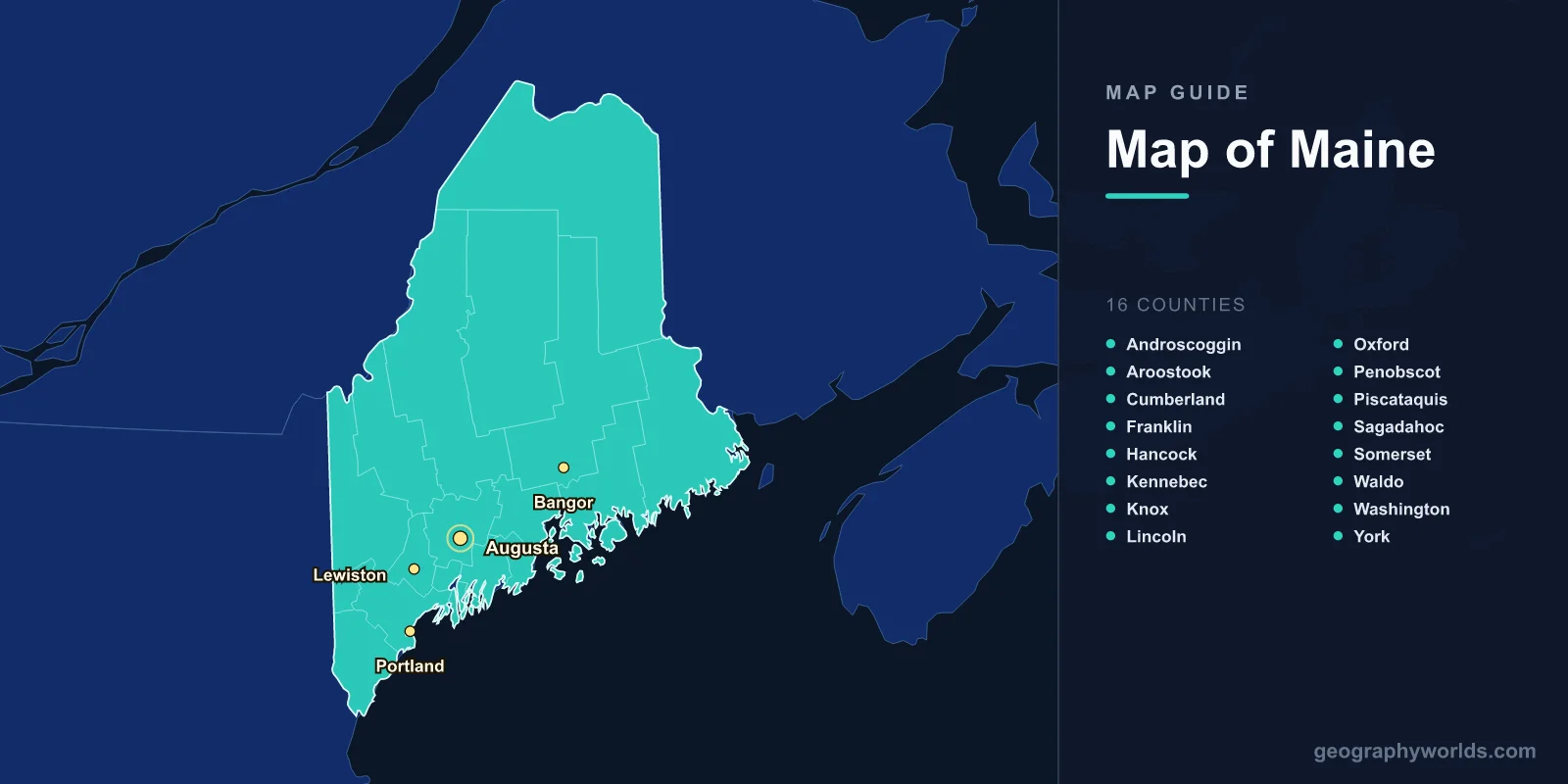
Maine is the northeasternmost state in the United States, located between 43.1°N and 47.5°N latitude. Covering 91,633 square kilometers, it is the largest of the six New England states and is divided into 16 counties. Maine is famous for its rugged Atlantic coastline stretching approximately 5,500 km (including islands and inlets), Acadia National Park, vast boreal forests, and its nickname "Vacationland."
Introduction
Maine occupies a unique position on the American map. It is the only US state that borders just one other state (New Hampshire), while sharing an extensive international border with Canada. Nearly 90% of the state is forested, making it the most heavily wooded state in the nation. From the rocky shores of Acadia to the remote wilderness of the North Woods, Maine's geography is defined by nature on a grand scale.

The 16 Counties
Maine's 16 counties range from the densely settled southern coast to the vast, sparsely populated north:
- Cumberland: The most populous county, home to Portland, Maine's largest city. Located on Casco Bay in the southern coastal region.
- York: The southernmost county, bordering New Hampshire. Includes the beach towns of Kennebunkport, Old Orchard Beach, and Kittery.
- Penobscot: Central Maine, home to Bangor, the state's third-largest city and historic lumber capital.
- Hancock: Contains Acadia National Park and the resort town of Bar Harbor on Mount Desert Island.
- Aroostook: The largest county by far at 17,687 km² — larger than Connecticut and Rhode Island combined. Known for potato farming and bordering both New Brunswick and Quebec.
- Kennebec: Home to Augusta, the state capital, on the Kennebec River.
- Knox: Midcoast region including Rockland and Camden, with a strong maritime heritage.
- Washington: The easternmost county in the US, bordering New Brunswick. Includes Eastport, the easternmost city in the United States.
The remaining counties — Androscoggin, Franklin, Lincoln, Oxford, Piscataquis, Sagadahoc, Somerset, and Waldo — fill out the interior and coast with a mix of mill towns, lakes, mountains, and farmland.
Major Cities
- Portland: 43.7°N, 70.3°W. Population ~68,000 (city), ~540,000 (metro). Maine's largest city, a vibrant coastal hub known for restaurants, craft breweries, and the Old Port district.
- Augusta: 44.3°N, 69.8°W. Population ~19,000. The state capital, located on the Kennebec River in central Maine.
- Bangor: 44.8°N, 68.8°W. Population ~33,000. Gateway to northern Maine and Acadia National Park.
- Lewiston: 44.1°N, 70.2°W. Population ~37,000. Maine's second-largest city, paired with Auburn across the Androscoggin River.
Coastline & Acadia
Maine's coastline is one of the most complex in the United States. While the straight-line distance from Kittery to Eastport is only about 370 km, the tidal coastline — including bays, peninsulas, and over 4,600 islands — stretches approximately 5,500 km.
- Acadia National Park: Located on Mount Desert Island in Hancock County, it is the most visited national park in the Northeast. Cadillac Mountain (466 m) is the tallest peak on the US Atlantic coast north of Brazil and is one of the first places in the US to see sunrise from October to March.
- Casco Bay: Off Portland, containing the Calendar Islands, so named because there are said to be 365 of them.
- Penobscot Bay: A major bay between the midcoast and Downeast regions, dotted with islands and lobster boats.
- Downeast Coast: The remote northeastern coast including Washington County, known for wild blueberry barrens and dramatic tides at the Bay of Fundy.
Interior Geography
- Highest Point: Mount Katahdin, 1,606 m, in Baxter State Park. The northern terminus of the Appalachian Trail.
- Largest Lake: Moosehead Lake, 311 km², the largest lake in New England.
- Major Rivers: Penobscot (560 km), Kennebec (240 km), Androscoggin, St. John
- Forest Cover: ~89%, the highest percentage of any US state
Maine's interior is dominated by the North Woods, a vast expanse of boreal and mixed forest covering the northern two-thirds of the state. This region is sparsely populated, with more moose than people in some areas. Baxter State Park, surrounding Mount Katahdin, preserves over 800 km² of wilderness. The Allagash Wilderness Waterway, a 148 km canoe route, passes through some of the most remote territory in the eastern United States.
Borders & Position
Maine borders New Hampshire to the west, the Atlantic Ocean to the south and east, and the Canadian provinces of New Brunswick and Quebec to the north and east. Its international border with Canada stretches approximately 611 km. The state's northernmost point, at 47.5°N in Aroostook County, is farther north than Montreal or Ottawa.
West Quoddy Head in Lubec is the easternmost point of the contiguous United States. Maine's position means it experiences some of the earliest sunrises in the country, particularly from Cadillac Mountain in Acadia.
Key Facts
- Maine has 16 counties, with Aroostook the largest at 17,687 km².
- The tidal coastline stretches approximately 5,500 km including islands and inlets.
- Mount Katahdin at 1,606 m is the state's highest point and the northern end of the Appalachian Trail.
- Nearly 90% of Maine is forested, the highest percentage of any US state.
- Portland is the largest city; Augusta is the state capital.
Fun Facts
- Maine produces about 90% of the US wild blueberry crop, mostly from Washington County's barrens.
- Aroostook County is larger than Connecticut and Rhode Island combined yet has a population of only about 68,000.
- Maine has roughly one moose per 2.5 square kilometers of forest in the North Woods region.
- Eastport, Maine, experiences tidal ranges of up to 8.5 meters due to its proximity to the Bay of Fundy.
Final Thoughts
Maine's map reveals a state where the coastline and wilderness dominate. Its 5,500 km of rocky shore, 4,600 islands, and vast forested interior create a landscape unlike anywhere else in the eastern United States. From the tourist-friendly charm of Portland and Acadia to the remote wilderness of the North Woods and Aroostook County, Maine lives up to its license plate motto: "Vacationland."
Test Your Knowledge!
Think you know where things are on the map? Test your skills!
Play Geography Games →