
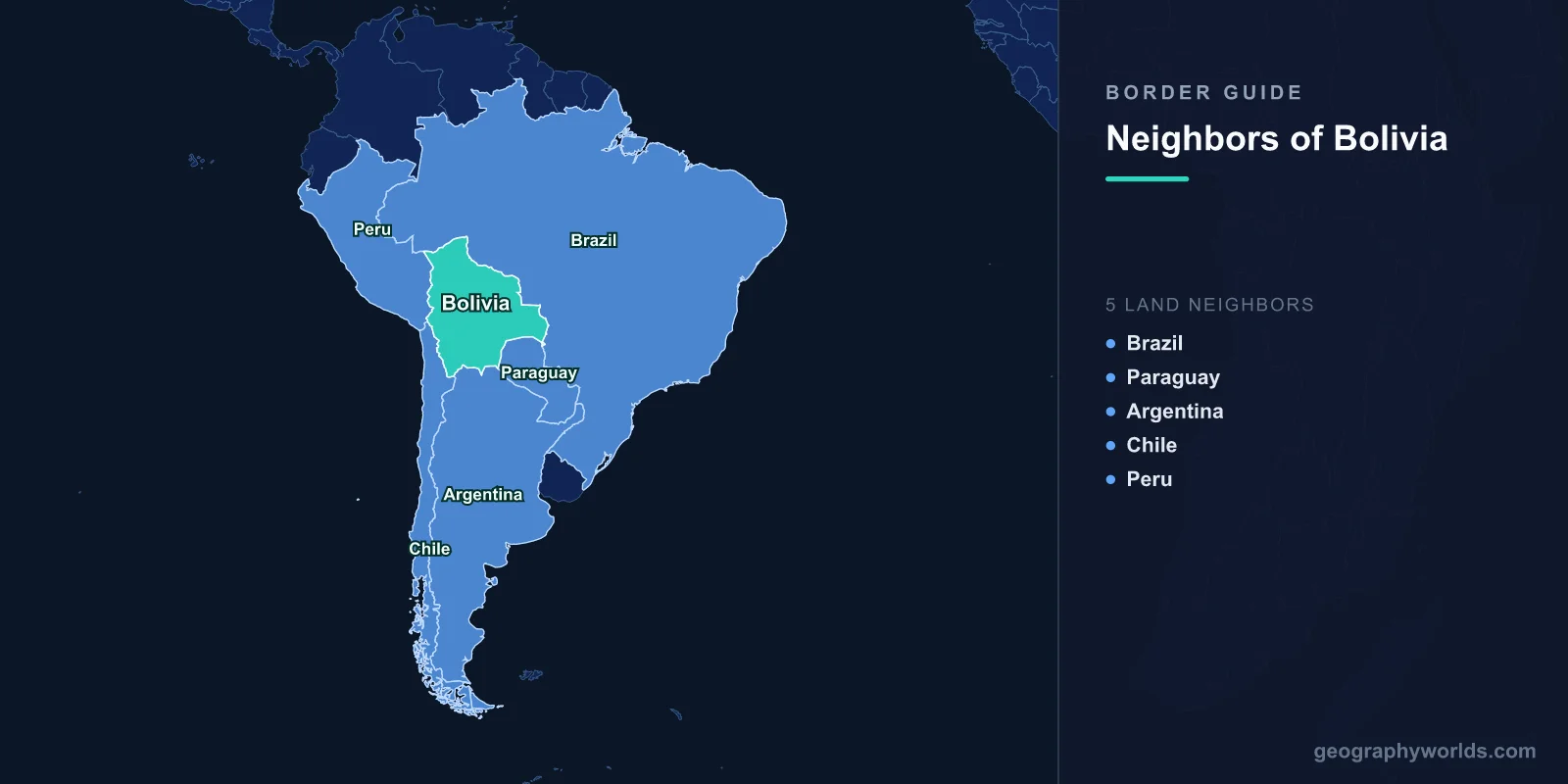
Bolivia borders five countries: Brazil, Peru, Argentina, Chile, and Paraguay. Together these frontiers stretch roughly 7,252 km, making Bolivia one of South America's most connected nations despite having no coastline of its own. Wedged into the center of the continent, Bolivia shares its longest boundary with Brazil and its most politically charged one with Chile, the neighbor that absorbed Bolivia's former Pacific coast in the late nineteenth century.
Bolivia's borders trace an extraordinary range of landscapes, from the icy peaks of the Andes and the high Altiplano plateau down into the steamy Amazon lowlands and the scrubby Gran Chaco. The list below covers each neighbor in order, from the longest border to the shortest.
Brazil — Bolivia's Longest Border
Brazil shares Bolivia's longest frontier, running about 3,403 km along the north and east. Much of it follows rivers such as the Madeira, Mamoré, and Guaporé, threading through Amazon rainforest in the north and the Pantanal wetlands and Chiquitano dry forests in the east. The twin towns of Cobija and Brasiléia in the north, and Puerto Quijarro and Corumbá in the east, anchor cross-border commerce.
Brazil is by far Bolivia's largest neighbor and one of its most important economic partners. A major natural-gas pipeline carries Bolivian gas to Brazilian markets, historically a cornerstone of Bolivia's export earnings, while the Santa Cruz–Corumbá corridor moves goods overland. The region is also home to Indigenous Chiquitano and Guaraní communities whose lands straddle the line.
Peru — Lake Titicaca and Ancient Roots
Peru sits to the northwest along roughly 1,212 km of shared border. Its defining feature is Lake Titicaca, the world's highest navigable lake at about 3,812 meters, split roughly 60–40 between Peru and Bolivia. The Desaguadero River, which drains the lake, forms part of the boundary further south, and the towns of Copacabana, Desaguadero, and Yunguyo serve as the busiest crossings.
The Bolivia–Peru relationship runs deeper than any modern treaty. Both nations grew from the ancient Tiwanaku and Inca civilizations, and Aymara and Quechua peoples live on either side of the border. The two were even briefly joined as the Peru–Bolivian Confederation between 1836 and 1839. Today they jointly manage Titicaca's fragile ecosystem and share heavy tourist and trade traffic.
Argentina — A Southern Gateway
Argentina runs along Bolivia's southern edge for about 942 km, from the Chaco lowlands in the east through the Andean foothills to the Altiplano in the west. The crossing between Villazón and La Quiaca is one of the most heavily used points on the Pan-American route, with Yacuiba–Salvador Mazza and Bermejo–Aguas Blancas also seeing steady traffic.
Argentina has long been the leading destination for Bolivian migrants, who form sizeable communities in Buenos Aires and the northern provinces of Salta and Jujuy. Bolivian natural gas has flowed south by pipeline, and the two share management of the Bermejo and Pilcomayo river basins. Shared Quechua and Aymara heritage gives the borderlands a common thread of music, cuisine, and festivals.
Chile — The Border That Made Bolivia Landlocked
Chile lies to the southwest along roughly 942 km of high Andean and Atacama Desert terrain, much of it above 3,500 meters. The frontier is studded with volcanic peaks and skirts the western edge of the Altiplano; the Salar de Uyuni, the world's largest salt flat, lies on the Bolivian side, while the hyper-arid Atacama spreads across Chile. The Tambo Quemado–Chungará crossing links La Paz with the port of Arica.
No border weighs more heavily on Bolivian identity. In the War of the Pacific (1879–1884), Bolivia lost its coastal Atacama province to Chile and became landlocked, a grievance the country has never abandoned. Diplomatic relations were cut in 1978 and only partly mended since. Bolivia took its claim for sovereign sea access to the International Court of Justice, which ruled in 2018 that Chile could not be compelled to negotiate. Trade nonetheless continues through Chilean ports, and Bolivia still marks every March 23 as the "Day of the Sea."
Paraguay — Across the Gran Chaco
Paraguay shares Bolivia's shortest border, about 753 km to the southeast across the Gran Chaco, a vast semi-arid plain of scrubland and dry forest. This was the battleground of the Chaco War (1932–1935), a brutal conflict that ended with Paraguay holding most of the disputed land, formalized by a 1938 treaty. The region remains thinly populated, dotted with Mennonite farming colonies, Indigenous communities, and cattle ranches.
Cross-border movement runs through Bolivian towns such as Villamontes and Boyuibe, with the Trans-Chaco Highway improving connections on the Paraguayan side. The two countries cooperate on the Pilcomayo River, which forms part of the boundary and is notorious for shifting its course during seasonal floods.
Border Lengths at a Glance
- Brazil: about 3,403 km (north and east)
- Peru: about 1,212 km (northwest)
- Argentina: about 942 km (south)
- Chile: about 942 km (southwest)
- Paraguay: about 753 km (southeast)
For a fuller look at the country behind these borders, see our bolivia country guide.
Frequently Asked Questions
How many countries border Bolivia?
Bolivia borders five countries: Brazil, Peru, Argentina, Chile, and Paraguay. It is one of only two landlocked nations in South America, the other being Paraguay.
Which country has the longest border with Bolivia?
Brazil shares Bolivia's longest border at roughly 3,403 km, accounting for nearly half of Bolivia's total land frontier of about 7,252 km.
Why is Bolivia landlocked?
Bolivia lost its Pacific coastline to Chile during the War of the Pacific (1879–1884). The loss of its Atacama coast left the country without sea access, and regaining sovereign ocean access remains a central goal of Bolivian foreign policy.
Which neighbors does Bolivia share Lake Titicaca with?
Bolivia shares Lake Titicaca with Peru. The world's highest navigable lake is divided roughly 60–40 between the two countries, with Bolivia holding the smaller share.
