
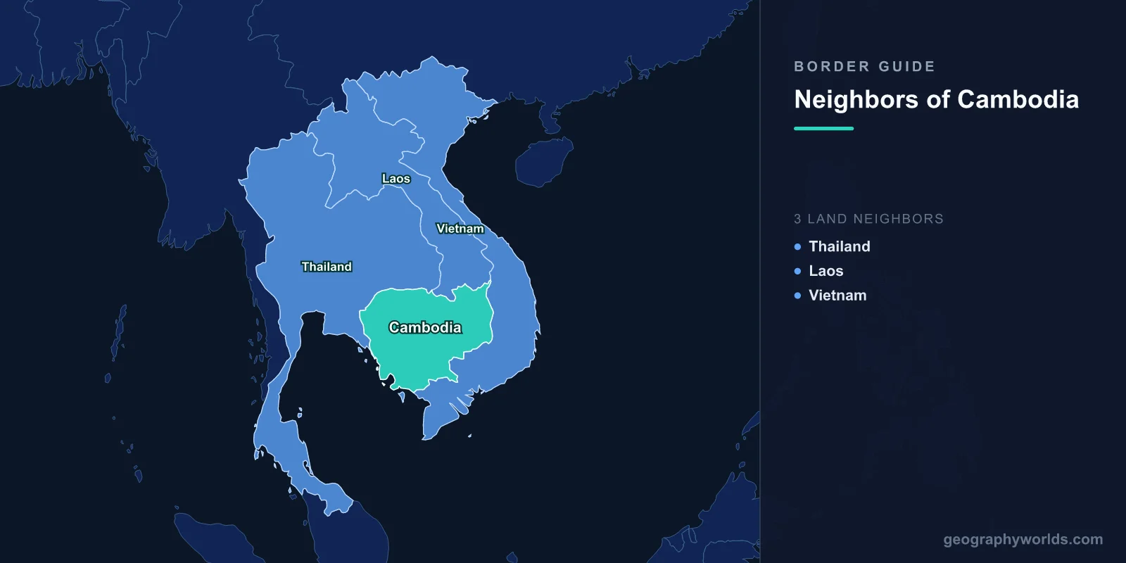
Cambodia has three neighboring countries: Thailand to the north and west, Laos to the north and northeast, and Vietnam to the east and southeast. Together these shared land boundaries stretch roughly 2,530 km, wrapping Cambodia on three sides while the Gulf of Thailand forms its open southwestern edge. Sitting in the heart of mainland Southeast Asia on the Indochinese Peninsula, Cambodia is defined by the Mekong River and the great Tonle Sap lake, with frontier mountains and rivers separating it from each of its three Indochinese neighbors.
An Overview of Cambodia's Three Borders
Cambodia is a compact country of about 181,000 square kilometers, roughly the size of Oklahoma, yet it borders three of mainland Southeast Asia's most important nations. Its frontiers are not arbitrary lines on a map but a record of empire, colonial rule, and the relentless geography of the Mekong basin. Two of its three borders were largely fixed during the French colonial period, when Cambodia, Laos, and Vietnam together made up French Indochina, while the Thai border traces a far older contest between the Khmer and Siamese kingdoms.
Reading clockwise from the east, Vietnam supplies the longest boundary, Thailand the second longest along the north and west, and Laos the shortest stretch in the far north. The remaining side of the country faces the sea. Understanding these three neighbors explains much about Cambodia's trade routes, its rivers, its ethnic make-up, and its modern diplomacy.
Vietnam: Cambodia's Longest Border
Vietnam shares the longest boundary with Cambodia, running about 1,158 km along the country's eastern and southeastern flank. The line begins near the forested Central Highlands in the north and descends through lowland plains until it reaches the edge of the Mekong Delta in the south. Much of this border was drawn during the French colonial era, when both territories formed part of French Indochina.
The history here runs deep. The fertile delta lands of southern Vietnam, which Cambodians call Kampuchea Krom, were once part of the Khmer Empire, and a sizeable ethnic Khmer minority still lives there today. The Mekong River itself flows out of Cambodia into Vietnam near Chau Doc, where it fans into the channels that nourish one of the world's most productive rice-growing regions. The busy Bavet-Moc Bai crossing links Phnom Penh directly to Ho Chi Minh City by highway, and Vietnam now ranks among Cambodia's most important trading partners. Vietnam's 1978 intervention that toppled the Khmer Rouge remains a defining episode in the two countries' shared modern history.
Thailand: A Border Shaped by Empires
Thailand shares an 817 km border with Cambodia along the north and west. The Dangrek Mountains, a long sandstone escarpment, form much of the northern boundary, while the western section runs through gentler terrain toward the Gulf of Thailand. The most famous landmark on this frontier is Preah Vihear, an 11th-century Khmer temple perched on a 525-meter cliff. Sovereignty over the temple was a long-running dispute that the International Court of Justice ultimately settled in Cambodia's favor, first in 1962 and again in a 2013 reaffirmation.
The relationship between the two nations is layered with history, reflecting the rise of the Khmer Empire and later Siamese expansion that absorbed Khmer-speaking regions such as the area around Surin in modern Thailand. Despite occasional tensions, day-to-day life on the border is dominated by commerce. The Poipet-Aranyaprathet crossing is one of the busiest land gateways in Southeast Asia, heavily used by traders, casino visitors, and the many Cambodian workers who travel to Thailand seeking employment. Cultural ties run just as deep, as both peoples share Theravada Buddhism, similar temple architecture, and overlapping culinary traditions.
Laos: The Mekong Frontier
Laos shares the shortest of the three borders, about 555 km, along Cambodia's north and northeast. The Mekong River defines a meaningful stretch of this boundary, including the area near the river's spectacular Si Phan Don, or "4,000 Islands," in southern Laos. Cambodia's Stung Treng province meets Laos's Champasak province here, in a sparsely populated landscape of tropical forest. The two countries also share a strong common thread in their Theravada Buddhist heritage and a history within French Indochina.
The Mekong is the lifeblood of communities on both sides, supporting fishing, farming, and river transport. Hydropower dams built upstream in Laos have raised real concerns in Cambodia about reduced fish stocks and disruption to the Tonle Sap ecosystem downstream. Even so, improved roads have steadily increased cross-border trade and travel between the two neighbors, and this remote frontier is becoming more accessible to overland travelers.
Rivers, Mountains, and the Coast
Cambodia's borders are not just political lines but physical features that have shaped the nation. The Mekong River enters from Laos in the north, passes through the country, and exits into Vietnam in the south, tying all three neighbors together in a single watershed. The Tonle Sap, the largest freshwater lake in Southeast Asia, is connected to the Mekong by a river so unusual that it reverses direction twice a year as floodwaters rise and fall, an annual cycle that underpins one of the world's richest inland fisheries.
To the southwest, Cambodia opens onto the Gulf of Thailand, giving it a coastline rather than a land border on that side. This stretch of roughly 440 km makes Thailand and Vietnam maritime neighbors as well as land neighbors, and the delimitation of overlapping sea boundaries and island claims in the gulf remains an ongoing diplomatic process. The port city of Sihanoukville anchors Cambodia's access to the sea and its growing international trade, while the Cardamom Mountains rise inland as one of Southeast Asia's largest remaining wilderness areas.
Regional Cooperation and Modern Ties
Because the Mekong is shared, Cambodia, Laos, Thailand, and Vietnam coordinate through the Mekong River Commission to manage water resources, fisheries, and flood risk across the basin. All four are members of ASEAN, and cross-border cooperation underpins regional trade, tourism, and environmental protection. Cambodia's three neighbors are also its largest sources of imports, tourists, and foreign investment, making the management of these frontiers central to the country's economic future. For a wider look at the country's geography, history, and travel highlights, see our cambodia country guide.
Key Facts
- Number of bordering countries: 3 (Thailand, Laos, Vietnam)
- Total land border length: approximately 2,530 km
- Longest border: Vietnam, about 1,158 km
- Shortest border: Laos, about 555 km
- Coastline: roughly 440 km along the Gulf of Thailand
- Shared river: the Mekong, flowing from Laos through Cambodia into Vietnam
- Regional bloc: all four nations are members of ASEAN
Frequently Asked Questions
How many countries border Cambodia?
Cambodia borders three countries: Thailand, Laos, and Vietnam. Its total land border measures approximately 2,530 km, and it also has a coastline along the Gulf of Thailand.
Which country has the longest border with Cambodia?
Vietnam shares Cambodia's longest border at about 1,158 km, running along the country's eastern and southeastern edge from the Central Highlands down to the Mekong Delta.
Does Cambodia have a coastline?
Yes. Cambodia has a southwestern coastline of around 440 km along the Gulf of Thailand, where Sihanoukville serves as its main seaport. This gives it maritime proximity to both Thailand and Vietnam.
What river connects Cambodia to its neighbors?
The Mekong River, the longest river in Southeast Asia, flows from Laos through Cambodia and into Vietnam, linking all three nations within a single river system that supports millions of people.
