
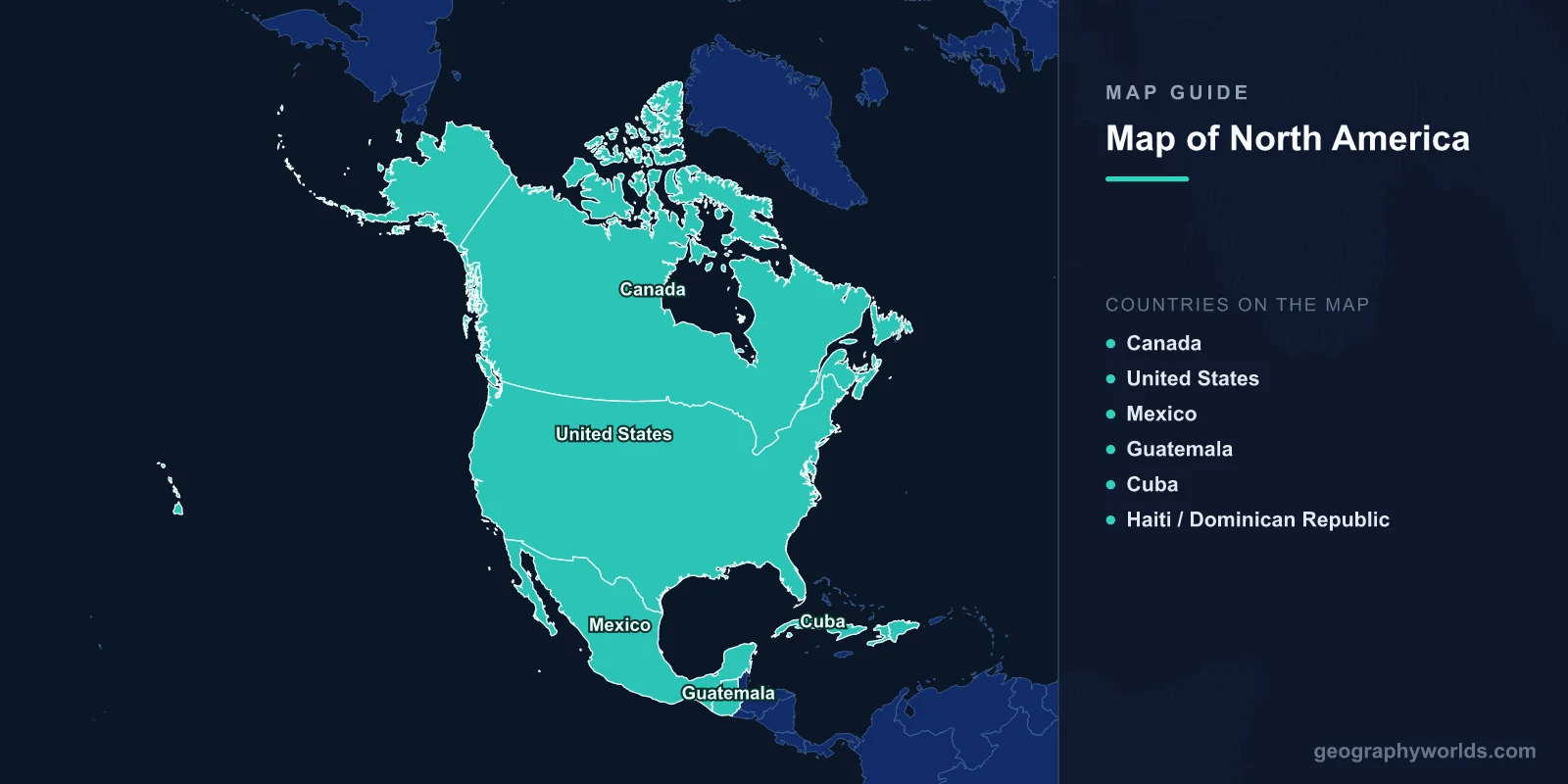
North America is the third-largest continent by area, covering 24.71 million km2 (9.54 million sq mi) with a population of approximately 579 million. It includes 23 sovereign countries, from Canada in the north to Panama in the south. The continent spans from the Arctic Circle to the tropics, encompassing the Rocky Mountains, the Great Plains, the Great Lakes, the Mississippi River system, and the Caribbean archipelago.
Introduction
North America is bounded by the Arctic Ocean to the north, the Atlantic Ocean to the east, the Pacific Ocean to the west, and South America to the southeast (connected by the Isthmus of Panama). The continent’s geographic extremes range from Denali in Alaska (6,190 m) to Death Valley, California (-86 m below sea level), and from Arctic tundra to tropical rainforests.

Geographic Overview
- Area: 24.71 million km2 (9.54 million sq mi)
- Population: 579 million (2024)
- Countries: 23 sovereign nations
- Highest Point: Denali (Mount McKinley), 6,190 m, Alaska
- Lowest Point: Death Valley, -86 m, California
- Longest River: Mississippi-Missouri, 6,275 km
North America’s geography is anchored by the Rocky Mountains (4,800 km long) in the west and the Appalachian Mountains in the east, with the vast Great Plains between them. The Canadian Shield, one of the oldest rock formations on Earth, underlies much of central and eastern Canada. The continent’s climate zones span from Arctic tundra to tropical rainforest, with nearly every biome represented.
Major Countries
- Canada: Ottawa; 9.98 million km2; second-largest country in the world; 40 million
- United States: Washington, D.C.; 9.83 million km2; 333 million; world’s largest economy
- Mexico: Mexico City; 1.96 million km2; 129 million; connects North and Central America
- Guatemala: Guatemala City; 108,889 km2; 18 million; Central American highlands
- Cuba: Havana; 109,884 km2; 11 million; largest Caribbean island
- Haiti / Dominican Republic: Share Hispaniola; 76,192 km2 total; second-largest Caribbean island
Canada, the United States, and Mexico together account for 97% of North America’s land area. Central America includes seven countries (Belize, Guatemala, Honduras, El Salvador, Nicaragua, Costa Rica, Panama) on the isthmus connecting North and South America. The Caribbean nations add 13 island countries to the continental total.
Major Geographic Features
- Rocky Mountains: 4,800 km from Alaska to New Mexico; Continental Divide
- Great Lakes: 5 lakes totaling 244,106 km2; largest freshwater system by surface area
- Mississippi-Missouri: 6,275 km; drains 40% of the contiguous US
- Grand Canyon: 446 km long, up to 1,857 m deep; Arizona
- Great Plains: Vast grassland between the Rockies and the Mississippi; 1.3 million km2
- Canadian Shield: 8 million km2 of ancient Precambrian rock; mineral-rich
The Great Lakes (Superior, Michigan, Huron, Erie, Ontario) hold 21% of the world’s surface fresh water. The Mississippi River system drains 31 US states and 2 Canadian provinces. The Colorado River carved the Grand Canyon over 5–6 million years. North America’s volcanoes include the Cascade Range (Mount St. Helens, Mount Rainier) and Mexico’s Popocatepetl.
Bodies of Water
- Atlantic Ocean: Eastern coastline; Gulf Stream moderates climate
- Pacific Ocean: Western coastline; Ring of Fire volcanic activity
- Gulf of Mexico: 1.55 million km2; bordered by US, Mexico, Cuba
- Caribbean Sea: 2.75 million km2; over 7,000 islands
- Hudson Bay: 1.23 million km2; large inland sea in northern Canada
- Great Lakes: 244,106 km2; US-Canada border; world’s largest freshwater surface area
North America’s oceans and seas profoundly influence its climate. The Gulf Stream carries warm water northward along the Atlantic coast, while the California Current brings cold water southward along the Pacific. The Gulf of Mexico is a major source of moisture for precipitation across the central and eastern continent. The Caribbean Sea’s warm waters fuel Atlantic hurricanes from June through November.
Climate Zones
- Arctic: Northern Canada and Alaska; permafrost; tundra
- Temperate: Most of US and southern Canada; four seasons
- Arid/Semi-arid: Great Basin, Sonoran Desert, Chihuahuan Desert
- Tropical: Central America, Caribbean, southern Mexico; year-round warmth
- Mediterranean: California coast; dry summers, mild wet winters
North America spans nearly every climate zone on Earth. The continent’s interior experiences extreme temperature swings due to the lack of east-west mountain barriers (except in the west), allowing Arctic air to sweep south to the Gulf of Mexico and tropical air to push northward. Tornado Alley in the central US is the world’s most tornado-prone region, with an average of 1,200 tornadoes per year.
Key Facts
- North America is the third-largest continent at 24.71 million km2.
- The Great Lakes contain 21% of the world’s surface fresh water.
- Denali (6,190 m) is the highest peak in North America.
- The Mississippi-Missouri river system is the fourth-longest in the world at 6,275 km.
- North America has 23 sovereign countries and over a dozen dependent territories.
Fun Facts
- Lake Superior is so large it could cover all of North and South America in 30 cm of water.
- The US-Canada border at 8,891 km is the longest international boundary in the world.
- Central America’s Panama Canal handles about 5% of world trade.
- Greenland (politically part of Denmark) is the world’s largest island at 2.16 million km2.
Final Thoughts
North America’s map reveals a continent of staggering geographic scale and diversity—from Arctic ice caps to tropical reefs, from the Rockies to the Great Plains, from the Great Lakes to the Grand Canyon. Understanding its 23 countries, major river systems, mountain ranges, and climate zones provides a foundation for studying global geography.
Test Your Geography Knowledge!
Think you know your maps? Try our interactive geography games!
Play Geography Games →