

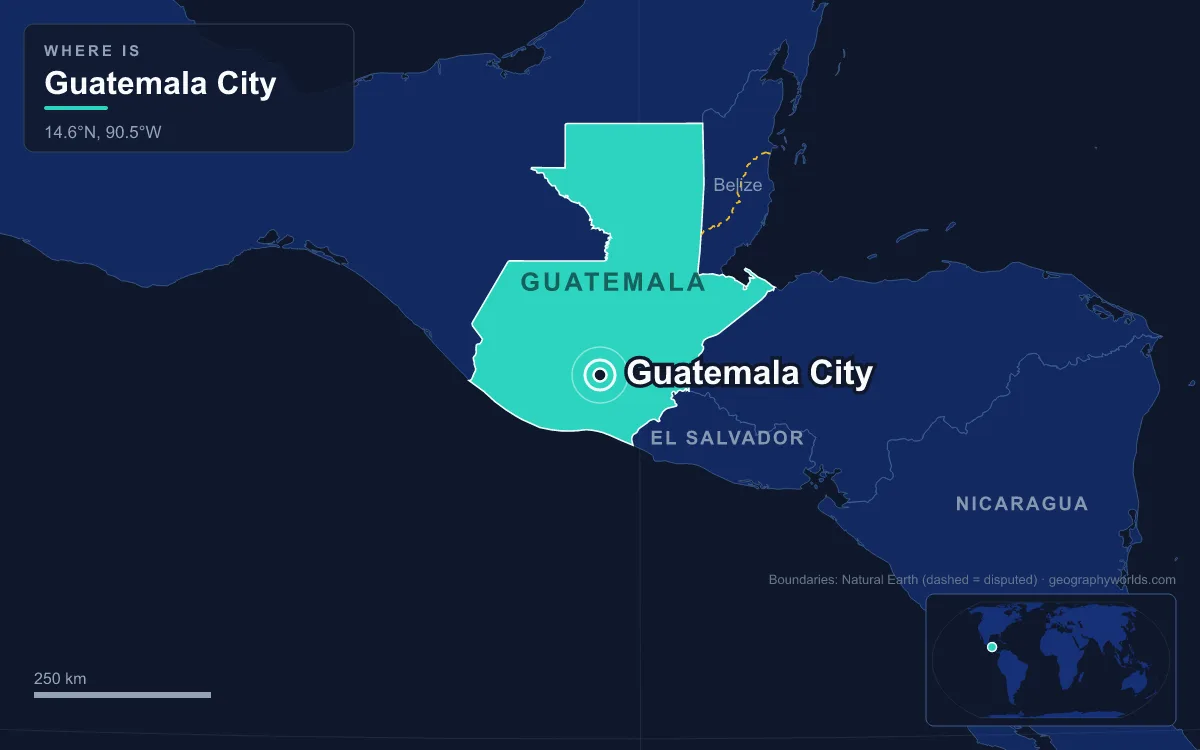
Guatemala City is the capital and largest city of Guatemala, built at about 1,500 m above sea level in the Valle de la Ermita, a highland valley in the south-central part of the country cut by deep ravines and ringed to the south by volcanoes. The city municipality had a projected 1,221,739 people in 2023, and its metropolitan area, which has swallowed neighbouring towns such as Mixco and Villa Nueva, is the largest in Central America at around 3 million. Its site explains almost everything about it: the valley drew a Maya city more than 3,000 years ago, drew the Spanish after an earthquake destroyed their old capital, and still shapes the hazards and growth of the city today.
Valle de la Ermita at 1,500 Metres
The valley sits in Guatemala’s central highlands, between the Pacific coastal plain to the south and the lowlands of Petén to the north. Beneath it lie loose volcanic ash and other pyroclastic deposits laid down by past eruptions, and water has cut that soft fill into steep-sided canyons that criss-cross the valley and break the city into separate stretches of level ground. Neighbourhoods run along the level ground; poorer settlements cling to the ravine edges.
Altitude gives the city a climate much milder than Central America’s coasts. It is classed as tropical savanna, bordering on a subtropical highland climate, with daytime temperatures of about 22–28 °C and nights of 12–17 °C for most of the year. April is the warmest month. Rain falls mainly from May to October, which overlaps the Atlantic and Caribbean hurricane season; the dry season runs from November to April. South of the valley the land rises again into the volcanic chain, and on a clear day the cone of Agua rises on the southwestern horizon.
Just south of the city lies Lake Amatitlán, 11 km long and filling a volcanic caldera at 1,186 m. Its main inflow is the Villalobos River, and the lake has paid the price of the city’s growth: around 2010 pollution turned it green, and it remains heavily contaminated and unfit for swimming. Water in the valley has shaped its settlement from the very beginning, as the next layer down shows.
Kaminaljuyu, the Maya City Beneath the Streets
Long before the Spanish, the Valle de la Ermita held one of the largest cities of the ancient Maya world. Kaminaljuyu, whose K’iche’ name is usually translated as “hill of the dead”, was occupied from roughly 1500 BC to AD 1200 and was the biggest Maya settlement outside the lowlands of the Yucatán Peninsula. It rose to prominence around 300 BC on the mining and trade of obsidian, a volcanic glass prized across pre-Columbian Mesoamerica. The valley then also held a lake, and recent research links the city’s decline in the Late Classic period, and its collapse around AD 800–900, to drought, political instability and the shrinking of that lake.
When it was first mapped, Kaminaljuyu comprised some 200 platforms and pyramid mounds across about 5 km². Its builders used hardened adobe rather than the limestone of the lowlands, and modern Guatemala City has built over most of it. Only about 0.5 km² survives as an archaeological park inside the city, where excavated mounds sit under protective roofs. For the great limestone cities of the north, see our guide to Tikal.

From Antigua to the Ermita Valley: The 1776 Move
For its first two and a half centuries Spanish Guatemala was governed from elsewhere. The first capital was founded on 25 July 1524 beside the Kaqchikel Maya city of Iximche; after uprisings it moved in 1527 to the Almolonga valley, and from 1543 it stood at Santiago de los Caballeros, the city now called Antigua Guatemala, under the slopes of Agua. Santiago was the seat of the Captaincy General of Guatemala, but its site was violently unstable. Earthquakes damaged it in 1717 and 1751, and a sequence that began in May 1773 peaked on 29 July, the feast of Saint Martha, with a shock of about magnitude 7.5 that wrecked the city. Around 500 to 600 people died at once and at least 600 more of hunger and disease.
Spanish officials had talked of moving the capital after 1717; this time they did. In 1776 the government moved east to the Valle de la Ermita, judged less prone to earthquakes, where a small colonial town had grown up around a monastery called El Carmen, founded in 1620. The new city was named Nueva Guatemala de la Asunción, after the Virgin of the Assumption whose feast day, 15 August, is still the city’s own feast day. Its central plaza was laid out beside a neoclassical Metropolitan Cathedral, mostly built between 1782 and 1815 and finished in 1871.
The abandoned capital was never entirely emptied. Its ruined churches, convents and Baroque streets survived well enough, even after further damage in the tremors of 1917 and 1918, for Antigua Guatemala to be listed as a UNESCO World Heritage Site in 1979, and it now lies about 25 km from the new capital’s airport.
The move made the valley the political centre of the isthmus. In September 1821 the Act of Independence of Central America was signed in the city, with 15 September now celebrated as independence day, and Guatemala City became the capital of the United Provinces of Central America. When Guatemala declared itself a separate republic in 1847, it became the national capital. Nineteenth-century governments added the Carrera Theatre in the 1850s and a presidential palace in the 1890s, while the city spread along the 30 de Junio boulevard.
Agua, Fuego, Pacaya and the Motagua Fault
The site chosen for its safety turned out to carry the same risks as the old one, because the whole region sits where the Cocos Plate dives beneath the Caribbean Plate, feeding a line of 33 stratovolcanoes across Guatemala from the Mexican border to El Salvador. Four of them, Agua, Fuego, Pacaya and Acatenango, are visible from the city, and two are active. Pacaya, 2,552 m high and 25 to 30 km south of the capital (sources differ), has erupted frequently since 1961; Fuego is almost constantly active at a low level.
Earthquakes came back too. Between 17 November 1917 and 24 January 1918 a series of tremors grew stronger until they almost completely destroyed Guatemala City, 144 years after the Santa Marta quake. Rebuilding produced wider streets and grid-planned districts. On 4 February 1976 a magnitude 7.5 earthquake ruptured the Motagua Fault, the boundary between the North American and Caribbean plates, about 160 km northeast of the city. It struck at 3:01 a.m., destroyed most of the adobe houses on the capital’s outskirts and killed about 23,000 people across Guatemala.
The loose ground beneath the valley brings a hazard of its own. In February 2007 a circular hole about 100 m deep with vertical walls opened in the northeast of the city, killing five people and forcing about 1,000 to leave their homes; geologists linked it to water from a sewer washing out the soft volcanic fill below. In May 2010 Pacaya erupted and forced 2,000 people to evacuate; two days later Tropical Storm Agatha made landfall, and on 30 May its rains, together with leaking sewer pipes, opened another sinkhole about 90 m deep in Zona 2. Agatha killed about 165 people in Guatemala.

Guatemala City’s Numbered Zonas Across the Valley Floor
Modern growth has followed the level ground between the ravines. The city is divided into 22 zones designed by the engineer Raúl Aguilar Batres, numbered 1 to 25 with 20, 22 and 23 left out because they would have fallen in neighbouring municipalities. Addresses give the avenue or street, then the distance in metres from the nearest cross street, then the zone, so 7a Avenida 1-17, Zona 4 is on 7th Avenue, 17 m from 1st Street. Zona 1 is the historic centre, with the cathedral, Congress and the Palacio Nacional de la Cultura, the palace Jorge Ubico built between 1939 and 1943 before the revolution of 1944 overthrew him.
After 1949 mayor Martín Prado Vélez pushed the city outward with Avenida Roosevelt, now its main east–west axis, the El Incienso bridge and the city’s first cloverleaf interchange. Migration from the countryside since the 1970s has done the rest, spilling the city across the valley into Mixco, Villa Nueva, Chinautla and other municipalities; the eight municipalities formally defined as the metropolitan area in 2005 cover 478 km². The capital is also the country’s commercial centre: the central bank sets monetary policy here, and banks such as Banco Industrial and Banrural and telecom firms such as Tigo and Claro keep their headquarters in the city. La Aurora International Airport sits only 6.4 km south of the centre, so building heights are capped for aircraft, at 60 m in the financial district of Zona 10 and up to 95 m in Zona 1. Traffic congestion, patchy water supply and crime have grown with the population, and the city has answered with the Transmetro bus rapid-transit system.
The highlands that hold the capital run on northwest into Mexico and southeast toward El Salvador, a landscape covered in our guide to the geography of Guatemala, while the neighbours beyond those ranges are introduced in the countries that border Guatemala.
Quick Facts About Guatemala City
- Country: Guatemala
- Continent: North America (Central America)
- Country population: approximately 19.0 million
- Capital city status: Guatemala City is the capital of Guatemala, the seat of national government, and the location of foreign embassies, parliament, and the head of state's official residence.
Frequently Asked Questions
What is the capital of Guatemala?
The capital of Guatemala is Guatemala City. Guatemala City is the seat of national government, hosts most foreign embassies and consulates, and is typically where the head of state and parliament are located.
What continent is Guatemala City in?
Guatemala City, the capital of Guatemala, is located in North America, in the Central America region. As Guatemala's capital, Guatemala City serves as the country's primary connection to the broader North American political, economic, and cultural sphere.
Why is Guatemala City the capital of Guatemala?
Guatemala City was chosen as the capital of Guatemala for reasons that typically combine geography, history, and politics. Capital city selections often reflect a desire for centrality (being accessible from across the country), historical importance (being a longstanding seat of government or culture), or neutrality (being acceptable to multiple regions or ethnic groups within the country). The specific reasons for Guatemala City's designation are detailed in the city's history above.
What is Guatemala City known for?
As the capital of Guatemala, Guatemala City is best known for housing the country's central government institutions — parliament, presidential or royal residences, supreme court, and key ministries. It is also typically a major cultural and economic center within Guatemala, hosting national museums, embassies, and signature monuments. The introduction and history sections above provide detailed coverage of the city's specific notable institutions and landmarks.
Related Pages
- Guatemala Country Guide — full geography, climate, economy, and culture overview
- Flag of Guatemala — meaning, history, and design of Guatemala's national flag