

The North Atlantic Drift, also called the North Atlantic Current, is the broad, slow northeastward flow that continues where the Gulf Stream ends near the Grand Banks of Newfoundland and carries relatively warm subtropical water across the Atlantic toward northwestern Europe. Unlike the Gulf Stream, which is a narrow, fast, sharply defined jet, the Drift is a wide and diffuse flow spread across hundreds of kilometres, moving at a few tens of centimetres per second. It splits as it approaches Europe: one branch turns north as the Norwegian Atlantic Current and continues past Norway into the Barents Sea, another curls around Iceland, and a southern branch turns down past Iberia to become the Canary Current. The Drift is the reason western Europe is dramatically warmer in winter than its latitude implies and the reason ports well above the Arctic Circle stay ice-free year-round. It is also the surface limb of the Atlantic overturning circulation, which makes the question of whether it is weakening one of the more consequential in climate science.
Where the Gulf Stream Ends and the Drift Begins
The handover happens near the Grand Banks, and it is a real change of character rather than a bookkeeping convention.
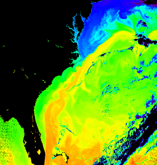
Up to Cape Hatteras the Gulf Stream is pinned against the continental shelf, narrow and fast. Beyond Hatteras it runs free, meanders and sheds rings, and by the time it passes the Grand Banks — where it meets the cold Labrador Current — it has lost most of its coherence. What continues is no longer a jet. It is a broad drift, driven principally by the prevailing westerly winds and by the density-driven overturning pulling water north, spread over a swathe of ocean and carrying far less concentrated energy.
It also splits repeatedly. The main branch heads northeast toward the British Isles and Norway. A portion turns north past Iceland as the Irminger Current. The Norwegian Atlantic Current carries warm water up the entire Norwegian coast and into the Barents Sea, and a branch even penetrates the Arctic Ocean through the Fram Strait west of Svalbard. Meanwhile a southern limb curves down past Portugal to feed the Canary Current, closing the gyre.
Europe's Temperature Anomaly, Measured
The anomaly is easiest to see by comparing places at matched latitudes on the two sides of the Atlantic and the top of the Pacific.
- Murmansk, Russia (68.9°N) has a January mean around −10 °C and, crucially, an ice-free harbour all year — the reason it exists as a major port and naval base. Churchill, Manitoba (58.8°N), ten degrees of latitude further south, is icebound for roughly half the year.
- Bergen, Norway (60.4°N) has a January mean above freezing, around 1.5 °C. Nuuk, Greenland (64.2°N) sits near −8 °C, and Anchorage, Alaska (61.2°N) near −8 °C as well.
- Tromso, Norway (69.6°N), well inside the Arctic Circle, averages about −4 °C in January. Equivalent latitudes in Siberia and northern Canada run twenty to thirty degrees colder.
So the effect is real and very large. The complication is attribution, and this is where the standard account goes wrong.
Research from the early 2000s took the question apart by asking what an Atlantic with no ocean heat transport would look like, and found that a substantial share of Europe's advantage does not depend on the current at all. Two atmospheric effects do much of the work. First, any ocean stores summer heat and gives it back in winter, so air arriving off the Atlantic is milder than air off a continent regardless of whether a current is delivering extra heat. Second, the Rocky Mountains force the mid-latitude westerlies into a large standing wave that drives cold air southward over eastern North America and warm air northward over western Europe — an effect of continental topography, not ocean circulation, and one that accounts for a large part of the east-west contrast that gets attributed to the Gulf Stream.
The ocean's contribution is genuine but smaller than folklore suggests. The most defensible framing: ocean heat transport adds a few degrees to northwestern European winters, and rather more to the far north of Norway and the Barents Sea, where the effect is concentrated and where the ice-free ports really are a direct consequence.
The Conveyor Underneath
The Drift is the visible surface half of a system that operates in the vertical.
Warm, salty water moves north. As it goes it loses heat to the atmosphere — which is what warms Europe — and because it is salty, cooling makes it dense enough to sink. That happens in two main places: the Nordic Seas between Greenland, Iceland and Norway, and the Labrador Sea. The sunk water then flows south along the deep Atlantic as North Atlantic Deep Water, eventually joining the global circulation and returning to the surface elsewhere, largely in the Southern Ocean.
This is the Atlantic Meridional Overturning Circulation, and the essential point is that it is self-reinforcing while it runs: the northward flow delivers the salt that lets water sink, and the sinking pulls more water north. Both halves depend on each other, which is what makes the system capable of more than one stable state. The general mechanism is set out in the explainer on thermohaline circulation.
The Collapse Question, Honestly Stated
Fresh water is the threat, because fresh water is light and light water will not sink no matter how cold it gets. Greenland is losing mass, Arctic river discharge is rising, and precipitation at high northern latitudes is increasing — all of which freshen the surface exactly where sinking needs to happen.
The evidence is genuinely mixed. Direct measurement across the Atlantic at 26.5°N began only in 2004 and shows large year-to-year variability with no clear trend yet extractable. Indirect reconstructions from sediment cores and from the pattern of sea surface temperatures — including a persistent cold patch south of Greenland that some read as a weakening fingerprint — suggest a decline over the twentieth century, but they are proxies with real uncertainties. Palaeoclimate records show the system has changed abruptly in the past, during the last glacial period and its aftermath, which establishes that it can.
The mainstream assessment is that weakening this century is likely, and that an abrupt collapse is unlikely but cannot be excluded and would be severe. Papers arguing collapse could occur within decades have been published and strongly contested on methodological grounds. Anyone claiming the question is settled in either direction is overstating the case.
What a collapse would actually do is also frequently overstated in a specific direction. Because much of Europe's mild winter comes from atmospheric effects, a shutdown would not give Britain the climate of Labrador. Model studies suggest cooling of a few degrees over northwestern Europe, concentrated in winter and strongest in the far north and around Iceland and Norway — serious, disruptive to agriculture and infrastructure, and set against a background of general greenhouse warming that would partly mask it. The larger effects would probably be elsewhere: a southward shift of tropical rainfall belts, changes to the monsoon, and accelerated sea level rise on the North American east coast.
One further wrinkle deserves mention because it is so often collapsed into the rest. The Drift also drives the Barents Sea's ongoing transformation, sometimes called Atlantification. Warm Atlantic water penetrating further north and east is reducing winter sea ice there faster than almost anywhere in the Arctic, and it is bringing Atlantic species with it: cod, haddock and herring have shifted their ranges hundreds of kilometres northeast over recent decades, into waters that were Arctic in character within living memory. Norwegian and Russian fisheries have followed them, which has turned a physical change into a question about who is entitled to fish where. The current that made northern Europe habitable is now redrawing the boundary of the Arctic itself.
The Human Geography It Built
The Drift's most tangible legacy is a pattern of settlement that would otherwise make no sense.
Norway supports towns, fisheries, airports and year-round shipping along a coast reaching to 71°N. The Lofoten cod fishery has operated for a thousand years in water that stays open through winter at a latitude where the Canadian and Russian coasts are frozen solid. Murmansk grew into a city of several hundred thousand people because it was the only Russian port with unrestricted year-round access to the open ocean, which made it strategically decisive in both world wars — the Arctic convoys of 1941 to 1945 existed because of it.
Iceland is habitable at all in a way Greenland at the same latitude is not, and its cod fishery underwrote an independent economy. Even the British Isles, which sit at the latitude of Labrador, support agriculture that would be impossible there. A current whose water moves at less than a kilometre an hour, spread invisibly over a thousand kilometres of open ocean, is the reason northern Europe looks the way it does on a population map.