

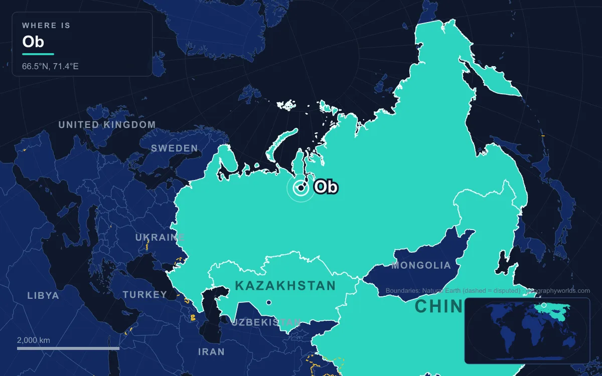
The Ob is the great river of western Siberia in Russia. It forms where the Biya and Katun rivers meet near Biysk in Altai Krai, then flows about 3,700 km north-west and north to the Gulf of Ob, an arm of the Kara Sea in the Arctic Ocean. Its main tributary, the Irtysh, rises in China, and together the two make a 5,410 km system, the seventh-longest in the world. The basin covers roughly 2.97 to 2.99 million km² of Russia, northern Kazakhstan, a corner of China and a sliver of western Mongolia. Along the way the river passes Barnaul and Novosibirsk, the largest city in Siberia, and then the oil towns of Surgut and Nizhnevartovsk. Its estuary is the longest on Earth. The account below follows the water downstream, from the glaciers of the Altai to the gas fields at the mouth.
Belukha and Lake Teletskoye: the two sources in the Altai
The Ob has two headstreams, and each starts in a different landscape. The Katun, about 700 km long, rises in a glacier on Belukha, the highest massif in the Altai, whose peaks reach from about 4,350 m to just over 4,500 m on the border between Russia's Altai Republic and Kazakhstan. The Tronov brothers first climbed it in 1914. Ice cores drilled on the Belukha Glacier between 2001 and 2003 may hold 3,000 to 5,000 years of climate record. Belukha is so remote that independent travellers have needed a border-zone permit to reach it since 2008.
The Biya is calmer. It is the only outlet of Lake Teletskoye, which lies 434 m above sea level and is 78 km long, about 5 km wide and up to 325 m deep, holding at least 40 km³ of fresh water. Around 70 rivers and 150 seasonal streams feed the lake, and the Chulyshman supplies more than half of its inflow. In the Altay language the lake is Altın Köl, the "Golden Lake". It lies inside the Altaisky Nature Reserve, which UNESCO lists with the Katun reserve and the Ukok Plateau as the Golden Mountains of Altai World Heritage Site.
Biysk to Barnaul: the Ob takes its name
The two rivers join about 25 km south-west of Biysk, at an elevation of roughly 195 m. Below that point the river is called the Ob. Biysk sits on the Biya just above the confluence. It began as the Bikatunsky fortress, ordered by Peter the Great in 1708 and destroyed by the Dzungars in 1710, and was rebuilt upstream in 1718. The 2021 census counted 183,852 people there.

As the Altai foothills give way to the Ob Plateau, the river winds west and north through forest-steppe. Barnaul, the capital of Altai Krai, stands on the left bank where the small Barnaulka joins. The Demidov family founded it to smelt copper and silver, and it became a major centre of Russian silver production before gaining city status in 1771. It had 630,877 residents in 2021. Ice holds the river at Barnaul from early November until nearly the end of April. This southern stretch is the mildest part of the whole basin, warm enough in summer for grapes, melons and watermelons.
Novosibirsk and the Ob Sea, 1893 to 1956
For about 200 km above Novosibirsk, the river is widened into the Novosibirsk Reservoir, which locals call the Ob Sea. It was created by a 33 m concrete dam completed in 1956, and at the time it was the largest artificial lake in Siberia. The reservoir is 200 km long and up to 17 km wide, covers 1,070 km² and holds 8.8 km³ at normal level. Its hydroelectric station was designed for 460 MW and produces about 1,687 GWh a year. The flooding cost something too: the historic centre of Berdsk and several villages now lie under the water. The Karakan Pine Forest lines the eastern shore, and the Akademgorodok science town sits on the western side.
Below the dam lies Novosibirsk. It was founded in 1893 at the point where the future Trans-Siberian Railway was to cross the Ob, and a rail bridge was built there. The town was called Novonikolayevsk until 1926. During the Second World War it took in factories evacuated from western Russia. With 1,633,595 people in 2021, it is the third-largest city in Russia and the largest in North Asia. The railway is the reason a city of that size grew on a Siberian riverbank.
Tomsk Oblast: Kolpashevo and the Ket canal
North of Novosibirsk the Ob enters Tomsk Oblast. Here it picks up the Tom, the Chulym and the Ket from the east and the Vasyugan from the west. The city of Tomsk is not on the Ob but on the Tom, and before the railway it served as an important terminus for river traffic in the eastern part of the basin. In the late 19th century engineers tried to join the Ob system to the Yenisei with about 900 km of canals that used the Ket. The railway soon made the route uncompetitive, and it was abandoned.
The town of Kolpashevo, on the middle Ob, is part of a darker history. During the Great Purge the NKVD executed prisoners there and buried them in mass graves. In May 1979 the river cut into its bank and exposed a grave holding more than 1,000 mummified bodies. The regional party chief, Yegor Ligachev, organised a cover-up: tugs were used to wash the bank away, and local people were pressured into sinking the corpses in the river.
Surgut and Nizhnevartovsk: the oil reach of Khanty-Mansi
In Khanty-Mansi Autonomous Okrug the Ob flows across the West Siberian petroleum basin. Surgut is one of the oldest Russian settlements on the river, founded in 1594 on the orders of Tsar Feodor I. With 396,443 people in 2021, it is now larger than the okrug's capital. Here the Yugra Bridge crosses the Ob. It is a cable-stayed road bridge 2,070 m long, opened in September 2000, and its 408 m central span is the longest of any single-tower cable-stayed bridge in the world. A steel truss rail bridge runs beside it.

Nizhnevartovsk, upstream on the right bank, grew because of oil. The Samotlor field nearby was discovered in 1965 and produced its first oil in 1969. It covers 1,752 km² and is Russia's largest oil field. Output peaked in 1980 at 158.9 million tonnes, and about 2.6 billion tonnes had been produced over the field's life. The town had 283,256 people in 2021. The river has paid for this. In the lower Ob, petroleum products have been measured at 9 to 10 times the permitted maximum, with oxygen four times below normal. Surveys of the middle Ob in 2003–2008 and 2014–2018 found phenols, hydrocarbons, iron, manganese, copper and phosphate as the main pollutants.
Khanty-Mansiysk: where the Irtysh joins
At about 69° E the Irtysh flows in, and the Ob doubles in scale. The Irtysh is the longer of the two: it measures 4,248 km from its source in China to the confluence, against 2,538 km for the Ob. The Ob keeps its name anyway. Khanty-Mansiysk, the capital of the okrug, stands on the Irtysh 15 km above the junction and had 107,473 residents at the 2021 census, fewer than Surgut, Nizhnevartovsk or Nefteyugansk. It is named after the Khanty and Mansi peoples, and before 1940 it was called Ostyako-Vogulsk. The Khanty know the Ob as the As, the source of the old Russian name "Ostyak" for them. The Nenets call it Kolta, and the Siberian Tatars call it Umar.
Below the confluence the river splits into several arms. It then turns north past Beryozov, one of the Russian forts founded on the lower Ob at the end of the 16th century. In the 1960s–80s Soviet planners considered diverting Ob and Irtysh water south to Kazakhstan, Central Asia and the Aral Sea. The scheme was abandoned in 1986 on economic and environmental grounds.
Salekhard and the 1,000 km Gulf of Ob
Salekhard is the last town of any size. It was founded in 1595 as Obdorsk, on the site of a Khanty settlement, and it sits almost exactly on the Arctic Circle. In 2021 it had 47,910 people. The river here is frozen from late October until early June, more than seven months of the year. There is no bridge. The nearest railway station is at Labytnangi on the far bank. Between 1949 and 1953 Gulag prisoners built the Salekhard–Igarka railway, and thousands of them died on it before the project was abandoned. At Salekhard the Ob carries an average of 12,889 m³/s (1971–2015 data), and peaks have reached 40,200 m³/s.
The river then enters the Gulf of Ob, an estuary about 1,000 km long and 50 to 80 km wide between the Yamal and Gyda peninsulas. With an average depth of only 10 to 12 m, it limits heavy shipping. The Nadym and Pur flow into it, and the Taz enters through its own side estuary. Beluga whales come into the gulf each season. The islands near its head were protected Ramsar wetlands until July 2025; the floodplain upstream is covered in our guide to the Ob River floodplain. Gas now dominates the shores. The Yamburg field lies between the gulf and the Taz Estuary, and in December 2017 the port of Sabetta, on the west bank, loaded its first cargo for the Yamal LNG plant.
The water route itself is old. Novgorod knew the lands of western Siberia from at least the 11th century, and it opened two trade routes to the Ob from Ustyug: one along the Sukhona, Vychegda and Usa to the lower river, the other down the Northern Dvina and along the White Sea and Kara Sea coasts to the mouth. Steamers worked the middle Ob from 1845, and by 1916 there were 49 of them, against 10 on the Yenisei. In the 1870s Christian Dahl explored the river's navigability and helped open a direct trade route from central Siberia to Western Europe. The basin still has about 15,000 km of navigable waterways and more than 50 fish species. The Ob ends in the shallow, ice-bound Kara Sea, and its eastern neighbour, the Yenisei, crosses the same plain on a parallel course to the same sea.