

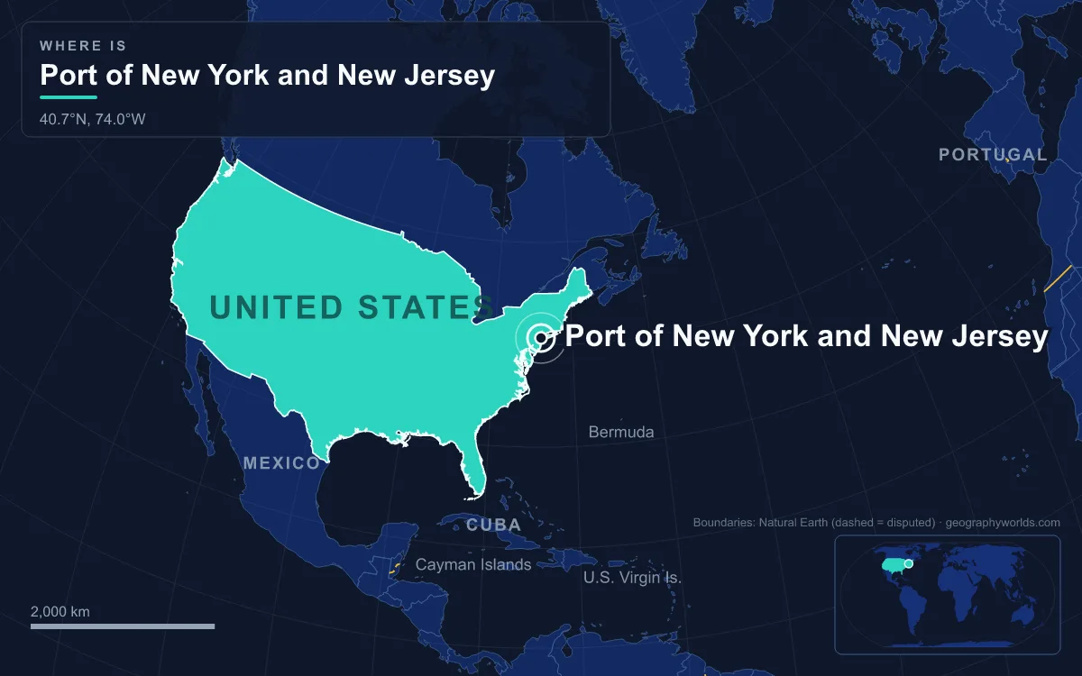
The Port of New York and New Jersey is the largest port on the East Coast of the United States: a port district reaching about 40 km (25 miles) in every direction from the Statue of Liberty, spread across the New York–New Jersey Harbor Estuary where the Hudson River meets the Atlantic. It handled about 8.7 million twenty-foot equivalent units (TEU) of containers in 2024, 24th in the world in Lloyd's List's One Hundred Container Ports ranking, and in 2022 it briefly overtook Los Angeles as the busiest port in the country by maritime cargo volume. European ships have traded here since the Dutch founded New Amsterdam after Henry Hudson's voyage of 1609, but the modern container port dates from 1956, when the Ideal X, generally considered the first container ship, sailed from Port Newark, and it runs on an engineered system of dredged channels, a raised bridge, four container terminals and dockside railyards, with the main marine terminals run by the bi-state Port Authority of New York and New Jersey, set up in 1921.
Ambrose Channel and the Narrows: The Only Way In
Every large ship bound for the port follows the same route. From the open sea of the New York Bight, between the Sandy Hook peninsula in New Jersey and Breezy Point on the Rockaway peninsula, it enters the Ambrose Channel, the single deep-water shipping channel into and out of the harbour. Named after John Wolfe Ambrose, a New York engineer, the channel became the main entrance in 1914, when it was dredged to 40 feet (12 m) deep and 2,000 feet (600 m) wide. For decades a lightship and then the Ambrose Light tower, built in 1967 and removed in 2008, marked its seaward end and served as the station where the Sandy Hook Pilots boarded incoming ships. Most vessels still need a pilot to get through the port, and the biggest ships also need tugs for the sharper turns.
The Ambrose Channel ends at the Ambrose Anchorage, just south of the Verrazzano–Narrows Bridge, which leaves 228 feet (69.5 m) of clearance at mean high water. Beyond the Narrows it becomes the Anchorage Channel in Upper New York Bay, then branches into a network of about 240 miles (386 km) of maintained channels: Bay Ridge, Red Hook, Buttermilk, Claremont, Port Jersey, Kill Van Kull, Newark Bay, Port Newark, Elizabeth and Arthur Kill. Ships waiting for a berth use the Stapleton, Bay Ridge and Gravesend anchorages. The Hudson itself, known to pilots as the North River, stays navigable for large ships as far upstream as the Port of Albany-Rensselaer.
Fifty Feet Down: Dredging the Kill Van Kull and Newark Bay
New York Harbor is one of the largest natural harbours in the world, but it is not naturally deep. Its natural depth is only about 17 feet (5 m). Engineers had deepened the controlling depth to about 24 feet by 1880 and the Main Ship Channel to at least 30 feet by 1891. The Rivers and Harbors Act of 1899 funded 40-foot channels at Bay Ridge, Red Hook and Sandy Hook, and during the Second World War the main channel went to 45 feet for Panamax-sized ships. The US Army Corps of Engineers, involved in the harbour since about 1826, still maintains the channels and bulkheads.
The latest step was the biggest. To handle the post-Panamax ships able to use the widened Panama Canal, the Corps completed a $2.1 billion project in August 2016 that took the main channels to 50 feet (15 m). In many places the sandy bottom had already been excavated down to rock, so the work meant blasting before dredgers could lift the broken rock out; in 2005 about 70 dredging machines were working in the harbour at once, the largest such fleet anywhere. Dredging also disturbed a layer of PCBs and other pollutants lying just under the bed of the channels leading to Port Newark, and in 2009 plans were announced to treat about 200,000 cubic yards of it and store it at the former Yankee Stadium site and Brooklyn Bridge Park.
Raising the Bayonne Bridge from 151 to 215 Feet
Depth was only half the problem. Container ships bound for Newark Bay must pass under the Bayonne Bridge, the steel arch that crosses the Kill Van Kull between Bayonne, New Jersey, and Port Richmond on Staten Island. Designed by Othmar Ammann with the architect Cass Gilbert and completed in 1931, it was then the longest steel arch bridge in the world, beating the Sydney Harbour Bridge by 25 feet (7.6 m), and its roadway sat 151 feet (46 m) above the water. That was adequate for the US Navy's tallest ships in 1931, but not for a modern vessel stacked with containers.
Instead of replacing the bridge, the Port Authority built a new roadway higher up inside the existing arch, at a cost of about $1.7 billion. Work began in 2013; the new clearance of 215 feet (66 m) was reached on 8 June 2017, and the new roadways opened on 24 May 2019. The payoff came immediately. In July 2017 the OOCL Berlin, the largest ship to call at an East Coast port up to that time, passed under the raised deck, and in 2021 the even larger MSC Cristina and MSC Virgo reached the port. A ship bound for Newark Bay must now clear both the 215-foot Bayonne Bridge and the 228-foot Verrazzano–Narrows. By comparison, the Brooklyn Bridge over the East River leaves only 135 feet (41.1 m).
Port Newark–Elizabeth, Howland Hook and the Railyards Behind the Berths
Four container terminals sit at the end of those channels: Port Newark–Elizabeth Marine Terminal on Newark Bay, Port Jersey on Upper New York Bay, Howland Hook on the Arthur Kill in Staten Island, and Red Hook in Brooklyn. Port Newark–Elizabeth is the largest. It was carved out of the Newark Meadows, about 12 square miles (31 km²) of tidal wetland, after the city of Newark began cutting an angled shipping channel in the 1910s. The Port Authority took it over in 1948. On 26 April 1956 the Ideal X left Port Newark for Houston carrying 58 containers. In 1958 the Port Authority straightened Bound Brook into the Elizabeth Channel and used the spoil to build new land, and there the 90-acre (36 ha) Sea-Land terminal opened in 1962, the prototype for almost every container terminal built since.

Ships reach the complex through The Narrows and the Kill Van Kull, or occasionally by the Arthur Kill, and berth along two main dredged slips. Terminals are leased to operators, which in 2009 included Maher Terminals, APM Terminals and Port Newark Container Terminal, whose lease deal in 2011 committed $500 million of investment and an expansion from 180 to about 287 acres. Boxes are stacked beside the New Jersey Turnpike and loaded onto trucks or onto ExpressRail, the Port Authority's network of dockside rail yards, which connects through Conrail's shared lines to Norfolk Southern, CSX and Canadian Pacific. A surcharge on every container helps pay for it.
Rail is the harbour's awkward link, because freight trains cannot use the passenger tunnels under the Hudson. The nearest freight crossing of the river is about 140 miles (225 km) north, a detour known as the Selkirk hurdle. The alternative is the car float: New York New Jersey Rail barges freight cars 2.5 miles (4 km) across Upper New York Bay between Greenville Yard in Jersey City and the 65th Street Yard in Brooklyn, a trip of about 45 minutes that replaces a truck journey of 35 to 50 miles. Around 1,600 cars are floated on the one remaining car float today, compared with nearly 600,000 a year at the service's peak.

What 8.7 Million TEU Means for the New York Region
The engineering has paid off in volume. Lloyd's List recorded about 6.3 million TEU in 2016, the year the 50-foot channels were finished; that rose every year to about 9.5 million in 2022, the year New York–New Jersey became the busiest port in the United States by maritime cargo volume. Volume fell back to about 7.8 million TEU in 2023, a sharper drop than in California, and Los Angeles regained first place. In 2024 it recovered to about 8.7 million.
Those containers serve the New York–Newark metropolitan area and markets far beyond it. The port district covers all or part of 17 counties, including all five boroughs of New York City and the New Jersey counties of Hudson, Bergen, Essex and Union. It holds Foreign-Trade Zone No. 1, the first in the United States, set up on the New York side in 1937, and FTZ 49 on the New Jersey side. In 2006 Port Newark–Elizabeth handled more than a fifth of all US imports from Germany, more than any other American port. The same waterfront also carries bulk trade the containers never touch: petroleum along the Arthur Kill beside the Bayway Refinery, scrap metal at Constable Hook on the Kill Van Kull, and cargo on the Passaic River and Newtown Creek, some of them now Superfund sites.
Passengers use the same water. Cruise ships berth at Cape Liberty in Bayonne, the Brooklyn Cruise Terminal on the Buttermilk Channel and the New York Passenger Ship Terminal on the Hudson, from which the Queen Mary 2 sails a scheduled transatlantic service to Southampton. The free Staten Island Ferry carries about 75,000 people a day across the same Upper Bay the car floats cross.
The container era also emptied the old waterfront. Once Sea-Land's terminal at Elizabeth showed what a purpose-built box port could do, the traditional piers of Manhattan, Hoboken, Jersey City and Brooklyn went into steep decline, and sections of that waterfront have since become parks such as Hudson River Park and Brooklyn Bridge Park. The river that made the harbour is traced from source to mouth in our guide to the Hudson River, the locks that sent bigger ships to Newark are explained in our piece on the Panama Canal locks, and the West Coast rival that took back first place in 2023 is profiled in our history of the Port of Los Angeles.