
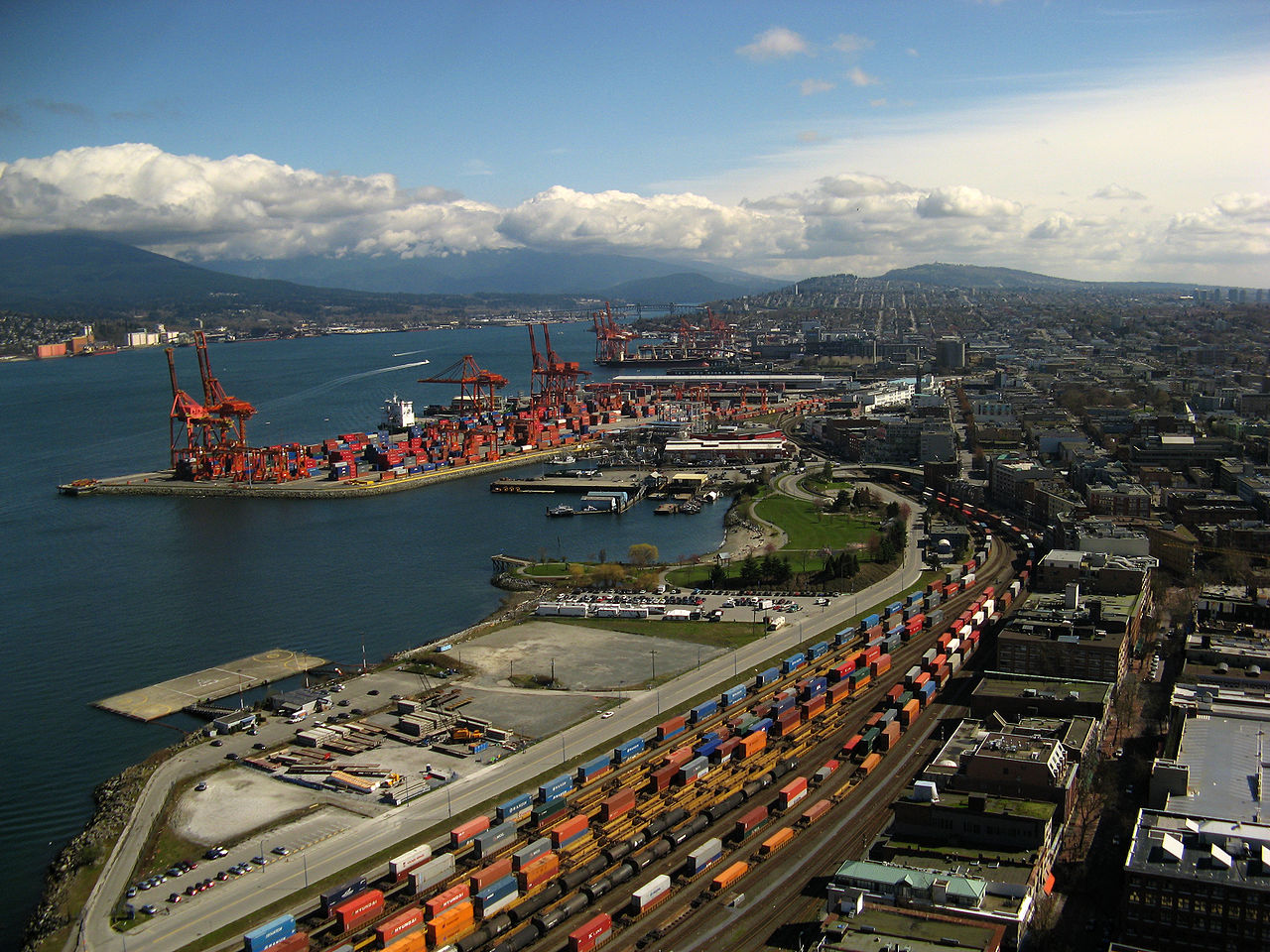
The Port of Vancouver is Canada's largest port and the third-largest in North America by tonnage, handling over 145 million tonnes of cargo annually. Spread across 28 major terminals on Burrard Inlet, the Fraser River, and English Bay, it is Canada's Pacific Gateway—the primary link between the nation's resource-rich interior and the growing economies of the Asia-Pacific region.
Introduction
The port operates in one of the most spectacular geographic settings of any major commercial port, with snow-capped mountains rising directly behind container terminals and bulk loading facilities. This dramatic landscape, while beautiful, also creates significant logistical challenges, as all rail and road connections to the port must navigate narrow mountain passes.

Geographic Location
- Location: Burrard Inlet and Fraser River, Strait of Georgia, British Columbia
- Coordinates: 49.29°N, -123.11°W
- Water Depth: 18.3 meters at Deltaport container terminal
The port's terminals are distributed across three main geographic areas: Burrard Inlet (the deep fjord-like inlet that forms Vancouver's iconic harbor), the North Arm and South Arm of the Fraser River, and Roberts Bank (including the major Deltaport container terminal on a causeway extending into the Strait of Georgia).
Vancouver's Pacific position gives it the shortest shipping distance between North American ports and the major economies of East Asia. Ships from Vancouver reach Shanghai in approximately 10 days and Tokyo in 8 days, providing competitive transit times for Canadian exports of resources and agricultural products.
Port Infrastructure
- Terminals: 28 major terminals across three areas
- Deltaport: Primary container terminal on Roberts Bank causeway
- Cargo Types: Containers, coal, grain, potash, sulphur, forest products
Deltaport, located on a causeway extending 4 kilometers into the Strait of Georgia, is the primary container terminal with three berths handling the largest trans-Pacific container vessels. The Roberts Bank Terminal 2 project proposes to add a new container terminal adjacent to Deltaport, which would significantly increase container capacity.
The port handles an exceptionally diverse range of cargo, reflecting Canada's resource-based economy. Bulk terminals on Burrard Inlet load coal from British Columbia and Alberta, grain from the prairies, potash from Saskatchewan, and sulphur from Alberta's oil sands operations. Forest product terminals handle lumber, pulp, and paper from B.C.'s forestry industry.
Trade & Shipping
- Cargo Tonnage: 145+ million tonnes annually
- Container Volume: 3.7+ million TEU
- Top Trade Partner: China is the largest trading partner by volume
Canada's resource exports drive the port's bulk traffic: coal, grain, potash, and sulphur are loaded onto bulk carriers destined primarily for Asian markets. China, Japan, South Korea, and India are the top destinations for Canadian commodities, reflecting the growing Asia-Pacific demand for energy, food, and industrial inputs.
Container trade serves both import and export markets. Asian manufactured goods arrive for the Canadian domestic market and for intermodal transport to central and eastern Canada, while exports include forest products, specialty agricultural goods, and manufactured items. The port's container operations compete with the U.S. ports of Seattle and Tacoma for Pacific Northwest market share.
Economic & Strategic Impact
- National Trade: Handles ~$1 in every $5 of Canadian trade
- Employment: 115,000+ jobs across British Columbia
- Supply Chain: Rail bottlenecks through Rocky Mountains create vulnerability
The port facilitates approximately $1 in every $5 of Canadian international trade, making it the single most important piece of trade infrastructure in the country. Over 115,000 jobs across British Columbia depend on port-related activity, from longshore workers to rail crews, truck drivers, and logistics professionals.
The port's greatest vulnerability is its dependence on two railway corridors through the Rocky Mountains (operated by Canadian Pacific Kansas City and Canadian National) for connections to the rest of Canada. Weather events, avalanches, mudslides, and infrastructure failures in the mountain passes can shut down the port's supply chain, as dramatically demonstrated by the 2021 British Columbia floods that severed all rail and road links for weeks.
Key Facts
- Vancouver is Canada's largest port, handling $1 in every $5 of Canadian trade
- The port handles over 145 million tonnes of cargo across 28 terminals
- Deltaport container terminal sits on a 4 km causeway into the Strait of Georgia
- Coal, grain, potash, and sulphur are major bulk export commodities
- The port depends on just two railway corridors through the Rocky Mountains
Fun Facts
- Vancouver's harbor is home to pods of orca whales that swim among container ships and bulk carriers
- The original port area, Gastown, is where the city of Vancouver was founded in the 1860s as a sawmill settlement
- The 2021 B.C. floods demonstrated that virtually all of Canada's Pacific trade flows through a single geographic corridor
Final Thoughts
The Port of Vancouver is where Canada's vast natural resources meet the Asia-Pacific marketplace. Its spectacular mountain-and-ocean setting belies the serious logistical challenges of moving millions of tonnes of cargo through narrow mountain passes. As Asia-Pacific trade continues to grow, the port's capacity and its vulnerable rail corridors will increasingly determine Canada's ability to participate in the Pacific century.
Test Your Knowledge!
Think you know the world's great harbors and ports? Try our geography quiz games!
Play Geography Games →