

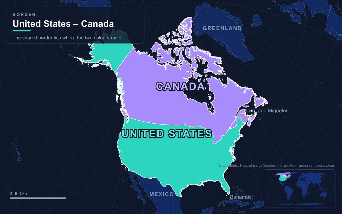
The US-Canada border is the boundary between the United States and Canada, and at 8,891 km (5,525 miles) it is the longest international border in the world. It comes in two pieces: 6,416 km between Canada and the contiguous 48 states, running from the Bay of Fundy to the Strait of Juan de Fuca, and 2,475 km between Canada and Alaska, running from the Pacific up to the Beaufort Sea. Thirteen US states and eight of Canada's thirteen provinces and territories touch it. It matters because it is the line across which two closely linked economies trade every day, and because it is policed by civilian customs and border agencies rather than armies, which is why it is so often called the world's longest undefended border. The simplest way to understand it is to travel it, east to west, section by section.
Machias Seal Island to the Saint John River
The border starts at sea. In the mouth of the Bay of Fundy it separates Maine from New Brunswick's Grand Manan Island, and here the line is still disputed. Machias Seal Island, a treeless rock about 16 km southeast of Cutler, Maine, has carried a Canadian lighthouse since 1832, and the Canadian Coast Guard still staffs it. The United States also claims sovereignty over the island, although it has never had a physical presence there.
Coming ashore, the boundary runs up Passamaquoddy Bay and the St. Croix River, then through the Chiputneticook Lakes and along Monument Brook to a point near Amity, Maine. From there it strikes north to the Saint John River and follows the river past Grand Falls, New Brunswick, and Hamlin, Maine, before leaving it for Beau Lake. Almost none of this was clear in 1783, when the Treaty of Paris described the line from "the northwest angle of Nova Scotia" using maps that did not match the ground. The confusion produced the Aroostook War of 1838–1839, in which militias were called out but never fought, and the Webster–Ashburton Treaty of 1842 settled the Maine boundary where it runs today.
The 45th Parallel and the Haskell Library
West of Maine the border meets the Appalachian highlands along the Quebec line and then settles onto the 45th parallel north, which King George III had already set in 1763 as the boundary between the provinces of Quebec and New York. John Collins and Thomas Valentine surveyed and marked it between 1771 and 1773. Their line was not quite straight, and that caused one of the border's odd episodes. After the War of 1812 the US government started building a fort at Rouses Point, New York, on Lake Champlain, only for later measurements to show that the true 45th parallel lay about 1.2 km south of the surveyed line. The unfinished work, nicknamed "Fort Blunder", was in Canada. The 1842 treaty solved the problem by keeping the old, slightly wandering survey line as the legal border.
That wandering line runs straight through towns. In Derby Line, Vermont, and Stanstead, Quebec, the Haskell Free Library and Opera House was deliberately built across the border and opened on 7 June 1904. Its library collection and theatre stage sit in Canada, while the main entrance and most of the theatre seats are in the United States, and a black line across the floor marks where one country ends. Further west along the same parallel, the Mohawk community of Akwesasne straddles the meeting point of Ontario, Quebec and New York, where the border leaves the St. Lawrence River between Massena, New York, and Cornwall, Ontario.

Through the St. Lawrence and the Great Lakes
For most of Ontario the border is water. It follows the St. Lawrence River upstream past the Thousand Islands into Lake Ontario, then the Niagara River, Lake Erie, the Detroit River, Lake St. Clair, the St. Clair River and Lake Huron. It passes through the False Detour Channel near Drummond Island, runs up the St. Marys River at Sault Ste. Marie, and crosses Lake Superior to the mouth of the Pigeon River. Four of the five Great Lakes are split by the line; only Lake Michigan lies wholly in the United States. Because so much of the boundary is shared water, the two countries created the International Joint Commission under the Boundary Waters Treaty of 1909 to approve projects that affect lake levels and river flows.
The Detroit River is where the border carries the most freight. The Ambassador Bridge between Detroit and Windsor opened in 1929 and for decades carried more than a quarter of all US-Canada merchandise trade by value. Its private owners, the Moroun family, fought for years against a public rival. That rival, the Gordie Howe International Bridge, is owned equally by Canada and the state of Michigan, cost about CA$3.8 billion, and opened to traffic on 27 July 2026. It links Interstate 75 directly to Ontario's Highway 401.
Lake of the Woods and the Northwest Angle
West of Lake Superior the border climbs the Pigeon River and crosses the Height of Land Portage, the divide between the Great Lakes and Hudson Bay basins. It then threads the canoe country of the Boundary Waters: Sea Gull Lake, Lac la Croix, Namakan Lake, Rainy Lake and the Rainy River, before entering Lake of the Woods. Here the negotiators of 1783 made their most visible mistake. Working from John Mitchell's map, they wrote that the line should run from the lake's northwesternmost point due west to the Mississippi River. The Mississippi's source is actually far to the south, so the line could never meet it.
When the border was later fixed by running south from that point to the 49th parallel, it left a piece of Minnesota stranded on the Canadian side of the lake. The Northwest Angle is the only place in the contiguous United States north of the 49th parallel, apart from survey errors. It had 149 residents at the 2020 census, about 70 percent of its land is held in trust for the Red Lake Band of Ojibwe, and anyone driving there from the rest of Minnesota has to pass through Manitoba and report by telephone to US Customs.
Along the 49th Parallel from Manitoba to the Rockies
From the Northwest Angle the border becomes the long straight line most people picture. The Treaty of 1818 (the London Convention) extended the boundary along the 49th parallel from Lake of the Woods to the Rocky Mountains, trading away British claims in the Red River Valley and American claims north of the parallel in the Missouri River basin. The whole of the Alberta and Saskatchewan borders, and nearly all of Manitoba's, lie on this parallel, facing Minnesota, North Dakota and Montana. The International Boundary Survey began marking this stretch in 1872.
A straight line on a map is not quite straight on the ground. The 19th-century survey markers stray from the true parallel by up to several hundred feet in places, and the markers, not the mathematics, are the legal border. Since 1925 the International Boundary Commission has been permanent. It maintains the monuments and keeps a "border vista" clear of trees and brush, 6 m wide in total and 3 m on each side of the line. Landowners may not build within that strip without the commission's permission.

Point Roberts, the Peace Arch and the Strait of Juan de Fuca
West of the Rockies, the 49th parallel was not settled until the Oregon Treaty of 1846. President James K. Polk's supporters had demanded a boundary at 54°40′N, while Britain wanted the line to follow the Columbia River. The compromise carried the parallel across the mountains to the sea, and the Northwest Boundary Survey marked it on land between 1857 and 1861. At the coast the parallel clips the tip of the Tsawwassen Peninsula, leaving Point Roberts, Washington, cut off from the rest of the country. Its 1,191 residents (2020 census) have to drive about 40 km through British Columbia to reach the rest of Washington, unless they go by boat or plane.
Just east of Point Roberts, where Interstate 5 becomes British Columbia Highway 99, stands the 20.5 m Peace Arch, built on the exact boundary between Blaine, Washington, and Surrey, British Columbia. Sam Hill led its construction, and it was dedicated in September 1921 to mark the Treaty of Ghent, which ended the War of 1812. About 500,000 people visit it every year. Offshore, the water boundary was left vague by the 1846 treaty. That vagueness led to the Pig War standoff on San Juan Island in 1859, and arbitration in 1872 finally ran the line through Haro Strait and Boundary Pass, putting the Gulf Islands in Canada and the San Juan Islands in the United States. The line then turns west down the Strait of Juan de Fuca to the open Pacific.
The 141st Meridian and the Alaska Panhandle
The second US-Canada border began with Russia. The Anglo-Russian Convention of 1825 set the edge of Russian America along the Portland Canal and "the summit of the mountains situated parallel to the coast", then north along the 141st meridian. After the United States bought Alaska in 1867, that vague wording became a real dispute, and it grew sharper after the Klondike Gold Rush of 1897, when Canada wanted its own outlet to the sea. A tribunal decided the matter in 1903, largely in favour of the United States, and many Canadians felt Britain had given way to protect its relations with Washington.
Today the Alaska boundary climbs from Dixon Entrance up the Portland Canal and follows the Coast Mountains inland of the panhandle's fjords, passing near Skagway and Mount Fairweather. It crosses the Saint Elias Mountains and joins the 141st meridian at 60°18′N, then runs due north along the Yukon's western edge to the Beaufort Sea at 69°39′N. The US Border Patrol divides the northern line into eight sectors, based in Blaine, Spokane, Havre, Grand Forks, Detroit, Buffalo, Swanton and Houlton.
The border's modern rules were shaped by two shocks. After the attacks of 11 September 2001 the two governments signed the Smart Border Declaration of 12 December 2001, which led to the NEXUS trusted-traveller card and FAST lanes for pre-approved cargo. On 21 March 2020 they closed the line to non-essential travel because of COVID-19. The closure was extended 15 times, and the United States did not reopen its land border to vaccinated Canadians until 8 November 2021, which reportedly made it the first long blanket closure since the War of 1812. For how this line ranks against other long frontiers, see our guide to the countries with the longest borders, and for the much more heavily guarded boundary one-third its length, read about the US-Mexico border.