
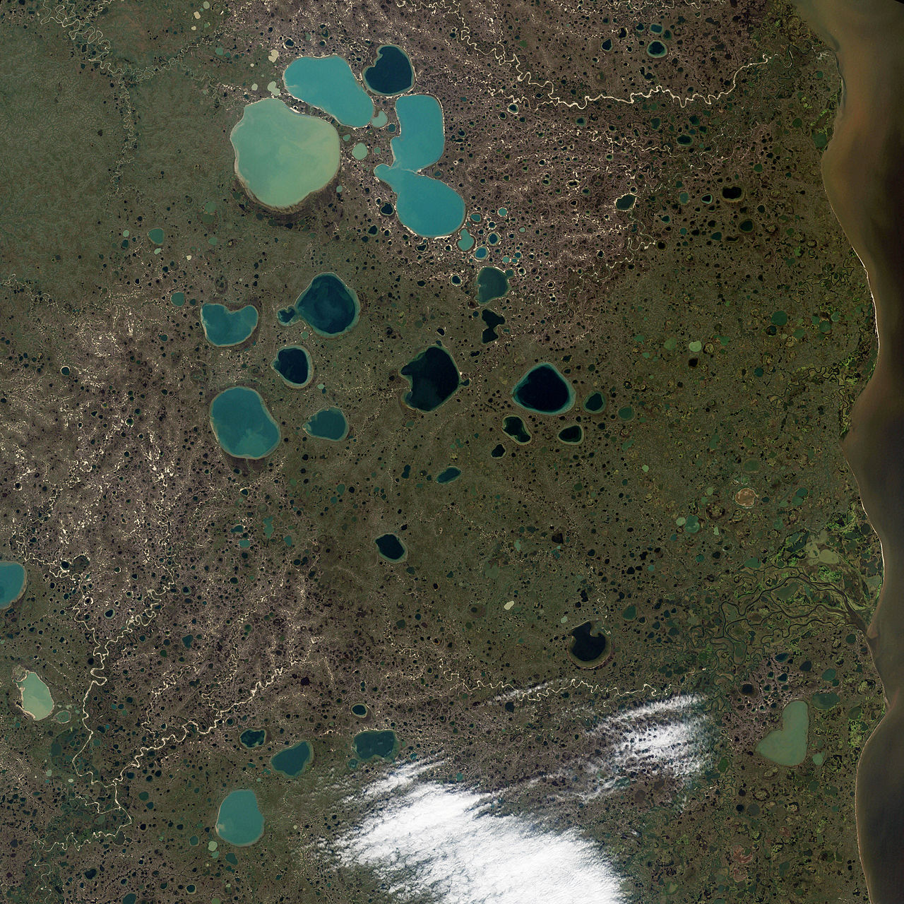
In landscapes that were once buried under continental ice sheets — Minnesota, Wisconsin, the Canadian prairies, northern Europe — you can often see them: small, round lakes scattered across the countryside, sometimes hundreds of them within a few hundred square kilometres. They are typically a few hundred metres across, fairly deep relative to their width, often with steep banks that descend abruptly into the water. The Minnesota state motto is "Land of 10,000 Lakes" — and most of those lakes are kettle lakes, formed in a curious way: from the slow melting of blocks of glacial ice that were buried in sediment by the retreating ice sheet. Kettle lakes are direct windows into how the great ice sheets disappeared at the end of the last ice age. They are scattered like coins across the landscape, each one marking the location of a vanished block of buried ice. Understanding kettle lakes is understanding one of the more subtle but consequential ways that the Pleistocene ice ages shaped the modern landscape.
The Name
"Kettle" comes from the resemblance of these features to cooking kettles — round, deep depressions in the ground. The term has been used for these features in English-language geology since at least the 19th century. The German equivalent is "Kessel" (literally meaning kettle), used in German-speaking glacial geology. Other languages have their own terms — "kraterssjö" in Swedish, "supraglacial kettle" or "kettle hole" in technical English. The German town of Kesselsdorf and the various other places named "Kessel" in glaciated regions of Europe often refer to local kettle features.
How They Form
The formation of a kettle lake begins when a block of ice breaks off the main body of a retreating glacier and is buried by sediment. The sediment can come from various sources — glacial till deposited by the surrounding melting ice, outwash sand and gravel deposited by meltwater rivers, or a combination. The ice block, once buried, is insulated from the atmosphere by the overlying sediment and melts slowly — over decades to centuries depending on the size of the block and the local climate. As the ice melts, the sediment above it gradually slumps down into the void left by the melted ice, producing a depression. The depression typically takes on a roughly circular shape, with steep walls and a relatively flat floor. When the surrounding water table is high enough, the depression fills with water from groundwater seepage or surface runoff, producing a kettle lake.
The Time Scale
Kettle lakes formed at the end of the last ice age — primarily between about 18,000 and 10,000 years ago in the regions that were under the Laurentide Ice Sheet (North America) and the Scandinavian Ice Sheet (northern Europe). The ice blocks that produced the kettles became buried in sediment fairly quickly as the parent ice sheets retreated, but the actual melting of the buried ice took thousands of years longer. Some kettle lakes are believed to have formed as recently as 8,000-10,000 years ago, with the buried ice blocks finally disappearing well after the surrounding ice sheets had already vanished. The kettle lakes we see today are essentially the same shape and depth they have been for the past 8,000-10,000 years, though some have been modified by subsequent sedimentation, erosion, and human activity.
Size and Shape
Kettle lakes vary enormously in size, depending on the size of the original ice block. The smallest are essentially pond-sized — 50-100 metres across, a few metres deep. The largest can be much larger — Walden Pond in Massachusetts is a famous kettle lake, about 25 hectares in area and 31 metres deep. Lake Wabamun in Alberta is several kilometres across. Most kettle lakes are roughly circular or oval in plan view, with relatively steep banks (reflecting the original sediment-supported depression). The depth-to-width ratio is typically higher than for most other lake types — kettles are characteristically "deep for their size," reflecting the underlying geometry of the buried ice block they formed from.
The Geography of Kettles
Kettle lakes are concentrated in the regions that were under the great ice sheets and that experienced rapid deglaciation. The "Coteau des Prairies" region of South Dakota has thousands of kettle lakes — many of them now dry "prairie potholes." Minnesota and Wisconsin together have over 20,000 kettle lakes, with the highest densities in central and northern parts of both states. The North Dakota and Manitoba prairies have similar concentrations. In Europe, kettle lakes are common in northern Germany, Poland, the Baltic states, Russia, and Scandinavia. Ireland's "Esker Riada" region has kettles among its various glacial landforms. The geographic distribution of kettles essentially traces the boundaries of the great ice sheets and the routes their retreating margins took.
The Prairie Pothole Region
The "Prairie Pothole" region of central North America — covering parts of Manitoba, Saskatchewan, the Dakotas, Minnesota, and Iowa — is one of the most kettle-rich landscapes on Earth. The region contains an estimated 10 million kettle depressions, ranging from small wet meadows to small lakes. Many are too shallow to be permanent lakes but hold water seasonally. The Prairie Pothole region is one of the most important wetland complexes in North America, supporting an extraordinary diversity of waterfowl and other wildlife. Approximately 50 percent of North American ducks breed in the Prairie Pothole region. The kettles are critical habitat, and their continued health is a major focus of conservation efforts in the US, Canada, and the broader continent.
Walden Pond and Other Famous Kettles
Walden Pond, made famous by Henry David Thoreau's 1854 book "Walden," is one of the more culturally prominent kettle lakes. Thoreau lived in a small cabin near the pond from 1845-1847 and wrote his classic work on simple living and self-reliance based on his observations of the pond, its ecosystem, and its surrounding forests. Walden Pond is in many ways a typical kettle lake — roughly circular, deep relative to its size, fed by groundwater rather than surface streams. Other famous kettle lakes include Lake of the Isles in Minneapolis (a small kettle lake transformed into an urban park), Lake Wabamun in Alberta, and many of the lakes of the Adirondack Park in New York. Many of the smaller lakes prized as fishing destinations and summer-cottage locations throughout the upper Midwest and northern New England are kettle lakes.
Ecology of Kettle Lakes
Kettle lakes have distinctive ecological characteristics. They are typically isolated from major drainage systems, fed primarily by groundwater seepage rather than by surface inflow. This isolation means kettle lakes often have unique fish communities — sometimes including endemic populations of fish that have evolved in isolation over thousands of years. The water quality of kettle lakes is often very good, with clear water and limited eutrophication risks (no major nutrient inputs from surrounding land use). The steep banks and limited shallow-water habitat constrains the vegetation patterns — kettle lakes typically have relatively narrow littoral zones with limited emergent vegetation. The deep central zones support cold-water fish populations and characteristic cold-water plankton communities. Many kettle lakes have become important recreational and conservation resources.
Connections to Other Glacial Landforms
Kettle lakes occur in landscapes that have other glacial landforms. They are often associated with eskers (the ridges that mark the paths of subglacial rivers), kames (mounds of sand and gravel deposited at the margin of glaciers), drumlins (streamlined hills of glacial till), and outwash plains (broader sand-and-gravel deposits). The combination of these landforms produces the characteristic "knob-and-kettle" terrain of glaciated regions — irregular topography with mounds and depressions, lakes and ridges, deep and shallow areas all juxtaposed within short distances. Reading such a landscape requires recognising the various landforms and understanding how they relate to one another — which is in turn understanding how the parent glaciers behaved as they advanced and retreated.
Kettle Lakes Under Climate Change
Climate change is affecting kettle lakes in several ways. Some kettle lakes are drying as evaporation rates increase and precipitation patterns shift. The Prairie Pothole region has seen substantial declines in spring water levels in recent decades, with implications for waterfowl breeding. Warmer winters are reducing ice cover duration and affecting the seasonal cycling of nutrients and oxygen in kettle lakes. Some kettle lakes are becoming more eutrophic as land-use changes around them increase nutrient inputs. The continued health of kettle lake ecosystems depends on a combination of climate adaptation, land-use management, and broader conservation efforts. As small, isolated features sensitive to local conditions, kettle lakes are among the more vulnerable freshwater habitats in many landscapes.
Echoes of the Ice Age
Kettle lakes are direct, visible reminders that the landscape we see today was shaped by ice ages that ended only a few thousand years ago. The lakes themselves are essentially the last remnants of the great Pleistocene ice sheets — the very last blocks of buried glacial ice took thousands of years to finish melting after their parent ice sheets had retreated. Standing beside a kettle lake, you are looking at the precise location where, 10,000 to 18,000 years ago, a block of ancient glacier ice was buried in sediment. The kettle lake exists today only because of that vanished ice. Each kettle lake in the Minnesota landscape, each "pond" in New England, each pothole in the Canadian prairies is a tiny monument to the great ice ages — features that connect the present landscape directly to the deep ice age past.