
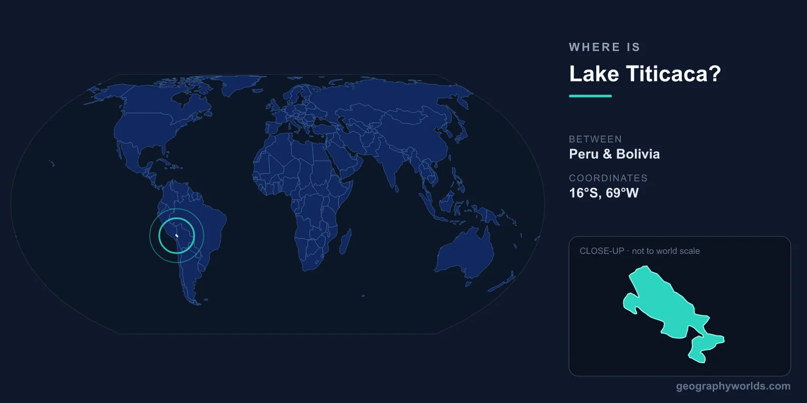
Lake Titicaca is located on the Altiplano of the Andes Mountains, centered at approximately 15°50'S latitude and 69°20'W longitude. It straddles the border between Peru and Bolivia at an elevation of 3,812 meters (12,507 feet) above sea level, making it the world's highest navigable lake for large vessels.
Introduction
Covering approximately 8,372 square kilometers, Lake Titicaca is the largest lake in South America by surface area and the largest lake in the world above 2,000 meters elevation. It has been sacred to Andean civilizations for millennia and is considered the birthplace of the Inca in their creation mythology.

Exact Location & Coordinates
- Center Coordinates: 15°50'S, 69°20'W
- Region: Altiplano, Andes Mountains
- Elevation: 3,812 m above sea level
- Border: Peru (western 56%) and Bolivia (eastern 44%)
On a world map, Lake Titicaca is found in western South America, in the broad highland plateau between the Western and Eastern Cordillera of the Andes. Find Peru and Bolivia on a map, then look at their shared border — Lake Titicaca sits right on it. The city of Puno, Peru, is on the western shore, while Copacabana, Bolivia, is on the southeastern shore.
The lake sits on the Altiplano, a vast plateau averaging 3,750 meters that stretches between Bolivia and Peru. This is the second-highest plateau in the world after the Tibetan Plateau. The Altiplano's flat, treeless landscape and bright blue lake are unmistakable from aerial photographs.
Surrounding Countries & Borders
- Peru: Western and northern shore (56% of lake)
- Bolivia: Eastern and southern shore (44% of lake)
- Key Cities: Puno (Peru), Copacabana (Bolivia)
Peru's major lakeside city is Puno (population ~150,000), the "folklore capital of Peru," located on the western shore. From Puno, boats visit the famous Uros floating islands, constructed from totora reeds by the indigenous Uros people. Bolivia's main lakeside town is Copacabana, a pilgrimage site with a famous basilica.
The Isla del Sol (Island of the Sun) in the Bolivian portion of the lake is considered the birthplace of the Inca sun god Inti and the first Inca, Manco Capac. This island, along with the nearby Isla de la Luna, contains important pre-Columbian ruins and is one of Bolivia's most visited tourist destinations.
Geographic Context
- Part Of: Altiplano plateau between Andean cordilleras
- Outlet: Desaguadero River (flows to Lake Poopo, Bolivia)
- Inflow: Over 25 rivers feed into the lake
Lake Titicaca has over 25 inflowing rivers but only one outlet, the Desaguadero River, which flows southward into Bolivia's Lake Poopo (now largely dry). Less than 5 percent of the lake's water loss occurs through the Desaguadero; the rest evaporates in the thin, dry Altiplano air.
The lake moderates the harsh Altiplano climate, keeping surrounding areas warmer in winter and cooler in summer than they would otherwise be at this altitude. This microclimate effect allowed agriculture to develop around the lake, supporting dense populations of the Tiwanaku and later Inca civilizations for thousands of years.
Physical Characteristics
- Area: 8,372 km²
- Maximum Depth: 281 m
- Average Depth: 107 m
- Length: 190 km, Width ~80 km
Lake Titicaca is divided into two sub-basins connected by the narrow Strait of Tiquina. The larger northern basin (Lago Grande) has a maximum depth of 281 meters, while the smaller southern basin (Lago Menor or Huinamarca) is much shallower at about 40 meters maximum depth.
The lake's water is slightly brackish due to the accumulation of dissolved minerals with limited outflow. Despite its high altitude, the lake rarely freezes due to its large thermal mass, though thin ice sometimes forms on the shallow southern basin during cold winter nights. The deep blue color of the lake against the brown Altiplano landscape is striking.
Why It Matters
- Sacred Site: Birthplace of the Inca civilization in mythology
- Biodiversity: Home to endemic species found nowhere else
- Cultural Heritage: Uros floating islands, Tiwanaku ruins nearby
Lake Titicaca is home to several endemic species, including the giant Titicaca water frog (Telmatobius culeus), which can grow to over 50 centimeters and breathes primarily through its extremely wrinkled skin. The lake also supports endemic fish species (killifish) and the flightless Titicaca grebe, a critically endangered bird.
The lake and its surroundings are rich in archaeological heritage. The ancient city of Tiwanaku, a major pre-Inca civilization center near the lake's southeastern shore, is a UNESCO World Heritage Site. The Uros people's floating islands on the Peruvian side are a living cultural tradition, constructed from layers of totora reeds that must be constantly replenished.
Key Facts
- Lake Titicaca is centered at approximately 15°50'S, 69°20'W on the Peru-Bolivia border.
- At 3,812 m elevation, it is the world's highest navigable lake for large vessels.
- It covers 8,372 km² — the largest lake in South America by surface area.
- Peru controls 56% and Bolivia controls 44% of the lake.
- It is considered the birthplace of the Inca civilization in mythology.
Fun Facts
- The Uros people of Lake Titicaca live on floating islands made entirely of totora reeds.
- The giant Titicaca water frog breathes through its wrinkled skin and can be over 50 cm long.
- Lake Titicaca's name may derive from Aymara words meaning "rock of the puma" for the lake's shape.
- Only 5% of the lake's water loss is through its single outlet river; 95% evaporates.
Final Thoughts
Lake Titicaca sits on the Altiplano at approximately 15°50'S, 69°20'W, straddling the Peru-Bolivia border at 3,812 meters above sea level. As the world's highest navigable lake and South America's largest, it combines extraordinary geography with deep cultural significance. From the floating reed islands of the Uros to the creation myths of the Inca, Titicaca is one of the most remarkable bodies of water on the world map.
Test Your Knowledge!
Think you know where things are on the map? Test your skills!
Play Geography Games →