
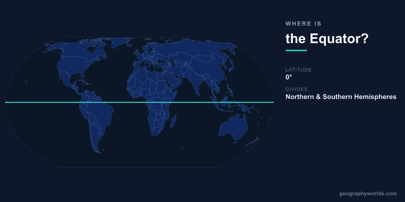
The equator is the imaginary line at 0° latitude that circles the Earth horizontally at its widest point, equidistant from the North and South Poles. Its circumference is approximately 40,075 kilometers (24,901 miles). The equator crosses 13 countries: Ecuador, Colombia, Brazil, Sao Tome and Principe, Gabon, Republic of the Congo, Democratic Republic of the Congo, Uganda, Kenya, Somalia, Maldives, Indonesia, and Kiribati.
Introduction
The equator is the most fundamental geographic reference line on Earth. It divides the globe into the Northern and Southern Hemispheres and receives the most direct and consistent solar radiation, creating the warm tropical climate that defines equatorial regions. Day and night are nearly equal in length throughout the year at the equator — roughly 12 hours each.
Exact Location & Coordinates
- Latitude: 0° (by definition)
- Circumference: 40,075 km (24,901 miles)
- Countries Crossed: 13
- Oceans Crossed: Atlantic, Indian, Pacific
The equator crosses land in South America (Ecuador, Colombia, Brazil), Africa (Sao Tome and Principe, Gabon, Republic of Congo, DRC, Uganda, Kenya, Somalia), and Southeast Asia/Oceania (Maldives, Indonesia, Kiribati). The majority of the equator crosses ocean, particularly the vast Pacific.
Ecuador literally means "equator" in Spanish — the country is named after the line that crosses its northern territory. The "Middle of the World" monument (Mitad del Mundo) near Quito marks the equator's approximate location, though GPS measurements have shown the actual equator is about 240 meters north of the monument.
Surrounding Countries & Borders
- South America: Ecuador, Colombia, Brazil
- Africa: Gabon, Republic of Congo, DRC, Uganda, Kenya, Somalia, Sao Tome and Principe
- Asia/Oceania: Maldives, Indonesia, Kiribati
In Africa, the equator passes through some of the continent's most ecologically important regions: the Congo Basin rainforest, the East African highlands, and Lake Victoria. Kenya's Mount Kenya (5,199 m), located virtually on the equator, has glaciers despite its tropical location — demonstrating how altitude can override latitude in determining climate.
In Southeast Asia, the equator crosses Indonesia's islands of Sumatra, Borneo (Kalimantan), Sulawesi, and Halmahera. Indonesia straddles the equator for roughly 5,000 km east to west, giving it one of the longest equatorial extents of any country. The warm equatorial waters of Indonesia's archipelago are among the most biodiverse marine environments on Earth.
Geographic Context
- Tropics: Equator is the center of the tropical zone (23.5°N to 23.5°S)
- ITCZ: Intertropical Convergence Zone follows the equator, bringing rainfall
- Coriolis Effect: Zero at the equator; hurricanes cannot form directly on it
- Earth's Bulge: Equator is ~43 km farther from Earth's center than the poles
The equator marks the center of the tropical zone, bounded by the Tropic of Cancer (23.5°N) and the Tropic of Capricorn (23.5°S). Within this zone, the Sun can be directly overhead at least once per year. At the equator itself, the Sun is directly overhead twice per year — at the March and September equinoxes.
The Intertropical Convergence Zone (ITCZ), a belt of rising warm air and heavy rainfall, roughly follows the equator but shifts north and south with the seasons. This is why equatorial regions receive heavy rainfall year-round, supporting the tropical rainforests of the Amazon, Congo, and Southeast Asia.
Physical Characteristics
- Solar Radiation: Most direct and intense year-round
- Day Length: Nearly constant at ~12 hours throughout the year
- Temperature: 25-30°C year-round at sea level
- Rainfall: Generally 2,000-3,000+ mm per year
At the equator, the Sun's rays strike the surface almost directly (near vertical) year-round, delivering maximum solar energy per unit area. This intense heating drives the atmospheric circulation that distributes heat to higher latitudes. The equator receives roughly 2.5 times more solar energy per square meter than the poles.
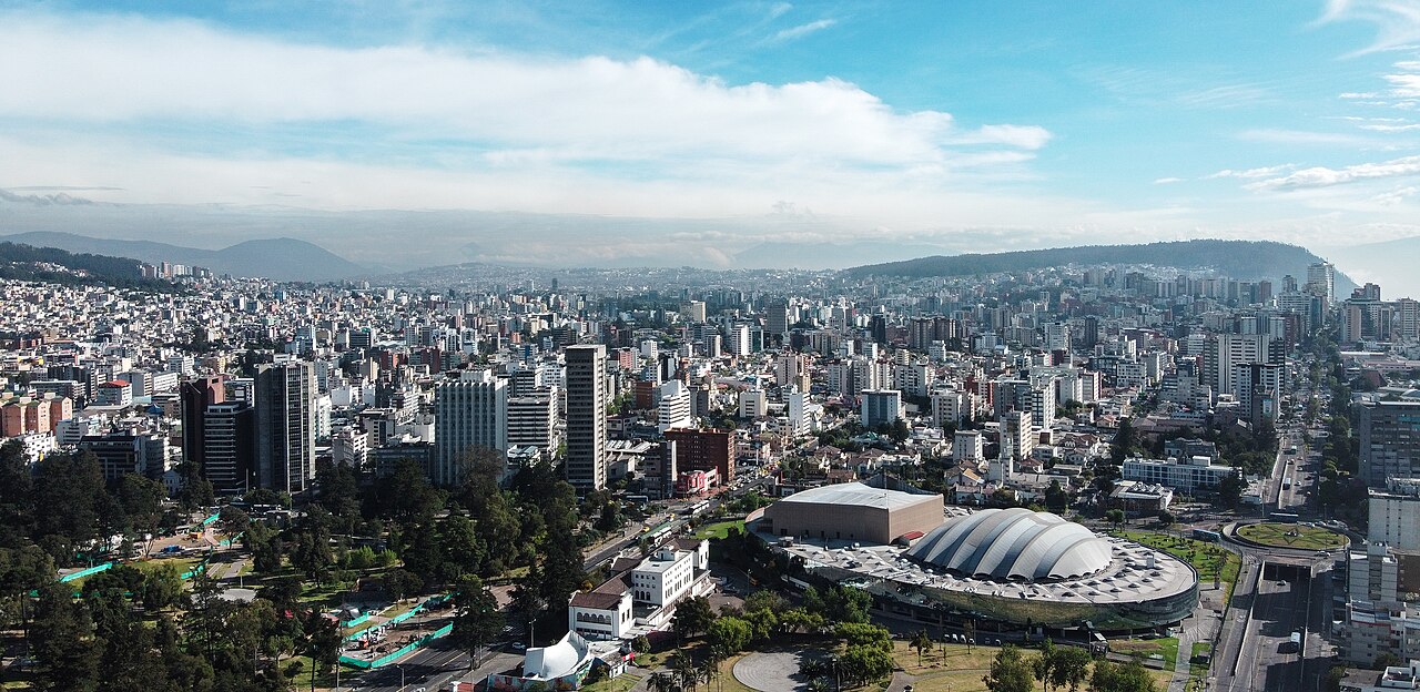
Equatorial climate is characterized by warm temperatures (25-30°C at sea level) with little seasonal variation, high humidity, and heavy rainfall. However, altitude can dramatically modify this pattern. Quito, Ecuador, sits on the equator at 2,850 meters elevation and has a mild, spring-like climate averaging 15°C — demonstrating that altitude trumps latitude for temperature.
Why It Matters
- Climate Driver: Equatorial heating drives global atmospheric and oceanic circulation
- Biodiversity: Equatorial regions contain the highest biodiversity on Earth
- Rocket Launches: Equatorial locations provide the most efficient orbital launch sites
- Navigation: Fundamental reference for all geographic coordinate systems
The equator is the fundamental reference line for Earth's geography. All latitude is measured as degrees north or south of the equator, and the equator's position determines the boundaries of the tropics, the paths of hurricanes, and the distribution of climate zones. Without the concept of the equator, geographic coordinates and navigation would not function.
Equatorial locations are ideal for launching rockets into orbit because Earth's rotational speed is highest at the equator (1,674 km/h). This gives rockets a "free" speed boost when launching eastward. This is why the European Space Agency launches from French Guiana (5°N) and why several nations have proposed equatorial launch sites.
Key Facts
- The equator is at 0° latitude, circling Earth for 40,075 km.
- It crosses 13 countries across South America, Africa, and Southeast Asia/Oceania.
- Equatorial regions receive the most intense solar radiation year-round.
- Day and night are nearly equal (12 hours each) at the equator throughout the year.
- The equator is ~43 km farther from Earth's center than the poles due to the equatorial bulge.
Fun Facts
- Ecuador is literally named after the equator (ecuadór in Spanish means "equator").
- The "Middle of the World" monument in Ecuador is actually 240 meters south of the true equator.
- Hurricanes cannot form directly on the equator because the Coriolis effect is zero there.
- Mount Kenya (5,199 m) sits virtually on the equator but has glaciers.
Final Thoughts
The equator circles the Earth at 0° latitude for 40,075 kilometers, crossing 13 countries and three oceans. As the line of maximum solar energy input, it drives the atmospheric and oceanic circulation patterns that shape global climate. The equator is more than a line on a map — it is the fundamental geographic reference from which all other positions on Earth are measured.
Test Your Knowledge!
Think you know where things are on the map? Test your skills!
Play Geography Games →