
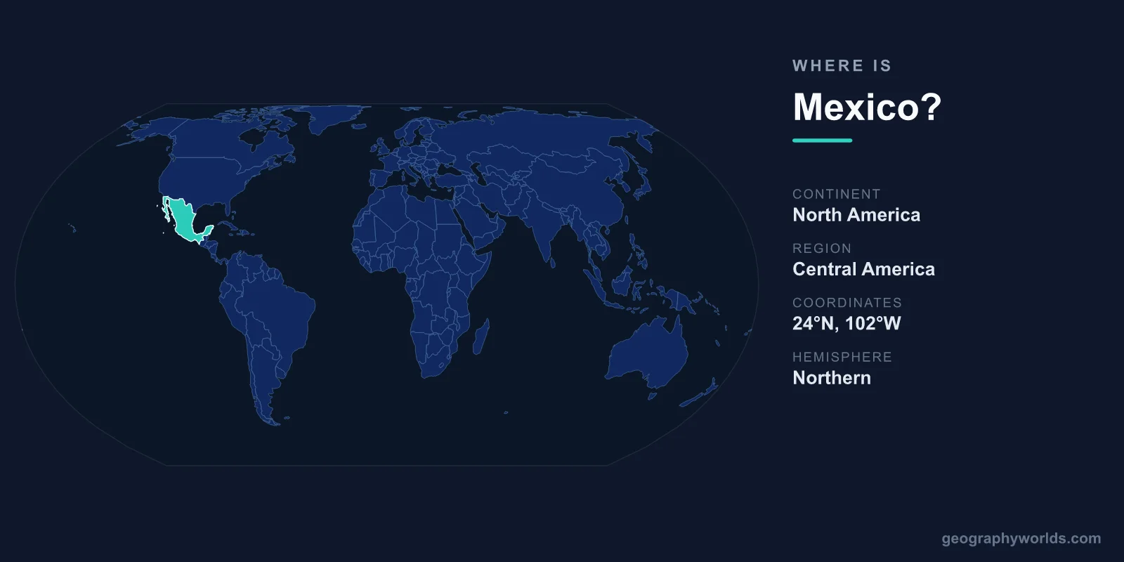
Mexico is located in the southern part of North America, sharing its northern border with the United States and its southeastern borders with Guatemala and Belize, while the Pacific Ocean lies to the west and the Gulf of Mexico and Caribbean Sea to the east. Its capital, Mexico City, sits roughly in the center of the country, and Mexico spans an area of about 1,964,375 km², making it the third-largest nation in Latin America.
Where Mexico Sits on the Globe
Mexico occupies a unique position as the geographic and cultural bridge between North and Central America. The country lies entirely within the Northern and Western Hemispheres, between roughly 14°N and 33°N latitude and 86°W and 119°W longitude. Geographers classify Mexico as part of North America, the continent it shares with the United States and Canada, though its southern reaches blend culturally and economically into the Central American region.
This in-between location matters. To the north, Mexico shares one of the busiest land borders on Earth with the United States, stretching about 3,145 kilometers from the Pacific coast of California and Baja California across to the Gulf at Brownsville and Matamoros. To the south and east, narrower borders connect Mexico to Guatemala and Belize, opening the way toward the rest of Central America.
Oceans and Coastlines
Few countries are framed by so much water. Mexico has coastline on two major bodies: the Pacific Ocean to the west and southwest, and the Gulf of Mexico and Caribbean Sea to the east. Altogether, the country boasts more than 9,000 kilometers of coastline, which helps explain its enormous range of beach destinations, from the Pacific resorts of Acapulco and Puerto Vallarta to the Caribbean shores of Cancún and the Riviera Maya.
The Gulf of California, also called the Sea of Cortez, separates the long, slender Baja California Peninsula from the Mexican mainland. On the opposite side of the country, the Yucatán Peninsula juts northeast into the Gulf of Mexico and the Caribbean, giving Mexico a distinctive hooked shape on the map.
Countries That Border Mexico
Mexico shares land borders with three countries. Each connection has shaped the nation's trade, migration, and culture over the centuries.
- United States — the long northern border touching the U.S. states of California, Arizona, New Mexico, and Texas.
- Guatemala — a southeastern border running through tropical highlands and rainforest.
- Belize — a short border in the far southeast, near the Yucatán Peninsula.
Because it touches both the United States and Central America, Mexico functions as a vital corridor for goods and people moving across the hemisphere, anchoring agreements like the United States–Mexico–Canada trade pact.
The Landscape Inside Mexico's Borders
Within those borders, Mexico is strikingly varied. Two great mountain ranges, the Sierra Madre Occidental in the west and the Sierra Madre Oriental in the east, run roughly parallel and frame the high Central Plateau where most Mexicans live. Mexico City itself sits in a mountain-ringed valley at about 2,240 meters above sea level, making it one of the highest major capitals in the world.
The country straddles the Tropic of Cancer, so the north tends toward dry desert and scrubland while the south is humid and tropical. This spread of latitude and altitude gives Mexico an extraordinary range of climates and ecosystems, from the deserts of Sonora to the cloud forests of Chiapas. Towering volcanoes such as Pico de Orizaba, the highest peak at 5,636 meters, and the iconic Popocatépetl rise above the central highlands. To learn more about its regions, states, and travel highlights, see our mexico country guide.
A Country of Many Regions
Mexico is a federal republic made up of 31 states plus the capital, Mexico City. Spanish is the dominant language, spoken by the vast majority of its roughly 130 million people, though dozens of Indigenous languages such as Nahuatl and Maya remain alive across the country. This blend of geography and heritage is part of why landmarks like the ancient Maya city of Chichén Itzá on the Yucatán Peninsula draw visitors from around the globe. The national currency is the Mexican peso (MXN).
Frequently Asked Questions
What continent is Mexico in?
Mexico is part of North America, the same continent as the United States and Canada. Although it borders Central America and shares many cultural ties with that region, geographers consistently place Mexico within North America.
Is Mexico in Central America?
No. Mexico is in North America, not Central America. The confusion is common because Mexico borders Guatemala and Belize, which are Central American countries, and because Mexico shares cultural and linguistic links with the region.
What countries border Mexico?
Mexico borders three countries: the United States to the north, and Guatemala and Belize to the southeast. It is also surrounded by the Pacific Ocean, the Gulf of Mexico, and the Caribbean Sea.
What is the capital of Mexico?
The capital is Mexico City, located in a high valley near the center of the country. It is one of the largest metropolitan areas in the world and serves as Mexico's political, economic, and cultural heart.
