
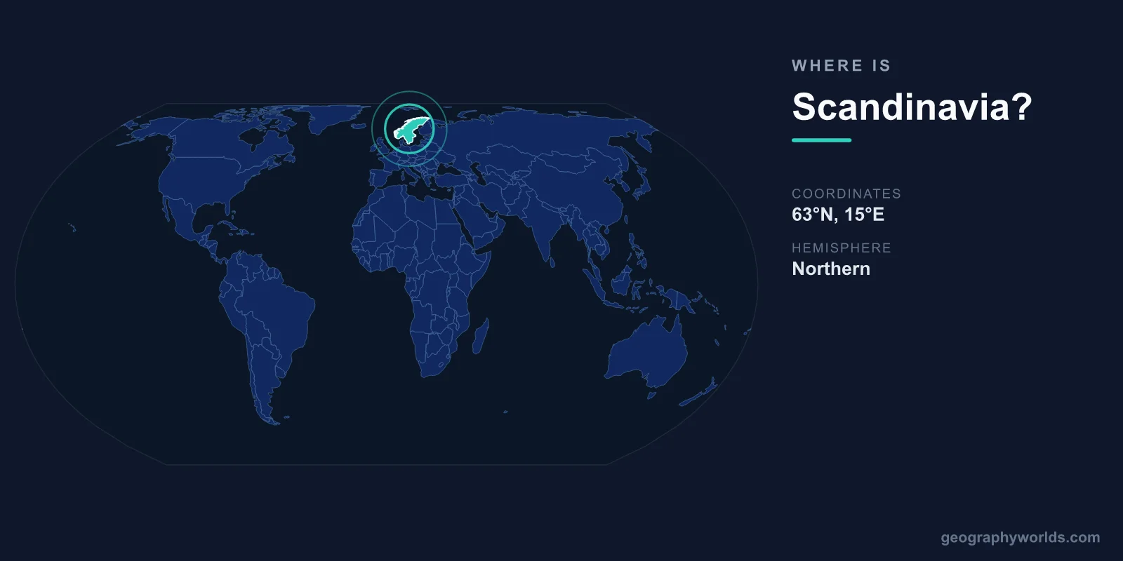
Scandinavia is located in northern Europe, centered at approximately 62°N latitude and 15°E longitude. In its strictest definition, Scandinavia comprises three countries: Norway, Sweden, and Denmark. The broader term "Nordic countries" adds Finland, Iceland, and the autonomous territories of the Faroe Islands, Greenland, and Aland Islands.
Introduction
The core of Scandinavia is the Scandinavian Peninsula, shared by Norway and Sweden, which is the largest peninsula in Europe at roughly 750,000 square kilometers. Denmark, located on the Jutland Peninsula and numerous islands to the south, is included due to deep historical, cultural, and linguistic ties.

Exact Location & Coordinates
- Center Coordinates: ~62°N, 15°E
- Region: Northern Europe
- Extent: From Denmark (~55°N) to Norway's North Cape (~71°N)
- Peninsula Area: ~750,000 km²
On a world map, Scandinavia is the region in the upper-left portion of Europe, extending north toward the Arctic. The Scandinavian Peninsula is the large landmass projecting northward from the European mainland, with Norway on the west coast and Sweden on the east. Denmark is the small country to the south, bridging Scandinavia with continental Europe.
To find Scandinavia, locate the United Kingdom on a map and look northeast across the North Sea. Norway's distinctive fjord-indented coastline on the peninsula's western side is one of the most recognizable features on any European map.
Surrounding Countries & Borders
- Norway: Western Scandinavian Peninsula
- Sweden: Eastern Scandinavian Peninsula
- Denmark: Jutland Peninsula and islands to the south
- Finland: Eastern neighbor (Nordic, but not traditionally Scandinavian)
- Iceland: Mid-Atlantic (Nordic, but not traditionally Scandinavian)
The three Scandinavian countries share deep linguistic and cultural connections. Norwegian, Swedish, and Danish are mutually intelligible North Germanic languages. All three nations were united under various dynastic unions throughout history, most notably the Kalmar Union (1397-1523) which united all of Scandinavia under one crown.
Finland, though often grouped with Scandinavia colloquially, is linguistically and ethnically distinct — Finnish is a Finno-Ugric language unrelated to the Scandinavian languages. Iceland, settled by Scandinavian Vikings, shares the cultural heritage but lies far to the west in the North Atlantic.
Geographic Context
- Arctic Circle: Crosses northern Scandinavia (~66.5°N)
- Scandinavian Mountains: Spine of the peninsula, up to 2,469 m
- Gulf Stream: Keeps Norway's coast ice-free year-round
Northern Scandinavia extends well above the Arctic Circle, experiencing the midnight sun in summer and polar night in winter. The Scandinavian Mountains (Scandes) form the border between Norway and Sweden, creating Norway's dramatic fjord coast on the western side and Sweden's gentler terrain to the east.
The North Atlantic Current (Gulf Stream extension) gives Scandinavia's western coast a remarkably mild climate for its latitude. Bergen, Norway, at 60°N, has average winter temperatures similar to New York City at 40°N. Without this warm current, Scandinavia would be significantly colder and less habitable.
Physical Characteristics
- Combined Area: ~880,000 km² (3 countries)
- Population: ~21.5 million (3 countries)
- Highest Point: Galdhopiggen, Norway, 2,469 m
- Coastline: Over 25,000 km (Norway alone, including fjords)
Scandinavia's terrain varies dramatically. Norway's coast features over 1,000 fjords, deep glacially carved inlets that are among the most dramatic landscapes on Earth. Sweden's interior is dominated by forests and lakes — roughly 100,000 lakes dot the landscape. Denmark is flat and low-lying, with its highest natural point at just 171 meters.
The region contains vast wilderness areas, particularly in northern Sweden and Norway. Sweden alone has 29 national parks and the right of public access (allemansratten) allows anyone to hike, camp, and forage on most land. Northern Scandinavia is home to the indigenous Sami people, who have herded reindeer across the Arctic landscape for thousands of years.
Why It Matters
- Quality of Life: Consistently ranked among world's highest
- Viking Heritage: Launched the Viking Age (793-1066 CE)
- Sustainability: Global leaders in renewable energy and environmental policy
Scandinavian countries consistently rank at the top of global indices for quality of life, education, healthcare, gender equality, and happiness. The "Scandinavian model" of social democracy — combining free-market economies with comprehensive welfare states — is widely studied and emulated.
Scandinavia was the origin of the Viking Age (793-1066 CE), when Norse seafarers from Norway, Sweden, and Denmark explored, traded, and settled across Europe, the North Atlantic, and as far as North America and Central Asia. This Viking heritage remains central to Scandinavian cultural identity and has experienced a major revival in popular culture.
Key Facts
- Scandinavia is centered at approximately 62°N, 15°E in northern Europe.
- It traditionally comprises Norway, Sweden, and Denmark.
- The Scandinavian Peninsula is Europe's largest at ~750,000 km².
- The Gulf Stream keeps Norway's coast ice-free despite its Arctic latitude.
- Scandinavian countries consistently rank among the world's highest for quality of life.
Fun Facts
- Norwegian, Swedish, and Danish are so similar that speakers can often understand each other.
- Sweden has roughly 100,000 lakes, more than almost any other country.
- The midnight sun is visible for 76 days at Norway's North Cape in summer.
- Vikings from Scandinavia reached North America roughly 500 years before Columbus.
Final Thoughts
Scandinavia occupies northern Europe at approximately 62°N, 15°E, comprising Norway, Sweden, and Denmark. Home to the largest peninsula in Europe, dramatic fjords, and a Viking heritage that shaped the medieval world, Scandinavia is one of the most distinctive and well-known regions on the world map. Its modern reputation for quality of life and sustainability adds to its geographic and cultural significance.
Test Your Knowledge!
Think you know where things are on the map? Test your skills!
Play Geography Games →