
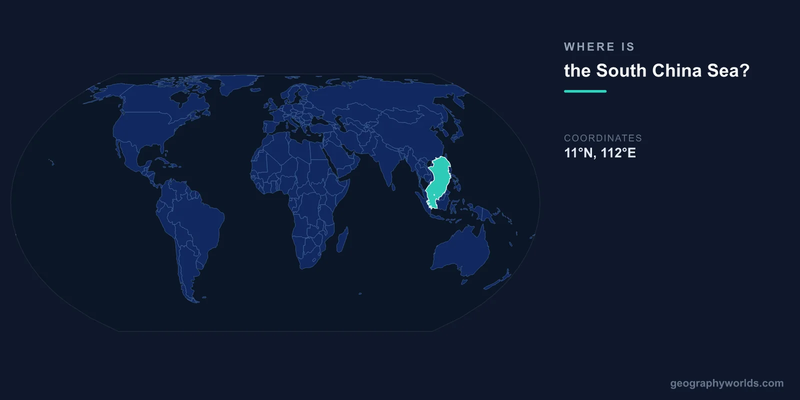
The South China Sea is located in Southeast Asia, centered at approximately 12°N latitude and 113°E longitude. It is bounded by China and Taiwan to the north, the Philippines to the east, Borneo (Malaysia and Brunei) and Indonesia to the south, and Vietnam, Cambodia, and Thailand to the west.
Introduction
Covering approximately 3,500,000 square kilometers, the South China Sea is one of the most contested bodies of water on Earth. It serves as a vital shipping lane connecting the Pacific and Indian Oceans and is the subject of overlapping territorial claims by six nations.

Exact Location & Coordinates
- Center Coordinates: 12°N, 113°E
- Region: Southeast Asia, western Pacific
- Connected To: Pacific Ocean, Indian Ocean via Malacca Strait
On a world map, the South China Sea is the large body of water enclosed by Southeast Asian countries. Find China's southern coast and look south — the sea stretches from Hainan Island and Hong Kong down to Borneo. The Philippines archipelago forms its eastern boundary, and Vietnam's long coastline runs along its western edge.
The sea communicates with the Pacific Ocean through the Luzon Strait between Taiwan and the Philippines, and with the Indian Ocean through the Strait of Malacca between Malaysia and Sumatra. The Taiwan Strait connects it to the East China Sea in the north.
Surrounding Countries & Borders
- China: Northern shore (Hainan, Guangdong)
- Vietnam: Western shore (longest coastline)
- Philippines: Eastern boundary (archipelago)
- Malaysia: Southern shore (Sabah, Sarawak)
- Brunei: Southern shore
- Taiwan: Northeastern boundary
Vietnam has the longest coastline on the South China Sea, stretching over 3,400 kilometers from the Gulf of Tonkin in the north to the Mekong Delta in the south. China's southern province of Hainan, a large island, sits at the sea's northern end, while the Philippines' western islands of Luzon and Palawan face directly onto the sea.
Malaysia and Brunei share the southern coastline along northern Borneo, and Indonesia's Natuna Islands extend into the sea's southern reaches. Cambodia and Thailand border the Gulf of Thailand, a smaller body of water that is technically an arm of the South China Sea.
Geographic Context
- Part Of: Western Pacific Ocean
- Key Features: Spratly Islands, Paracel Islands, Scarborough Shoal
- Shipping: ~33% of global maritime trade passes through
The South China Sea is dotted with hundreds of small islands, reefs, and atolls, most notably the Spratly Islands in the south and the Paracel Islands in the north. These features, many barely above water, are at the center of intense territorial disputes involving China, Vietnam, the Philippines, Malaysia, Brunei, and Taiwan.
An estimated one-third of global maritime shipping passes through the South China Sea, making it one of the busiest waterways in the world. The Strait of Malacca at its southwestern corner is the primary shipping route between the Indian and Pacific Oceans, handling over 80,000 vessels annually.
Physical Characteristics
- Area: 3,500,000 km²
- Maximum Depth: 5,016 m (Manila Trench area)
- Average Depth: 1,212 m
- Major Islands: Hainan, Spratly Islands, Paracel Islands
The South China Sea has a complex bottom topography. A broad continental shelf extends from the Asian mainland and Borneo, while the deep central basin reaches 5,016 meters near the Manila Trench area off the Philippines. Numerous coral reefs, atolls, and submerged banks rise from the sea floor.
The sea's waters are warm and tropical, with surface temperatures ranging from 25°C to 29°C. It is affected by the East Asian monsoon system, with typhoons regularly crossing it from the western Pacific between June and November, sometimes causing devastating damage to coastal communities.
Why It Matters
- Global Trade: ~$3.4 trillion in annual shipping passes through
- Energy: Significant oil and natural gas reserves
- Territorial Disputes: Overlapping claims by 6 nations
The South China Sea is arguably the most geopolitically significant body of water in the 21st century. China's expansive "nine-dash line" claim encompasses roughly 90 percent of the sea, overlapping with the exclusive economic zones of neighboring nations. This dispute involves competing claims to fisheries, energy resources, and strategic waterways.
Beneath the sea floor lie estimated reserves of 11 billion barrels of oil and 190 trillion cubic feet of natural gas. Combined with its fishing resources — which provide food security for hundreds of millions of people in the region — the stakes of the territorial disputes are enormous.
Key Facts
- The South China Sea is centered at approximately 12°N, 113°E in Southeast Asia.
- It covers about 3,500,000 km², bounded by China, Vietnam, the Philippines, Malaysia, Brunei, and Taiwan.
- Roughly one-third of global maritime trade passes through its waters.
- Maximum depth reaches 5,016 m near the Manila Trench.
- The Spratly and Paracel Islands are at the center of major territorial disputes.
Fun Facts
- The South China Sea contains over 250 small islands, atolls, cays, shoals, reefs, and sandbars.
- China has built artificial islands with military installations on several reefs in the Spratly Islands.
- The sea has more than 3,000 species of fish and is one of the most biodiverse marine regions in the world.
- An estimated $3.4 trillion worth of goods passes through the South China Sea annually.
Final Thoughts
The South China Sea is a vast and strategically vital body of water in Southeast Asia, centered at approximately 12°N, 113°E. Bordered by six nations and serving as a corridor for one-third of global shipping, it is one of the most contested and consequential features on the world map. Its combination of trade routes, energy resources, biodiversity, and geopolitical tension makes it a region of immense global significance.
Test Your Knowledge!
Think you know where things are on the map? Test your skills!
Play Geography Games →