
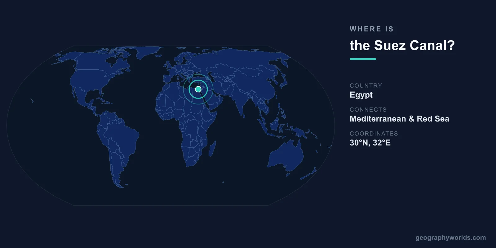
The Suez Canal is located in northeastern Egypt at approximately 30.5°N latitude and 32.3°E longitude, cutting through the Isthmus of Suez — the narrow land bridge connecting Africa and Asia. The canal runs 193.3 kilometers from Port Said on the Mediterranean Sea to Suez on the Gulf of Suez (northern arm of the Red Sea).
Introduction
The Suez Canal is one of the most strategically important waterways in the world, carrying roughly 12 percent of global trade. Without it, ships traveling between Europe and Asia would need to sail around the entire continent of Africa — adding roughly 8,900 kilometers and 10-14 days to the journey. Approximately 50 ships transit the canal daily.
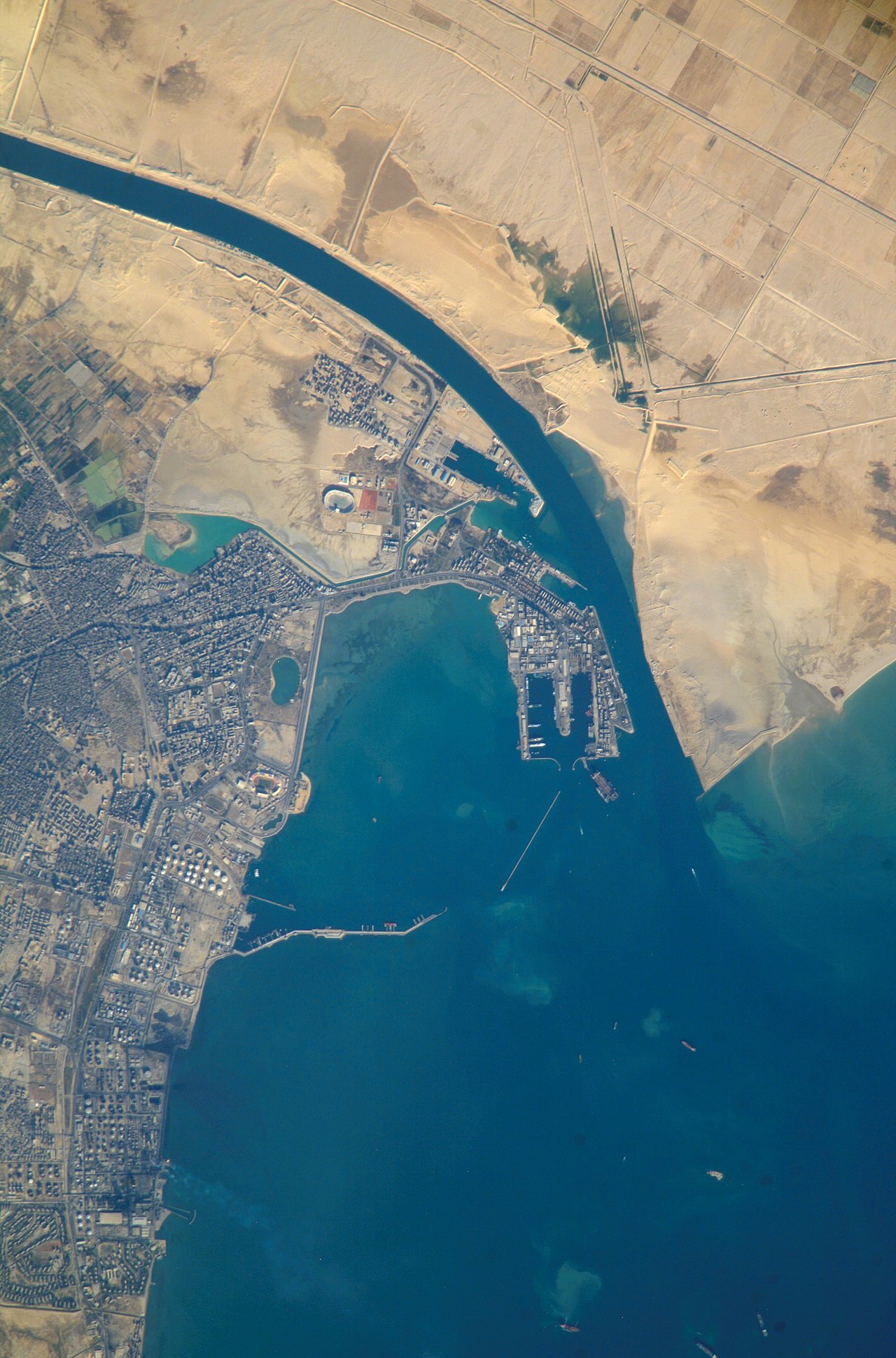
Exact Location & Coordinates
- Port Said (North): 31.27°N, 32.30°E (Mediterranean entrance)
- Suez (South): 29.97°N, 32.55°E (Red Sea entrance)
- Length: 193.3 km
- Country: Egypt
On a world map, the Suez Canal is visible as a thin line cutting through the northeastern corner of Egypt, connecting the Mediterranean Sea to the Red Sea. It separates the main body of Egypt (in Africa) from the Sinai Peninsula (which is geographically in Asia). The canal runs roughly north-south with a slight eastward curve.
To locate the Suez Canal on a map, find Egypt and look at its northeastern border with Israel. The canal connects the Mediterranean coast (Port Said) with the northern tip of the Red Sea (Gulf of Suez), passing through the Bitter Lakes and Lake Timsah along its route.
Surrounding Countries & Borders
- Egypt: Canal runs entirely through Egyptian territory
- Israel: Sinai Peninsula borders to the east
- Sinai Peninsula: East bank of canal; geographically part of Asia
- Africa-Asia Boundary: The canal serves as part of the conventional boundary between Africa and Asia
The Suez Canal is entirely within Egyptian territory, owned and operated by the Suez Canal Authority, an Egyptian government entity. The canal forms part of the conventional boundary between Africa and Asia, with mainland Egypt on the western (African) side and the Sinai Peninsula on the eastern (Asian) side.
The canal's strategic location has made it a flashpoint for conflict. The 1956 Suez Crisis, when Egypt nationalized the canal and Britain, France, and Israel invaded, was a defining moment in post-colonial history. The canal was closed from 1967 to 1975 due to the Arab-Israeli wars, during which ships trapped in the canal became known as the "Yellow Fleet."
Geographic Context
- Isthmus of Suez: Narrow land bridge the canal cuts through
- Sea-Level Canal: No locks required (Mediterranean and Red Sea are at similar levels)
- Bitter Lakes: Natural salt lakes the canal passes through
- New Suez Canal: Parallel channel opened in 2015 to allow two-way traffic
Unlike the Panama Canal, the Suez Canal requires no locks because the Mediterranean Sea and the Red Sea are at approximately the same level. The canal is essentially a sea-level trench cut through flat, sandy desert terrain. This simplicity was key to the canal's original construction in the 1860s and to its subsequent expansions.
The 2015 "New Suez Canal" project added a 35-kilometer parallel channel that allows two-way traffic in part of the canal, reducing transit time from 18 to 11 hours for some ships and increasing daily capacity. The $8.2 billion project was completed in just one year.
Physical Characteristics
- Length: 193.3 km
- Width: 205-225 m (at water surface)
- Depth: 24 m (allows most commercial vessels)
- Transit Time: 12-16 hours
- Daily Traffic: ~50 ships
The Suez Canal has been progressively deepened and widened since its original construction. The current depth of 24 meters accommodates fully loaded supertankers and the largest container ships in the world. A typical transit takes 12-16 hours, with ships traveling in convoys through single-lane sections and passing each other in the wider sections.
The canal handles roughly 12 percent of global trade and 30 percent of global container traffic. In 2022, roughly 23,583 vessels transited the canal, carrying about 1.4 billion tons of cargo. The canal generates over $7 billion annually in toll revenue for Egypt, making it one of the country's most important economic assets.
Why It Matters
- Global Trade: ~12% of world trade and 30% of container shipping passes through
- Revenue: $7+ billion/year in tolls for Egypt
- Strategic: One of the world's most critical maritime chokepoints
- Ever Given: 2021 blockage cost an estimated $9.6 billion/day in trade disruption
The Suez Canal's importance to global trade was dramatically illustrated in March 2021, when the container ship Ever Given (one of the largest in the world at 400 meters long) ran aground and blocked the canal for six days. An estimated 422 vessels were delayed, and the blockage disrupted global supply chains with costs estimated at $9.6 billion per day.
The canal is one of several critical maritime chokepoints — narrow waterways through which a disproportionate share of global trade passes. Others include the Strait of Hormuz, the Strait of Malacca, and the Panama Canal. Disruption of any of these chokepoints can have immediate and severe effects on global trade, energy supplies, and prices.
Key Facts
- The Suez Canal runs 193.3 km through northeastern Egypt, from Port Said (Mediterranean) to Suez (Red Sea).
- It carries ~12% of global trade and ~30% of global container shipping.
- The canal is a sea-level waterway requiring no locks.
- The 2021 Ever Given blockage cost an estimated $9.6 billion per day in trade disruption.
- The canal generates over $7 billion annually in toll revenue for Egypt.
Fun Facts
- The Suez Canal was built in 10 years (1859-1869) by roughly 1.5 million workers, with significant loss of life.
- The canal forms part of the conventional boundary between Africa and Asia.
- During the closure from 1967-1975, 14 ships were trapped in the canal and became known as the "Yellow Fleet" due to sand accumulation.
- The Ever Given, which blocked the canal in 2021, was 400 m long — longer than the Eiffel Tower is tall.
Final Thoughts
The Suez Canal sits at approximately 30.5°N, 32.3°E in northeastern Egypt, a 193-kilometer waterway connecting the Mediterranean and Red Seas. As a corridor for 12 percent of global trade, it is one of the most strategically and economically important waterways on Earth. Its location at the junction of Africa and Asia has made it a focal point of geopolitics for over 150 years.
Test Your Knowledge!
Think you know where things are on the map? Test your skills!
Play Geography Games →