
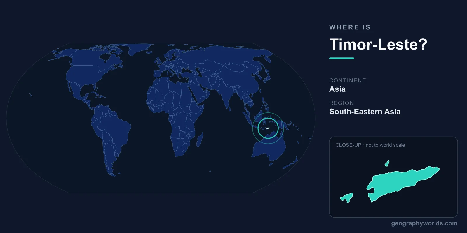
Timor-Leste (East Timor) occupies the eastern half of the island of Timor in Southeast Asia, plus the Oecusse exclave on the island's north coast. Just 640 km north of Australia, it became independent in 2002, making it one of the world's newest and most mountainous nations.
Location
Timor-Leste (officially the Democratic Republic of Timor-Leste, also known as East Timor) is located in Southeast Asia, occupying the eastern half of Timor island in the Lesser Sunda Islands. It also includes the Oecusse exclave on the northwestern coast of Timor (entirely surrounded by Indonesian West Timor) and the small islands of Atauro and Jaco.
The country covers 14,874 km², roughly the size of Northern Ireland or the US state of Connecticut. It lies at approximately 8-9°S latitude, 124-127°E longitude. The Timor Sea separates it from Australia, which is only about 640 km to the south — making Australia Timor-Leste's nearest major neighbor. The capital is Dili, located on the northern coast facing the Banda Sea.
Region & Neighbors
Timor-Leste shares its only land border with Indonesia (West Timor, part of the province of East Nusa Tenggara). The border runs roughly north-south through the center of Timor island, plus a separate border surrounding the Oecusse exclave. This makes Indonesia's East Nusa Tenggara province Timor-Leste's only direct land neighbor.
Across the Timor Sea to the south lies Australia's Northern Territory (~640 km). To the north, across the Banda Sea and Wetar Strait, are the Indonesian islands of Wetar and the broader Maluku archipelago. Timor-Leste gained independence from Indonesia on May 20, 2002, following a UN-supervised referendum in 1999, making it the first new sovereign state of the 21st century and one of the youngest nations in the world.
Key Geographic Facts
Timor-Leste is a remarkably mountainous country for its size. The island of Timor was pushed upward by the collision of the Australian and Eurasian tectonic plates, creating rugged terrain across most of the country. The highest peak is Mount Ramelau (Tatamailau) at 2,963 meters — an impressive altitude for a small tropical island, higher than any mountain in Australia.
The northern coast drops steeply to the sea, with narrow coastal plains giving way quickly to mountains. The southern coast is gentler, with broader plains and swampy lowlands. The country has numerous rivers, but most are short and seasonal, swelling dramatically in the wet season (November-April) and drying to trickles in the dry season.
Timor-Leste's marine environment is exceptional. The Coral Triangle, the global epicenter of marine biodiversity, encompasses Timor-Leste's waters. Atauro Island, just 25 km north of Dili, has been documented as having the highest recorded reef fish biodiversity of any single site in the world — over 640 species counted at one location. The deep Wetar Strait between Timor and Wetar island plunges to over 3,000 meters just offshore.
Travel & Access
Presidente Nicolau Lobato International Airport (DIL) in Dili is the country's main airport. It has connections to Darwin (Australia), Denpasar/Bali (Indonesia), and Singapore. The airport is small and flights are limited, so advance booking is essential. Flight time from Darwin is about 1 hour; from Bali, about 1.5 hours.
There are no rail services in Timor-Leste, and the road network, while improving, remains challenging outside the main highways. The journey from Dili to the Oecusse exclave typically requires crossing through Indonesian territory or taking a ferry. Internal travel between towns is often by minibus (microlet) or shared taxi along winding mountain roads. A ferry connects Dili to Atauro Island.
Key Facts
- Location: Eastern half of Timor island, Southeast Asia, plus Oecusse exclave.
- Area: 14,874 km² (roughly the size of Northern Ireland).
- Capital: Dili, on the northern coast.
- Coordinates: Approximately 8-9°S, 124-127°E.
- Borders: Indonesia (West Timor) to the west; Timor Sea and Australia (~640 km) to the south.
- Highest point: Mount Ramelau (Tatamailau), 2,963 m.
- Independence: May 20, 2002 (first new sovereign state of the 21st century).
- Population: ~1.3 million.
Fun Facts
- Timor-Leste was the first new sovereign state of the 21st century, gaining independence on May 20, 2002.
- Mount Ramelau at 2,963 m is higher than any mountain on the entire continent of Australia.
- Atauro Island, just north of Dili, holds the world record for the most reef fish species counted at a single site — over 640.
- The Oecusse exclave is completely surrounded by Indonesian territory and has no road connection to the rest of Timor-Leste without crossing Indonesia.
- Timor-Leste has two official languages: Portuguese and Tetum (an Austronesian language). Indonesian and English are also widely used.
Test Your Knowledge!
Think you know your world geography? Try our interactive quiz!
Play Country Quiz →