
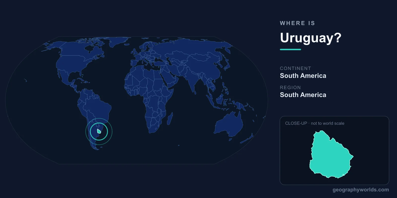
Uruguay is located in southeastern South America, on the Atlantic coast between Brazil to the north and Argentina to the west, with its capital at Montevideo and a total area of about 176,215 km². It is the second-smallest sovereign country in South America, sitting at the mouth of the Río de la Plata and facing the South Atlantic Ocean, firmly within the Southern and Western Hemispheres.
Where Exactly Is Uruguay on the Map?
Uruguay occupies a wedge of land roughly between 30° and 35° south latitude and 53° to 58° west longitude. Because it lies south of the Equator, its seasons are the reverse of those in the Northern Hemisphere — summer falls in December through February, and winter spans June through August. The country shares the wide Río de la Plata estuary with Argentina, whose capital, Buenos Aires, sits almost directly across the water from Montevideo.
To picture its scale, Uruguay covers an area comparable to that of South Korea or the U.S. state of Washington. Its roughly 660 kilometers of coastline along the Atlantic and the Río de la Plata give it an unusually maritime character for a country with a relatively small footprint. You can practice pinpointing it among its neighbors with our interactive map games at /games.
Which Countries Border Uruguay?
Uruguay shares land borders with just two countries, which is part of what makes its location so distinctive in South America:
- Brazil — to the north and northeast, along a frontier marked partly by the Cuareim and Yaguarón rivers and the Laguna Merín.
- Argentina — to the west, separated largely by the Uruguay River, which gives the country its name.
The third boundary is not a country at all but water: the Río de la Plata to the southwest and the open Atlantic Ocean to the southeast. This three-sided arrangement — two neighbors and a long coast — has historically positioned Uruguay as a buffer and a meeting point between the larger powers of Brazil and Argentina, a role that shaped its independence in 1828.
The Landscape and Geography of Uruguay
Uruguay is one of the flattest countries in South America. Its terrain is dominated by gently rolling plains and low hills known as cuchillas, which rarely rise to significant heights — the highest point, Cerro Catedral, reaches only about 514 meters. These grasslands form part of the wider Pampas and are ideal for cattle and sheep ranching, the backbone of the rural economy.
Rivers crisscross the landscape, with the Río Negro flowing through the heart of the country and dividing it into northern and southern halves. The temperate climate is mild and humid, without the extremes of tropical heat or polar cold, and frost is uncommon. Along the southeastern coast, sandy beaches, lagoons, and resort towns such as Punta del Este draw visitors throughout the southern summer. The whitewashed sculptural building known as Casapueblo, near Punta del Este, is among the country's most photographed landmarks.
Montevideo and How People Live There
Montevideo, on the southern coast facing the Río de la Plata, is Uruguay's capital, largest city, and main port. Nearly half of the country's roughly 3.4 million people live in the Montevideo metropolitan area, making Uruguay one of the most urbanized nations in the Americas. The official language is Spanish, and the cultural fabric blends strong Spanish and Italian immigrant heritage with influences from neighboring Brazil and Argentina.
The country operates as a presidential republic and uses the Uruguayan peso (UYU) as its currency. Uruguay is widely recognized for its political stability, high literacy, and progressive social policies. Its central location on the Plata estuary has long made it a hub for regional trade and a gateway between the Atlantic and the river systems that reach deep into the continent. For a fuller overview of its history, economy, and culture, see our uruguay country guide.
Frequently Asked Questions
What continent is Uruguay on?
Uruguay is in South America, in the southeastern part of the continent. It lies entirely within the Southern and Western Hemispheres, south of the Equator and west of the Prime Meridian.
Is Uruguay a small country?
Yes. At about 176,215 km², Uruguay is the second-smallest country in South America after Suriname. Despite its modest size, it has a long Atlantic coastline and a population of roughly 3.4 million people.
What is the capital of Uruguay and where is it?
The capital is Montevideo, located on the southern coast along the Río de la Plata estuary. It sits almost directly across the water from Buenos Aires, Argentina, and serves as the country's largest city and main seaport.
What countries are near Uruguay?
Uruguay borders only Brazil to the north and Argentina to the west by land. Across the Río de la Plata lies Argentina's capital, Buenos Aires, while the Atlantic Ocean forms the country's eastern edge.
