

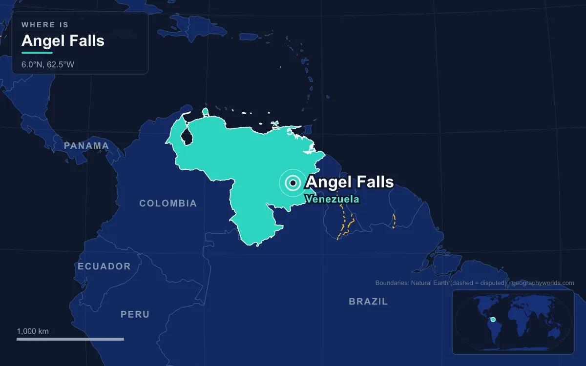
Angel Falls (Salto Ángel in Spanish, Kerepakupai Vená in the Pemón language) is the world’s tallest uninterrupted waterfall, dropping 979 m (3,212 ft) in total, including a single plunge of 807 m (2,648 ft), from the edge of Auyán-tepui, a sandstone table mountain in Bolívar state in south-eastern Venezuela. The tepui’s summit plateau covers about 667 km² and rises to 2,450 m, and the falls lie inside Canaima National Park, a 30,000 km² park created in 1962 and listed by UNESCO as a World Heritage Site in 1994. The water that goes over the edge belongs to the Orinoco basin: it runs along a fork of the Kerep (Körepa) River into the Churún, then the Carrao, the Caroní and finally the Orinoco, which carries it to the Atlantic. The falls are named after the US pilot Jimmie Angel, who flew over them on 16 November 1933.
Auyán-tepui: a Heart-Shaped Plateau Up to 2,450 m
The journey starts on top of the mountain the Pemón call the “House of the Gods”. Auyán-tepui is the most visited and one of the largest tepuis of the Guiana Highlands, though not the highest. Its uneven, heart-shaped summit tilts steeply, climbing from roughly 1,600 m at the north-western rim to 2,450 m at the south-eastern end. A vast valley, the Cañón del Diablo or Devil’s Canyon, cuts into it from the north, carved by the Churún River. The western part of the plateau is partly forested; the eastern part is mostly bare rock with patchy vegetation, and the mountain hides several large cave systems. About 25 species of amphibians and reptiles are known from the summit.
Its shape comes from the rock. Tepuis are blocks of Precambrian quartz arenite sandstone resting on a granite basement; at nearby Mount Roraima the same kind of Proterozoic sandstone has been dated to about 1.7 to 2 billion years ago. They are remnants of a sandstone plateau that once covered the region between the Amazon and the Orinoco, part of the old supercontinent Gondwana; that plateau began to break up about 300 million years ago, and the tepuis stood out as isolated mesas by about 70 million years ago. There are 115 of them in the Gran Sabana of south-eastern Venezuela, covering about 5,000 km² between them and rising up to 1,000 m above the forest at their feet.
Jimmie Angel learned the terrain the hard way. On 9 October 1937 he tried to land his Flamingo monoplane, El Río Caroní, on the summit, but its wheels sank into marshy ground. He, his wife Marie and two companions walked down the gentler back slope, a trek of 11 days. The plane stayed on the tepui for 33 years until a helicopter lifted it off; restored at the Aviation Museum in Maracay, it now stands outside the airport at Ciudad Bolívar.
The Kerep Stream and the Lip of the Falls
Rain falling on the summit gathers into the stream that feeds the falls, a fork of the Río Körepa, or Kerep, which flows into the Churún. Its name has its own history. The Latvian explorer Aleksandrs Laime, known to the Pemón as Alejandro Laime, announced on 18 November 1955, Latvian independence day, that the stream should be called the Gauja after a Latvian river, and the name was registered with Venezuela’s national cartographic institute that year. Auyán-tepui was considered a dangerous place and was not usually visited by the Pemón, and there is no convincing evidence that they had named its streams, though the Pemón name Kerep is now used as well.
The falls themselves carry two names. “Salto del Ángel” first appeared on a Venezuelan government map in December 1939. In 2009 President Hugo Chávez said the country’s best-known landmark should carry an indigenous name, Kerepakupai Merú, “waterfall of the deepest place”, but he later said he would not decree a change, only defend the use of Kerepakupai Vená.
807 Metres Through the Air: Measuring the Drop
From the lip, the water falls free for 807 m before it touches rock again. The 979 m total also includes about 400 m of sloping cascades and rapids over the talus below the cliff, and a final 30 m plunge downstream of them. Those figures come from a survey by an expedition organised and paid for by the American journalist Ruth Robertson, which set out on 23 April 1949, became the first expedition to reach the foot of the falls, and fixed the official height on 13 May 1949. No fresh measurement has been made since, so whether Angel Falls or South Africa’s Tugela Falls is the taller remains open; both were measured from a distance.
Angel Falls is famous for height, not volume. The stream is small, and during the dry season, from about December to March, its volume is lower than in the rest of the year. The face has still drawn climbers: an attempt in the 1968 wet season failed on slippery rock, a 1969 dry-season attempt was stopped by lack of water and an overhang 120 m from the top, and a four-man team led by George Bogel finally reached the top on 13 January 1971 after nine and a half days on the wall. The first jump from the falls was made by Max Botto of Venezuela in November 1983.

Mirador Laime, Isla Ratón and the Churún
At the foot of the cliff the water joins the Churún, the river that carved the Devil’s Canyon, and this is where most people first see the falls up close. Laime was the first recorded European to reach the base, alone, in 1946, and later the first to reach the top of the falls, climbing the gentler back of the tepui in the late 1950s; he also found Jimmie Angel’s plane, 18 years after the crash landing. He cleared the trail that still runs from the Churún to the base of the falls. On the way is the viewpoint from which most photographs are taken, named Mirador Laime in his honour, and the trail now carries visitors from the camp at Isla Ratón to a small clearing below the falls.
Getting there is a river journey. Trips upstream generally run from June to December, when the rivers are deep enough for the boats of the Pemón guides who run them; in the dry months the water is lower.
Canaima and the Carrao Rapids, 46 km Downstream
The Churún flows into the Carrao River, which turns north, widens and passes the small town of Canaima, the gateway to the falls. Canaima Airport sits beside the Carrao Rapids, 46 km downstream of Angel Falls, and reaching it requires a flight: visitors fly from Maiquetía near Caracas, from Puerto Ordaz or from Ciudad Bolívar, and travel on by boat. The tourist camp was founded by the Boulton family near the town, where many Pemón live, and many Pemón people now work in hotels and tourism. The Pemón, a Cariban-speaking people whose main groups in Venezuela are the Arekuna, Kamarakoto and Taurepang, hold that the tepuis are home to the mawari spirits; most are now Catholic, though traditional healers still practise.

Canaima National Park, about the size of Belgium, is Venezuela’s second-largest park after Parima-Tapirapecó and among the largest national parks in the world. It was established on 12 June 1962 and reaches the borders with Brazil and Guyana. About 65% of its area is tepui, including Mount Roraima, the tallest and easiest to climb, and Kukenán. More than 300 plant species are found only in the Gran Sabana, among them carnivorous pitcher plants of the genus Heliamphora, and the forests shelter jaguars, giant otters, giant anteaters and harpy eagles. Rock paintings in the park are estimated at 4,000 to 7,000 years old, long predating the Pemón. In 2017 the International Union for Conservation of Nature listed the park as of significant concern, citing ineffective protection and management.
Into the Caroní and the Guri Reservoir
Beyond Canaima the Carrao narrows, swings west and drains into the Caroní, and the park takes in the whole watershed on the Caroní’s right bank. The Caroní runs 952 km from the Kukenán tepui to the Orinoco, making it the longest river entirely within Venezuela. Humic acids leached from rotting plant matter dye its water dark, making it a blackwater river, and for the size of its 95,000 km² basin it carries an exceptional volume: about 4,850 m³ a second on average, with a recorded extreme of 17,576 m³ a second. That is 15.5% of the Orinoco’s discharge.
A steep, staircase-like course of falls and rapids, combined with that flow, makes the Caroní Venezuela’s great power river. The Guri Dam, officially the Simón Bolívar Hydroelectric Plant, was built in the Necuima Canyon from 1963 to 1969 and enlarged from 1976 to a height of 162 m and a crest about 7.4 km long. Its reservoir covers about 4,250 km², the largest body of fresh water in Venezuela, and the plant, rated at about 10,000 MW, was for a time the largest hydroelectric station in the world. Further downstream stand the Caruachi plant and the Macagua plants near the river’s mouth.
Ciudad Guayana and the Orinoco to the Atlantic
The last stretch of the Caroní runs through Ciudad Guayana, a planned city founded in 1961 by joining the old town of San Félix, east of the river, with the newer Puerto Ordaz to the west. The Llovizna and Cachamay falls lie inside the city limits, and with about a million people in its metropolitan area it is a centre of iron, steel, aluminium and hydroelectric industries. Ocean-going ships and barges reach its port from the Atlantic, and since 2006 the Orinoquia Bridge has crossed the Orinoco nearby.
Here the water from Auyán-tepui joins the Orinoco, one of South America’s longest rivers at 2,140 km and the third largest in the world by discharge, about 39,000 m³ a second at its delta. Christopher Columbus recorded its mouth on 1 August 1498 on his third voyage. From the confluence the river heads east through its delta to the Atlantic, ending a journey that began as rain on a Precambrian sandstone summit.
The same tableland country holds Venezuela’s other great tepui, described in our guide to Mount Roraima, and the river at the end of the journey has its own guide, the Orinoco River; for the falls that rival Angel Falls on other continents, see the tallest waterfall on each continent.