

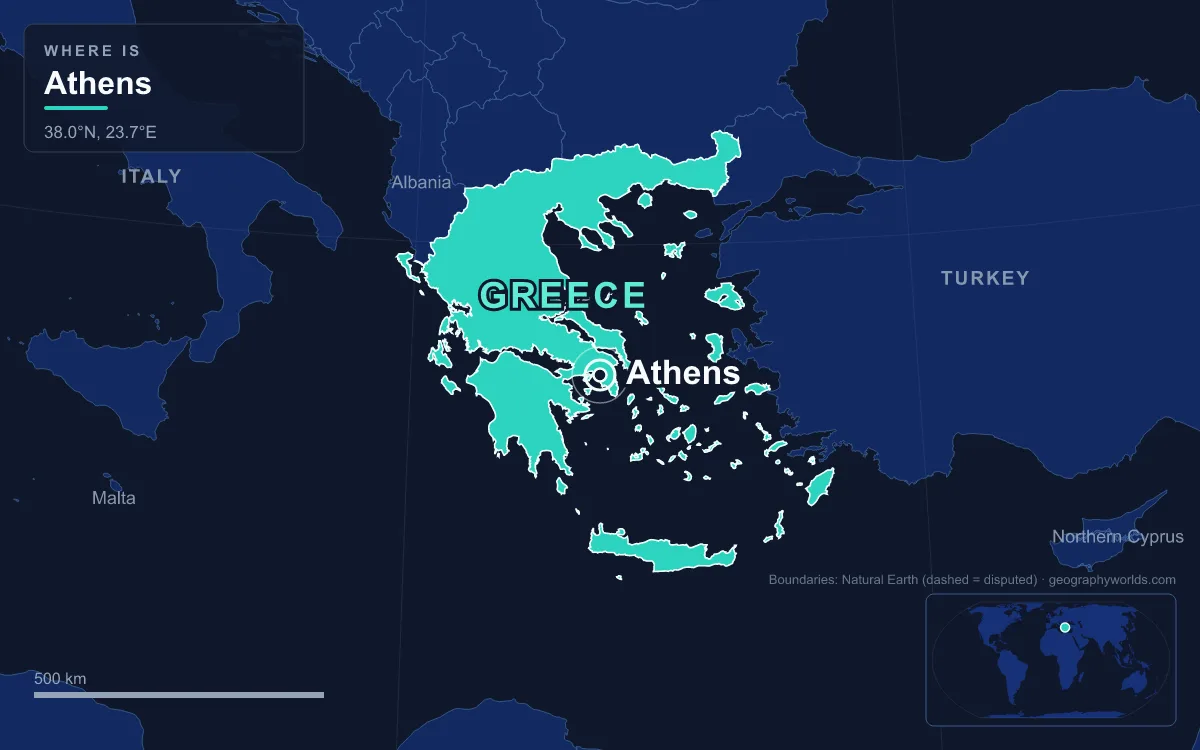
Athens is the capital and largest city of Greece, filling the Attica Basin in the south-east of the Greek mainland, between four mountains and the Saronic Gulf. The Municipality of Athens itself had 643,452 residents in the 2021 census, but the continuous urban area held about 3.06 million and the metropolitan area roughly 3.7 million, over a third of the country. It is the southernmost capital on the European mainland and one of the oldest cities in the world, and nearly everything about it, from its ancient power to its modern smog, grows out of one rock, one basin and one harbour.
The Acropolis Rock: 150 Metres of Limestone Above the Plain
The city began with the Acropolis. It is a flat-topped limestone outcrop that rises to about 150 metres above sea level, with a summit area of about 3 hectares and steep cliffs on most sides. That made it an ideal refuge. People were living on the hill by the 4th millennium BC, and by about 1400 BC it carried a Mycenaean palace. Soon afterwards the builders wrapped the summit in a Cyclopean wall about 760 metres long and up to 10 metres high, which followed the natural edge of the rock. It remained the hill's main defence until the 5th century BC.
The rock also had water, which mattered as much as the cliffs. Unlike Mycenae and Pylos, it is not known whether Athens was destroyed around 1200 BC, and the Athenians always maintained that they were pure Ionians, with no Dorian element among them. From about 900 BC, rich burials in the Kerameikos show that Athens was one of the leading trading centres in the region.

The rock later became a stage. After the Persians sacked Athens in 480 BC, Pericles directed the building programme whose ruins still stand on the summit: the Parthenon, the Propylaea, the Erechtheion and the Temple of Athena Nike. The Parthenon survived as a church and then as a mosque, but in 1687, during a Venetian siege, a shell hit the gunpowder the Ottoman garrison had stored inside it. The explosion left the building largely as it looks today.
Around the Acropolis are other hills that shaped the city. The Areopagus, the Hill of Ares just north-west of it, gave its name to a principal council of ancient Athens. The Pnyx, less than a kilometre west of the Acropolis, is where the citizens' assembly met from around 507 BC, just after Cleisthenes introduced democracy. To the north-east stands Mount Lycabettus, a Cretaceous limestone hill whose summit, at 277 metres, is the highest point in central Athens. A funicular climbs it from Kolonaki, and from the top the whole shape of the basin is clear.
The Attica Basin and Its Four Mountains
From Lycabettus you can see the frame that holds the city. The Attica Basin is closed in by four mountains: Aigaleo to the west, Parnitha to the north, Pentelicus to the north-east and Hymettus to the east. The only open side is the south-west, where the plain slopes down to the Saronic Gulf. Parnitha is the tallest at 1,413 metres and is a national park. Hymettus is a ridge about 16 kilometres long that runs from the edge of Athens all the way to the sea, with its highest point, Evzonas, at 1,026 metres.
The mountains give Athens its climate. It has a hot-summer Mediterranean climate, but the basin is drier than many Mediterranean places because the Pindus range and Parnitha put it in a rain shadow. Piraeus, on the coast, gets only about 332 millimetres of rain a year. The same bowl traps heat. Athens has been called the hottest city on mainland Europe and was the first city in Europe to appoint a chief heat officer. Elefsina, just west of Aigaleo, held the European temperature record of 48.0 °C, set on 10 July 1977, until 2021.
The bowl also traps air. The mountains cause temperature inversions that hold pollution close to the ground, and by the 1980s the smog that Athenians call the nefos had become the city's biggest problem. It was eating away at the marble of the Acropolis: Greece's culture minister warned in the late 1970s that the details on the caryatids of the Erechtheion had seriously decayed. Anti-pollution measures in the 1990s, the Attiki Odos motorway, a larger metro and a new airport improved things. Serious fires on Parnitha in 2007 damaged the forest that helps clean the basin's air.
Water has always been short. The historical rivers of Athens are the Cephissus (Kifisos), the Ilisos and the Eridanos stream. The Ilisos, whose shady banks were a favourite walking place of Socrates, now runs mostly underground in channels, and together the Kifisos and Ilisos drain a catchment of about 420 square kilometres. A city of millions could never live off them.
Piraeus and the Long Walls: Tying the City to the Saronic Gulf
The Acropolis stands several kilometres inland, safe from raids from the sea but no use as a port. Early Athenians beached their ships in the open, sandy bay of Phaleron. The real harbour was a rocky peninsula to the south-west, once an island, with three natural harbours: Kantharos, the largest, and the smaller Zea and Munichia. In 493 BC Themistocles began fortifying it and persuaded the Athenians to use it instead of Phaleron.
Then the city built a road it could defend. The first Long Walls went up between about 462 and 457 BC, one from Athens to Phaleron and one to Piraeus. They were about 6 kilometres long. With the walls, the city and its port became a single fortress: an enemy could march into Attica and burn the farms, but Athens could still be fed by sea with grain from the Black Sea. The strategy held until Athens lost the Peloponnesian War, and Sparta's peace terms had the walls pulled down in 404 BC. They were rebuilt between 395 and 391 BC. Piraeus itself was laid out on the grid plan of Hippodamus of Miletus.

The link still works. The Athens urban area today runs from Agios Stefanos in the north to Varkiza on the south coast, about 50 kilometres, and Piraeus is part of it. The port is the busiest container port in the eastern Mediterranean, with a throughput of about 5.44 million TEU (twenty-foot container units), and its central harbour is where ferries leave for Crete, the Cyclades, the Dodecanese and the eastern Aegean.
Laurion Silver and Pentelic Marble: The Ground That Paid for Athens
Attica's rocks paid for the city as well as sheltering it. At Laurion, in the south-east of the peninsula, the state owned silver mines worked by enslaved people. In about 483 BC a rich new vein was found, and Themistocles persuaded the Athenians to spend the money on warships rather than share it out. The result was a fleet of 200 triremes, built in the Piraeus yards, which beat the Persians at Salamis in 480 BC. That victory made the Athenian navy the core of the Delian League, founded in 478 BC, and when the Acropolis became the seat of the league in the mid-5th century BC, Pericles began the building programme on its summit; the Parthenon, begun in 447 BC, served for a time as the league's treasury.
Those buildings were made from the mountains around them. Pentelicus, north-east of the city, rises to 1,109 metres at its peak, Pyrgari, and its fine white Pentelic marble was used for much of the Acropolis. Later it was shipped to Rome. The ancient quarry is still protected by law and now supplies stone only for the Acropolis Restoration Project, so the rock that made the Parthenon is still being used to repair it.
From 4,000 People in 1834 to a Basin-Filling Metropolis
By the 19th century all of this had shrunk to a small town. After the Ottoman conquest of 1458, Athens became a provincial town, and the War of Independence left it in ruins. When it replaced Nafplio as the capital of the new Greek kingdom in 1834, chosen largely for historical and sentimental reasons, it had about 4,000 people living in a scatter of houses at the foot of the Acropolis.
King Otto, a Bavarian, commissioned the architects Stamatios Kleanthis and Eduard Schaubert to plan a new capital. Their plan was a triangle whose corners were the Acropolis, the ancient cemetery of the Kerameikos and the new royal palace, which now houses the Greek Parliament, deliberately joining the ancient city to the modern one. Athens hosted the first modern Olympic Games in 1896. In the 1920s refugees from Asia Minor, after the population exchange with Turkey, swelled the city, and after the Civil War its population boomed again in the 1950s and 1960s, as apartment blocks filled the basin up to the lower slopes of the mountains.
The 2004 Summer Olympics brought a new airport, metro lines and the Attiki Odos, and in the 2020s the city began turning towards its coast with projects such as Hellinikon Park and the Faliro Delta upgrade. The geography is still the main constraint: the four mountains leave little room to grow. You can see how the classical city used this ground in our visit to the Acropolis site, compare it with its rivals in the guide to the city-states of ancient Greece, or see how far ahead of Thessaloniki and Patras the capital now sits among the largest cities in Greece.
Quick Facts About Athens
- Country: Greece
- Continent: Europe (Southern Europe)
- Country population: approximately 9.9 million
- Capital city status: Athens is the capital of Greece, the seat of national government, and the location of foreign embassies, parliament, and the head of state's official residence.
Frequently Asked Questions
What is the capital of Greece?
The capital of Greece is Athens. Athens is the seat of national government, hosts most foreign embassies and consulates, and is typically where the head of state and parliament are located.
What continent is Athens in?
Athens, the capital of Greece, is located in Europe, in the Southern Europe region. As Greece's capital, Athens serves as the country's primary connection to the broader Europen political, economic, and cultural sphere.
Why is Athens the capital of Greece?
Athens was chosen as the capital of Greece for reasons that typically combine geography, history, and politics. Capital city selections often reflect a desire for centrality (being accessible from across the country), historical importance (being a longstanding seat of government or culture), or neutrality (being acceptable to multiple regions or ethnic groups within the country). The specific reasons for Athens's designation are detailed in the city's history above.
What is Athens known for?
As the capital of Greece, Athens is best known for housing the country's central government institutions — parliament, presidential or royal residences, supreme court, and key ministries. It is also typically a major cultural and economic center within Greece, hosting national museums, embassies, and signature monuments. The introduction and history sections above provide detailed coverage of the city's specific notable institutions and landmarks.
Related Pages
- Greece Country Guide — full geography, climate, economy, and culture overview
- Flag of Greece — meaning, history, and design of Greece's national flag