
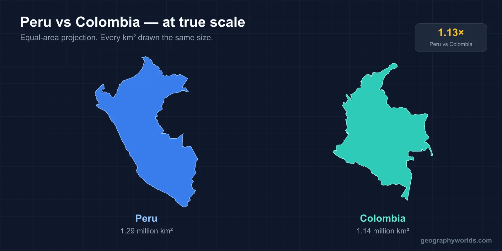
Peru is the larger country at about 1.29 million km² against Colombia's 1.14 million, but Colombia has more people — roughly 52 million to Peru's 34 million. Both contain Andes, Amazon rainforest and Pacific coast. Only Colombia also has a Caribbean coastline, and that single difference has pointed the two countries in different directions for five centuries.
The coast that changes everything
Colombia is the only South American country with coastline on both the Pacific and the Caribbean. That gave it Cartagena and Barranquilla, ports facing the Atlantic world, and made it the natural land bridge between South and Central America.
Peru faces the Pacific only. Its entire maritime orientation is westward, toward a cold current and, historically, toward the trans-Pacific galleon trade with Manila and the mining economy that fed Spain through Panama.
The consequence for the modern countries is a difference in what they are close to. Colombia's Caribbean coast puts it within easy reach of the United States and the Antilles; Peru's Pacific ports face Asia, and China is now its largest trading partner by a wide margin.
The Andes split, then split again
Both countries are Andean, but the range behaves differently in each.
In Colombia the Andes divide into three parallel chains — the Cordillera Occidental, Central and Oriental — separated by the deep valleys of the Cauca and Magdalena rivers. That three-way split is why Colombia's population is distributed across several distinct highland basins rather than concentrated in one, and it is a large part of why the country has historically been so regionally fragmented and so hard to govern from a single centre.
In Peru the Andes run as a single massive block, higher and drier, reaching 6,768 metres at Huascarán. The range separates a narrow desert coastal strip from the Amazon basin behind it, and crossing it has always been the country's central logistical problem.
Two capitals, opposite altitudes
The capitals invert what you might expect.
- Bogotá sits at about 2,640 metres on a high plateau in the eastern cordillera — one of the highest capital cities in the world, cool year-round, with an average around 14°C despite being nine degrees from the equator.
- Lima sits at sea level on the coast, in one of the driest inhabited places on Earth. It receives a few millimetres of rain a year, yet is grey and humid for months, blanketed by the garúa — a coastal fog produced by the cold Humboldt Current chilling moist air from below.
So the equatorial country has a cold capital, and the country further from the equator has a warm, rainless one. Both are consequences of the same two forces — altitude and ocean currents — working in opposite directions.
The Humboldt Current, and the fish
Peru's coast is desert because of the Humboldt Current, which carries cold water north along the shore and suppresses rainfall. The same current drives an upwelling of nutrients that supports one of the largest fisheries in the world.
Peruvian anchoveta catches have at times been the biggest single-species fishery anywhere, most of it processed into fishmeal for animal feed rather than eaten directly. The fishery is also the classic case study in climate variability: in El Niño years the warm water suppresses the upwelling, the anchoveta collapse, and the industry contracts sharply.
The anchoveta fishery also feeds an industry most people never see: fishmeal from Peru is a primary protein input for salmon farming in Norway and Chile and for pig and poultry production in China, which makes a Peruvian coastal upwelling a variable in food prices a long way from South America.
Colombia's Pacific coast, by contrast, is one of the wettest places on the planet — the Chocó receives extraordinary annual rainfall, in places among the highest recorded anywhere — because there is no cold current to suppress convection.
How high the capitals sit, and what altitude does to visitors
Bogotá at 2,640 metres is high enough that arriving visitors sometimes feel it, though the effect is mild compared with Cusco at about 3,400 metres or Lake Titicaca on the Peru–Bolivia border at 3,812 — where altitude sickness is a routine consideration and coca tea is offered on arrival as a matter of course.
That difference shapes tourism logistics in Peru specifically. Most itineraries build in acclimatisation days before Machu Picchu, and the site itself, at around 2,430 metres, is notably lower than the city most people travel from — which surprises visitors who assume the famous ruins must be the highest point of the trip.
Coffee against minerals
Both export commodities, but different ones, and the difference shapes who benefits.
Colombia's coffee belt lies on the volcanic slopes of the central cordillera at altitudes suited to arabica, and the crop is grown overwhelmingly on smallholdings — hundreds of thousands of small farms rather than plantations. That has spread the income unusually widely for a commodity economy, and the Federación Nacional de Cafeteros has been a significant political actor for a century.
Peru's export base is mining: copper above all, along with gold, zinc and silver. It is among the world's largest copper producers, and the mines are capital-intensive, concentrated and mostly in the highlands — which has produced recurring conflict between mining companies, the state and highland communities over water and land.
Both also hold large Amazon territories. Peru's Amazon covers well over half the country; Colombia's covers roughly a third, and both face deforestation pressure from ranching, coca cultivation and illegal gold mining.
Indigenous populations, and who speaks what
Peru has a far larger indigenous population, both proportionally and in absolute terms. Quechua and Aymara are official languages alongside Spanish, Quechua is spoken by millions, and the Inca inheritance is central to national identity — Cusco was the Inca capital, and Machu Picchu is the country's defining image abroad.
Colombia's indigenous population is a much smaller share, and its demographic story is more strongly Afro-Colombian, particularly along both coasts. Cartagena was a major slaving port, and the Pacific department of Chocó has one of the highest Afro-descendant populations in the Americas.
Language policy differs accordingly. Peru made Quechua and Aymara co-official nationally and has pushed bilingual education in highland schools, while Colombia recognises dozens of indigenous languages regionally but with Spanish dominant almost everywhere in practice.
Both countries recognise indigenous territorial rights constitutionally, and both have struggled to enforce them where mining and coca economies intersect with those territories.
The border in the rainforest
Colombia and Peru share a border of roughly 1,600 km, almost all of it in dense Amazon rainforest, and the shape of it is the result of a war.
Colombia's access to the Amazon river itself runs through a narrow southward projection of territory called the Amazon Trapezium, ending at the town of Leticia — its only port on the river. Peru ceded that corridor under the 1922 Salomón–Lozano Treaty, and the arrangement was resented enough that Peruvian forces seized Leticia in 1932, triggering a short war that ended with the League of Nations confirming Colombian sovereignty.
The result is one of the more unusual borders in South America: at Leticia, Colombia, Peru and Brazil meet, and the town is contiguous with Brazilian Tabatinga with no physical barrier between them. It is reachable from the rest of Colombia only by air or river.
Two of the most biodiverse countries on Earth
Both are megadiverse states, and both rank at the very top of global biodiversity counts — a direct consequence of holding Andes, Amazon and coast within one territory, which stacks an enormous range of altitudes and climates into a short horizontal distance.
Colombia consistently records the highest bird count of any country, with something over 1,900 species, and leads on orchids. Peru is close behind on birds and ahead on butterflies, and holds the Manú and Tambopata reserves in its Amazon south-east.
Both countries also protect large areas on paper that they struggle to police in practice: illegal gold mining in Peru's Madre de Dios and coca-driven clearance in Colombia's Amazon departments both operate well inside nominally protected territory.
Peru also holds the Galápagos-style outlier in reverse: the Humboldt Current's cold water supports marine life that would be unusual at that latitude, including Humboldt penguins living within a few degrees of the tropics.
Two conflicts, different shapes
Both countries fought long internal wars in the second half of the twentieth century, and both have largely emerged from them, but the conflicts differed.
Colombia's ran for over five decades between the state, left-wing guerrillas — the FARC principally — right-wing paramilitaries and drug cartels, displacing millions. The 2016 peace agreement with the FARC ended the main conflict and won a Nobel Peace Prize, though violence involving dissident and successor groups continues in parts of the country.
Peru's was shorter and more concentrated: the Shining Path insurgency of the 1980s and early 1990s, an unusually doctrinaire Maoist movement, and the state's response to it, together killed tens of thousands, disproportionately Quechua-speaking highlanders.
Both have since become substantially safer and both have built significant tourism industries on the back of that — Peru around Cusco and the Inca sites, Colombia around Cartagena, Medellín and its coffee region. Our Colombia and Peru guides cover each in full.
