
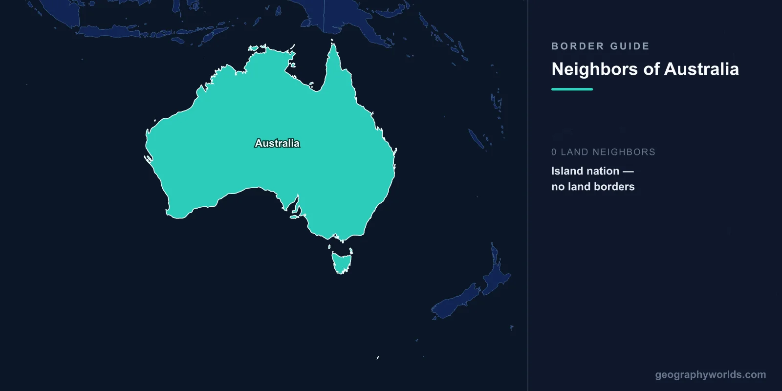
Australia has no land borders with any country. As the world's smallest continent and largest island nation, Australia is entirely surrounded by water — the Indian Ocean to the west and south, the Pacific Ocean to the east, and the Arafura and Timor seas to the north. Its closest maritime neighbors are Papua New Guinea (150 km across the Torres Strait), Indonesia (approximately 250 km across the Timor Sea), East Timor (Timor-Leste), New Zealand (approximately 2,000 km across the Tasman Sea), and several Pacific Island nations.
Introduction
While Australia lacks the land border relationships that define most nations, its maritime boundaries are extensive and strategically significant. Australia's Exclusive Economic Zone (EEZ) is the third-largest in the world at over 8.1 million km², extending over vast areas of ocean and encompassing important fishing grounds, mineral resources, and shipping lanes. The Torres Strait between Australia and Papua New Guinea, in particular, has complex border arrangements that affect indigenous communities, shipping, and environmental management.

Australia's Closest Maritime Neighbors
- Papua New Guinea: ~150 km across the Torres Strait
- Indonesia: ~250 km across the Timor Sea
- East Timor (Timor-Leste): ~450 km across the Timor Sea
- New Zealand: ~2,000 km across the Tasman Sea
- New Caledonia (France): ~1,500 km to the east
- Solomon Islands: ~1,700 km to the northeast
Despite having no land borders, Australia maintains maritime boundary agreements with several nations. These boundaries govern fishing rights, seabed resource extraction, and shipping lanes. Australia's geographic isolation has profoundly shaped its history, ecology, and national identity.
The Torres Strait: Papua New Guinea
- Distance: ~150 km at the narrowest point between Cape York and PNG
- Treaty: 1978 Torres Strait Treaty, ratified 1985
- Islands: Over 270 islands, with some Australian islands just 5 km from PNG
The Torres Strait between Australia and Papua New Guinea is the closest any nation comes to sharing a land border with Australia. At its narrowest, the strait is approximately 150 km wide, but the presence of hundreds of islands means that some Australian and PNG islands are separated by as little as 5 km. The 1978 Torres Strait Treaty established a complex border arrangement that includes a Protected Zone recognizing the traditional rights of Torres Strait Islander and Papua New Guinean peoples to move freely across the maritime boundary for traditional activities.
The Torres Strait Islands have been inhabited for thousands of years, and the indigenous communities maintain cultural and family connections across the international boundary. Traditional inhabitants can cross the border without passports for customary purposes under the treaty — one of the world's most unique border arrangements.
Northern Maritime Borders: Indonesia and East Timor
- Indonesia maritime boundary: Extensive agreements covering the Timor Sea, Arafura Sea, and Indian Ocean
- East Timor maritime boundary: Finalized in 2018 after decades of dispute over Timor Sea resources
- Key issue: Oil and gas resources in the Timor Sea
Australia's maritime relationship with Indonesia spans the full width of the country's northern coast. The two nations share an extensive maritime boundary across the Timor Sea, Arafura Sea, and Indian Ocean. Indonesia's southern islands — including Timor, Rote, and others — are visible from parts of northern Australia. The maritime boundary has been established through multiple treaties, governing everything from fishing to seabed mining rights.
The Australia-East Timor maritime boundary was one of the most contentious in the region. After East Timor gained independence from Indonesia in 2002, it disputed the existing maritime boundary with Australia, arguing it should be drawn at the median line rather than at the edge of Australia's continental shelf. The dispute was significant because of massive oil and gas reserves in the Timor Sea, particularly the Greater Sunrise gas field. A permanent maritime boundary was finally agreed upon in 2018 through UN-supervised conciliation — the first case resolved under this mechanism.
Eastern and Southern Neighbors: New Zealand and Pacific Islands
- New Zealand distance: ~2,000 km across the Tasman Sea
- Cultural ties: ANZAC military alliance, Trans-Tasman Travel Arrangement
- Pacific Islands: Maritime boundaries with New Caledonia, Solomon Islands, and others
New Zealand, located approximately 2,000 km across the Tasman Sea, is Australia's most culturally aligned neighbor. While the distance is considerable, the two nations maintain one of the closest bilateral relationships in the world. The Trans-Tasman Travel Arrangement allows citizens of each country to live and work in the other without a visa. The ANZAC (Australian and New Zealand Army Corps) military tradition, dating to World War I, symbolizes the deep bond between the countries.
Australia also has maritime boundaries with France (via New Caledonia), the Solomon Islands, and other Pacific island nations. Norfolk Island, an Australian external territory, lies roughly between Australia and New Zealand. Australia plays a significant role as a regional power in the Pacific, with diplomatic, economic, and security relationships extending across Oceania.
Why Australia Has No Land Borders
- Continental separation: Australia separated from Antarctica ~45 million years ago
- Land bridge: Connected to PNG via Sahul land bridge during ice ages, last flooded ~8,000 years ago
- Geographic isolation: Shaped unique wildlife (marsupials, monotremes) and indigenous cultures
Australia's lack of land borders is a consequence of plate tectonics and rising sea levels. During the last ice age, Australia was connected to Papua New Guinea and Tasmania via land bridges, forming the continent of Sahul. Aboriginal Australians first arrived via these land bridges at least 65,000 years ago, making them one of the world's oldest continuous civilizations. When sea levels rose around 8,000 years ago, the Torres Strait flooded, severing the land connection.
This geographic isolation has had profound consequences. Australia's unique wildlife — kangaroos, koalas, platypuses, and countless other species found nowhere else — evolved in isolation for millions of years. The absence of land borders also shaped European colonization patterns, as the continent was effectively unreachable for most of human history. Today, Australia's isolation influences its immigration policies, biosecurity regulations (among the strictest in the world), and its strategic outlook as a maritime nation dependent on sea lanes for trade.
Historical Context
Australia's maritime boundaries have been shaped by colonial history and post-independence diplomacy. The Torres Strait boundary with Papua New Guinea was among the first to be formally established after PNG's independence in 1975. Maritime boundaries with Indonesia were negotiated in the 1970s, though some sections remain unsettled. The East Timor boundary was the most recent to be resolved (2018). Australia's claim to the Australian Antarctic Territory — roughly 42% of Antarctica — is recognized by only a handful of nations and adds a polar dimension to its boundary considerations. The nation's Exclusive Economic Zone of 8.1 million km² is larger than its land area of 7.7 million km², underscoring Australia's identity as a maritime nation.
Key Facts
- Australia has zero land borders — it is the world's largest island nation and smallest continent
- Papua New Guinea is the closest country, just 150 km away across the Torres Strait
- Australia's Exclusive Economic Zone (8.1 million km²) is larger than its land area (7.7 million km²)
- The Torres Strait Treaty allows traditional inhabitants to cross the border without passports
- Australia was connected to PNG by a land bridge until approximately 8,000 years ago
Fun Facts
- Australia's EEZ of 8.1 million km² is the third-largest in the world — larger than the land area of every country except Russia.
- Aboriginal Australians arrived via a land bridge at least 65,000 years ago, making them one of the oldest continuous civilizations on Earth.
- Some Australian islands in the Torres Strait are just 5 km from Papua New Guinea — close enough to see across the water.
- Australia's strict biosecurity laws mean you can be fined thousands of dollars for bringing undeclared food across its maritime borders — a consequence of evolving in isolation for millions of years.
Final Thoughts
While Australia is the only continent-country with no land borders, its maritime boundaries are vast, complex, and strategically vital. From the culturally rich Torres Strait crossing with Papua New Guinea to the resource-laden Timor Sea boundaries with Indonesia and East Timor, Australia's relationship with its ocean neighbors defines its role in the Indo-Pacific region. The continent's splendid isolation has shaped its unique ecology, indigenous cultures, and modern national identity in ways that few other nations can match.
Test Your Knowledge!
Think you know your borders and boundaries? Try our interactive geography quiz!
Play Geography Games →