
India shares land borders with six countries: Bangladesh, China, Pakistan, Nepal, Myanmar and Bhutan. Together those boundaries run to almost exactly 15,000 km, with Bangladesh (about 4,096 km) the longest and Bhutan (699 km) the shortest. India's Ministry of Home Affairs also counts a 106 km border with a seventh country, Afghanistan, as part of its claim to Kashmir, although that stretch lies in Gilgit-Baltistan, which Pakistan has administered since 1947. At sea, India shares boundaries with Sri Lanka, the Maldives, Indonesia and Thailand, as well as with Pakistan, Bangladesh and Myanmar. Those lines matter because they cross the Himalayas, the Thar Desert, the Ganges delta and the Bay of Bengal, and because several of them, above all with China and Pakistan, are still disputed.
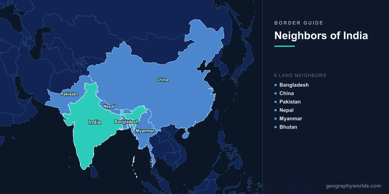
How India’s 15,000 km of Land Border Splits Between Six Neighbours
The figures below are those Wikipedia gives for each boundary, drawn from Indian government and border-force sources. Measurements differ with method: the Geography of India article, for instance, rounds India's whole land frontier to 15,200 km and gives a longer 4,057 km figure for the Line of Actual Control with China, while the Indo-Tibetan Border Police, which guards that frontier, works from 3,488 km. The chart uses the border-force figure.
At the centre of this map sits the Siliguri Corridor in West Bengal, a narrow neck of Indian land squeezed between Nepal, Bhutan and Bangladesh, is the only land link between mainland India and its eight north-eastern states. Four of India's six recognised neighbours touch the borders around that corridor.
Bangladesh: 4,096 km and the 2015 Enclave Exchange
India's longest boundary wraps around Bangladesh on three sides. At 4,096 km it is ranked the sixth-longest land border in the world, and it is divided between five Indian states: West Bengal (2,217 km), Tripura (856 km), Meghalaya (443 km), Mizoram (318 km) and Assam (262 km). Its western half follows the Radcliffe Line, published on 17 August 1947 when Sir Cyril Radcliffe's commission partitioned Bengal; the line became the India–Bangladesh border when East Pakistan became Bangladesh in 1971.
For decades it was also a patchwork. The main body of Bangladesh held 102 Indian enclaves, which contained 21 Bangladeshi counter-enclaves, one of which in turn held Dahala Khagrabari, the world's only third-order enclave. A joint census in 2010 counted 51,549 people living in these pockets. The Land Boundary Agreement first signed in 1974 was finally ratified on 6 June 2015, after India's Parliament passed the 100th Amendment to the Constitution. At midnight on 31 July 2015 India handed over 111 enclaves covering 17,160 acres and received 51 covering 7,110 acres, a net loss of about 40 km². Only Dahagram–Angarpota, a Bangladeshi exclave, remains.
The busiest crossing is Petrapole–Benapole, about 95 km from Kolkata on National Highway 112. Described as the largest land customs station in Asia, it handles close to 60 per cent of India–Bangladesh trade. A rail link through it reopened in 2001 after 24 years, and since 9 November 2017 the Bandhan Express has run from Kolkata to Khulna across it.

Pakistan: From the Siachen Glacier to Sir Creek
The India–Pakistan border, about 3,323 km long, is really several lines of different legal status. In the far north the Actual Ground Position Line runs for about 110 km across the Saltoro Mountains beside the Siachen Glacier, a ridge with peaks above 7,000 m. South of it lies the Line of Control, which separates Indian-administered Jammu and Kashmir and Ladakh from Pakistani-administered Azad Kashmir and Gilgit-Baltistan, and which was delineated after the 1972 Simla Agreement. Both countries claim the whole of the former princely state, so neither treats the Line of Control as a settled frontier; our guide to the Kashmir border dispute sets out each side's position.
From Jammu southwards the recognised international border follows the 1947 Radcliffe Line through the Punjab plains and then the old provincial boundaries of Rajasthan and Gujarat with Sindh, across the Thar Desert and the salt flats of the Rann of Kutch. It ends at Sir Creek, a 96 km tidal estuary in the Indus delta whose exact boundary line is still contested; the land boundary further east was fixed by a tribunal award in 1968. India has lit much of the frontier with about 150,000 floodlights on some 50,000 poles, which makes the line visible from space at night.
The best-known crossing is Attari–Wagah on the Grand Trunk Road between Amritsar and Lahore. Every evening before sunset India's Border Security Force and the Pakistan Rangers perform a joint flag-lowering drill of high kicks and stamping, watched from grandstands on both sides. The ceremony has been suspended at times of tension, most recently from 8 May 2025 after the Pahalgam attack; a scaled-down version resumed on 20 May. The India–Pakistan border guide follows the line section by section.
China: 3,488 km Along the Line of Actual Control
India and China have never agreed a boundary. What separates them is the Line of Actual Control (LAC), a term Chinese premier Zhou Enlai used in a 1959 letter to Jawaharlal Nehru and which came to mean the line left after the 1962 Sino-Indian War. The two governments agreed in 1993 to respect it without marking it on the ground. The Indo-Tibetan Border Police guards it from the Karakoram Pass in Ladakh to the eastern end of Arunachal Pradesh.
The LAC has three sectors. In the west, Ladakh faces Tibet and Xinjiang, and India claims the whole of Aksai Chin, a high, almost uninhabited plateau of about 38,000 km² that China administers; this sector saw the 2020 clashes in the Galwan valley area. The middle sector runs along Himachal Pradesh and Uttarakhand. In the east, the line broadly follows the McMahon Line along Arunachal Pradesh, which India administers as a state and China claims as Zangnan. Our guide to the China–India LAC covers the sectors in detail.
The most visited point on the line is Nathu La, a pass at 4,310 m in the Dongkya Range linking Sikkim with China's Yadong County in the Chumbi Valley. It was sealed after 1962, saw fatal clashes in 1967, and reopened for border trade in 2006. Snow limits that trade to roughly seven or eight months a year, and the pass also serves as a route for pilgrims to Mount Kailash and Lake Manasarovar.

Nepal and Bhutan: Open Frontiers Below the Himalayas
India's borders with its two Himalayan neighbours are the opposite of the guarded lines to the west and north. The 1,751 km India–Nepal border, touching Uttarakhand, Uttar Pradesh, Bihar, West Bengal and Sikkim, was delimited after the Treaty of Sugauli of 1816, which ended the Anglo-Nepalese War. Indian and Nepali citizens need neither passports nor visas to cross, and tens of thousands do so every day. The main trade gateway is Raxaul in Bihar, which adjoins Birgunj in Nepal; a 6 km broad-gauge line runs from Raxaul to the Sirsiya inland container depot, fully operational since 2005. Even this open border has a dispute: Nepal has claimed the Kalapani territory in Uttarakhand's Pithoragarh district since 1997, including the Lipulekh Pass, and its 2020 political map moved the western tripoint to Limpiyadhura.
The 699 km Bhutan–India border touches Assam (267 km), Arunachal Pradesh (217 km), West Bengal (183 km) and Sikkim (32 km). Its line goes back to the Treaty of Sinchula after the Bhutan War of 1860–65, when Bhutan ceded the Bengal and Assam Duars. A final demarcation treaty was signed in 2006. Because Bhutan's border with China is closed, India is its only land access, and the longest-established crossing joins Jaigaon in West Bengal to the adjoining town of Phuentsholing, which had 27,658 people in 2017.
Myanmar: 1,643 km Through the Indo-Burman Ranges
The eastern border runs 1,643 km from the tripoint with China to the tripoint with Bangladesh, along Arunachal Pradesh, Nagaland, Manipur and Mizoram. Forested ranges such as the Patkai, Chin and Kachin hills form a physical barrier between South and Southeast Asia. The line took shape under British rule after the Treaty of Yandabo in 1826 and was fixed in detail by a boundary treaty signed on 10 March 1967.
Communities such as the Naga, Mizo, Kuki and Chin live on both sides, and for decades a Free Movement Regime let border residents travel up to 16 km across without a visa. India ended it in February 2024, citing violence in Manipur and cross-border smuggling, and approved about ₹30,000 crore to fence the 1,624 km line; only about 30 km had been fenced by September 2024. The main crossing is at Moreh in Manipur, opposite Tamu in Myanmar, the start of the unfinished India–Myanmar–Thailand Trilateral Highway.
Afghanistan and the 106 km Line India Claims in Gilgit-Baltistan
India lists Afghanistan as a seventh land neighbour because it claims the whole of the former princely state of Jammu and Kashmir, including Gilgit-Baltistan. On that claim, India would meet Afghanistan for 106 km along the Wakhan Corridor, the thin strip of Afghan territory created after the 1893 Durand Line Agreement, whose valley rises to 4,923 m. In practice Pakistan has administered Gilgit-Baltistan since 1947, so the boundary there is Afghan–Pakistani, and there is no Indian crossing point or border post with Afghanistan.
Sri Lanka, the Maldives, Indonesia and Thailand Across the Sea
India claims a 12-nautical-mile territorial sea and a 200-nautical-mile exclusive economic zone, which at about 2.3 million km² is the 18th-largest in the world. Its maritime boundaries total more than 7,000 km and are shared with seven countries: Pakistan, Bangladesh and Myanmar, which are also land neighbours, plus four that are reached only by sea.
- Sri Lanka lies across the Palk Strait, which runs about 137 km between Pamban Island in Tamil Nadu and Mannar Island and is 64 to 137 km wide. The shoals of Ram Setu, or Adam's Bridge, almost close it to the south. A 1974 agreement recognised Sri Lankan sovereignty over the uninhabited island of Katchatheevu, and a second agreement followed in 1976. See our Palk Strait guide for the crossing itself.
- The Maldives begin at Thuraakunu, about 125 km south of Minicoy, the southernmost island of Lakshadweep; the maritime boundary runs through the Eight Degree Channel between them.
- Indonesia is closest at Indira Point on Great Nicobar Island, India's southernmost land point, which lies about 145 km from Rondo Island, Indonesia's northernmost island off Sumatra.
- Thailand meets India in the Andaman Sea, about 650 km south-east of the Andaman and Nicobar Islands.
Counted that way, India touches ten countries by land or sea, from the Siachen Glacier in the north to Indira Point in the south.