
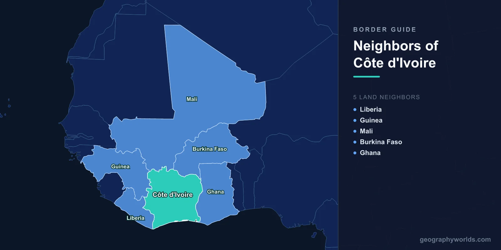
Ivory Coast shares land borders with five countries: Liberia and Guinea to the west, Mali and Burkina Faso to the north, and Ghana to the east. The Gulf of Guinea forms the southern edge. Those five lines were drawn by France and Britain between the 1890s and the 1930s, and the most important thing about them is how much labour has crossed them — because the world's largest cocoa industry was built on people who did.
Burkina Faso Was Once Administered From Abidjan
The northern border with Burkina Faso has an unusual history: for fifteen years it did not exist. In 1932 the French colonial administration dissolved the colony of Upper Volta and divided its territory between neighbouring colonies, with the largest share going to Côte d'Ivoire.
The reason was labour. Ivorian plantations needed workers, and the densely populated Mossi plateau had them. Abolishing the internal boundary made recruitment — often forced — administratively simpler. Upper Volta was reconstituted in 1947 after sustained pressure from Mossi leadership, and became independent Burkina Faso in 1960.
The migration pattern established in those years never stopped. Millions of Burkinabè and their descendants live in Ivory Coast, and for much of the twentieth century the movement was so routine that it was barely thought of as international at all.
Cocoa, and the Hands That Pick It
Ivory Coast produces roughly 40 per cent of the world's cocoa, more than any other country, and the industry is concentrated in the forested south and west. The workforce has always included large numbers of migrants from Burkina Faso and Mali, alongside internal migrants from the northern savanna.
Land tenure was the mechanism. Under Félix Houphouët-Boigny's first decades, the principle that land belonged to whoever cleared and cultivated it drew settlers into the forest belt and produced an extraordinary agricultural expansion. It also created overlapping claims — customary rights held by local lineages against use rights acquired by newcomers — that were manageable while forest remained and became explosive when it ran out.
Smuggling Beans Across the Ghanaian Line
The eastern border with Ghana is a working economic instrument. Both countries fix a farmgate price for cocoa through state marketing bodies, and whenever the two prices diverge, beans move across the frontier at night in the direction of the better one.
The flow has reversed repeatedly over the decades depending on exchange rates and policy, and both governments have deployed forces to interdict it. Since the two countries together supply well over half the world's cocoa, and since they attempted to coordinate through a joint living income differential from 2019, the smuggling is not a fringe activity but a structural feature of the global chocolate supply chain.
The same border carries a long-running irredentist claim. The Sanwi kingdom in the south-east, an Anyi state with historical ties across the line into Ghana, attempted secession in the 1960s and the claim has resurfaced periodically since.
The Border That Ran Through the Middle
Between 2002 and 2007 the most consequential boundary in the country was internal. A failed coup in September 2002 left rebel forces holding the north and the government the south, with a buffer strip — the Zone of Confidence — patrolled by French and United Nations troops running east to west across the centre.
The dispute that produced it was about who counted as Ivorian. The doctrine of ivoirité, elaborated in the 1990s, distinguished true Ivorians from those of recent immigrant descent, and was used to bar Alassane Ouattara, whose parentage was disputed, from the presidency. Since a large part of the northern population traced descent to Burkinabè and Malian migration, the doctrine drew a line through the country along much the same axis as the eventual front.
The war reignited after the 2010 election and ended in 2011 with Ouattara in office and his predecessor Laurent Gbagbo sent to the International Criminal Court, where he was eventually acquitted.
What Happened to the Migrants
The practical effect of ivoirité was felt on the land. Burkinabè and Malian farming families who had cleared and planted cocoa under the old rules were subject to a 1998 land law that restricted rural land ownership to Ivorian citizens, and many were expelled from plots they had worked for a generation.
Large numbers returned to Burkina Faso, a country that had not expected them and could not absorb them. Reintegration and land restitution remained contentious long after the fighting stopped, and the process of returning plots to displaced families has continued for years, village by village.
The Forest Corner: Liberia and Guinea
The western boundary with Liberia follows the Cavalla river for much of its length and runs through dense forest that was, until recently, among the least accessible parts of the country. The Guinean border to the north-west crosses the Nimba range, where Mount Nimba — a UNESCO World Heritage site shared by three countries — holds species found nowhere else and iron ore deposits that have attracted mining interest for decades.
These frontiers have been conduits for other countries' wars. Liberian fighters crossed during the Liberian civil wars and again during the Ivorian conflict, mercenary recruitment ran both ways, and refugee flows moved in whichever direction was safer at the time.
Where an Epidemic Began
The West African Ebola epidemic of 2014 to 2016 began at the tripoint region where Guinea, Liberia and Sierra Leone meet, with the index case identified in the village of Meliandou in Guinea's forest region, close to the Ivorian border.
The outbreak spread rapidly precisely because the borders there are dense with movement — weekly markets, funerals attended across the line, families divided by colonial boundaries. Ivory Coast closed its frontiers with Guinea and Liberia in 2014 and, unusually for a country in the immediate neighbourhood, recorded no cases.
The closure was economically damaging and widely criticised, but it is one of the few instances in which shutting a West African land border appears to have produced the intended result.
Forty-Nine Soldiers and a Diplomatic Crisis
The Malian border is the longest of the northern pair and runs through savanna toward the Sahel. Relations across it collapsed in 2022 when Malian authorities arrested 49 Ivorian soldiers arriving at Bamako airport, describing them as mercenaries; Abidjan said they were support personnel contracted to the United Nations mission.
The men were tried and sentenced before being pardoned six months later, after mediation by Togo. The episode was a symptom of the wider realignment in the Sahel, in which Mali's military government broke with France and with the Economic Community of West African States, while Ivory Coast remained closely aligned with both.
The Threat That Came South
Since 2020 the northern borders have become a security frontier. Jihadist groups operating in Burkina Faso and Mali have pushed toward the coastal states, and Ivory Coast recorded its first significant attacks in the border zone around Kafolo in 2020 and 2021.
The response has combined a heavier military presence with development spending in the northern departments, on the reasoning that the recruitment pool is created by neglect rather than by ideology. Ivory Coast, Ghana, Togo and Benin have all faced the same pressure, and the coastal states now treat their northern frontiers as their principal security problem.
Parks on the Edge
Two of the country's protected areas sit against these borders. Comoé National Park in the north-east, one of the largest protected areas in West Africa and a UNESCO World Heritage site, was placed on the list of sites in danger during the civil war and removed in 2017 after wildlife populations recovered.
Taï National Park in the south-west, against the Liberian border, holds one of the last substantial blocks of primary Upper Guinean rainforest, a remnant of a forest that once ran unbroken along the coast. Cocoa expansion is the principal pressure on both, which brings the story back where it started.
The Fulani Question Along the Northern Line
The insecurity arriving from Burkina Faso and Mali has a communal dimension that the security framing often misses. Fulani pastoralists move across all three borders on seasonal routes, and recruitment by armed groups has drawn disproportionately on Fulani communities that felt excluded from land settlements and cattle-theft justice.
The response in Ivory Coast has therefore had to be careful. Collective suspicion of Fulani herders in the northern departments risks producing exactly the alienation that armed groups exploit, a dynamic already visible in central Mali and northern Burkina Faso, and Ivorian authorities have combined military deployment with land-tenure and citizenship documentation programmes intended to remove the underlying grievance.
The Lagoon Coast
Ivory Coast's southern edge is a 515-kilometre coastline of sandbars and lagoons, and Abidjan sits on one of them, connected to the sea by the Vridi Canal cut in 1950. That canal made Abidjan the principal port of francophone West Africa and the destination of the road and rail routes running north across all those borders.
The railway to Ouagadougou, built under colonial rule to move labour and cotton, still runs, and landlocked Burkina Faso and Mali both depend on Ivorian ports for a large share of their trade — which means the borders drawn to serve a colonial labour system now serve as the trade arteries of their successors. A wider account sits in our Ivory Coast country guide, and the belt these northern frontiers run into is described in the geography of the Sahel.
