
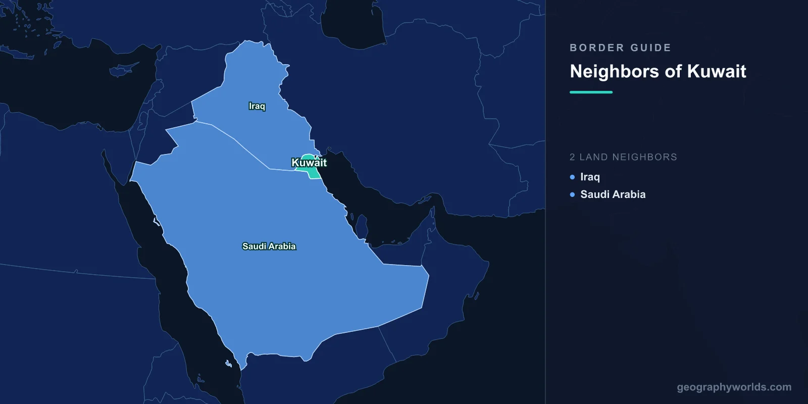
Kuwait shares land borders with two countries: Iraq to the north and west, and Saudi Arabia to the south. The Iraqi boundary runs about 250 kilometres and the Saudi one about 220, with roughly 500 kilometres of coastline on the Persian Gulf. Both land borders have been redrawn in living memory, one of them by the United Nations Security Council after an invasion.
A Border Iraq Never Accepted
Kuwait was a self-governing sheikhdom under Ottoman nominal suzerainty and then a British protectorate from 1899. Its boundary with what became Iraq derived from the Anglo-Ottoman Convention of 1913, which was never ratified, and from an exchange of letters in 1932 when Iraq entered the League of Nations.
Iraq's claim rested on the assertion that Kuwait had been part of the Ottoman vilayet of Basra and should have been inherited accordingly. It was pressed in 1961, immediately after Kuwaiti independence, when Abd al-Karim Qasim declared Kuwait part of Iraq; British and then Arab League forces deployed and the claim lapsed.
Iraq recognised Kuwaiti independence in 1963 but never agreed a demarcated boundary, and disputes over the Rumaila oilfield and over access to the Gulf persisted. Both featured in the justifications given for the invasion of August 1990.
The United Nations Draws a Line
After Iraq was expelled in 1991, the Security Council took the unusual step of settling the boundary itself. Resolution 687 established the Iraq-Kuwait Boundary Demarcation Commission, which surveyed and demarcated the line, and Resolution 833 in 1993 declared the result final and guaranteed it.
The commission's line shifted the border a few hundred metres north in places. The consequences were material: it placed a portion of the Rumaila oilfield and part of the Umm Qasr port area on the Kuwaiti side, along with several Iraqi border installations and a number of farms, whose occupants were compensated and relocated.
Iraq accepted the demarcation formally in 1994. It remains a grievance in Iraqi politics, periodically revived, but no Iraqi government since has repudiated it.
Kuwait then built a physical barrier along the frontier — a trench several metres deep, a sand berm, fencing and patrol roads — first constructed after 1991 and reinforced in 2004. A United Nations observer mission monitored a demilitarised zone along it until 2003.
The Waterway That Is Still Argued About
The land border is settled; the water is not. The Khawr Abd Allah is the navigable channel separating Kuwait's Bubiyan and Warbah islands from the Al-Faw peninsula, and it is Iraq's access to the Gulf for the port of Umm Qasr.
The two states signed an agreement regulating navigation in the channel in 2012 and ratified it in 2013. In September 2023 Iraq's Federal Supreme Court ruled the ratification unconstitutional, effectively voiding it from the Iraqi side, which Kuwait rejected as contrary to Resolution 833 and to the law of treaties.
Underlying the legal argument is a commercial one. Kuwait is building the Mubarak Al Kabeer port on Bubiyan island, and Iraq is building the Grand Faw port a short distance away; each would compete for the same transhipment traffic, and each depends on the same channel.
Bubiyan and Warbah
The two islands at the head of the Gulf have been the object of Iraqi interest for decades. Both are low, largely uninhabited and strategically placed across the approaches to Umm Qasr, and Iraq sought to lease or acquire them repeatedly from the 1970s onward.
Bubiyan is Kuwait's largest island and among the largest in the Gulf, mostly salt flat and mudflat, ecologically significant as a wader habitat and connected to the mainland by a causeway. Warbah is smaller and closer to the Iraqi shore.
Kuwait's refusal to concede them was among the immediate causes of friction in 1990, and their retention after the war, confirmed by the UN demarcation, is why the Khawr Abd Allah question has no easy answer.
The Neutral Zone
The southern border has a stranger history. When Britain brokered the 1922 Uqair Protocol between Kuwait and what became Saudi Arabia, the negotiators could not allocate a diamond-shaped area of desert used by Bedouin from both sides, so they left it undivided — the Kuwait-Saudi Neutral Zone, in which both states held equal rights.
Oil was found in it. The two countries partitioned the zone territorially in agreements of 1965 and 1969, drawing a boundary through the middle, while keeping the petroleum resources of the whole area in shared ownership regardless of which side of the new line they lay on.
The area is now called the Divided Zone, and the arrangement is one of the longest-running joint petroleum régimes anywhere.
Five Years Without Production
The Divided Zone's onshore Wafra field and offshore Khafji field were shut down in 2014 and 2015 amid a dispute between the two governments. The public explanations involved environmental permits and the operating rights of a foreign partner; the underlying disagreement concerned the extension of a concession and jurisdictional questions in the zone.
Production remained halted for around five years, removing several hundred thousand barrels a day from the market at a cost of billions to both states. A memorandum in December 2019 resolved it, and output resumed in 2020.
It is a useful illustration of how shared-resource arrangements fail: not through invasion, but through an administrative disagreement that neither side is under enough pressure to settle quickly.
A Country Built on a Harbour
Kuwait exists because of Kuwait Bay, one of the few natural deep harbours on the northern Gulf coast. The settlement founded there in the eighteenth century by the Bani Utbah lived on pearling, boatbuilding and the long-distance dhow trade to India and East Africa, and Kuwaiti shipwrights supplied vessels across the Gulf.
That maritime orientation is why the territory is shaped as it is: a small hinterland behind a harbour, with borders drawn across desert that nobody wanted until oil was found under it. Failaka island in the bay carries the remains of a Greek settlement from the period after Alexander, evidence that the harbour has been useful for a very long time.
The Wall of Fire, and What the Border Left Behind
When Iraqi forces withdrew in February 1991 they set light to Kuwait's oil wells. Somewhere over 600 wellheads burned, some for more than eight months, and firefighting teams from around the world were brought in to cap them.
The smoke plume was visible from orbit and depressed daytime temperatures across the region. On the ground, oil that did not ignite formed lakes across the desert, and hundreds of square kilometres of surface were contaminated with a hardened tar-and-sand crust that is still being remediated decades later.
The United Nations Compensation Commission awarded Kuwait substantial sums for environmental damage, and the remediation programme has been among the largest of its kind ever attempted. Parts of the border area also remain affected by mines and unexploded ordnance from the same period.
Failaka, and a Greek Island in the Gulf
Failaka, an island in Kuwait Bay a short distance offshore, carries the remains of a settlement established by Alexander the Great's successors, who called it Ikaros. A Greek temple, a fortress and inscriptions have been excavated there, alongside earlier Bronze Age material from the Dilmun civilisation centred on Bahrain.
The island was inhabited continuously until 1990, when its population was evacuated during the Iraqi occupation and the island was mined and fortified. The residents were never resettled, and Failaka today is largely empty, with the shell of its abandoned village standing beside the archaeology.
Bedoon, and People Without a Border to Belong To
Kuwait has a population of stateless residents, generally known as bedoon — from bidun jinsiya, without nationality — numbering in the tens of thousands. Most are descended from families present in the territory at or around independence who did not register for citizenship at the time, many of them nomadic or illiterate, or whose claims were subsequently rejected.
Their position deteriorated after 1991, when some were accused of collaboration during the occupation. Successive governments have maintained that the great majority are concealing another nationality, and have offered limited routes to naturalisation alongside proposals to grant them economic citizenship of a third country.
The bedoon are a direct product of how these borders were made: lines drawn across desert in the 1920s and 1930s over populations organised by tribe and allegiance rather than by residence, and then converted into citizenship registers decades later. The people who fell between the categories have been there ever since.
Borders That Close and Reopen
Kuwait's two land crossings — Abdali to Iraq and Nuwaiseeb to Saudi Arabia — carry a large volume of freight, and both have been closed at various points for security reasons, during the pandemic and during periods of regional tension.
The Saudi crossing is the more commercially significant, linking Kuwait to the wider Gulf road network and, through it, to the rest of the peninsula. The Iraqi crossing carries a growing trade northward, and Kuwait has been among the more active Gulf states in Iraqi reconstruction, having forgiven or restructured a substantial part of the reparations Iraq owed for the invasion.
Those reparations were finally paid off in 2022, more than three decades after the war, through a levy on Iraqi oil exports administered by the United Nations. It closed the last formal chapter of a dispute that began with a border nobody had agreed. Kuwait in the round is our Kuwait country guide, and our Middle East countries guide sets it beside its Gulf neighbours.
