

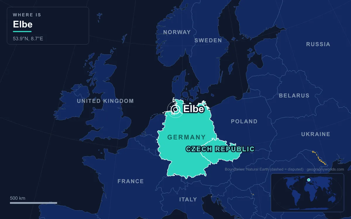
The Elbe (Czech: Labe) is a 1,094 km river in Central Europe. It rises at 1,386 m on the slopes of Mt Violík in the Giant Mountains of the northern Czech Republic, crosses Bohemia, passes Dresden, Magdeburg and Hamburg in Germany, and enters the North Sea at Cuxhaven. Its basin covers 148,268 km², the twelfth-largest in Europe. Almost all of it lies in Germany (65.5%) and the Czech Republic (33.7%), with small parts in Austria and Poland, and 24.4 million people live there, including the cities of Berlin, Prague and Hamburg. Managing the river across borders is not new: under the Treaty of Versailles, an International Commission of the Elbe based in Dresden took charge of navigation, and its statute was signed there on 22 February 1922. Today the Elbe faces floods, drought, channel deepening and urban development. In response it has gained a chain of protected areas: national parks at its source and in its sandstone gorge, a UNESCO biosphere reserve on its water meadows, and a Wadden Sea national park at its mouth. Its World Heritage listing in Dresden, however, was revoked in 2009.
Krkonoše, 1963: protecting the source on Mt Violík
The Elbe begins as a mountain stream above the 30 m Elbe Falls. Below the falls the Bílé Labe joins it, and the river leaves the mountains at Jaroměř. The source area is inside Krkonoše National Park, proclaimed by Czechoslovak government decree on 17 May 1963, four years after Poland protected its side of the range. The park now covers 363.52 km², plus a protection zone of 186.18 km². Its boundary was pulled back in 1991 to exclude most built-up villages. In 1992 the Czech and Polish parks were listed together as a UNESCO biosphere reserve, and the subalpine peat bogs are wetlands of international importance under the Ramsar Convention.
The source draws heavy visitor numbers. The Giant Mountains are the most visited mountains in the Czech Republic, and the source of the Elbe, the Elbe waterfall and the peat-bog trails are standard excursions. The park authority co-founded an association of protected areas along the river, Elbe Parks. Downstream, the river crosses the farmland of Polabí ("the land along the Elbe") past Hradec Králové, Pardubice and Kolín. Above Mělník it passes the chemical works at Neratovice, 17 km north of Prague. The Spolana plant there built new chlorine, sulphuric acid and PVC units on the riverbank in 1970–1976, and in 2025 it cut its workforce to about 150 and kept only sulphuric acid production. At Mělník the river receives the Vltava, which carries more water and is longer above the confluence (434 km against 294 km).
Saxon-Bohemian Switzerland: the national parks of 1990 and 2000
Below Děčín the Elbe cuts a steep, narrow valley through the Elbe Sandstone Mountains, which straddle the Czech–German border. About three-quarters of the range is in Saxony. Protection grew in stages. In Germany, a protected landscape of 287 km² was declared in 1956, and Saxon Switzerland National Park, about 93.5 km² in two separate sections, followed in 1990. In Bohemia, a protected landscape area of 324 km² was created in 1972. Bohemian Switzerland National Park, about 79 km² on the right bank of the river, was established on 1 January 2000 after years of opposition from forestry and hunting interests.
Protection has not stopped fire. In July 2022 a fire started by people burned about 10 km² of Bohemian Switzerland National Park, and another fire in April 2026 covered about 100 hectares. On the German side the park lies close to Dresden and takes in the Bastei near Rathen and the Schrammsteine. It has 400 km of marked hiking trails, and visitors must keep to marked routes. Some of its forest is left without human intervention, which is unusual in Central Europe.
August 2002 and June 2013: floods from Prague to Magdeburg
Flooding is the most immediate threat. In August 2002, two Genoa low-pressure systems brought warm, moist Mediterranean air north, and the heaviest rain fell over the Bohemian Forest and the headwaters of the Elbe and Vltava. The Vltava peaked in Prague at 5,300 m³/s, 20% above the 1845 flood. In Dresden the Elbe rose about 9 m above its normal level, higher than the 1845 record. The usually small Weißeritz returned to its old course and ran straight into Dresden's main railway station. Across Europe the 2002 floods killed 232 people and caused €27.7 billion in damage.

The lesson of 2013 was that strong defences in one place can raise the risk in another. In late May and early June, rain over the Elbe and Danube basins flooded the Saale and the Vltava. Fewer dykes on the upper Elbe failed than in 2002, so less water spread onto the floodplain upstream, and the flood wave further downstream was higher. Magdeburg recorded its highest water level ever. Dresden keeps large riverside meadows, the Elbwiesen, free of building so they can flood, and it has two 50 m wide relief channels to carry floodwater past the old town.
Drought is the other extreme. In the European heatwave of July 2018, high water temperatures in the Rhine and Elbe caused fish to suffocate, and low water disrupted shipping. Near the mouth the threat is storm surge. After the North Sea flood of 1962, Hamburg cut off the western Southern Elbe, which became the Old Southern Elbe.
The Waldschlösschen Bridge and the World Heritage listing lost in 2009
UNESCO inscribed the Dresden Elbe Valley in 2004. The site was a 20 km cultural landscape of meadows, vineyards and palaces stretching from Loschwitz to the Ostragehege plains. Dresden then pressed ahead with a road crossing at the Waldschlösschen, a bridge first proposed about a century earlier. A local referendum in 2005 voted for it. UNESCO placed the valley on its List of World Heritage in Danger in July 2006 and warned that it would withdraw the title. In August 2007 a court halted construction to protect the lesser horseshoe bat, of which only about 650 were thought to survive in Germany, but work resumed that November.

On 25 June 2009 the World Heritage Committee removed the Dresden Elbe Valley from the list. It was only the second site ever delisted, after the Arabian Oryx Sanctuary in Oman in 2007. The landscape is still protected under the EU's 1992 Habitats Directive, but the case shows that an international listing can be outweighed by a local transport decision.
Beavers and water meadows: the Middle Elbe Biosphere Reserve
Protection on the middle Elbe started early. An Anhalt environmental law of 1923 set aside the first reserves, and in 1927 conservation areas were added for the Elbe beaver and the water chestnut, Trapa natans. UNESCO recognised the Steckby-Lödderitzer Forst as a biosphere reserve in 1979. It was extended around Dessau and Wörlitz in 1988 and enlarged again in 1990 to become the Middle Elbe Biosphere Reserve. It covers 430 km² between Wittenberg, Dessau-Roßlau and Gommern, and it contains the largest continuous area of floodplain water meadows in Central Europe. It records more than 1,000 plant species, 250 bird species, 130 bee species and 50 dragonfly species. Wörlitz Park, the oldest landscape park on the European continent, lies inside it.
The beaver shows what the protection achieved. At the end of the 19th century about 200 Eurasian beavers survived in the Elbe system in Saxony, Saxony-Anhalt and Brandenburg. After protection and reintroduction programmes, Germany had more than 40,000 beavers by 2019.
From Iron Curtain to Green Belt, 1945–1990
For part of its length the Elbe's protection came by accident. On 25 April 1945 American and Soviet troops met at Torgau on the Elbe. From 1945 to 1990 the river formed about 95 km of the inner German border between Lauenburg and Schnackenburg. East Germany fenced and walled its bank and kept about 30 fast patrol boats on the river. Bridges blown up in 1945 were left in ruins, and the surviving ones were blocked or demolished on the eastern side. At Rüterberg the fortifications enclosed the whole village. Many people drowned or were killed trying to cross. The border's route has since been declared part of the European Green Belt, which links national parks and nature reserves along the former Iron Curtain.
Deepening the channel for Hamburg, and the Wadden Sea at the mouth
Below the weir at Geesthacht, at river kilometre 586, the Elbe is tidal. The Port of Hamburg, 110 km from the sea, handled 7.8 million TEU in 2024, down from 9.73 million in 2014. Deepening the river for ever larger container ships is controversial for ecological reasons. Our guide to the Port of Hamburg covers the port side of that debate.
At the mouth, Hamburg protects an exclave 12.5 km off Cuxhaven. The Hamburg Wadden Sea National Park was created on 9 April 1990, expanded in 2001 and added to the Wadden Sea World Heritage Site in 2011. It covers 13,750 hectares of mudflats, sandbars and the islands of Neuwerk, Scharhörn and Nigehörn. About 2,000 animal species live there, including common and grey seals, and around 180,000 shelducks of the north-western population moult in the wider Wadden Sea from July to September. The mudflats are part of the larger Wadden Sea wetlands. For the tributary that carries more water than the upper Elbe itself, read our Vltava River guide.