
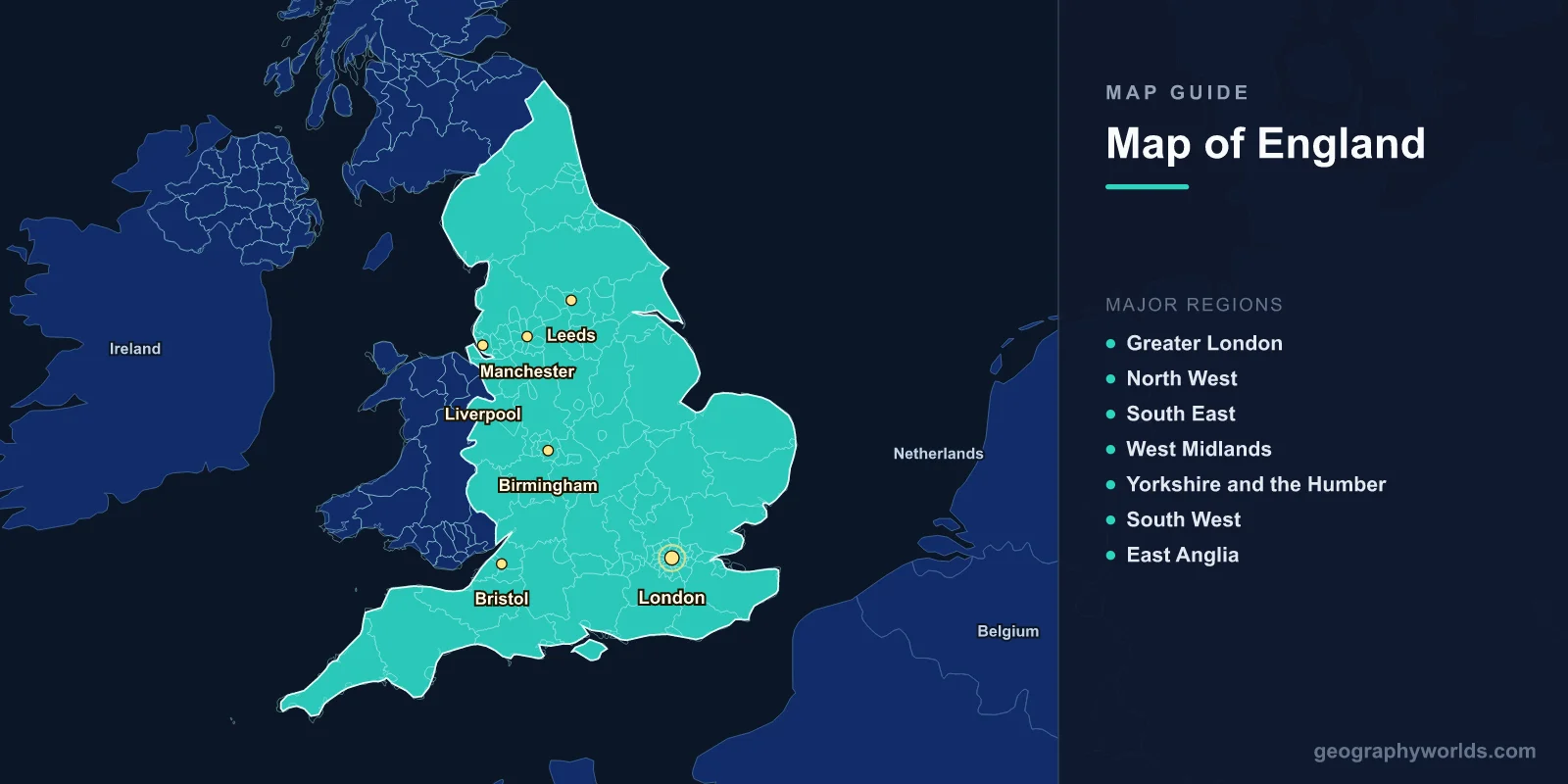
England is the largest and most populous country within the United Kingdom, covering 130,279 km2 (50,301 sq mi) with a population of approximately 56.5 million. The capital is London (51.5074°N, 0.1278°W). A map of England shows 48 ceremonial counties, 10 national parks, and coastlines along the North Sea, English Channel, Irish Sea, and Celtic Sea.
Introduction
England is bordered by Scotland to the north and Wales to the west, with the rest surrounded by water. The country’s geography ranges from the mountainous Lake District and Pennine hills in the north to the flat fenlands of East Anglia and the rolling chalk downs of the south. Major rivers include the Thames, Severn, Trent, and Great Ouse.

Geographic Overview
- Area: 130,279 km2 (50,301 sq mi)
- Population: 56.5 million (2024)
- Capital: London
- Coordinates: 52.3555°N, 1.1743°W
- Highest Point: Scafell Pike, 978 m (Lake District)
- Coastline: ~3,200 km
England’s terrain is predominantly low-lying, especially in the south and east, with the highest ground in the north and west. The Pennines, often called the "backbone of England," run north-south through the center. The chalky North and South Downs, the limestone Cotswolds, and the granite tors of Dartmoor provide additional topographic diversity.
Major Regions
- Greater London: Capital region; 8.8 million; 1,572 km2
- North West: Manchester, Liverpool; Lake District
- South East: Populous commuter belt; Kent, Surrey, Sussex
- West Midlands: Birmingham metro; industrial heartland
- Yorkshire and the Humber: Leeds, Sheffield, York; Pennines
- South West: Cornwall, Devon, Somerset; longest coastline
- East Anglia: Norfolk, Suffolk; flat agricultural land; the Fens
England is divided into nine official regions for statistical and administrative purposes. Population density varies enormously—from over 5,500 people per km2 in London to fewer than 75 per km2 in Northumberland. The north-south economic divide remains a significant geographic theme in English society and politics.
Major Cities
- London: Capital; 8.8 million; financial and cultural center on the Thames
- Birmingham: 1.15 million; second city; West Midlands
- Manchester: 550,000 (city), 2.8 million (metro); industrial heritage
- Leeds: 810,000; Yorkshire’s largest city
- Liverpool: 490,000; major port on the Mersey
- Bristol: 470,000; southwest England; aerospace and tech hub
London dominates England’s geography as the political, economic, and cultural center. It sits on the Thames estuary, 75 km from the North Sea. The "Northern Powerhouse" cities of Manchester, Leeds, Liverpool, and Sheffield form a major urban corridor along the M62 motorway. Historic cities like Oxford, Cambridge, Bath, and York draw millions of visitors annually.
Bodies of Water & Natural Features
- Thames: 346 km; flows through London to the North Sea
- Severn: 354 km; longest river in Great Britain; shared with Wales
- Lake District: 16 major lakes; Windermere is England’s largest lake (14.7 km2)
- The Fens: Flat, low-lying marshland in eastern England; much below sea level
- White Cliffs of Dover: Iconic chalk cliffs; 110 m high; face France across the Channel
- Pennines: Upland chain running 400 km from Peak District to Cheviot Hills
England’s 10 national parks protect landscapes from the granite moors of Dartmoor to the limestone pavements of the Yorkshire Dales. The Norfolk Broads is a network of navigable rivers and lakes formed by medieval peat excavation. The English coastline includes dramatic features such as the Jurassic Coast (a UNESCO World Heritage Site) and the white cliffs of the southeast.
Bordering Countries
- Scotland: Northern border; runs from the Solway Firth to the River Tweed
- Wales: Western border; roughly follows Offa’s Dyke
- France: Nearest continental neighbor; 34 km across the English Channel
- Ireland: Across the Irish Sea to the west
England shares the island of Great Britain with Scotland and Wales. The Channel Tunnel, opened in 1994, provides a 50 km rail link to France beneath the English Channel. England’s island geography has profoundly influenced its history, providing natural defense while encouraging maritime exploration and trade.
Key Facts
- England is the most densely populated country in the UK with 434 people per km2.
- The Lake District became a UNESCO World Heritage Site in 2017.
- London is built on a basin of clay, sand, and gravel deposited over millions of years.
- England has 10 national parks covering about 10% of its land area.
- The Jurassic Coast in Dorset and Devon spans 185 million years of geological history.
Fun Facts
- England’s shortest river, the River Bain in Yorkshire, is just 4 km long.
- The Isles of Scilly, 45 km off Cornwall, have a frost-free microclimate that supports subtropical gardens.
- The Humber estuary is the largest estuary by area in England at 305 km2.
- Doggerland, a landmass now beneath the North Sea, connected England to continental Europe until about 8,000 years ago.
Final Thoughts
England’s map tells the story of a geographically compact but extraordinarily varied country—from the volcanic rocks of the Lake District to the chalk downs of the south, from the industrial cities of the Midlands to the remote coastlines of Cornwall and Northumberland. Understanding its counties, rivers, and national parks is essential for anyone studying British geography.
Test Your Geography Knowledge!
Think you know your maps? Try our interactive geography games!
Play Geography Games →