
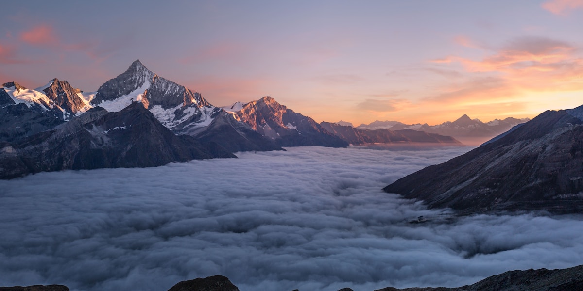
The Himalayas stretch approximately 2,400 kilometers across South Asia and contain all 14 peaks above 8,000 meters, including Mount Everest at 8,849 meters. Formed by the collision of the Indian and Eurasian plates beginning roughly 50 million years ago, they continue to rise by several millimeters per year.
Introduction
The Andes extend approximately 7,000 kilometers along the western edge of South America, making them the longest continental mountain range on Earth. Their highest peak, Aconcagua, reaches 6,961 meters — the highest point outside Asia. The Andes are volcanic, sitting along the Pacific Ring of Fire, while the Himalayas are not.

Size & Geography
- Himalayas Length: ~2,400 km
- Andes Length: ~7,000 km
- Himalayas Highest Peak: Mount Everest, 8,849 m
- Andes Highest Peak: Aconcagua, 6,961 m
- Himalayas Countries: India, Nepal, Bhutan, China, Pakistan
- Andes Countries: Venezuela, Colombia, Ecuador, Peru, Bolivia, Chile, Argentina
The Andes are nearly three times longer than the Himalayas but almost 1,900 meters lower at their highest point. The Andes run from roughly 10°N to 55°S, crossing virtually every climate zone from tropical to subantarctic. The Himalayas span from roughly 27°N to 36°N, entirely within the subtropics and mid-latitudes.
The Himalayas are far more concentrated in their extreme elevation. All 14 peaks over 8,000 meters and over 100 peaks over 7,200 meters are packed into a relatively short span. The Andes spread their elevation over a much larger area, with the Altiplano of Bolivia and Peru creating the world's second-highest plateau after Tibet.
Himalayas Profile
- Age: ~50 million years (still rising)
- Peaks Above 8,000 m: All 14 on Earth
- Glaciers: ~15,000
- Rivers Fed: Ganges, Indus, Brahmaputra, Mekong, Yangtze
The Himalayas are the youngest major mountain range on Earth, formed when the Indian plate began colliding with the Eurasian plate. This collision continues today, pushing the Himalayas upward at a rate of about 5 millimeters per year. The force of this collision is so great that it has raised marine fossils from the ancient Tethys Sea to the summit of Everest.
Himalayan glaciers, sometimes called the "Third Pole," provide water to over 1.5 billion people. The meltwater feeds Asia's greatest rivers: the Ganges, Indus, Brahmaputra, Mekong, and Yangtze. Climate change is causing these glaciers to retreat rapidly, threatening the water supply of a significant fraction of humanity.
Andes Profile
- Age: ~200 million years (ongoing subduction)
- Highest Volcano: Ojos del Salado, 6,893 m (world's highest active volcano)
- Altiplano Elevation: 3,700 m average
- Lake Titicaca: 3,812 m (highest navigable lake)
The Andes were formed by the subduction of the Nazca Plate beneath the South American Plate, a process that continues to generate earthquakes and volcanic eruptions. The range contains hundreds of volcanoes, dozens of which are active. Ojos del Salado on the Chile-Argentina border is the world's highest active volcano at 6,893 meters.
The Andes created unique high-altitude environments that supported advanced civilizations. The Inca Empire, centered on Cusco at 3,400 meters, built Machu Picchu, an extensive road network, and agricultural terraces that fed millions. The Altiplano, where Lake Titicaca sits at 3,812 meters, has been continuously inhabited for over 10,000 years and is the highest region of dense human settlement on Earth.
Key Differences
- Height vs Length: Himalayas far higher; Andes nearly 3x longer
- Volcanism: Andes highly volcanic; Himalayas have no active volcanoes
- Formation: Himalayas: continent-continent collision; Andes: oceanic-continental subduction
- Population at Altitude: Both support millions at high elevation; Andes more densely settled above 3,000 m
The geological processes forming these ranges differ fundamentally. The Himalayas result from two continental plates colliding head-on, which is why they are so high — continental crust is too buoyant to subduct, so it crumples and thickens. The Andes form from oceanic crust subducting beneath continental crust, generating volcanism and building the range through both uplift and volcanic accumulation.
The Andes have far more active volcanism. The Himalayas have no active volcanoes because the collision involves two continental plates with no oceanic crust to melt. The Andes sit squarely on the Ring of Fire, with eruptions occurring every few years. This difference means the Andes face volcanic hazards the Himalayas do not, while the Himalayas face more severe seismic hazards from the ongoing continental collision.
Which Is More Impressive?
- Himalayas Advantage: Unmatched height, 14 eight-thousanders, spiritual significance
- Andes Advantage: Greatest length, volcanic drama, Inca heritage, climate diversity
The Himalayas dominate in sheer altitude. Standing at the base of an 8,000-meter peak is an experience of overwhelming scale that nothing in the Andes can match. The religious and cultural significance of the Himalayas across Hinduism, Buddhism, and other traditions adds a spiritual dimension. Everest, K2, and Annapurna are among the most famous mountains on Earth.
The Andes excel in diversity and cultural richness. No other mountain range spans so many climate zones, from tropical glaciers in Colombia to subantarctic ice fields in Patagonia. The Inca civilization created some of the most remarkable high-altitude architecture in human history. The Atacama Desert, the Altiplano, Patagonia's glaciers, and the Amazon headwaters all lie within or alongside the Andes.
Key Facts
- The Himalayas contain all 14 peaks above 8,000 m; the Andes' highest peak (Aconcagua) is 6,961 m.
- The Andes are nearly 3 times longer than the Himalayas (7,000 km vs 2,400 km).
- The Himalayas formed from continent-continent collision; the Andes from oceanic-continental subduction.
- Himalayan glaciers supply water to 1.5 billion people; Andean glaciers supply water to ~50 million.
- The Andes have hundreds of active volcanoes; the Himalayas have none.
Fun Facts
- Mount Everest's summit contains limestone with marine fossils from an ancient seabed.
- The Andes' Atacama Desert receives less than 1 mm of rain per year in some areas — the driest place on Earth.
- Both ranges continue to grow: the Himalayas at ~5 mm/year, the Andes at 1-3 mm/year.
- Lake Titicaca at 3,812 m in the Andes has been continuously settled for over 10,000 years.
Final Thoughts
The Himalayas and the Andes are Earth's two mightiest mountain ranges, each supreme in different dimensions. The Himalayas are the highest, the youngest, and the most concentrated expression of tectonic power on the planet. The Andes are the longest, the most volcanically active, and the most climatically diverse mountain range on Earth. Together, they define the extremes of what mountains can be.
Test Your Knowledge!
Think you can tell geographic features apart? Test your knowledge!
Play Geography Games →