
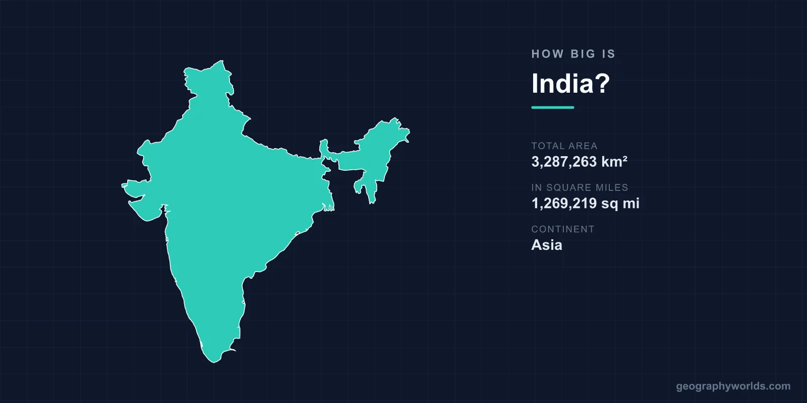
India covers 3,287,263 km² (1,269,219 sq mi), which makes it the seventh-largest country in the world, behind Russia, Canada, China, the United States, Brazil and Australia. It measures 3,214 km from north to south and 2,933 km from east to west. That is about a third of the area of the United States, roughly five times the size of France and about 13 times the size of the United Kingdom. Yet India is also the most populous country on Earth, so this fairly large territory holds around one person in every six alive today.
3,287,263 km²: What the Official Figure Counts
The headline area is the figure used in standard world rankings of countries by area. It splits into about 2,973,190 km² of land and 314,070 km² of inland water, so rivers, lakes and reservoirs make up roughly 9.6 percent of the total. That water share is high for a large country. Brazil's is 0.6 percent and Australia's 0.8 percent, a sign of how much of India is shaped by the Ganges–Brahmaputra system and by the reservoirs built across the Deccan.
The total also includes territory that India claims but does not control. India claims the whole of the former princely state of Jammu and Kashmir, including areas administered by Pakistan (Gilgit-Baltistan and Azad Kashmir) and by China (Aksai Chin). The 3,287,263 km² figure counts those areas. A total based only on land India actually administers would be smaller, and Pakistan's published area of 882,363 km² also counts the parts of Kashmir that Pakistan administers. India's area is best read as its official claimed extent, and the dispute is the reason different sources publish slightly different totals.
At sea, India's territorial waters run 12 nautical miles (22.2 km) out from the coastal baseline. Its exclusive economic zone covers 2,305,143 km², the 18th-largest in the world and equal to about 70 percent of its land area again. Much of that comes from the Andaman and Nicobar Islands, some 1,200 km southeast of the mainland, and the Lakshadweep group off Kerala.
Kanyakumari to Indira Col: Measuring India End to End
India spans from 8°4′ N on the mainland to 37°6′ N, and from 68°7′ E to 97°25′ E. The 3,214 km north–south measurement runs from the Himalaya down to Cape Comorin near Kanyakumari in Tamil Nadu, where the Arabian Sea, the Indian Ocean and the Bay of Bengal meet. Kanyakumari is the only one of India's extreme points with a town on it; the others are remote, mostly uninhabited ground.

The northernmost point India administers is near Indira Col on the Siachen Glacier in Ladakh, ground that Pakistan also claims. The southernmost point of the whole country is not on the mainland at all. It is Indira Point on Great Nicobar Island, at about 6°45′ N and only about 145 km from Rondo Island, Indonesia's northernmost island off Sumatra. In the west, the country ends in the swampy mouths of Sir Creek in Kutch district, Gujarat, where Guhar Moti is the westernmost inhabited settlement. The easternmost point India administers is near the Diphu Pass, east of Kibithu in Arunachal Pradesh, close to where India, Myanmar and Tibet meet. China claims part of Arunachal Pradesh as well.
The outline is just as long. India's land frontier runs about 15,200 km. The border with Bangladesh alone is 4,096.7 km, the border with Pakistan 3,323 km, the Line of Actual Control with China about 4,057 km, the border with Myanmar 1,643 km and the border with Bhutan 699 km. The coastline adds 7,516.6 km, stretching from the Rann of Kutch around to the Sundarbans.
India Against the Six Countries Larger Than It
Seventh place hides a big gap. The six countries ahead of India are far larger, and India sits much closer to the countries just below it. Russia is about 5.2 times India's size. Canada is just over three times, and China and the United States each about 2.9 times. Brazil is roughly 2.6 times larger and Australia, the sixth, about 2.35 times.
Just below India, Argentina covers 2,780,400 km², so India is about 18 percent larger. Kazakhstan, the largest landlocked country, covers 2,724,910 km². Among countries that lie wholly in Asia, only China is bigger.
The neighbours make India look much bigger. India is about 3.7 times the size of Pakistan (882,363 km²), about 22 times Bangladesh (148,460 km²) and about 49 times Sri Lanka (67,240 km²). One popular comparison does not hold up, though. India is not larger than the European Union. The EU's 27 members cover 4,233,255 km², so India is about 78 percent of the EU's size.
Rajasthan, Maharashtra and Uttar Pradesh: States the Size of Countries
India has 28 states and 8 union territories, and its biggest states are as large as whole European countries. Rajasthan, the largest state, covers about 342,239 km², only slightly less than Germany's 357,581 km². Madhya Pradesh (308,252 km²) and Maharashtra (307,713 km²) are each a little larger than Italy (302,068 km²). Uttar Pradesh covers 240,928 km², almost exactly the size of the United Kingdom (244,376 km²). At the 2011 census it had 199.6 million people, about three times the UK's population today on about the same area.
The smallest units are tiny by comparison. Goa, the smallest state, covers 3,702 km², roughly a hundredth of Rajasthan. The smallest union territory, the Lakshadweep islands, has just 32 km² of land. Ladakh, carved out in 2019 by the Jammu and Kashmir Reorganisation Act, is the largest union territory at about 59,146 km². Most of it is high, cold desert north of the Great Himalaya.
From the Thar to the Deccan: Where All That Space Goes
A lot of India's area is in a few huge landscapes. The Deccan Plateau covers about 422,000 km² of the peninsula, between the Satpura and Vindhya ranges in the north and the Western and Eastern Ghats on either side. That one plateau is bigger than Germany, and it takes in most of Maharashtra, Karnataka, Telangana and Andhra Pradesh.
The Thar Desert, also called the Great Indian Desert, covers 264,091 km² across India and Pakistan. About two-thirds of it lies in India, mostly in Rajasthan, which works out to roughly six percent of the country's area. South of the Thar, the salt flats of the Rann of Kutch in Gujarat mark the western edge of the land frontier with Pakistan.

The vertical range is just as wide. Kangchenjunga, on the border between Sikkim and Nepal, rises to 8,586 m. It is the third-highest mountain on Earth and the highest point on territory India administers; India also claims K2 (8,611 m), which lies in the Karakoram between Pakistan-administered Gilgit-Baltistan and China-administered territory. The lowest point is Kuttanad in Kerala's Alappuzha district, a delta of paddy fields farmed below sea level. The list of India's extreme points puts its lowest spot at about 2.2 m below the sea. Between them, the climate runs from equatorial in the far south to alpine and tundra in the high Himalaya.
The land itself is still moving. India sits on the Indian Plate, which broke away from Gondwana and began drifting north about 90 million years ago at around 15 cm a year. It hit Asia 50 to 55 million years ago, and that collision raised the Himalaya and the Tibetan Plateau. The plate is still moving northeast at about 5 cm a year.
One Clock Across 29 Degrees of Longitude
India's east–west width of 2,933 km covers more than 29 degrees of longitude. In time, that should be close to two hours. Yet the whole country keeps a single time zone, Indian Standard Time, at UTC+5:30, with no daylight saving. IST was adopted on 1 January 1906 and confirmed for the whole country after independence in 1947, although Kolkata and Mumbai kept their own local times until 1948 and 1955.
The reference meridian is 82°30′ E, which passes near Mirzapur in Uttar Pradesh. It was chosen because it lies between western India, whose solar time is close to UTC+5, and the northeast, whose solar time is close to UTC+6. As a result, the sun rises and sets almost two hours earlier in Arunachal Pradesh than in the Rann of Kutch. People in the northeastern states have long argued for a separate zone. Researchers in the late 1980s proposed two or three time zones, but the recommendation was not adopted. The debate is covered in our guide to why India has a single time zone.
1.45 Billion People on 2.2 Percent of the Land
In area alone, India is a large but not huge country. It covers about 2.2 percent of Earth's roughly 149 million km² of land. Its population is what sets it apart. India overtook China as the most populous country in the early 2020s. The UN's population dashboard put it at slightly over 1.428 billion on 1 July 2023, and the UN's 2024 estimate is about 1.45 billion. That is roughly one-sixth of humanity on about one-forty-fifth of the planet's land.
India has about 441 people per km². That is nearly three times China's density, roughly 12 times that of the United States and more than a hundred times Australia's, even though Australia has more than twice India's area. Among India's neighbours, only Bangladesh, at about 1,333 per km², is far more crowded. So when people talk about India's size, they usually mean two things: a territory of 3.29 million km² and a population that makes it feel even bigger. China covers almost three times as much ground with a similar number of people, a contrast set out in full in is India bigger than China?, and the countries along India's 15,200 km frontier are described one by one in our guide to the countries that border India.