
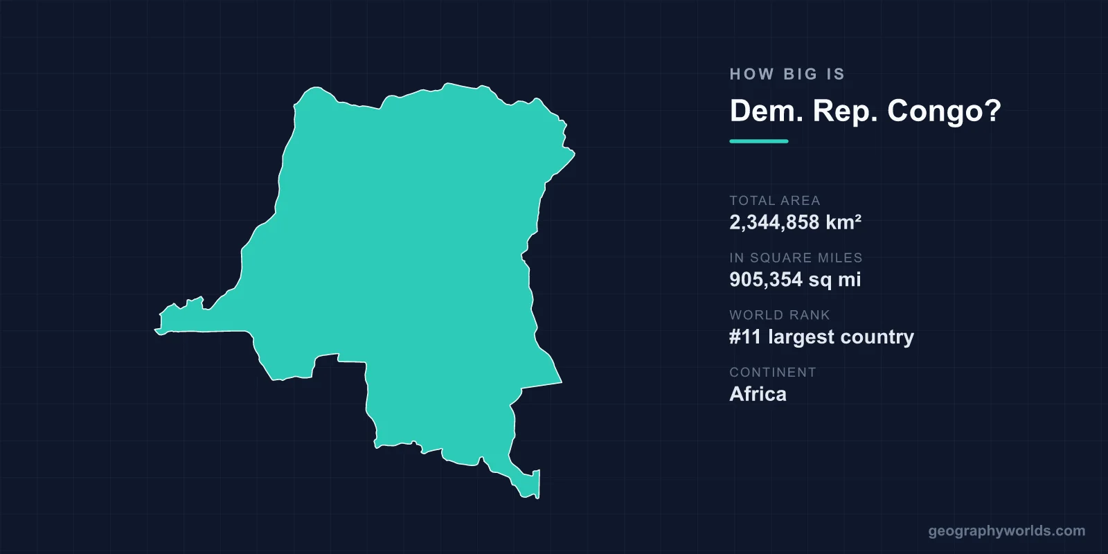
The Democratic Republic of the Congo covers 2,344,858 km², or 905,354 square miles, making it the 11th largest country in the world and the largest in sub-Saharan Africa. That is roughly the size of Western Europe, about a quarter of the United States, and more than four times the size of France. It also has around 37 kilometres of coastline, which is the shortest of any country of comparable size anywhere on earth.
Large Enough to Need Two Time Zones
The DRC spans roughly 2,300 kilometres east to west and a similar distance north to south, straddling the equator, and it is one of relatively few African countries divided into two time zones. Kinshasa in the west runs an hour behind Lubumbashi and Goma in the east.
Distances inside the country are continental. Kinshasa to Lubumbashi is about 1,550 kilometres in a straight line, and Kinshasa to Goma about 1,570 — further than London to Athens. There is no through road connecting them, so the practical options are flying or a multi-modal journey by river, rail and road that can take weeks.
The Coastline Problem
A country of 2.3 million square kilometres has a sea frontage of about 37 kilometres, at the mouth of the Congo river between Angola proper and the Angolan exclave of Cabinda.
This is a direct product of the Berlin Conference. King Leopold II needed his Congo Free State to have access to the Atlantic, and the settlement granted a corridor to the river mouth — enough to claim a coast, not enough to build a modern port economy on. The port of Matadi lies upriver and is limited by the channel; Banana on the coast is small.
The consequence is that a vast, resource-rich country exports much of its mineral output overland through other states — south through Zambia to South African ports, west through Angola on the Lobito railway, or east through Tanzania and Kenya.
Comparisons That Land
- Western Europe — France, Germany, Spain, Italy, the UK, Belgium, the Netherlands and Switzerland together come to roughly 2.4 million km², about the same.
- The United States is around 9.8 million km², so the DRC is about a quarter of it — comparable to the land east of the Mississippi.
- Greenland at 2,166,086 km² is slightly smaller.
- India at 3,287,263 km² is around 40 per cent larger.
- Belgium, which ruled it, is 30,528 km² — the DRC is about 77 times larger than its former coloniser.
The Rivers Are the Roads
The Congo river and its tributaries provide something on the order of 15,000 kilometres of navigable waterway, and for much of the country this network is the transport system rather than a supplement to it.
The river is the second longest in Africa and by a wide margin the deepest in the world, exceeding 220 metres in places. It is also the second largest by discharge after the Amazon, and because it crosses the equator twice, it has tributaries in both hemispheres experiencing rainy seasons at different times — which gives it a remarkably steady flow year-round.
What it does not offer is an unbroken route to the sea. The Livingstone Falls below Kinshasa — a series of rapids dropping some 270 metres over about 350 kilometres — make the lower river unnavigable, which is why Kinshasa exists where it does and why the colonial railway to Matadi was built.
The Forest
Around half the country is forested, and the DRC holds the largest share of the Congo Basin rainforest — the second-largest tropical forest on earth after the Amazon. That amounts to well over a million square kilometres inside this one country.
The Cuvette Centrale peatlands, mapped in detail only in the 2010s and shared with the Republic of the Congo, cover an area larger than England and store an estimated 30 billion tonnes of carbon, making them one of the most significant carbon stores anywhere.
The forest's scale is why the country's area matters globally rather than only regionally, and why concessions, logging rules and oil exploration blocks in the peatlands attract international attention out of proportion to their commercial value.
Neighbours: Nine of Them
The DRC borders nine countries — the Republic of the Congo, the Central African Republic, South Sudan, Uganda, Rwanda, Burundi, Tanzania, Zambia and Angola — which is among the highest counts in the world and a direct function of its size and central position.
Its border with the Republic of the Congo produces one of geography's standard trivia answers: Kinshasa and Brazzaville face each other across the Congo river and are the closest pair of capital cities in the world other than Rome and Vatican City, separated by a few kilometres of water.
The Lakes Along the Eastern Edge
The eastern boundary runs through the Albertine Rift, and the DRC's share of the rift lakes is substantial: Lake Tanganyika, the second deepest and second oldest lake in the world, along with Lakes Kivu, Edward and Albert.
Inland water accounts for around 3.3 per cent of the country's surface. The rift also supplies the country's highest ground — the Rwenzori range on the Ugandan border rises to Margherita Peak at 5,109 metres, one of the very few places on the equator with permanent glaciers, though those glaciers have retreated dramatically and are expected to disappear.
A Country Once Owned by One Man
The DRC's borders were fixed at the Berlin Conference of 1884 to 1885, and the territory was recognised as the personal property of Leopold II of Belgium rather than of Belgium itself. The Congo Free State was, for over two decades, an area the size of Western Europe held as private property.
Its administration for rubber and ivory involved forced labour, hostage-taking and mutilation on a scale that produced one of the first international human rights campaigns. Estimates of the population decline over the period run into the millions, and the atrocity reporting eventually forced Belgium to annex the territory in 1908.
The borders drawn in Berlin are the ones the country has today.
What Is Underneath
The area matters because of its contents. The DRC produces the large majority of the world's cobalt, is Africa's largest copper producer, and holds significant reserves of tantalum, tin, tungsten, gold and diamonds.
The copper and cobalt are concentrated in the Katanga region in the south-east, part of the Central African Copperbelt shared with Zambia. The tin, tantalum and tungsten of the eastern provinces have financed armed groups for three decades, which is the origin of the conflict-minerals reporting requirements now embedded in electronics supply chains.
Governing an Area That Size
The practical problem of the DRC's size is administration. The country was reorganised from 11 provinces into 26 in 2015, partly to bring government closer to populations that were days of travel from a provincial capital.
Road density is among the lowest in the world for a country of its area, and large regions have no functioning connection to the capital. It is not a coincidence that the eastern provinces — 1,500 kilometres from Kinshasa and adjacent to Rwanda and Uganda — have been the least governed and the most fought over.
Protected Areas the Size of Countries
The DRC's national parks are proportionate to the country. Salonga, in the central basin, covers around 36,000 km² — larger than Belgium — and is the largest protected tropical rainforest reserve in Africa, accessible essentially only by river.
Virunga in the east, Africa's oldest national park, founded in 1925, covers about 7,800 km² and spans terrain from swamp to the glaciers of the Rwenzori, holding mountain gorillas, the Nyiragongo volcano and a lava lake. Five Congolese sites are UNESCO World Heritage, and all five have spent years on the list of sites in danger.
Okapi Wildlife Reserve in the Ituri forest covers around 13,700 km² and protects the okapi, a forest giraffe found nowhere else. Garamba in the north-east was where the last northern white rhinos in the wild lived before poaching removed them.
Together these amount to a protected estate larger than many European countries, guarded by ranger forces that have suffered severe casualties — more than two hundred Virunga rangers have been killed on duty.
Almost No Railway, and Very Little Road
For a country of 2.3 million square kilometres, the DRC's land transport network is close to negligible. Estimates of paved road put the total in the low thousands of kilometres — a country the size of Western Europe with less surfaced road than a mid-sized European nation.
The rail network, built in segments under colonial rule to move minerals rather than to connect the country, runs to a few thousand kilometres in disconnected pieces: the Matadi-Kinshasa line around the unnavigable rapids, the Katanga network in the south-east linking to Zambia and Angola, and isolated stretches in the east. There is no single railway running the length or breadth of the country.
The consequence is that internal trade is often harder than international trade. Goods reach the eastern cities from Uganda, Rwanda and Tanzania rather than from Kinshasa, and Katanga's minerals leave through Zambia, Angola or Tanzania. A country this large without internal connections functions less as one economy than as several oriented toward different neighbours — which is the practical root of its persistent regionalism.
Western Europe, Governed From One Corner
2,344,858 km², 11th in the world, the largest country in sub-Saharan Africa and the second largest in Africa after Algeria. Big enough to hold Western Europe, forested across half its extent, and connected to the ocean by 37 kilometres of shore.
The gap between the size of the territory and the reach of the state is the central fact of Congolese history, and it was designed in that way from the beginning. A wider account sits in our DR Congo country guide, and the waterway that is still the country's main road is traced in our Congo river guide.
