
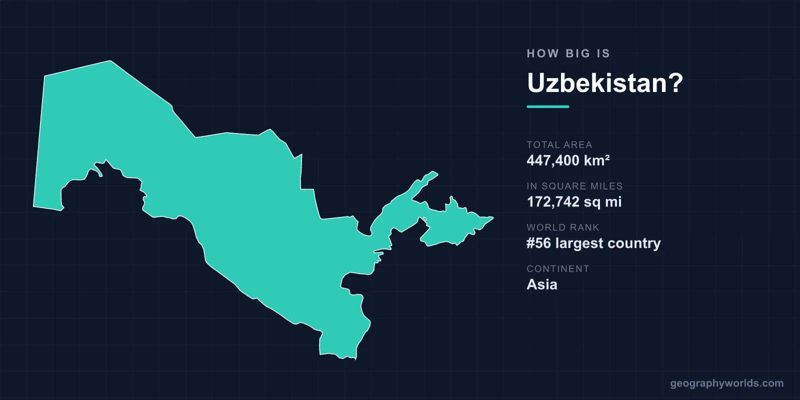
Uzbekistan covers 447,400 km², or 172,742 square miles, making it the 56th largest country in the world. That is close to the size of Sweden or Morocco, and slightly larger than California. It is also one of only two countries on earth that are doubly landlocked — surrounded entirely by other landlocked countries, so that reaching an ocean requires crossing at least two international borders.
Doubly Landlocked
Uzbekistan borders Kazakhstan, Kyrgyzstan, Tajikistan, Afghanistan and Turkmenistan. Every one of those five is itself landlocked. The only other country in this position is Liechtenstein, surrounded by Switzerland and Austria.
The nearest sea access involves crossing Turkmenistan to the Caspian — which is itself an enclosed body of water, so that does not really count — or crossing Afghanistan to Pakistan, or Kazakhstan and Russia to the Black Sea, or China to the Pacific.
The practical effect is that Uzbek exports of cotton, gold, gas and, increasingly, manufactured goods travel enormous distances overland. It is the geographic condition that most shapes the country's economy and its foreign policy, and it is why relations with Kazakhstan and the reopening of the Tajik and Afghan borders after 2016 mattered so much.
Sweden, Almost Exactly
- Sweden (450,295 km²) is almost exactly the same size.
- California (423,967 km²) is slightly smaller.
- Morocco (446,550 km²) is within a thousand square kilometres.
- Kazakhstan (2,724,900 km²), next door, is more than six times larger.
- Spain (505,992 km²) is about 13 per cent larger.
A Sea That Disappeared From the Map
The most dramatic change to Uzbekistan's area in modern times was not a border adjustment. The Aral Sea, shared with Kazakhstan, was the fourth-largest lake in the world in 1960, covering around 68,000 km².
Soviet irrigation schemes diverted the Amu Darya and Syr Darya to grow cotton in the desert, and the sea began to shrink. By the 2000s it had split into separate bodies; by 2014 the eastern basin — the part in Uzbekistan — had dried completely for the first time in modern record.
What replaced it is the Aralkum, a new desert of some tens of thousands of square kilometres covered in salt and agricultural chemical residue, which the wind lifts and deposits across the region. Rusting fishing vessels sit on sand at Moynaq, which was a port.
Uzbekistan's land area did not formally change, because the lake bed was already inside its boundaries. What changed is what that land is.
Mostly Desert
Around four-fifths of Uzbekistan is desert or semi-desert. The Kyzylkum — the red sand — covers a large part of the centre and north, shared with Kazakhstan and Turkmenistan, and is one of the largest deserts in Asia.
Arable land is roughly a tenth of the total, and almost all of it depends on irrigation. The country has one of the highest ratios of irrigated to cultivated land anywhere, which is the legacy of the cotton monoculture imposed under Soviet planning and only partially unwound since.
The east is different. The Tian Shan and Gissar-Alai ranges reach into the country from Kyrgyzstan and Tajikistan, rising above 4,600 metres, and their snowmelt is where the water comes from.
The Valley That Three Countries Share
The Fergana Valley in the east is the most fertile and most densely populated part of Uzbekistan, and it is divided between Uzbekistan, Kyrgyzstan and Tajikistan by boundaries drawn during Soviet national delimitation in the 1920s and 1930s.
Those lines were internal administrative divisions adjusted repeatedly for irrigation and cotton administration, and they became international borders overnight in 1991. The result is a tangle of enclaves — Uzbek territory inside Kyrgyzstan at Sokh and Shakhimardan, Tajik territory at Vorukh — and roads that cross frontiers several times in a few kilometres.
The valley holds a large share of the region's population on a small share of its area, and the disputes over its water and its boundaries have produced repeated violence, including two short wars between Kyrgyzstan and Tajikistan in the 2020s.
Two Rivers, Both of Them Shared
The Amu Darya and the Syr Darya define Uzbek agriculture, and neither rises in Uzbekistan. The Amu Darya forms part of the southern border with Afghanistan and Turkmenistan; the Syr Darya comes in from Kyrgyzstan through Tajikistan.
This puts Uzbekistan downstream of everybody. Under Soviet planning the upstream republics released water in summer for irrigation and received fuel in winter in exchange; after 1991 that arrangement collapsed, and Tajikistan's Rogun dam and Kyrgyzstan's Toktogul reservoir became sources of serious friction, with Tashkent warning publicly about water conflict.
Relations improved markedly after 2016, with Uzbekistan dropping its objection to Rogun, but the underlying dependence has not changed.
Karakalpakstan
The autonomous republic of Karakalpakstan in the north-west covers around 166,000 km² — over a third of Uzbekistan, larger than England and Wales combined — and holds a small fraction of the population.
It contains most of the dried Aral bed and most of the Kyzylkum, and it has suffered the worst of the environmental collapse: salinised soils, contaminated groundwater and elevated rates of respiratory and kidney disease.
Its constitutional right to secede by referendum became the subject of proposed amendments in 2022, which triggered protests in Nukus that were suppressed with deaths; the government withdrew the proposal.
The Cities on the Silk Road
Uzbekistan's historical significance has always been about position rather than size. Samarkand, Bukhara and Khiva sat on the overland routes between China, India, Persia and the Mediterranean, and all three are UNESCO World Heritage sites.
They exist where they do because of water — oases fed by rivers running off the mountains into desert — and the distance between them is the distance a caravan could manage between reliable wells. A country that is mostly desert has its entire urban history arranged along a thin thread of irrigated land.
The Most Populous State in the Region
With around 38 million people, Uzbekistan has more inhabitants than any other Central Asian state — more than Kazakhstan, which is six times its size — at a density of roughly 84 per square kilometre.
The distribution is extreme. The Fergana Valley and the Tashkent and Samarkand regions hold the large majority; Karakalpakstan and the Kyzylkum are nearly empty. A national density figure for a country four-fifths desert describes nowhere in particular.
What the Desert Holds
Uzbekistan's apparently empty area is not economically empty. The Muruntau mine in the Kyzylkum is one of the largest open-pit gold mines in the world, producing on a scale that makes Uzbekistan a significant global gold producer, and the pit is visible from orbit.
The country also holds substantial natural gas reserves, principally in the Bukhara-Khiva region and around Ustyurt, and was for years among the larger gas producers outside the major exporters, supplying Russia, China and its neighbours. Uranium, copper and molybdenum are mined in the same desert belt.
The pattern is consistent: the population is concentrated on a small share of irrigated land in the east and south, while the value extracted from the territory comes disproportionately from the four-fifths that nobody lives in.
A Country Built on Twelve Regions
Uzbekistan is divided into twelve provinces, the autonomous republic of Karakalpakstan and the city of Tashkent. The sizes are wildly uneven, which follows directly from the geography.
Navoiy province, covering the central Kyzylkum, is around 111,000 km² — larger than Bulgaria — with a small population. Andijan in the Fergana Valley is about 4,200 km², roughly a twenty-sixth the size, and holds substantially more people.
Tashkent, the capital, is the largest city in Central Asia with something over 2.5 million people, and it was rebuilt substantially after an earthquake destroyed much of it in 1966 — which is why a city on the Silk Road has the layout and architecture of a Soviet planned capital.
The Border Nobody Had Drawn
Uzbekistan's frontiers are among the least finished in Asia. Soviet delimitation in the 1920s and 1930s treated them as administrative conveniences and adjusted them repeatedly by decree, sometimes leasing rather than ceding land, and the paperwork did not always survive.
When those lines became international in 1991, substantial stretches had no agreed description. The boundary with Kyrgyzstan was only fully settled in the 2020s after years of negotiation and land swaps, and the Tajik border was mined by Uzbekistan after incursions in 1999 and 2000, killing civilians for years afterwards before demining began.
The enclaves are the sharpest expression of the problem. Sokh, an Uzbek enclave inside Kyrgyzstan, covers around 325 km² and holds tens of thousands of people, most of them ethnically Tajik, governed from Tashkent and reachable only across Kyrgyz territory. Shakhimardan is a second, smaller Uzbek enclave nearby. Any figure for Uzbekistan's area includes these fragments, which sit inside another country entirely.
Ordinary Area, Extraordinary Position
447,400 km², 56th in the world, the size of Sweden — mostly desert, entirely dependent on rivers that begin abroad, and two borders away from any ocean.
The area is ordinary; the position is not. Uzbekistan is the clearest case anywhere of a country whose geography is defined by what surrounds it rather than by how much of it there is. Uzbekistan more broadly is our Uzbekistan country guide, and the routes its cities were built to serve are described in the geography of the Silk Road.
