
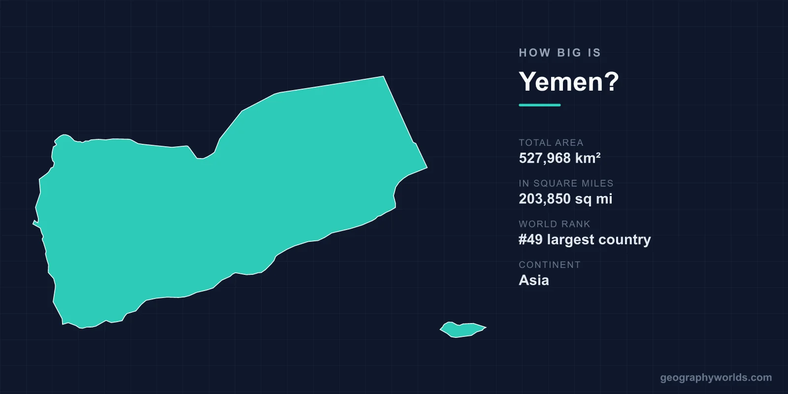
Yemen covers 527,968 km², or 203,850 square miles, making it the 49th largest country in the world. That is larger than Spain, larger than Thailand, and roughly the size of France plus Belgium. It occupies the south-western corner of the Arabian Peninsula, and the figure includes the island of Socotra, 350 kilometres off the Horn of Africa.
Where It Sits in the Table
Yemen slots in just above Spain (505,992 km²) and Thailand (513,120 km²), and just below France (551,695 km²). California, at 423,967 km², would fit inside it with around 100,000 km² to spare.
The comparison that shapes Yemeni politics is with Saudi Arabia next door, at 2,149,690 km² — more than four times larger, with a smaller population and vastly greater revenue. Yemen has around a quarter of the peninsula's people on roughly a fifth of its land, and almost none of its wealth.
Where the Boundary Stops Being Certain
Yemen's area figure has been stable only since 2000. The eastern half of the boundary with Saudi Arabia ran out into the Rub al Khali and was simply undefined for most of the twentieth century — maps showed a dotted line trailing into blank desert.
The Treaty of Jeddah in 2000 fixed it, and the two states demarcated the line. Before that, any area figure for Yemen carried an implicit assumption about where the desert boundary lay.
The western section had been settled earlier and more painfully: the Treaty of Taif in 1934, following a short war, confirmed Saudi control of Asir, Jizan and Najran — provinces Yemeni nationalists regarded as lost territory, amounting to a substantial area that is not in Yemen's total.
Mountains, Not Desert
The common picture of Yemen as desert is wrong for the part where people actually live. The western highlands rise steeply from the Red Sea coastal plain, the Tihama, and reach 3,666 metres at Jabal an-Nabi Shu'ayb near Sanaa — the highest point on the Arabian Peninsula.
Sanaa itself sits at around 2,250 metres, making it one of the highest capitals in the world. The highlands catch monsoon moisture and receive enough rain to support terraced agriculture that has been worked for millennia, which is why this corner of Arabia was called Arabia Felix — fortunate Arabia — by the Romans, in contrast to the deserts to the north.
East and north of the highlands the land falls away into the Rub al Khali, the Empty Quarter, which occupies a large share of Yemen's total area and almost none of its population.
A Country That Is Running Out of Water
Yemen is among the most water-scarce countries on earth, with renewable water availability per person a small fraction of the threshold conventionally used to define absolute scarcity.
There are no permanent rivers. Agriculture depends on seasonal wadi flow, terraced rainwater capture and, increasingly, groundwater pumped from aquifers that are being depleted far faster than they recharge. Water tables under the Sanaa basin have fallen by tens of metres, and the capital has been described for years as a candidate for the first modern city to run out of water.
A large share of irrigation goes to qat, the mildly narcotic leaf chewed by much of the adult population, which is more profitable than food crops and consumes a substantial portion of the country's water.
Socotra
Around 3,600 km² of Yemen's area lies in the Socotra archipelago, closer to Somalia than to the Yemeni mainland and separated from continental land long enough to have developed an extraordinary endemic flora.
Something like a third of its plant species occur nowhere else, including the dragon's blood tree with its inverted-umbrella canopy and the bottle-shaped desert rose. UNESCO inscribed it in 2008.
Its remoteness has kept it largely out of the war, though it has been under the control of the Southern Transitional Council and its Emirati backers for much of the recent conflict, and its strategic position near the approaches to the Gulf of Aden attracts more interest than its size suggests.
The Strait
Yemen's coastline runs roughly 1,900 kilometres, and at its south-western tip it forms one side of the Bab el-Mandeb, about 30 kilometres wide at the narrowest, separating Arabia from Africa.
Something like a tenth of world seaborne trade has historically passed through it, including a large part of the traffic between Asia and the Suez Canal. Perim Island sits in the middle of the strait and is Yemeni territory; Britain garrisoned it from 1857 for exactly that reason.
A country's area tells you nothing about this kind of leverage. Yemen's 49th-place ranking is unremarkable; its position beside a 30-kilometre gap is not.
Two Countries Until 1990
Yemen's present area is the sum of two states. The Yemen Arab Republic in the north, centred on Sanaa, and the People's Democratic Republic of Yemen in the south, centred on Aden and including Hadhramaut and Socotra, were separate countries until unification in May 1990.
South Yemen was much the larger in area and much the smaller in population — a pattern that has shaped the politics of unification ever since, since the south holds most of the oil and most of the land while the north holds most of the people.
A southern secession attempt in 1994 was defeated militarily. Since 2017 the Southern Transitional Council has controlled Aden and much of the former southern territory, and front lines in the current war have at points approximated the pre-1990 boundary.
Hadhramaut Alone
Hadhramaut, the eastern governorate, covers around 193,000 km² — well over a third of the entire country, and larger than Syria or Cambodia. Its population is a small fraction of the national total.
The Wadi Hadhramaut running through it supports a string of towns including Shibam, whose mudbrick tower houses of five to eleven storeys, built in the sixteenth century, earned it the description of the Manhattan of the desert and a UNESCO inscription. The governorate's emptiness is why it has been comparatively insulated from the fighting in the west.
Oil, and Where It Is
Yemen's oil fields lie in the eastern governorates — Marib, Shabwa, Hadhramaut — far from the population centres of the western highlands and from the capital.
That distribution is a significant part of the war's economics. Control of Marib, on the edge of the desert, was fought over for years precisely because the fields and the pipeline to the Red Sea run through it. A country whose resources sit in its emptiest third has a structural problem when the state fragments.
Density, and What the Land Supports
With around 43 million people in 527,968 km², Yemen's average density is roughly 81 per square kilometre — modest. The average is meaningless: the western highlands hold a large majority of the population at densities many times that, while Hadhramaut, Al Mahrah and the desert governorates are nearly empty.
Yemen is also the poorest country in the Arab world and has been the site of one of the largest humanitarian emergencies anywhere, with the great majority of the population needing assistance at points during the current conflict.
The Islands
Beyond Socotra, Yemen's territory includes a scatter of islands in two seas, and several have mattered out of proportion to their size.
Perim, in the Bab el-Mandeb, is about 13 km² and sits in the middle of the strait; Britain occupied it in 1857 to control the passage. Kamaran in the Red Sea, around 108 km², served for decades as a quarantine station for pilgrims travelling to Mecca, processing very large numbers of people each year.
The Hanish Islands produced Yemen's only serious modern territorial dispute with an African state. Eritrea seized Greater Hanish by force in 1995, and rather than fight over it the two governments agreed to arbitration. The tribunal awarded the main islands to Yemen in 1998 while confirming Eritrean rights in surrounding waters and preserving traditional fishing regimes for both sides, and both accepted the ruling — one of the more successful territorial arbitrations of the period.
Socotra's archipelago includes Abd al Kuri and Samhah, sparsely inhabited and closer to Somalia than to Yemen. Taken together, Yemen's islands add only a small fraction to its area and a great deal to its strategic position.
Terraces Built Over Centuries
The most distinctive use of Yemen's land area is agricultural engineering that took generations. The western highlands are cut into stone terraces climbing the mountainsides, some of them attributed to periods well over a thousand years ago, holding soil and rainwater on slopes that would otherwise shed both.
The system depends on constant maintenance. A collapsed terrace wall sends water and soil onto the terrace below, and the failure propagates downhill, so terraces survive only where households remain to repair them. Rural depopulation, the collapse of the qat-dominated rural economy into something more precarious, and the displacement caused by the war have left large areas untended.
Older still is the Marib dam, built around the eighth century BC by the Sabaean kingdom to capture seasonal flood water and irrigate an area of tens of thousands of hectares. Its final collapse in the sixth century AD is recorded in the Quran and in Arab tradition as a catastrophe that scattered tribes across the peninsula — the earliest known instance of a country's usable area shrinking because a piece of infrastructure failed.
Larger Than Spain, Emptier Than It Looks
527,968 km², 49th in the world, bigger than Spain — with a mountainous, densely settled, rain-fed west, an almost empty desert east, an island three hundred kilometres offshore, and a boundary that was only fully drawn in 2000.
What the number cannot convey is that the usable portion is small and shrinking as the water goes. Yemen in the round is our Yemen country guide, while our Socotra guide covers the archipelago that accounts for a small but extraordinary part of that total.
