

The Indus Valley Civilization (also called the Harappan Civilization) was the most extensive urban culture of the Bronze Age, covering approximately 1.5 million km² across modern-day Pakistan, northwest India, and parts of Afghanistan.
Introduction
At its height between 2600 and 1900 BCE, this civilization supported an estimated 5 million people in hundreds of settlements, including the remarkably well-planned cities of Mohenjo-daro and Harappa. Its urban planning, standardized weights, advanced drainage systems, and long-distance trade networks rivaled — and in some ways surpassed — contemporary Mesopotamia and Egypt.
Unlike its contemporaries, the Indus Valley Civilization remains largely undeciphered. Its script (about 400 symbols found on seals and pottery) has never been successfully read, leaving much of its history shrouded in mystery.
Geography and River Systems
- Indus River: 3,180 km from Tibet to the Arabian Sea — primary water source
- Ghaggar-Hakra: Seasonal river (possibly the ancient Sarasvati) — many settlements clustered along its course
- Extent: From Shortugai in Afghanistan to Daimabad in Maharashtra — over 1,500 km north-south
The Indus River, originating near Mount Kailash in Tibet, provided the alluvial floodplain that sustained the civilization. Annual monsoon-driven floods deposited silt, enabling agriculture in the semi-arid Sindh and Punjab regions. The parallel Ghaggar-Hakra river system, now mostly dried up, supported a dense concentration of settlements in what is today the Thar Desert border region.
The civilization's territory encompassed diverse landscapes: the Indus floodplain, the Thar Desert margins, the Gujarat coast, the Balochistan highlands, and the Punjab's five-river system. This geographic diversity supported varied economic activities from agriculture to maritime trade.
Urban Planning and Architecture
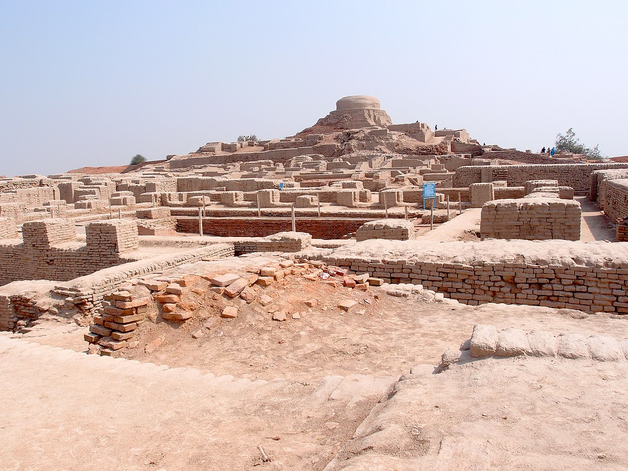
- Mohenjo-daro: Population ~40,000 — Great Bath, granary, grid street plan with 9 m wide main roads
- Harappa: Population ~25,000 — citadel mound, worker housing, and massive granaries
- Dholavira: Gujarat — stone-built city with sophisticated water reservoirs covering 10 hectares
Indus cities exhibited a level of urban planning unmatched until the Roman era. Streets were laid out in precise grids, oriented to the cardinal directions. Nearly every house had a private bathroom connected to a city-wide drainage system with covered sewers — a sanitation achievement not matched in Europe until the 19th century.
Standardized brick sizes (ratio 1:2:4) were used across the entire civilization, suggesting centralized planning or shared building codes across a region spanning 1.5 million km². The absence of obvious palaces or royal tombs suggests a more egalitarian or collective governance structure than contemporary civilizations.
Trade Networks
- Lothal: Gujarat coast — world's earliest known tidal dock (37 × 22 m)
- Trade Partners: Mesopotamia (called "Meluhha"), Oman (Magan), Bahrain (Dilmun)
- Exports: Carnelian beads, shell bangles, cotton textiles, timber, ivory
The port city of Lothal on the Gujarat coast featured what may be the world's first engineered tidal dock, enabling maritime trade with Mesopotamia and the Arabian Peninsula. Indus seals have been found at Ur, Kish, and other Mesopotamian sites, confirming active commercial exchange.
Overland routes connected the Indus Valley to lapis lazuli sources in Badakhshan (Afghanistan), turquoise from Iran, and jade from Central Asia. The standardized system of weights and measures used across all Indus settlements facilitated this vast trade network.
Decline and Legacy
The civilization began declining around 1900 BCE. Leading theories for its collapse include: the drying up of the Ghaggar-Hakra river due to tectonic shifts that diverted its tributaries, weakening monsoon patterns (confirmed by climate proxy data), and possible flooding or course changes of the Indus River.
Rather than a sudden catastrophe, the decline was gradual — large cities were abandoned over centuries as populations dispersed into smaller, rural settlements. Many Indus cultural practices, including urban planning principles, craft traditions, and possibly religious concepts, survived into later South Asian civilizations.
Key Facts
- The Indus Valley Civilization covered ~1.5 million km² — larger than Mesopotamia and Egypt combined
- Over 1,400 settlements have been identified, with about 900 in India and 500 in Pakistan
- Standardized brick ratios (1:2:4) were used across the entire civilization
- The Indus script contains ~400 symbols but remains undeciphered
- Lothal may have had the world's earliest known tidal dock
Fun Facts
- The Indus people were likely the first to cultivate cotton for textile production — around 5000 BCE
- Mohenjo-daro's Great Bath is considered the earliest public water tank in the ancient world
- Indus Valley craftspeople created perfectly drilled carnelian beads that were highly prized in Mesopotamia
- The civilization was only rediscovered in the 1920s — it was completely unknown to historians before excavations at Harappa and Mohenjo-daro
Final Thoughts
The Indus Valley Civilization demonstrates how river geography and monsoon climate can support vast urban networks. Its sophisticated urban planning, sanitation engineering, and trade networks were unmatched in the Bronze Age — yet its mysterious script and enigmatic decline remind us how much of the ancient world remains unknown.
Test Your Knowledge!
Think you know your ancient civilizations? Try our interactive geography quiz!
Play Geography Games →