

The Maldives is in Asia, not Africa. It is a South Asian island nation in the northern Indian Ocean, southwest of India and Sri Lanka. Its northernmost atoll is only about 130 km from India’s Minicoy Island and about 430 km from the coast of Kerala. The nearest point of Africa, the tip of Somalia, is roughly 2,400 km away. The United Nations counts the Maldives in Southern Asia, and it is a founding member of the South Asian Association for Regional Cooperation (SAARC). Its language, Dhivehi, is an Indo-Aryan language closely related to Sinhala. With 515,132 people at the 2022 census and just 298 km² of dry land, it is the smallest country in Asia by area.
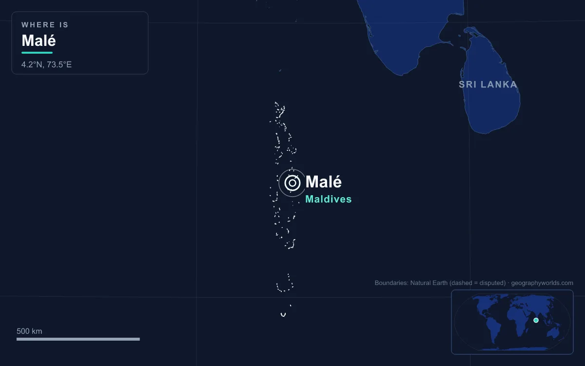
How Far the Maldives Lies from India, Sri Lanka and Somalia
Geography alone settles the question. Wikipedia describes the archipelago as about 750 km from the Asian mainland. The country stretches a long way north and south, though, so the distance depends on which island you start from. We measured the gaps between coastlines using Natural Earth boundary data. They show how much closer every part of the Maldives is to South Asia than to Africa.
Measured from the capital, the gaps are larger but the balance is the same. Malé is about 610 km from Thiruvananthapuram at the southern end of India and about 770 km from Colombo in Sri Lanka. It is more than 3,100 km from Mogadishu and almost 3,900 km from Mombasa in Kenya. Africa is roughly four to six times further away than the Indian subcontinent. People often guess Africa because the Maldives sits far out in open ocean with no land border to tie it to any continent. On a small world map, the gap to India looks much like the gap to East Africa.
871 km of Atolls from Ihavandhippolhu to Addu
The country is a double chain of 26 atolls holding 1,192 coral islands. It runs 871 km from Ihavandhippolhu Atoll in the north to Addu Atoll in the south and is about 130 km wide at most. Running from about 7° N to just under 1° S, it straddles the equator. Most of the country, including Malé, is in the Northern Hemisphere. The southernmost islands, Fuvahmulah in the Equatorial Channel and Addu Atoll beyond it, lie just south of the line. The islands are spread over about 90,000 km² of sea, and the Maldives’ exclusive economic zone of 923,322 km² is the world’s 31st largest. That makes it one of the most scattered countries on Earth, with more than 300 square kilometres of ocean for every square kilometre of land.
It is also the lowest country in the world. The average natural ground level is about 1.5 m above the sea, and the highest natural point is 2.4 m, a line of dunes on Hithadhoo in Addu Atoll. More than 80% of the land rises less than a metre above sea level. Most islands cover only one or two square kilometres, even the largest is no more than 8 km², and the islands are too small to have rivers.

Malé, traditionally called the “King’s Island”, lies in the north-central part of the chain. The royal dynasties ruled from there, and it is still the capital and largest city. For a closer look at how the atolls formed and how they are grouped, see our guide to the geography of the Maldives islands.
The Chagos–Laccadive Ridge: The Maldives’ Undersea Foundation
Under the water, the Maldives is joined to India far more firmly than to Africa. The atolls sit on a submarine ridge about 960 km long that rises steeply from the deep floor of the Indian Ocean. That ridge is the central part of a much larger feature, the Chagos–Laccadive Ridge, also called the Chagos–Lakshadweep Ridge. It runs about 2,550 km from roughly 10° S at the southern end of the Chagos Archipelago to around 14° N near the Adas Bank off western India.
The ridge has three blocks: Lakshadweep in the north, the Maldives in the middle and Chagos in the south. Each block’s islands are the coral caps of a submerged volcanic platform. Geologists describe the Lakshadweep block as thinned continental crust and the Maldives and Chagos blocks as oceanic. The whole ridge formed together with the western margin of India. It took shape as India broke away first from Madagascar in the mid-Cretaceous and then from the Seychelles in the late Cretaceous, with heavy volcanism around 66 million years ago. In other words, the Maldives sits on structures left behind as the Indian landmass drifted north. The African side of the ocean lies across deep basins to the west.
The southern block, the Chagos Archipelago, lies about 500 km south of the Maldives. It is administered by the United Kingdom as the British Indian Ocean Territory and is claimed by Mauritius. The Maldives has also asserted a historical claim, citing a document attributed to its king Hassan IX in 1561. In May 2025 the two governments signed a treaty to transfer sovereignty, with Diego Garcia leased back to the UK, but Wikipedia records that its ratification is on hold.
Minicoy and the Eight Degree Channel: The Border with India
The Maldives’ only close neighbour is India. Between Ihavandhippolhu Atoll and Minicoy Island lies a broad passage known locally as Maliku Kandu and on British Admiralty charts as the Eight Degree Channel, after the line of latitude it follows. The maritime boundary between the Maldives and India runs through it. Minicoy, called Maliku in Dhivehi, was traditionally counted as the northernmost Maldivian atoll. Fishermen from Thuraakunu and Minicoy crossed the channel to visit each other, and families married across it. Today Minicoy belongs to India’s union territory of Lakshadweep, 398 km southwest of Kochi. Dhivehi is still spoken there, though the Lakshadweep administration calls it Mahl.
The cultural ties run further north. Dhivehi descends from Elu Prakrit and is closely related to Sinhala, and the ancient Sri Lankan chronicle, the Mahāvaṃsa, records migrants from Sri Lanka settling the islands. Tamil and Malabar seafarers from southern India also settled here. Arab travellers reached the islands by around 947 CE, Islam arrived in the 12th century, and the islands became a sultanate with trade links to both Asia and Africa. They were a British protectorate from 1887 and became independent in 1965.
Seychelles, Mauritius and Comoros: Why Some Indian Ocean Islands Count as African
Part of the confusion comes from the Maldives’ island neighbours elsewhere in the Indian Ocean. Seychelles, Mauritius, Comoros and Madagascar are all usually grouped with Africa. They lie off the East African coast or on the Mascarene Plateau, and all of them belong to the African Union. Travel brochures often place them alongside the Maldives as “Indian Ocean islands”, so it is easy to assume they all belong to the same continent.
The Maldives is the exception because of where it sits. Seychelles sits on a submerged granite block, the Seychelles microcontinent, that once lay between Madagascar and India in Gondwana. It is now about 1,600 km east of Kenya. Mauritius and Comoros are volcanic islands on the African side of the basin. The Maldives lies on the Chagos–Laccadive Ridge, south of the Indian peninsula. It does keep some western ties. Since 1996 it has been the official progress monitor of the Indian Ocean Commission, whose members include Seychelles, Mauritius, Comoros and Madagascar, and it shares membership of the Organisation of Islamic Cooperation with Comoros. But it has never been a member of the African Union.
Southern Asia in the UN Geoscheme
The UN Statistics Division’s geoscheme, used for most international statistics, places the Maldives in Southern Asia. That subregion covers the Indian subcontinent and the Iranian Plateau: Afghanistan, Bangladesh, Bhutan, India, Iran, the Maldives, Nepal, Pakistan and Sri Lanka. The UN stresses that the grouping is for statistical convenience, and on this question almost every classification agrees. The one oddity is the UN’s Population Information Network, which files the Maldives in its Pacific subregional network rather than with South Asia. Atlases and reference works describe the Maldives as a South Asian country.

The Maldives’ outlying position does create one quirk. Its nearest foreign land is an Indian island, Minicoy, rather than any mainland. Even so, the only countries with land within 1,000 km are India and Sri Lanka. The one other territory that close is the Chagos Archipelago on the same ridge, whose sovereignty is contested as described above.
SAARC, the Commonwealth and the SAFF Championship
Diplomatically, the Maldives has looked to South Asia since independence. It was one of the seven founding members of SAARC when the association was set up in Dhaka on 8 December 1985. SAARC now has eight full members, Afghanistan, Bangladesh, Bhutan, India, the Maldives, Nepal, Pakistan and Sri Lanka, with its secretariat in Kathmandu. Our guide to SAARC and South Asia covers how the group works. The Maldives joined the Commonwealth in 1982, left in October 2016, and was readmitted on 1 February 2020.
Sport follows the same map. The Maldives plays football in the Asian Football Confederation and in the South Asian Football Federation. Its biggest successes came in South Asian competition. It won the 2008 SAFF Championship by beating India 1–0 in the final, with Mukhthar Naseer scoring from a corner in the closing minutes. It won the title again in 2018, once more beating India in the final.
So whether you go by distance, the undersea ridge, language, history, UN statistics or regional bodies, the answer is the same: the Maldives is an Asian country, the smallest in Asia, set out in the ocean southwest of India. To see how it compares with its nearest island neighbour, read our Sri Lanka vs Maldives comparison.