

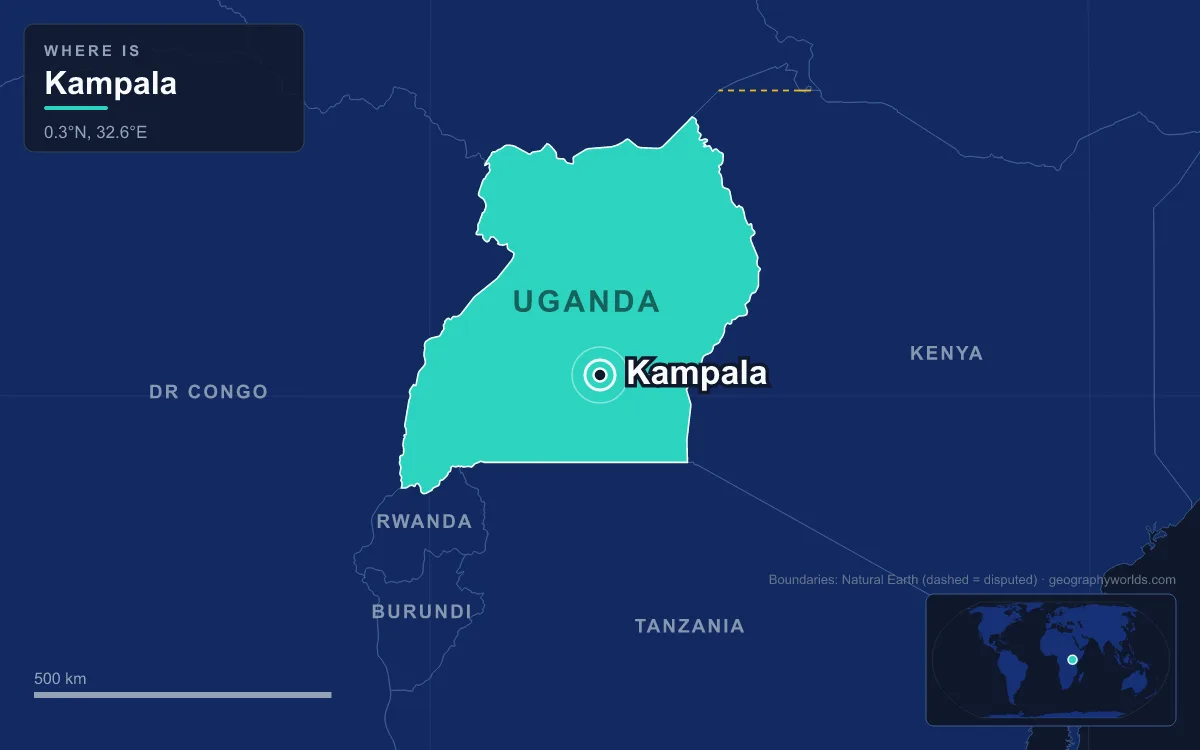
Kampala is the capital and largest city of Uganda, spread over a cluster of green hills that run down to the northern shore of Lake Victoria, just north of the equator. The city proper had 1,797,722 residents at the 2024 census, and its wider metropolitan area, which reaches into Wakiso, Mukono and neighbouring districts, was estimated at about 6.7 million in 2019. What makes Kampala unusual among African capitals is that it grew up beside, and eventually swallowed, the royal capital of the Buganda Kingdom, so the city has always held two centres of power on neighbouring hilltops. It only became the national capital in 1962, taking over from the lakeside town of Entebbe.
Entebbe or Kampala? The 1962 Transfer of the Capital
Before the British arrived, the capital of the region was a moving target. Each Kabaka, or king, of Buganda set up his kibuga, his royal capital, on a hill of his choosing, often a new one on his coronation. The explorer John Speke found the kibuga at Banda Hill in 1862, Henry Morton Stanley found it at Lubaga Hill in 1875, and when Frederick Lugard of the Imperial British East Africa Company arrived in 1890, Kabaka Mwanga II was ruling from Mengo Hill. Lugard was given a neighbouring hill, where he built a fort. That hill had been the Kabaka's hunting ground and was full of impala, so the British called it the Hill of the Impala. In Luganda that became akasozi k'empala, shortened over time to Kampala.
Kampala was the first British base, but it was not chosen as the capital of the new Uganda Protectorate. In 1893 the colonial commissioner Sir Gerald Portal used Entebbe, a peninsula on Lake Victoria about 36 kilometres to the south-west, as his base, and Entebbe remained the seat of the protectorate government until independence. Kampala, meanwhile, grew as a trading town, and in 1931 the Uganda Railway finally reached it from the port of Mombasa, 35 years after construction began.
Uganda gained independence on 9 October 1962, and in the same year the capital was moved from Entebbe to Kampala, which was also granted city status. Kampala already had the railway link to Mombasa, and it was home to Makerere, founded in 1922 as the Uganda Technical College and today Makerere University. Entebbe did not disappear from national life. It still has State House, the official office and residence of the president, and Entebbe International Airport, the country's main airport.
Seven Hills Shared Out by the 1900 Buganda Agreement
Kampala is often said to have been built on seven hills, and each one got its role from a single document: the Buganda Agreement of 1900. It was signed by Sir Harry Johnston for Britain and by the regents of the infant Kabaka Daudi Cwa II, including the Katikiro, or prime minister, Apolo Kagwa. The agreement created new forms of land tenure, including freehold, Crown land and mailo, and handed out the hills among the rival powers of the day. The result still shapes the map.
The colonial hills
Old Kampala Hill, where Lugard built his fort, and Nakasero Hill were classed as Crown land. The British moved their fort from Old Kampala to Nakasero, and Nakasero became the administrative heart of the modern city. Parliament and the headquarters of the Kampala Capital City Authority stand there today.
The mission hills
The missionaries who arrived in 1877 and 1879 had fought a religious war through their converts from 1888 to 1892, and the agreement gave each faction its own hill. The Protestant Church Missionary Society kept Namirembe, now crowned by the Anglican cathedral. The Catholic White Fathers got Lubaga, site of the Catholic cathedral. Muslims under Prince Nuhu Mbogo received Kibuli, home of the Kibuli Mosque, and the British Catholic Mill Hill Missionaries were given most of Nsambya. The missions also gave the city its first modern institutions: the Church Missionary Society opened Mengo Senior School on Namirembe in 1895, and in 1897 the missionary doctor Albert Ruskin Cook founded Mengo Hospital there. Cook went on to found Mulago Hospital in 1913, which is now Uganda's National Referral Hospital.
The royal hill
Mengo, the royal hill, stayed with the Kabaka. The kibuga that surrounded it was allocated to the young king and his chiefs under mailo and freehold title, and the kibuga remained a separate town, later called Mengo Municipality, until 1968.
Mengo Against Nakasero: Buganda's Capital Inside Uganda's
Mwanga II built the Lubiri, the royal palace, on Mengo Hill in 1885, and it has been the main royal seat ever since. A straight road about 1.6 kilometres long, Kabaka Anjagala Road, known as the Royal Mile, runs from the palace gate to the Bulange on Namirembe Hill, which houses the Lukiiko, Buganda's parliament. Standing at either end, you are looking at the capital of a kingdom that existed long before Uganda did.

Having two capitals within walking distance became a crisis only four years after independence. Milton Obote's Uganda People's Congress had governed in coalition with the Buganda party Kabaka Yekka, and in 1963 the Kabaka, Mutesa II, was elected to the largely ceremonial post of President of Uganda. The alliance broke down, and in May 1966 government forces under Obote attacked the Lubiri in what became known as the Buganda Crisis, or the Battle of Mengo Hill. The palace was wrecked and Mutesa II fled into exile. The Lubiri was renovated only in 1999, in time for the wedding of the current Kabaka.
The national government followed its victory by absorbing the royal town. In 1968 Kampala's boundaries were extended to take in the kibuga, then called Mengo Municipality, along with Kawempe and Nakawa townships and areas such as Muyenga and Ggaba. That single change multiplied the city's area nearly sevenfold, to the 189 square kilometres it covers today, 176 of them land and 13 water.
Buganda's royal heritage is still part of the capital's landscape. The Kasubi Tombs, on Kasubi Hill about 5 kilometres north-west of the centre, hold the graves of four Kabakas and became a UNESCO World Heritage Site in December 2001. A fire in March 2010 almost destroyed the main buildings; after restoration, the site was taken off the list of World Heritage in Danger in 2023.
From the 1912 Plan to the 2010 KCCA Act: Running a Capital of 1.8 Million
Kampala has been planned many times and built mostly without plans. In 1906 the township boundary was drawn as a three-mile radius from the fort, and the first land-use plan of 1912 covered about 1,400 acres, when the township had a European and Asian population of 2,850. The German architect Ernst May drew up a new plan in 1947 that would have extended the city east over Kololo and Naguru hills, with the first planned housing for Ugandans; it was set aside in favour of Henry Kendall's plan of 1951. Further plans in 1972 and 1994 were never carried out, the first because of the political and economic turmoil of the 1970s and 1980s. In January 1986 the Battle of Kampala ended with Yoweri Museveni's National Resistance Movement capturing the city.
Growth ran far ahead of planning. The city proper went from 62,264 people in 1948 to more than 1.1 million in 2002, and it reached 1,797,722 in 2024, with an average household size of 2.9. The terrain makes that growth awkward. The highest point in the city is the summit of Kololo Hill at 1,311 metres, and the lowest is the Lake Victoria shore at 1,135 metres, and between the hills lie slow rivers and swamps that cover about 15 per cent of the land. The Nakivubo swamp river, about 9 kilometres long, drains south to the lake from the foot of Makerere. Kampala has a tropical rainforest climate with no true dry month, and April is the wettest, with about 169 millimetres of rain.

Being the capital also means being run from the top. The Kampala Capital City Authority Act of 2010 replaced the old Kampala City Council with the Kampala Capital City Authority, placing the city under a cabinet minister and an appointed executive director. The elected mayor became the Lord Mayor, now a largely ceremonial post, and professional bodies such as the Uganda Society of Architects and the Uganda Law Society gained voting seats on the authority's council. The same act created a metropolitan planning authority for the city and the surrounding districts of Wakiso, Mukono, Buikwe, Mpigi and Luwero. The stakes are economic as well as political: in 2015 the metropolitan area produced an estimated $13.8 billion of output, more than half of Uganda's GDP. The capital's prominence has also made it a target, most seriously in the al-Shabaab bombings of 11 July 2010, which killed 74 people.
Kampala today divides into five divisions: Kampala Central, Kawempe, Makindye, Nakawa and Rubaga. For how it compares with the country's other urban centres, see our list of the largest cities in Uganda, and for the lake that shapes its southern edge, our guide to Lake Victoria. The wider story of the country governed from these hills is in our Uganda country guide.
Quick Facts About Kampala
- Country: Uganda
- Continent: Africa (East Africa)
- Country population: approximately 52.8 million
- Capital city status: Kampala is the capital of Uganda, the seat of national government, and the location of foreign embassies, parliament, and the head of state's official residence.
Frequently Asked Questions
What is the capital of Uganda?
The capital of Uganda is Kampala. Kampala is the seat of national government, hosts most foreign embassies and consulates, and is typically where the head of state and parliament are located.
What continent is Kampala in?
Kampala, the capital of Uganda, is located in Africa, in the East Africa region. As Uganda's capital, Kampala serves as the country's primary connection to the broader African political, economic, and cultural sphere.
Why is Kampala the capital of Uganda?
Kampala was chosen as the capital of Uganda for reasons that typically combine geography, history, and politics. Capital city selections often reflect a desire for centrality (being accessible from across the country), historical importance (being a longstanding seat of government or culture), or neutrality (being acceptable to multiple regions or ethnic groups within the country). The specific reasons for Kampala's designation are detailed in the city's history above.
What is Kampala known for?
As the capital of Uganda, Kampala is best known for housing the country's central government institutions — parliament, presidential or royal residences, supreme court, and key ministries. It is also typically a major cultural and economic center within Uganda, hosting national museums, embassies, and signature monuments. The introduction and history sections above provide detailed coverage of the city's specific notable institutions and landmarks.
Related Pages
- Uganda Country Guide — full geography, climate, economy, and culture overview
- Flag of Uganda — meaning, history, and design of Uganda's national flag